The best hikes from bus stations around Lac du Portillon
4.6
(1287)
15,578
hikers
4
hikes
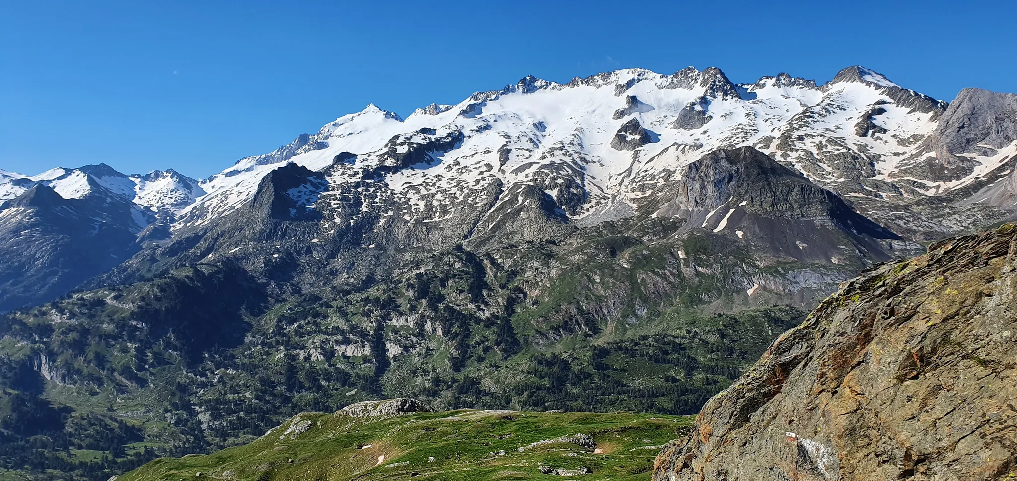
Bus station hiking trails around Lac du Portillon offer access to high-mountain landscapes in the French Pyrenees. The region is characterized by stunning high-altitude lakes, including Lac du Portillon itself, and towering peaks like Pic de Perdiguère. Trails transition through diverse ecosystems, from initial forest paths to rocky, mineral landscapes at higher elevations. The area features varied terrain, including large rock slabs and impressive waterfalls.
Best bus station hiking trails around Lac du Portillon
- The most popular bus station hiking…
Last updated: May 17, 2026
5.0
(7)
57
hikers
18.0km
05:55
790m
790m
Hard hike. Very good fitness required. Sure-footedness, sturdy shoes and alpine experience required.
5.0
(3)
39
hikers
21.7km
09:32
1,350m
1,350m
Hard hike. Very good fitness required. Sure-footedness, sturdy shoes and alpine experience required.

Sign up for free
5.0
(1)
27
hikers
Hard hike. Very good fitness required. Sure-footedness, sturdy shoes and alpine experience required.
4.0
(1)
13
hikers
4.53km
01:19
120m
120m
Easy hike. Great for any fitness level. Easily-accessible paths. Suitable for all skill levels.
4.8
(53)
622
hikers
14.5km
04:41
400m
400m
Moderate hike. Good fitness required. Mostly accessible paths. Sure-footedness required.
Our route recommendations are based on thousands of hikes, rides, and runs completed by other people on komoot.
Start today with a free account
Your next adventure awaits.
Login or Signup
Popular around Lac du Portillon
Other adventures around Lac du Portillon

Tips from the Community


The Renclusa Refuge is located on the northern slope of the Maladeta massif in the municipality of Benasque, in the Ribagorza region of Huesca. Its location makes it the reference point for starting the ascent to Aneto. It has a capacity of 93 places and offers bed linen. It also has hot water showers, heating, a kitchen for guests to use freely, a restaurant and a bar, among other amenities.
1
0

If instead of staying at the waterfall you go two more minutes you will have a spectacular photo of the Aneto glacier.
0
0
If instead of standing at the waterfall you advance two more minutes you will have a spectacular photo with the Aneto glacier.
1
0

Lovely stop at the Hospital Plains!
0
0

A hike to Renclusa is also suitable for families with children.
0
1

Located in the Benasque valley, at the foot of the Maladetas massif and the Aneto peak, La Renclusa is one of the mountain places par excellence. This circumstance is reflected in the fact that in 1916 the Excursionist Center of Catalonia built a guarded shelter right here. Recently remodeled, La Renclusa continues to provide a magnificent service to mountaineers, and although its appearance has changed, it maintains a faithful mountaineering tradition.
0
0

See ground conditions. In winter there is usually a risk of avalanches; In summer the access is signposted as GR11 from La Besurta, where you can get there by bus.
0
0
Frequently Asked Questions
How many bus-accessible hiking trails are available around Lac du Portillon?
This guide features 5 distinct hiking routes that are accessible from bus stations near Lac du Portillon. These trails offer a range of experiences, from easy strolls to challenging high-mountain ascents.
What kind of landscapes can I expect on bus-accessible hikes near Lac du Portillon?
The region around Lac du Portillon is renowned for its dramatic high-mountain landscapes. You'll encounter stunning high-altitude lakes like Lac d'Oô and Lac Saussat, towering peaks such as Pic Perdiguère, and impressive waterfalls like the 275-meter Oô waterfall. Trails often transition from lush forest paths to more rocky, mineral terrain as you gain elevation, offering a diverse and visually rich experience.
Are there any easy bus-accessible routes suitable for beginners or families?
Yes, for an easier option, consider the Camino de Aigualluts loop from Antiguo hospital de Benasque (Siglo XII). This route is approximately 4.5 km long and is rated as easy, making it a great choice for those looking for a less strenuous walk with beautiful scenery.
What are some challenging bus-accessible hikes for experienced trekkers?
Experienced hikers looking for a challenge can explore routes like the GR 11 (Senda Pirenaica): Vallibierna Valley Trail, which spans over 18 km with significant elevation gain. Another demanding option is the Plan of the Hospital de Benasque – Salvaguardia Peak loop from Hospital de Benasque, offering nearly 1000 meters of ascent over 15.5 km.
Can I find circular hiking routes that are accessible by bus?
Yes, several routes in this guide are circular, allowing you to start and end at the same point, often near a bus stop. For example, the Camino de Aigualluts loop from Antiguo hospital de Benasque (Siglo XII) is a great easy circular option. For a more moderate challenge, the Plan d'Aigualluts – Forau de Aiguallut loop from Hospital de Benasque is also a circular trail.
What do other hikers say about the trails around Lac du Portillon?
The hiking trails in the Lac du Portillon area are highly regarded by the komoot community, boasting an average rating of 4.6 out of 5 stars from over 1200 reviews. Hikers frequently praise the stunning high-mountain scenery, the clear turquoise waters of the lakes, and the diverse terrain that makes each route unique.
Are there any notable natural features or landmarks to look out for on these trails?
Absolutely! Many trails lead to or pass by significant natural attractions. You might encounter the impressive Oô waterfall, which cascades 275 meters into Lac d'Oô, or the picturesque Lac Saussat. The region is also home to several 3,000-meter peaks, offering breathtaking panoramic views. The high-altitude ponds and sculpted rock formations are noted for their exceptionally colorful and orange-hued appearance.
Is it possible to do multi-day hikes from bus stations in this area?
While this guide focuses on day hikes, the region is part of the extensive GR10 long-distance hiking trail network. For those interested in multi-day adventures, the Refuge du Portillon (Jean Arlaud) at 2,570 meters serves as a crucial staging point for ascents of surrounding 3000m peaks. You can plan your bus-accessible starting point to connect with these longer routes and refuge stays.
What is the best time of year to hike these bus-accessible trails?
The best time to hike around Lac du Portillon is typically during the late spring, summer, and early autumn months (June to September). During this period, the weather is generally more stable, and the high-altitude trails are free of snow, making them safer and more accessible. Always check local weather forecasts and trail conditions before heading out, especially for higher elevation routes.
Are there any facilities like cafes or refuges near the bus-accessible trailheads?
Yes, depending on your starting point, you may find facilities. The Hospital de Benasque, a common starting point for several routes in this guide, offers amenities. For higher-altitude routes, the Refuge du Portillon (Jean Arlaud) provides a crucial stop for hikers, offering accommodation and refreshments. It's always advisable to carry sufficient supplies as facilities can be sparse in the high mountains.
What should I pack for a bus-accessible hike in the Lac du Portillon area?
Given the varied terrain and high-mountain environment, it's essential to be well-prepared. Pack layers of clothing suitable for changing weather conditions, including waterproof and windproof outer layers. Sturdy hiking boots, plenty of water, snacks, a map or GPS device, sun protection, and a first-aid kit are highly recommended. For longer or more challenging routes, consider trekking poles and emergency supplies.
Most popular routes around Lac du Portillon

Get inspired with the komoot mobile app


Explore more
Browse the best Hikes in other regions.
