The best hikes from bus stations around Park Krajobrazowy Góry Opawskie
4.7
(271)
4,663
hikers
48
hikes
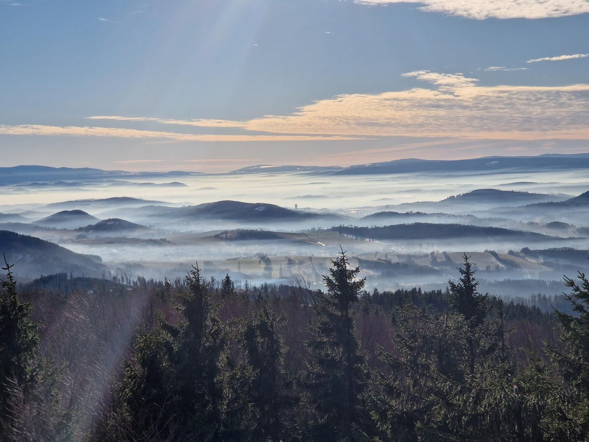
Hiking around Park Krajobrazowy Góry Opawskie offers a diverse landscape for outdoor activities. This protected area in southwestern Poland encompasses the northern slopes and foothills of the Opawskie Mountains, bordering the Czech Republic. The terrain features gentle hills, deep stream valleys, and steep, forested slopes, with approximately 75% of the park covered by dense forests. Key elevations include Biskupia Kopa, the highest peak on the Polish side at 890 meters above sea level.
Best bus station hiking trails around Park Krajobrazowy Góry Opawskie
- The most popular bus station hiking route is Jarnołtówek - Pokrzywna Trail, a 7.8 miles (12.5 km) trail that takes 3 hours 54 minutes to complete. This moderate route traverses varied terrain, including forested sections and open views.
- Another top favourite among local hikers is Srebrna Kopa Summit – Emperor Franz Josef Observation Tower loop from Park Krajobrazowy Góry Opawskie, a moderate 8.3 miles (13.4 km) path. This route leads to the Emperor Franz Josef Observation Tower, offering panoramic views.
- Local hikers also love the Gwarkowa Trail – View from Biskupia Kopa loop from Park Krajobrazowy Góry Opawskie, an 8.8 miles (14.2 km) trail leading through the Gwarkowa Trail and towards Biskupia Kopa, often completed in about 4 hours 29 minutes.
- Hiking around Park Krajobrazowy Góry Opawskie is defined by varied forest types, stream valleys, and hills, with options for different ability levels from easy walks to more challenging ascents.
- The routes in Park Krajobrazowy Góry Opawskie are highly rated by the komoot community with an average score of 4.7 stars from over 249 reviews. More than 4000 hikers have used komoot to explore Park Krajobrazowy Góry Opawskie's varied terrain.
Last updated: July 12, 2026
4.6
(5)
93
hikers
12.5km
03:55
470m
490m
Moderate hike. Good fitness required. Easily-accessible paths. Suitable for all skill levels.
4.7
(34)
734
hikers
Moderate hike. Good fitness required. Easily-accessible paths. Suitable for all skill levels.

Sign up for free
5.0
(1)
25
hikers
Easy hike. Great for any fitness level. Easily-accessible paths. Suitable for all skill levels.
23
hikers
Easy hike. Great for any fitness level. Easily-accessible paths. Suitable for all skill levels.
5.0
(1)
19
hikers
Moderate hike. Good fitness required. Mostly accessible paths. Sure-footedness required.
Get access to more routes and recommendations from other explorers.
Sign up for free
Already have an account?
Our route recommendations are based on thousands of hikes, rides, and runs completed by other people on komoot.
Start today with a free account
Your next adventure awaits.
Login or Signup
Popular around Park Krajobrazowy Góry Opawskie
Other adventures around Park Krajobrazowy Góry Opawskie

Tips from the Community

A beautiful PTTK mountain shelter at an altitude of 850 meters above sea level, near the summit of Biskupia Kopa (hence its name, of course). The shelter was built here in 1923, but was later rebuilt. Everything is here: meals, accommodations (50 beds), a restaurant, and even the possibility of organizing discos (probably not for you today, right?). https://biskupiakopa.pl/
1
0
And that's what I call a view. This viewing platform (in the Cicha Dolina Reserve) offers stunning views of the forested slopes of the Opawskie Mountains. Marvelous!
1
0


Unfortunately, during the flood in 2024, the shelter was destroyed.
0
0

The site of the former ski jump. A plaque commemorates its location
1
0
A nice, scenic section of the trail
0
0
A beautiful, short section of Gwarkowa Perć. It is really worth going to BIskupia Kope
0
0
Frequently Asked Questions
How many hiking trails are accessible from bus stations in Park Krajobrazowy Góry Opawskie?
There are over 40 hiking trails in Park Krajobrazowy Góry Opawskie that are easily accessible from various bus stations, offering a convenient way to explore the region without a car. These routes cater to a range of abilities, from easy strolls to more challenging ascents.
Are there easy, family-friendly hikes accessible by bus?
Yes, the region offers several easy routes perfect for families. For instance, the Zamkowa Góra (571 m) – Pass below Zamkowa Góra loop is an easy option, as is the Chapel in the Bystre Valley – Gwarkowa Trail loop. These trails often feature gentle terrain and offer opportunities to enjoy the natural surroundings.
What kind of natural features and landmarks can I expect to see on these bus-accessible trails?
The trails often lead through diverse landscapes, including dense forests, picturesque stream valleys like Złoty Potok and Bystry Potok, and unique rock formations. You might encounter natural monuments such as Żabie Oczko Pond or the Juvenia Spring. The region is also known for remnants of medieval gold mining.
Are there any trails that lead to viewpoints or observation towers?
Absolutely. Many routes offer stunning panoramic views. A notable highlight is the Emperor Franz Josef Observation Tower on Biskupia Kopa, which provides extensive vistas. The Srebrna Kopa Summit – Emperor Franz Josef Observation Tower loop is a moderate route that takes you to this iconic spot.
Can I find circular hiking routes starting from bus stations?
Yes, many of the trails in Park Krajobrazowy Góry Opawskie are designed as circular routes, allowing you to return to your starting point without retracing your steps. Examples include the Gwarkowa Trail – View from Biskupia Kopa loop and the Zamkowa Góra (571 m) – Pass below Zamkowa Góra loop, both offering varied scenery.
What is the best time of year to hike in Park Krajobrazowy Góry Opawskie?
The park is beautiful year-round, but spring and autumn are particularly recommended. In spring, the deciduous forests burst with fresh greenery and wildflowers, while autumn brings vibrant colors to the landscape. Summer offers pleasant temperatures for hiking, and even winter can be magical for snowshoeing, though some trails might be more challenging.
Are there any challenging routes for experienced hikers accessible by bus?
For those seeking a challenge, the region offers routes with significant elevation gain. The Gwarkowa Trail – View from Biskupia Kopa loop, for instance, includes the unique Gwarkowa Perć, which features an 11-meter metal ladder, providing an exciting and memorable experience for well-prepared hikers.
Are dogs allowed on the hiking trails?
Generally, dogs are welcome on most hiking trails in Park Krajobrazowy Góry Opawskie, but they should always be kept on a leash to protect wildlife and ensure the safety of other hikers. Please be mindful of local regulations, especially in nature reserves.
Are there places to eat or find accommodation near the bus-accessible trailheads?
Yes, towns like Głuchołazy, Jarnołtówek, and Pokrzywna, which serve as common starting points for bus-accessible trails, offer various amenities. You can find restaurants, cafes, and accommodation options, including the historic Mountain Tourist House 'Under the Biskupia Kopa' (Schronisko PTTK 'Pod Biskupią Kopą'), which is a great resting point for hikers.
What do other hikers enjoy most about the bus-accessible trails in Park Krajobrazowy Góry Opawskie?
The area is highly rated by the komoot community, with an average score of 4.7 stars. Reviewers often praise the diverse landscapes, the well-maintained and extensive trail network, and the stunning panoramic views from peaks like Biskupia Kopa. The convenience of public transport access is also frequently highlighted.
Can I hike between different towns using bus-accessible trails?
Yes, you can plan point-to-point hikes between towns. For example, the Jarnołtówek - Pokrzywna Trail connects two villages, allowing you to start in one and finish in another, utilizing local bus services for your return journey.
Most popular routes around Park Krajobrazowy Góry Opawskie
Most popular attractions around Park Krajobrazowy Góry Opawskie

Get inspired with the komoot mobile app


Explore more
Browse the best Hikes in other regions.
