The best hikes from bus stations around Contrafforte Pliocenico
4.4
(3009)
10,516
hikers
114
hikes
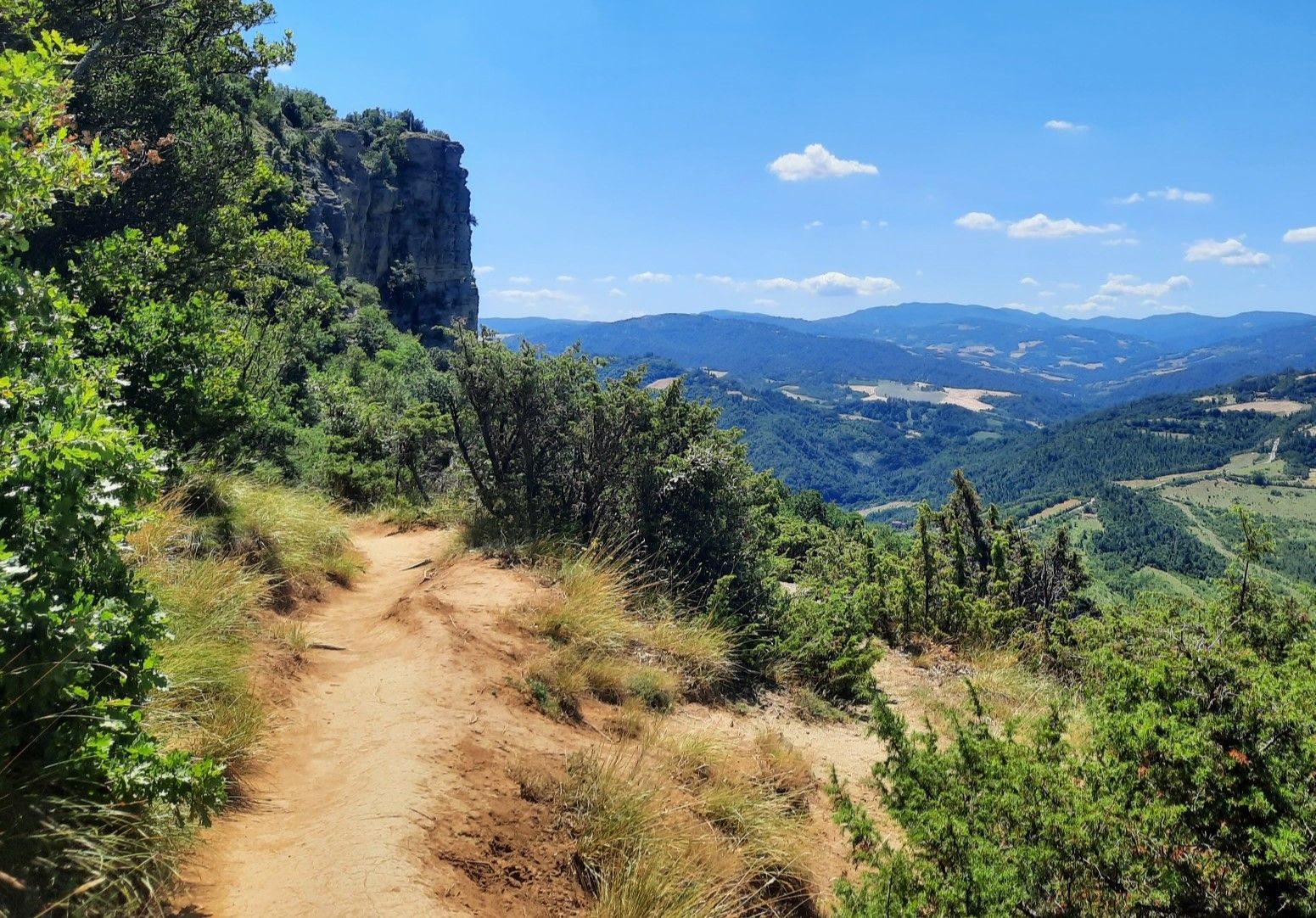
Bus station hiking trails around Contrafforte Pliocenico traverse a landscape characterized by majestic sandstone outcrops, formed during the Pliocene epoch. This region features a natural bastion between the Setta, Savena, Zena, and Idice river valleys, with elevations reaching over 600 meters. The terrain includes golden-yellow sandstone cliffs contrasting with softer clay badlands, supporting diverse Mediterranean flora and a rich fauna.
Best bus station hiking trails around Contrafforte Pliocenico
- The most popular bus station hiking route is From Sasso Marconi to…
Last updated: June 28, 2026
5.0
(1)
15
hikers
7.86km
02:58
460m
460m
This moderate hike, From Sasso Marconi to La Piazza via Monte Mario, covers 4.9 miles (7.9 km) with a significant elevation gain of 1518 feet (463 metres), typically taking around…
4.6
(8)
30
hikers
23.9km
07:37
900m
900m
Embark on the Monte Sole Loop via the Wool and Silk Road, a challenging hike that takes you through quiet forest paths and across open meadows. You will discover expansive…

Sign up for free
4.7
(25)
72
hikers
Moderate hike. Good fitness required. Mostly accessible paths. Sure-footedness required.
4.3
(3)
101
hikers
17.7km
05:11
490m
500m
Hard hike. Very good fitness required. Easily-accessible paths. Suitable for all skill levels.
4.0
(4)
13
hikers
Moderate hike. Good fitness required. Mostly accessible paths. Sure-footedness required.
Get access to more routes and recommendations from other explorers.
Sign up for free
Already have an account?
Our route recommendations are based on thousands of hikes, rides, and runs completed by other people on komoot.
Start today with a free account
Your next adventure awaits.
Login or Signup
Popular around Contrafforte Pliocenico
Other adventures around Contrafforte Pliocenico

Tips from the Community

The small center of Monzuno is perfect for a break on the second stage of the Via degli Dei. Here you can strengthen yourself in a café or restaurant, get a snack in a small supermarket, or refill your water at the drinking fountain.
1
0
In the small village of Monzuno, you can find this beautiful wall art at the local library.
1
0


Be careful because there are 2 or 3 difficult points to cross due to landslides, with trunks, brambles and mud galore.
0
0

The monument in memory of the Red Star located on top of Monte Sole is an absolute must-see to never forget what happened and not repeat history again.
0
0

From this path, not far from the town of Borgo Casola, in the heart of the Contrafforte Pliocenico nature reserve, you can see Mount Formiche and its sanctuary in the distance.
0
0

arriving from the south you find it before us in all its majesty
0
0

at certain times it is also possible to find it open to visit the church
0
0
Frequently Asked Questions
How many bus-accessible hiking trails are available in Contrafforte Pliocenico?
There are over 100 bus-accessible hiking trails in Contrafforte Pliocenico, offering a wide range of options for different preferences and fitness levels.
What is the overall difficulty level of bus-accessible hikes in Contrafforte Pliocenico?
The trails accessible by bus in Contrafforte Pliocenico cater to various skill levels. You'll find approximately 23 easy routes, 67 moderate routes, and 16 more challenging options, ensuring there's something for everyone.
What do other hikers say about the bus-accessible trails in Contrafforte Pliocenico?
The area is highly rated by the komoot community, with an average score of 4.4 stars from over 2,600 ratings. Reviewers often praise the unique geological features, the panoramic views, and the well-maintained paths that make these routes enjoyable.
When is the best time of year to hike these bus-accessible trails?
The Contrafforte Pliocenico region is beautiful year-round. Spring and autumn offer pleasant temperatures and vibrant colors, making them ideal for hiking. Summer can be warm, but the trails often provide shade. Winter hikes are also possible, offering a different, serene experience, though some paths might be more challenging.
What kind of natural features can I expect to see on these trails?
You'll encounter stunning rocky outcrops of sandstone, which are rich in marine fossils from the Pliocene epoch. The landscape features dramatic contrasts between these golden-yellow cliffs and softer clay terrains, often marked by 'calanchi' (badlands). The area also boasts diverse Mediterranean flora, including Phillyrea, alaternus, and tree heather, alongside oaks and hollies.
Are there family-friendly hiking options accessible by bus?
Yes, there are several family-friendly routes. Look for trails marked as 'easy' in the guide. These often feature less elevation gain and shorter distances, perfect for a day out with children. Many routes offer opportunities to explore the unique geology and observe local wildlife.
Can I bring my dog on these bus-accessible trails?
Generally, dogs are welcome on trails in Contrafforte Pliocenico, but it's always best to keep them on a leash, especially in nature reserve areas and near wildlife. Be sure to check specific trail regulations and public transport rules regarding pets before you go.
Are there circular routes available from bus stops?
Yes, many of the bus-accessible routes are designed as circular walks, allowing you to start and end your hike at the same bus stop. An example is the Hiking loop from Riserva regionale Contrafforte Pliocenico, which offers a moderate challenge.
What historical or natural landmarks can I explore along bus-accessible routes?
You can discover several significant landmarks. The ancient 'Via degli Dei' (Pathway of the Gods) partially traverses the reserve. Near Sasso Marconi, you can find the ruins of a Roman aqueduct built in 15 BC. Natural highlights include the impressive Monte Adone Cliffside and the Sanctuary of Santa Maria di Zena (Monte delle Formiche).
Which peaks can be reached via bus-accessible trails?
Several prominent peaks in the Contrafforte Pliocenico are accessible. You can hike to the Monte Adone summit, considered an authentic symbol of the area. Other accessible peaks include Monte del Frate and the Summit of Monte Mario, offering panoramic views.
Are there places to eat or drink near the bus-accessible trailheads?
While specific cafes directly at every bus stop trailhead might be limited, many villages and towns served by bus routes in the Contrafforte Pliocenico area offer local trattorias, cafes, and shops where you can refuel before or after your hike. It's advisable to check local amenities for your specific starting point.
What should I wear or bring for hiking in Contrafforte Pliocenico, especially when relying on public transport?
Wear comfortable hiking shoes suitable for varied terrain, and dress in layers as weather conditions can change. Bring sufficient water, snacks, a map or GPS device (like komoot), sun protection, and a small first-aid kit. Since you're using public transport, pack light and ensure you have your bus schedule and tickets readily available.
Can I find long-distance routes that start from a bus station?
Yes, some longer and more challenging routes are accessible by bus. For instance, the Monte Sole Loop via the Wool and Silk Road is a difficult, nearly 24 km hike that can be reached via public transport, offering a full day's adventure.
Most popular routes around Contrafforte Pliocenico
Most popular attractions around Contrafforte Pliocenico

Get inspired with the komoot mobile app


Explore more
Browse the best Hikes in other regions.
