The best hikes from bus stations in Deux-Sèvres
4.5
(2744)
14,757
hikers
220
hikes
Bus station hiking trails in Deux-Sèvres offer access to a diverse landscape characterized by extensive wetlands, river valleys, and forests. The region is home to the Marais Poitevin, a vast wetland ecosystem with an intricate network of canals. Hikers can explore picturesque river valleys like the Thouet and Sèvre, as well as unique dry valleys with calcareous soil. State-owned forests such as Forêt domaniale de Chizé provide additional natural settings for exploration.
Best bus station hiking trails in Deux-Sèvres
- The…
Last updated: May 16, 2026
4.4
(5)
26
hikers
6.17km
01:39
70m
70m
Easy hike. Great for any fitness level. Easily-accessible paths. Suitable for all skill levels.
4.8
(9)
22
hikers
9.37km
02:28
80m
80m
Moderate hike. Good fitness required. Easily-accessible paths. Suitable for all skill levels.

Sign up for free
4.2
(6)
17
hikers
9.77km
02:34
80m
80m
Moderate hike. Good fitness required. Easily-accessible paths. Suitable for all skill levels.
4.7
(3)
7
hikers
13.5km
03:33
110m
110m
Hike the 8.4-mile (13.5 km) Pigeonnier de Pouzay loop, a moderate trail featuring a unique dovecote with an oak tree inside.
5.0
(1)
4
hikers
10.3km
02:39
40m
40m
Moderate hike. Good fitness required. Easily-accessible paths. Suitable for all skill levels.
Get access to more routes and recommendations from other explorers.
Sign up for free
Already have an account?
Our route recommendations are based on thousands of hikes, rides, and runs completed by other people on komoot.
Start today with a free account
Your next adventure awaits.
Login or Signup
Popular around Deux-Sèvres
Other adventures in Deux-Sèvres


Tips from the Community

The Château de la Roche-Faton, located in Lhoumois (Deux-Sèvres) in Nouvelle-Aquitaine, is an elegant castle listed as a Historic Monument, dating from the medieval period and enriched during the Renaissance. 🏰 History & Architecture Mentioned as early as 1179, burned down in 1417, it was rebuilt starting in 1544 by Mathurin Pidoux. It comprises three buildings around a courtyard, round towers, a gatehouse with drawbridges (now lost), and outbuildings built in the 17th century. The fortified entrance is flanked by machicolations, while the central building includes a 15th-16th-century main building, crowned by an authentic spiral staircase. 🖼️ Interiors & Decor Several intact fireplaces from the 15th and 18th centuries, as well as a large living room decorated with 18th-century stucco. The Saint-Nicolas Chapel contains the tombstones of Charles-Marie-Auguste de Beaumont, Marquis d'Autichamp, and his wife. 🌳 Gardens & Park An English-style landscaped park and French gardens – designed in the 17th century by the Lords of Vassé – surround the château. A pond from the former moat also remains. 🛡️ Protection & Visits Listed as a Historic Monument: facades and roofs of the main building registered in 1973, wings of the outbuildings in 1993. A private property belonging to the du Dresnay family, the château is open for guided tours of the exterior and for events such as European Heritage Days.
2
0
The Thouet, a peaceful river in western France (142 km), crosses several departments before flowing into the Loire. Its name, of Gallic origin, evokes "tranquility." Why stroll along the Thouet? Bucolic walks The landscaped banks around Parthenay offer a green and peaceful path, popular for walking or cycling. The "Along the Thouet" route (approximately 5–6 km) is classified as easy, punctuated by picnic tables, pétanque courts, and recreational areas.
1
0
Picturesque walk: Strolling along the bridge at the foot of the walls, with the tranquil waters of the Thouet River and the reflections of the arches, is a moment of pure bliss. Historical immersion: Walk in the footsteps of medieval pilgrims, protected by this powerful military structure, all in a still-authentic setting. Iconic photo: The view from the bridge—or from the banks slightly downstream—offers a perfect frame to capture the gate and its towers reflected in the river.
1
0
The fortified Saint-Jacques bridge (or “citadel bridge”) in Parthenay is a masterpiece of medieval architecture, bordered by its high walls and almond-shaped towers, offering an exceptional setting when the Thouet is reflected in the water.
1
0
Things to See & Do Ramparts: With approximately 30 semicircular towers, the granite walls symbolize medieval urban robustness. Ruined Castle: All that remains of the castle is a round tower (perhaps the keep) and sections of walls restored since the 1980s. Panoramic Walk: The rampart path offers splendid views of the Thouet Valley and the Saint-Paul district.
1
0
History & Architecture Medieval Construction: Built in the early 13th century under the aegis of John Lackland, the citadel rests on a natural promontory reinforced by three defensive walls, towers, and ramparts. Castle and Bastion: Its original, isolated castle included towers such as the Powder Tower and the Harcourt Tower. In the 15th century, Arthur de Richemont added the bastille and an artillery boulevard. Citadel Gate (or Clock Gate): The gatehouse is flanked by two almond-shaped towers and topped with a clock tower. A granite staircase provides access to the guardroom and the patrol path.
1
0
The citadel of Parthenay, nicknamed the "little Carcassonne of the West", is one of the city's heritage jewels, perched on a rocky spur overlooking the bend of the Thouet River.
1
0

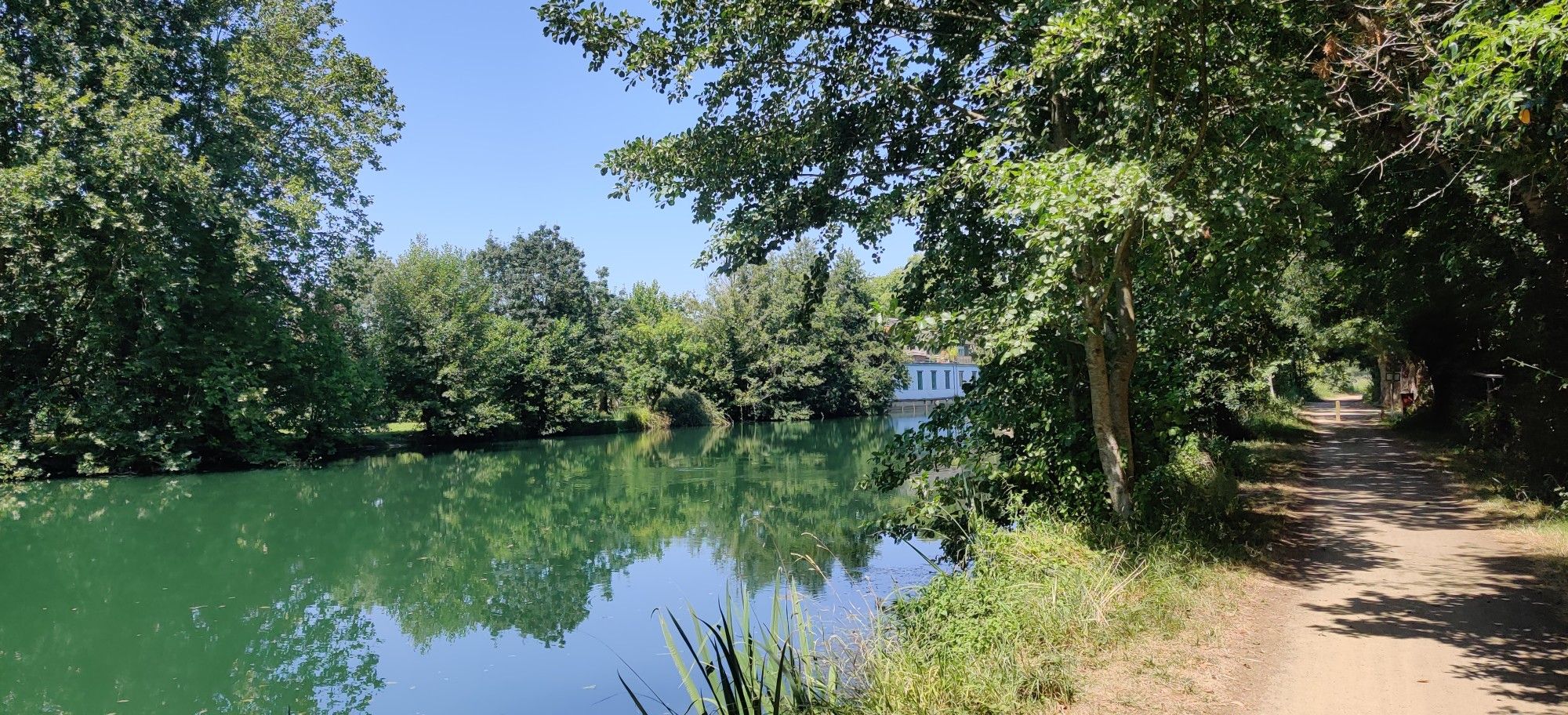
Idyllic stroll on the banks of the Thouet, just outside Parthenay. Following the river, you arrive at the leisure center, which has a lake, walking paths, picnic tables, pétanque courts and a sports course. Don't hesitate to stop in the medieval city, where you'll find plenty of options for food and accommodation.
2
0
Frequently Asked Questions
How many bus-accessible hiking trails are available in Deux-Sèvres?
There are over 200 hiking routes in Deux-Sèvres that are accessible from bus stations, offering a wide variety of options for all skill levels. These trails allow you to explore the region's diverse landscapes without needing a car.
Are there any easy, family-friendly hikes accessible by bus in Deux-Sèvres?
Yes, Deux-Sèvres offers many easy routes suitable for families. For example, the The citadel of Parthenay — loop from La Caserne is an easy 6.1 km loop that's perfect for a relaxed outing. Many trails are also part of the 'Green Ways' network, which are flat and traffic-free, ideal for all ages.
Can I find circular hiking routes from bus stops in Deux-Sèvres?
Absolutely. Many of the bus-accessible trails in Deux-Sèvres are circular, allowing you to start and end your hike at the same point, often conveniently located near a bus stop. An example is the moderate Saint-Gelais – loop, which covers about 9.3 km.
What kind of natural attractions can I discover along these bus-accessible routes?
Deux-Sèvres is rich in natural beauty. You can explore the famous Marais Poitevin, often called 'Green Venice,' with its intricate canals and lush wetlands. Many routes also pass through the picturesque Thouet Valley or offer glimpses of the Sèvre Niortaise river. For specific natural highlights, consider visiting Chizé Forest or the unique Le Puits d'Enfer waterfall.
Are there any historical landmarks or points of interest near bus station hiking trails?
Yes, the region is dotted with charming villages and historical sites. For instance, the Lhoumois and the castle of La Roche-Faton - loop offers a moderate 9.7 km hike that includes a castle. The Marais Poitevin also features historic villages like Coulon and Maillezais with its abbey ruins, often accessible via local bus services.
What is the best time of year to go hiking from bus stations in Deux-Sèvres?
Spring and autumn are generally the best times for hiking in Deux-Sèvres. The weather is mild, and the landscapes are particularly vibrant, whether with spring blossoms or autumn colors. Summer can also be pleasant, especially for shaded forest trails or routes near water, but be prepared for warmer temperatures. Winter offers a quieter experience, though some paths might be muddy.
Are there any longer, more challenging bus-accessible hikes for experienced hikers?
While many routes are easy to moderate, Deux-Sèvres does offer longer options. The Ardin - The Autize Valley Loop is a moderate 13.4 km trail that provides a good challenge. The region also features sections of the long-distance GR 36 footpath, which can be accessed from various points, though specific bus connections to these sections would need to be checked locally.
What do other hikers enjoy most about the bus-accessible trails in Deux-Sèvres?
The komoot community highly rates hiking in Deux-Sèvres, with an average score of 4.5 stars. Reviewers often praise the region's tranquil waterways, diverse landscapes, and the convenience of accessing trails via public transport. Many appreciate the well-maintained paths and the opportunity to discover hidden gems like the unique dry valleys of Availles-Thouarsais.
Are there any trails that offer scenic viewpoints or panoramic views?
Yes, particularly in areas like the Thouet Valley and certain parts of the Marais Poitevin. Villages such as Arçais within the Marais Poitevin are known for offering panoramic views of the wetlands. The diverse topography of Deux-Sèvres ensures many routes provide picturesque vistas of the countryside, rivers, and forests.
Can I find routes that pass by lakes or rivers?
Definitely. Deux-Sèvres is defined by its rivers, the Sèvre Nantaise and Sèvre Niortaise, and the Marais Poitevin's extensive canal network. Many trails follow these waterways, offering serene views. You can also find routes near lakes such as La Touche Poupard Dam or Ballastière Pond, providing opportunities for waterside walks.
Are there any moderate-difficulty routes that are easily accessible by bus?
Yes, there are numerous moderate routes. The Le Moulin de Rimbault – loop is a moderate 10.3 km trail that offers a good balance of distance and elevation, making it a popular choice for those looking for a bit more challenge than an easy walk, while still being conveniently located for bus access.
Most popular routes in Deux-Sèvres
Most popular attractions in Deux-Sèvres

Get inspired with the komoot mobile app


Explore more
Browse the best Hikes in other regions.
