The best traffic-free bike rides around Nahetal-Waldau
4.5
(177)
609
riders
24
rides
No traffic touring cycling routes around Nahetal-Waldau traverse a landscape characterized by scenic river valleys, rolling hills, and extensive forests within the Thuringian Forest and the "Vessertal" Biosphere Reserve. The region's topography ranges from mostly flat riverside paths to more challenging climbs in the upper valleys. This diverse terrain provides varied backdrops for outdoor activities, including the sources of the Nahe and Werra Rivers. The UNESCO-recognized "Vessertal" Biosphere Reserve further enhances the natural significance of the area.
Best no traffic…
Last updated: October 28, 2026
4.8
(53)
160
riders
Hard bike ride. Very good fitness required. Mostly paved surfaces.
5.0
(7)
29
riders
Hard bike ride. Very good fitness required. Mostly paved surfaces.

3.9
(9)
26
riders
Moderate bike ride. Good fitness required. Mostly paved surfaces.
5.0
(5)
18
riders
21.7km
02:12
530m
530m
Hard bike ride. Very good fitness required. You may need to push your bike for some segments of this route.
5.0
(3)
10
riders
36.8km
02:42
630m
630m
Hard bike ride. Very good fitness required. You may need to push your bike for some segments of this route.
Get access to more routes and recommendations from other explorers.
Already have an account?
Our route recommendations are based on thousands of hikes, rides, and runs completed by other people on komoot.
Start today with a free account
Your next adventure awaits.
Popular around Nahetal-Waldau
Tips from the Community

Top location on the Rennsteig: The proximity to the famous ridge trail allows for a combination of forest descents and ridge tours. Varied topography: Steep ascents from the Tannengrund or Reuscheltal demand stamina, but reward with brisk descents. Nature experience: The reservoir, with its bays, is reminiscent of a small fjord landscape in the middle of the dense low mountain forest. Tour combinations: Perfect as a stopover or turning point for larger loops, which often start in Schleusingen or Masserberg.
3
0
The Schönbrunn dam is located in the southern Thuringian Forest in the municipality of Schleusegrund (Hildburghausen district, Thuringia). It was commissioned in 1977. The dam is located about 20 kilometers south of Ilmenau and 15 kilometers northeast of Schleusingen. The river Schleuse is dammed. Source: https://de.wikipedia.org/wiki/Talsperre_Sch%C3%B6nbrunn#:~:text=Die%20Talsperre%20Sch%C3%B6nbrunn%20liegt%20im,Gestaut%20wird%20der%20Fluss%20Schleuse.
3
0
The Schönbrunn dam in the Thuringian Forest is attractive for mountain biking due to its charming combination of idyllic, flat shore paths and challenging, hilly ascents in the surrounding mountainous terrain around the Rennsteig. The circuit offers constant views of the blue water of the reservoir and the forest-rich heights of the Thuringian Forest.
3
0

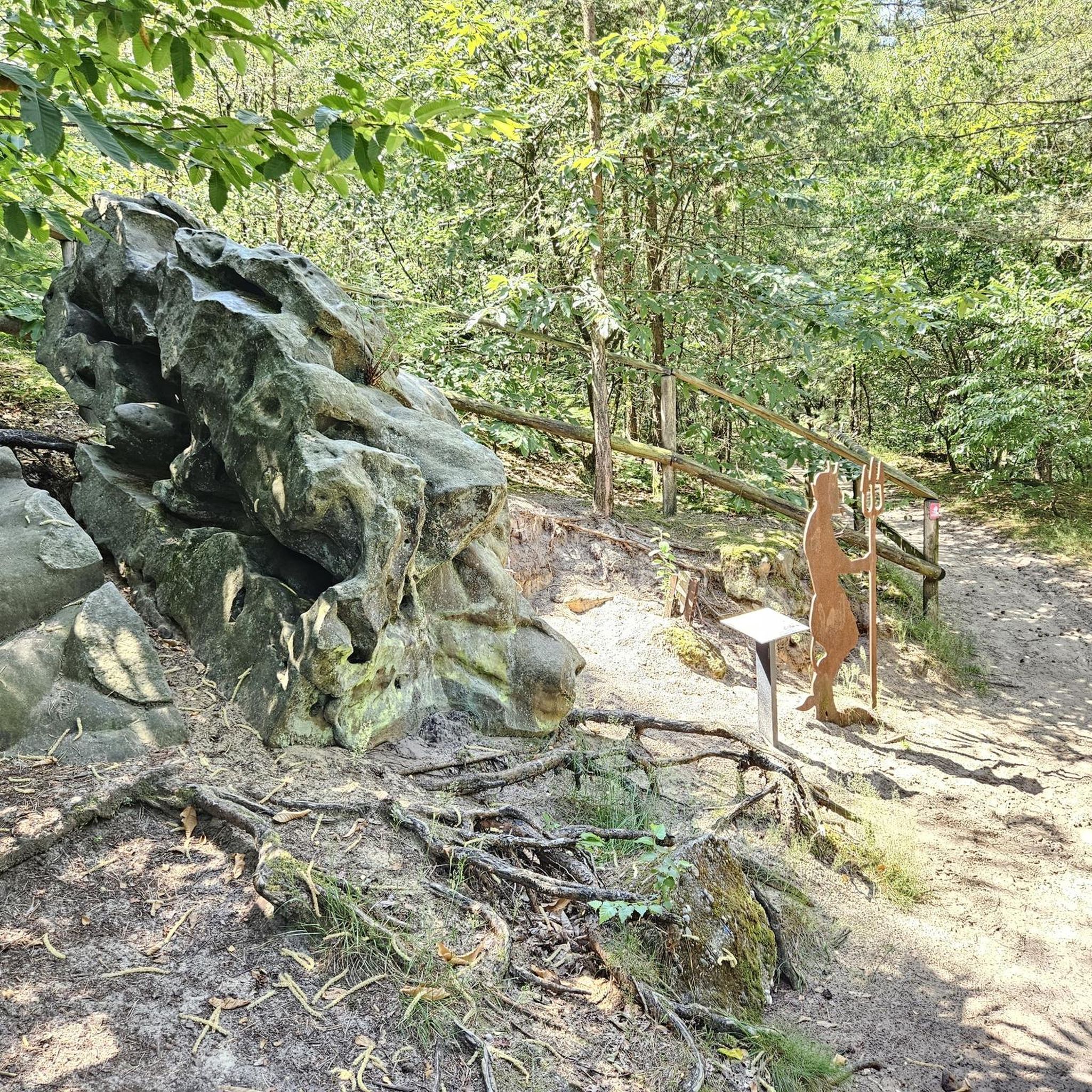
The Triniusstein is a porphyrite rock, also known as "Porphyr Trinii", and is located on the Schwalbenhauptwiese on the Rennsteig between Neustadt am Rennsteig and Masserberg. The namesake is the hiking writer and Rennsteig pioneer August Trinius (1851-1919). At this crossroads, there is also a restaurant, the Triniusbaude.
2
0

Easy to drive, partly asphalted route
0
0

a very nice cycle path
0
0

Signpost on one side and shelter on the other side.
1
1
Beautiful playground located in the forest.
2
1
Frequently Asked Questions
How many no-traffic touring cycling routes are available in Nahetal-Waldau?
There are over 20 no-traffic touring cycling routes around Nahetal-Waldau, offering a variety of distances and difficulty levels. You'll find options ranging from easy to difficult, ensuring there's a suitable tour for every cyclist.
Are there any easy, family-friendly no-traffic cycling routes in Nahetal-Waldau?
Yes, Nahetal-Waldau offers several easy, traffic-free routes suitable for families. These often follow the scenic river valleys, providing a gentle gradient. The region's commitment to well-marked trails makes it easy to navigate with children. For a moderate option that is popular with families, consider the Village Church of Waldau – Waldau–Ratscher Cycle Path loop from Nahetal-Waldau, which is 17.4 km long.
What is the best time of year for no-traffic touring cycling in Nahetal-Waldau?
The best time for touring cycling in Nahetal-Waldau is typically from spring through autumn (April to October). During these months, the weather is generally pleasant, and the landscapes are at their most vibrant, with lush forests and blooming vineyards. The region's varied topography means you can enjoy different views as the seasons change.
Are there any circular no-traffic cycling routes in the area?
Yes, many of the no-traffic touring cycling routes in Nahetal-Waldau are designed as circular loops, allowing you to start and end at the same point. This is convenient for those traveling by car. An example of a challenging circular route is the Brunnenhügel (704 m) – Brunnenhügel Summit Cross loop from Nahetal-Waldau, which covers 21.4 km with significant elevation.
What kind of landscapes can I expect on these routes?
The no-traffic routes in Nahetal-Waldau traverse diverse landscapes, including scenic river valleys of the Nahe and Werra, rolling hills, extensive vineyards, and lush forests. You'll experience a mix of mostly flat riverside paths and more challenging climbs in the upper valleys, offering picturesque backdrops for your ride. The "Vessertal" Biosphere Reserve also provides tranquil natural settings.
Are there any viewpoints or attractions along the no-traffic cycling routes?
Yes, the region offers several notable viewpoints and attractions. You might encounter the Finsteres Loch Wooden Bridge and Waterfall, or the Helms Waterfall. The View from Simmersberg – Triniusstein Memorial loop from Waldau offers stunning vistas. Additionally, the Ten Ponds and Knöpfelstaler Pond are beautiful spots to visit.
Are dogs allowed on the no-traffic touring cycling routes?
Generally, dogs are welcome on most cycling routes in Nahetal-Waldau, especially on natural paths and forest trails. However, it's always advisable to keep them on a leash, particularly in nature reserves like the "Vessertal" Biosphere Reserve, and to be mindful of other cyclists and wildlife. Always check local signage for specific restrictions.
What do other touring cyclists enjoy most about cycling in Nahetal-Waldau?
The no-traffic touring cycling routes in Nahetal-Waldau are highly rated by the komoot community, with an average score of 4.5 stars. Reviewers often praise the peacefulness of the car-free paths, the diverse and beautiful scenery ranging from river valleys to forests, and the well-maintained trail network that makes for an enjoyable and relaxing ride.
Are there options for longer, more challenging no-traffic touring routes?
Absolutely. For those seeking a greater challenge, there are several difficult no-traffic routes with significant elevation gain. An example is the Schönbrunn Dam – View of the Schönbrunn Dam loop from Nahetal-Waldau, which is over 52 km long and features nearly 700 meters of ascent, offering a demanding yet rewarding experience.
Can I access these routes using public transport?
While specific public transport connections directly to every trailhead may vary, Nahetal-Waldau is generally accessible by regional buses and trains. Many routes are designed to be accessible from local villages, which often have public transport stops. It's recommended to check local transport schedules and bike carriage policies in advance for the most convenient access to your chosen starting point.
Are there places to eat or drink along the no-traffic cycling routes?
Yes, many routes pass through or near charming villages where you can find local eateries, cafes, and traditional Thuringian inns. Additionally, some popular viewpoints, like the Adlersberg Observation Tower, include huts offering food and drinks, providing convenient resting points during your ride. The Werra Spring Fehrenbach also features a hut serving Thuringian delicacies.
Most popular routes around Nahetal-Waldau
Most popular attractions around Nahetal-Waldau

Get inspired with the komoot mobile app


Explore more
Browse the best Cycling routes in other regions.
