The best traffic-free bike rides around Bad Gottleuba-Berggießhübel
4.5
(789)
11,819
riders
23
rides
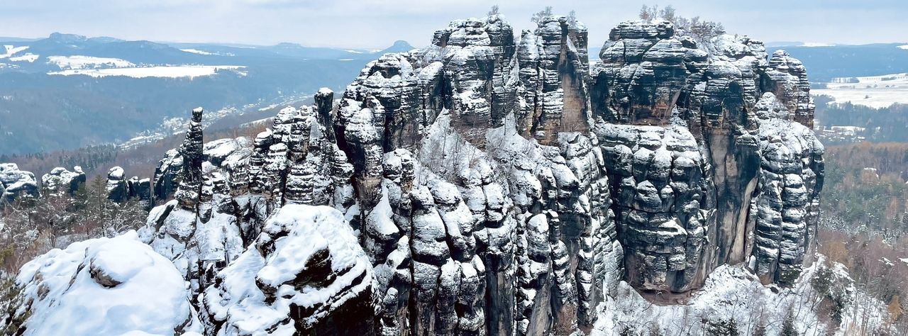
No traffic road cycling routes around Bad Gottleuba-Berggießhübel are characterized by a diverse landscape at the confluence of Saxon Switzerland and the Eastern Ore Mountains. The region features rolling hills, dense forests, and the Gottleuba River valley, providing varied terrain for road cyclists. Routes often include significant elevation changes, offering both challenging climbs and scenic descents. The area's proximity to Saxon Switzerland also provides glimpses of unique rock formations and natural monuments.
Best no traffic road cycling routes around Bad…
Last updated: July 11, 2026
5.0
(2)
60
riders
89.1km
04:27
1,290m
1,290m
Hard road ride. Very good fitness required. Some segments of this route may be unpaved and difficult to ride.
5.0
(1)
76
riders
24.7km
01:13
290m
290m
Moderate road ride. Great for any fitness level. Some segments of this route may be unpaved and difficult to ride.

Sign up for free
5.0
(2)
34
riders
37.3km
01:41
300m
300m
Easy road ride. Great for any fitness level. Mostly well-paved surfaces and easy to ride.
5.0
(2)
15
riders
42.2km
02:02
590m
600m
Moderate road ride. Good fitness required. Mostly well-paved surfaces and easy to ride.
3.8
(4)
12
riders
39.1km
01:56
630m
630m
Moderate road ride. Good fitness required. Mostly well-paved surfaces and easy to ride.
Get access to more routes and recommendations from other explorers.
Sign up for free
Already have an account?
Our route recommendations are based on thousands of hikes, rides, and runs completed by other people on komoot.
Start today with a free account
Your next adventure awaits.
Login or Signup
Popular around Bad Gottleuba-Berggießhübel

Other adventures around Bad Gottleuba-Berggießhübel

Tips from the Community

a beautiful destination and highly recommended
0
0

The Elbbrücke Bad Schandau, a central structure of the B172 built in 1977, was closed in November 2024 due to safety deficiencies. After a successful load test, it has been open to traffic up to 7.5 tons again since April 2025. Despite the reopening, a replacement new build is planned in the long term, while a temporary bridge is intended to provide relief.
3
0

An architectural gem: the Art Nouveau complex, built at the beginning of the 20th century, invites you to explore. Unfortunately, there are no dining options.
0
0

Ideal for a short break
0
0

The bike path is nice and wide. And the view makes you want to go hiking.
0
0

A beautifully renovated castle, but not open to the public. The castle grounds are freely accessible.
0
1
Brilliant asphalt. Little traffic.
0
0

View of the white quarries.
0
0
Frequently Asked Questions
How many no traffic road cycling routes are available in Bad Gottleuba-Berggießhübel?
There are over 25 dedicated no traffic road cycling routes in the Bad Gottleuba-Berggießhübel region, offering a wide range of distances and difficulty levels for cyclists to explore.
What kind of terrain can I expect on these no traffic road cycling routes?
The routes in Bad Gottleuba-Berggießhübel offer a diverse landscape, from relatively gentle inclines along the Gottleuba River Valley to more challenging climbs through the rolling hills and dense forests of the Eastern Ore Mountains. You'll encounter varied terrain with significant elevation gains on many routes, providing both scenic beauty and a good workout.
When is the best time of year to enjoy no traffic road cycling in Bad Gottleuba-Berggießhübel?
The best season for road cycling in Bad Gottleuba-Berggießhübel is typically summer, thanks to its mild climate. The vibrant colors of autumn also offer a beautiful backdrop for rides, especially through the forested areas.
Are there options for longer, more challenging no traffic road cycling routes?
Yes, for experienced cyclists seeking a challenge, there are several difficult routes with substantial elevation gains. An example is the 89.4 km route, View of Děčín – Ascent to Děčínský Sněžník loop from Königstein (Sächs Schweiz) Hp, which features over 1290 meters of ascent.
Are there any easy, family-friendly no traffic road cycling routes?
Absolutely. The region offers easy routes suitable for families or those looking for a more relaxed ride. The well-maintained cycle path along the Gottleuba River is particularly gentle. An example of an easy route is the 37.3 km View of the Elbe – Liebethal Gorge Road loop from Obervogelgesang.
What scenic views can I expect along the no traffic road cycling routes?
Cyclists can enjoy breathtaking views of the surrounding nature, including the picturesque Gottleuba River Valley, rolling hills, and dense forests. Routes often provide glimpses of the unique rock formations of Saxon Switzerland. For panoramic vistas, consider routes that ascend to points like Augustusberg or the Panoramahöhe viewing tower.
What historical or cultural sights can I discover along the routes?
Many routes pass through picturesque small villages with traditional Saxon half-timbered houses. You can also discover historic mills and old bridges. The town of Bad Gottleuba itself is known for its well-preserved architecture and spa facilities, offering a blend of natural beauty and cultural heritage.
Are there any circular no traffic road cycling routes?
Yes, many of the no traffic road cycling routes in the area are designed as loops, allowing you to start and end at the same point. For instance, the View of Saxon Switzerland loop from Liebstadt is a moderate 42.2 km option.
What do other road cyclists enjoy the most about road cycling in Bad Gottleuba-Berggießhübel?
The area is highly rated by the komoot community, with an average score of 4.4 stars. Reviewers often praise the quiet, traffic-free roads, the varied and scenic landscapes, and the rewarding climbs that offer stunning views over the region.
Are there any notable peaks or viewpoints accessible from the cycling routes?
Yes, the region is close to several impressive peaks and viewpoints. You might find routes that offer views towards Papststein Viewpoint, Gohrischstein, or even the Lilienstein Summit and Viewpoint, providing spectacular panoramas of Saxon Switzerland.
Can I find routes that pass by lakes or water features?
Yes, some routes may offer views of local water bodies. The Gottleuba River itself is a prominent feature, and you might find routes that pass near the Bad Gottleuba Dam. For specific lake highlights, consider exploring areas around Amselsee or Great Galgenteich.
Where can I park my car to access these no traffic road cycling routes?
Many routes in the Bad Gottleuba-Berggießhübel region offer convenient starting points with parking facilities. It's advisable to check the specific route details on komoot for recommended parking locations near the start of your chosen tour.
Most popular routes around Bad Gottleuba-Berggießhübel
Most popular attractions around Bad Gottleuba-Berggießhübel

Get inspired with the komoot mobile app


Explore more
Browse the best Road cycling routes in other regions.
