The best hikes from bus stations around Bad Königshofen im Grabfeld
4.5
(2514)
8,661
hikers
79
hikes
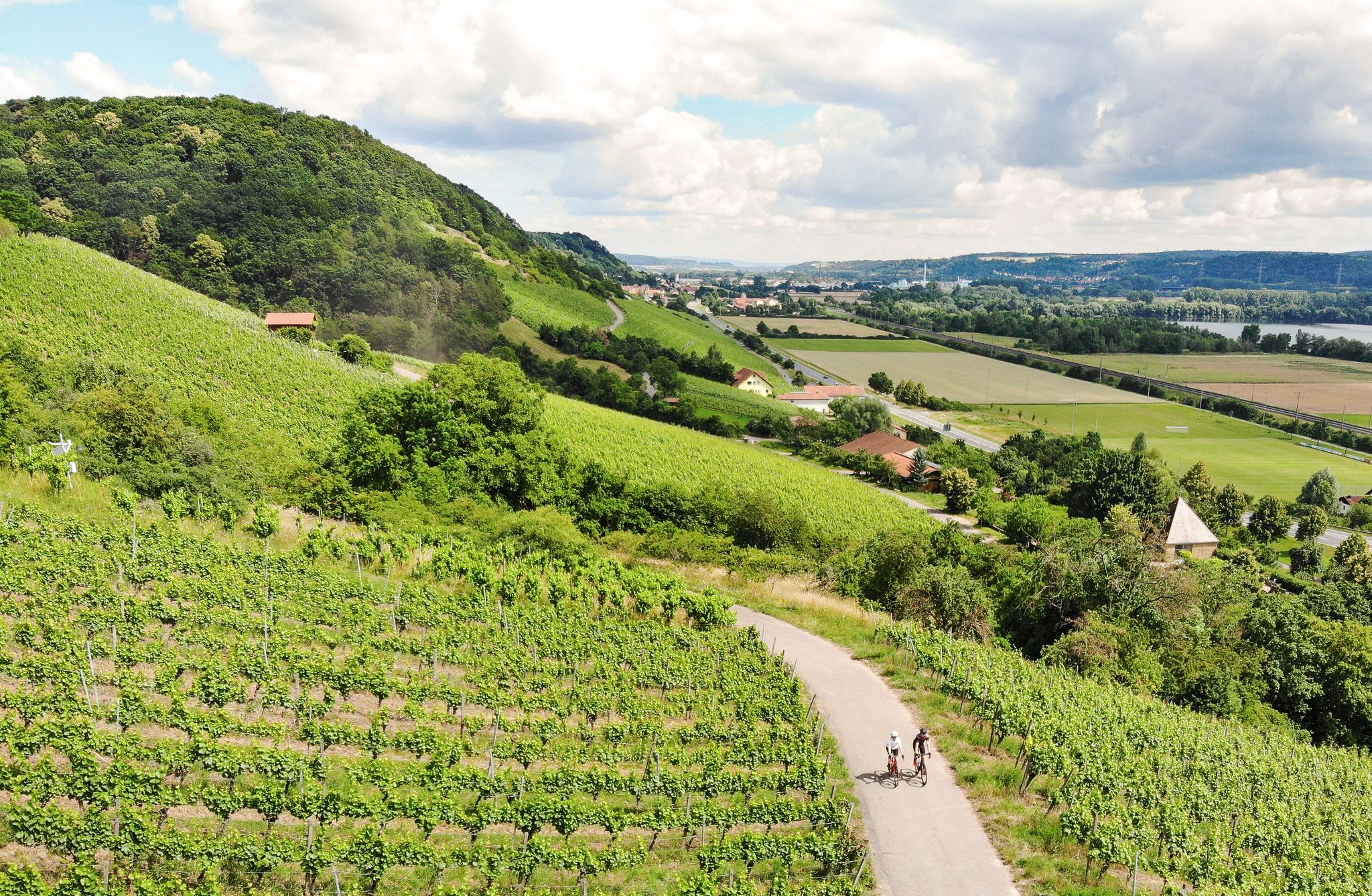
Bus station hiking trails around Bad Königshofen im Grabfeld traverse a landscape characterized by rolling hills, expansive meadows, and dense forests within the Grabfeld and Rhön regions. This area offers diverse scenery, from woodlands like Mönchsholz to open fields. The terrain includes gentle ascents and descents, providing varied experiences for hikers. Notable features include viewpoints like Grabfeldblick and the botanical diversity of Nesselgrund Nature Reserve.
Best bus station hiking trails around Bad Königshofen im Grabfeld
- The most popular bus station hiking route is Molkenbrünnlein – Kleinbardorf Jewish Cemetery loop from Nesselgrund, a 9.3 miles (15.0 km) trail that takes about 4 hours 10 minutes to complete. This route features varied terrain and includes a significant historical site.
- Another top favourite among local hikers is View of the Rhön – Berghäuschen Viewpoint loop from Bad Königshofen im Grabfeld, a moderate 7.1 miles (11.4 km) path. This trail offers views of the Rhön region and passes a viewpoint.
- Local hikers also love the Sambachshof fairytale forest – Molkenbrünnlein loop from Nesselgrund, a 4.4 miles (7.1 km) trail leading through a fairytale forest, often completed in about 1 hour 56 minutes.
- Hiking around Bad Königshofen im Grabfeld is defined by rolling hills, dense forests, and open meadows, with options ranging from easy walks to more challenging moderate routes. The network of bus accessible hiking trails offers options for different ability levels.
- The routes in Bad Königshofen im Grabfeld are highly rated by the komoot community with an average score of 4.5 stars from over 2,300 reviews. More than 8,700 hikers have used komoot to explore Bad Königshofen im Grabfeld's varied terrain.
Last updated: June 27, 2026
4.7
(41)
134
hikers
11.8km
03:07
110m
110m
Moderate hike. Good fitness required. Easily-accessible paths. Suitable for all skill levels.
4.4
(15)
43
hikers
7.05km
01:56
110m
110m
Easy hike. Great for any fitness level. Easily-accessible paths. Suitable for all skill levels.

Sign up for free
4.3
(14)
50
hikers
8.38km
02:19
150m
150m
Moderate hike. Good fitness required. Easily-accessible paths. Suitable for all skill levels.
4.7
(10)
31
hikers
Moderate hike. Good fitness required. Easily-accessible paths. Suitable for all skill levels.
4.7
(13)
41
hikers
15.0km
04:11
290m
290m
Moderate hike. Good fitness required. Easily-accessible paths. Suitable for all skill levels.
Get access to more routes and recommendations from other explorers.
Sign up for free
Already have an account?
Our route recommendations are based on thousands of hikes, rides, and runs completed by other people on komoot.
Start today with a free account
Your next adventure awaits.
Login or Signup
Popular around Bad Königshofen im Grabfeld
Other adventures around Bad Königshofen im Grabfeld

Tips from the Community

The air in the pavilion has a salt content of about 25%, which moisturizes and positively influences the respiratory tract. I found it pleasant 😊
2
0


Very nice little fairytale forest for small children.
2
0

In about 3 meters, two trunks become one, curious
0
0

The moated castle is almost hidden away, accessible via a small road that branches off from Sulzdorf at Lederhecke. https://inges-reiseblog.de/wasserschloss-brennhausen/
5
0

Brennhausen Castle is privately owned and can only be viewed from the outside. https://grabfeld-grenzenlos.de/burg-brennhausen/
5
0

The Baunach is a nearly 54-kilometer-long right and northern tributary of the Main in Bavaria (Germany). Part of the floodplain landscape of the Baunach is a nature reserve. The first evidence of the river dates back to 1321 (Bunach). The defining word of the name Baunach comes from the Middle Low German word Būne for 'groyne, bank protection structure', the root word ach occurs in many water names and means water, body of water.[5] An alternative derivation is based on the Indo-European word bhu (swell). Accordingly, Baunach would have the overall meaning of swelling water. The Baunach rises in the Haßberge mountains, which belong to the Franconian Keuper-Lias region, and separates the actual Haßberge from the Haßberge Zeilberge of the Itz-Baunach hill country. The Baunach rises in the Sulzfeld Forest south of the Großer Breitenberg, northeast of the Laubhügel and east of the village of Leinach. The Baunach flows into the Main in Baunach. (Wikipedia)
0
0

Not so easy to find this rare tree... 😉
0
0
Frequently Asked Questions
How many bus-accessible hiking trails are available around Bad Königshofen im Grabfeld?
There are over 80 bus-accessible hiking trails around Bad Königshofen im Grabfeld, offering a wide range of options for different preferences and fitness levels. These routes allow you to explore the picturesque Grabfeld and Rhön regions conveniently.
What kind of landscapes can I expect on these bus station hikes?
The bus-accessible trails around Bad Königshofen im Grabfeld traverse a diverse landscape characterized by rolling hills, expansive green meadows, and dense forests. You'll experience the scenic beauty of the Grabfeld region and parts of the picturesque Rhön, including areas like the beautiful Mönchsholz forest.
Are there easy hiking trails accessible by bus for beginners or families?
Yes, approximately 45 of the bus-accessible routes are rated as easy, making them ideal for beginners or families. These trails often wind through gentle terrain, such as the Sambachshof fairytale forest – Molkenbrünnlein loop from Nesselgrund, which is an easy 7 km hike.
Are there any circular routes that start and end at a bus stop?
Many of the bus-accessible trails in the region are circular routes, allowing you to return to your starting point without needing additional transport. An example is the Brennhausen Castle – Reuthsee loop from Aub, which offers a moderate 11.8 km journey.
What interesting sights or landmarks can I see along these bus-accessible trails?
The trails offer glimpses of various points of interest. You might encounter historical sites like the Brennhausen Castle or the significant Kleinbardorf Jewish Cemetery. Natural attractions include the Reuthsee and the Nesselgrund Nature Reserve, known for its botanical diversity.
Are there any routes with good viewpoints accessible by bus?
Absolutely. The region is known for its scenic vistas. For example, the View of the Rhön – Berghäuschen Viewpoint loop from Bad Königshofen im Grabfeld offers excellent panoramic views over the surrounding valleys and mountains, including the Rhön region.
What is the best time of year to go hiking from bus stations in Bad Königshofen im Grabfeld?
The best times for hiking in Bad Königshofen im Grabfeld are spring and autumn. During these seasons, the weather is generally pleasant, and nature is at its most vibrant, whether it's the fresh greenery of spring or the colorful foliage of autumn. The Nesselgrund Nature Reserve is particularly recommended for visits in May and June to observe its natural flora.
What do other hikers enjoy most about the bus-accessible trails in this area?
The komoot community highly rates the hiking experience around Bad Königshofen im Grabfeld, with an average score of 4.5 stars. Hikers often praise the diverse landscapes, the well-maintained paths, and the convenience of accessing these beautiful routes directly from bus stops.
Can I bring my dog on these bus-accessible hiking trails?
Many of the trails in the Bad Königshofen im Grabfeld region are dog-friendly, allowing you to enjoy the natural beauty with your canine companion. However, it's always advisable to keep dogs on a leash, especially in nature reserves or near livestock, and to check local regulations for specific routes.
Are there any longer, more challenging bus-accessible hikes for experienced hikers?
While many routes are easy to moderate, there are options for more experienced hikers. Approximately 34 routes are rated as moderate, and there is even 1 difficult route. These longer trails, such as the 14.9 km Molkenbrünnlein – Kleinbardorf Jewish Cemetery loop from Nesselgrund, often feature more elevation gain and cover greater distances, providing a good challenge.
Most popular routes around Bad Königshofen im Grabfeld
Most popular attractions around Bad Königshofen im Grabfeld

Get inspired with the komoot mobile app


Explore more
Browse the best Hikes in other regions.
