The best hikes from bus stations around Langenzersdorf
4.6
(10081)
65,547
hikers
39
hikes
Bus station hiking trails around Langenzersdorf offer access to a diverse landscape at the foot of the Bisamberg hill and on the edge of the Vienna Woods. The region is characterized by rolling hills, vineyards, and views of the Danube Valley. Trails often feature moderate ascents, leading through forested areas and open fields, providing varied terrain for hikers.
Best bus station hiking trails around Langenzersdorf
- The most popular bus station hiking route is View of Korneuburg – Elisabeth Heights loop…
Last updated: June 27, 2026
4.5
(46)
165
hikers
5.85km
01:53
190m
190m
Moderate hike. Great for any fitness level. Mostly accessible paths. Sure-footedness required.
4.5
(28)
116
hikers
7.17km
02:11
190m
190m
Moderate hike. Good fitness required. Mostly accessible paths. Sure-footedness required.

Sign up for free
4.3
(7)
41
hikers
4.99km
01:27
140m
140m
Easy hike. Great for any fitness level. Easily-accessible paths. Suitable for all skill levels.
4.4
(7)
19
hikers
Moderate hike. Great for any fitness level. Mostly accessible paths. Sure-footedness required.
5.0
(4)
28
hikers
4.43km
01:37
190m
190m
Moderate hike. Great for any fitness level. Mostly accessible paths. Sure-footedness required.
Get access to more routes and recommendations from other explorers.
Sign up for free
Already have an account?
Our route recommendations are based on thousands of hikes, rides, and runs completed by other people on komoot.
Start today with a free account
Your next adventure awaits.
Login or Signup
Popular around Langenzersdorf


Tips from the Community

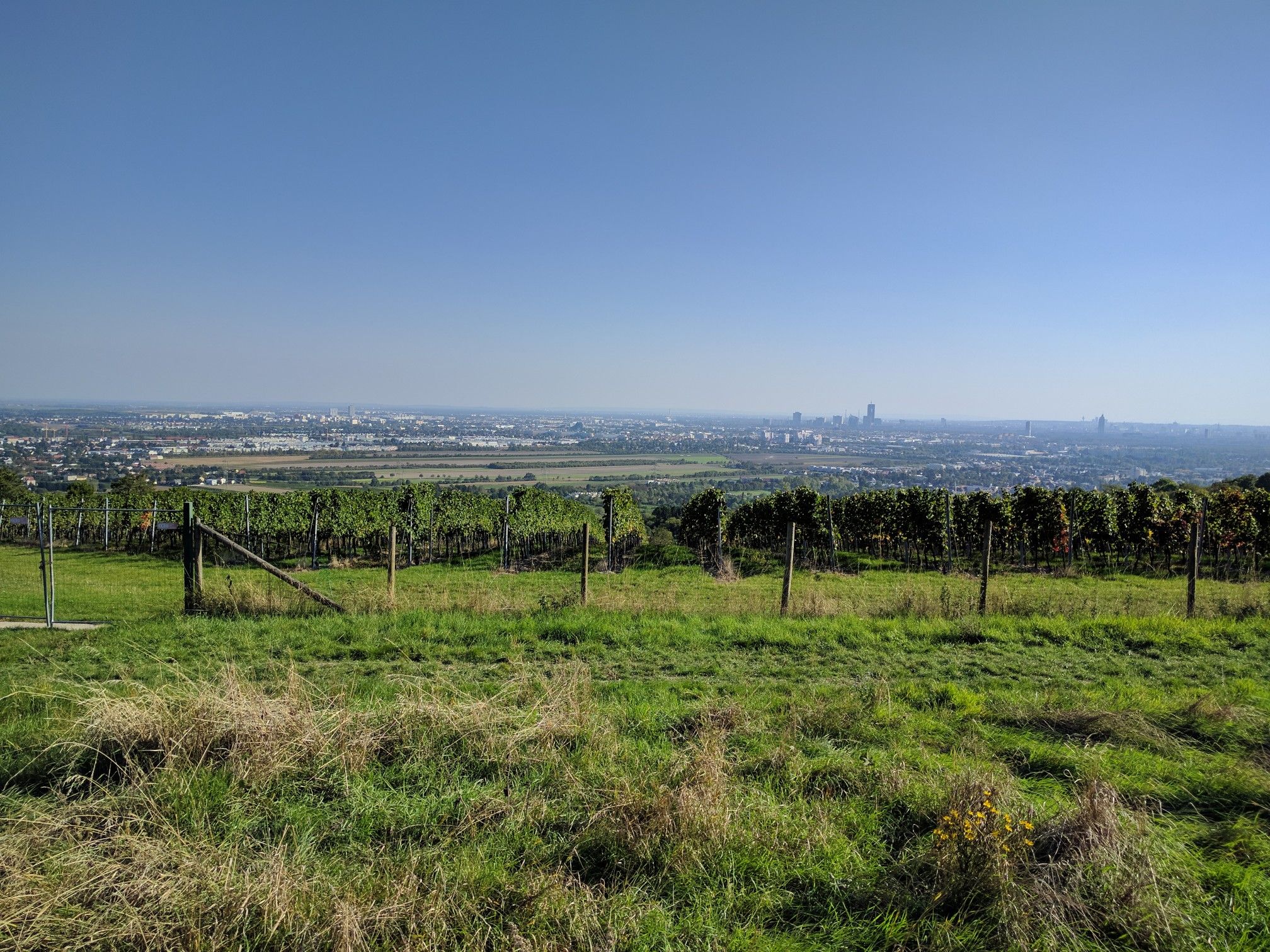
The Venus Garden on Bisamberg is an idyllic resting place amidst dry grasslands and vineyards, offering particularly beautiful panoramic views due to its open location. From here, the gaze sweeps over Langenzersdorf to Vienna and the Danube, where city and nature impressively meet. An atmospheric spot to pause for a moment and enjoy the special landscape at the transition between Weinviertel and the big city.
1
0

This one is named after the monument erected here in 1899 in memory of Empress Elisabeth. However, she was never up here. This small plateau offers enough space on its meadow for recreation, a play area for children, and a climbing frame with a slide. Folk dance festivals with St. John's bonfires also took place here. Information boards provide information about the flora and fauna of the Bisamberg, which are characterized by the Central European climate in the west and the foothills of the Pannonian climate in the east.
1
0
The Kellergasse begins at the intersection of Clessgasse – Hagenbrunner Straße and leads steeply uphill to the north. In numerous cellars, it repeatedly says „Ausg’steckt is“.
1
0
The Josef von Eichendorff Monument commemorates the poet Joseph von Eichendorff and is situated in a scenic location on the outskirts of Vienna. Surrounded by greenery, the site offers a tranquil atmosphere with beautiful views of the surrounding countryside. It's an evocative place that combines literary history with the experience of nature.
7
1
The Elisabethhöhe viewpoint on the Bisamberg offers a sweeping view over the Danube Valley and the rolling hills of the Weinviertel region. Nestled between forest and open fields, an impressive panorama unfolds, encompassing the Danube and the surrounding landscape. A worthwhile stop for anyone who appreciates peace, nature, and panoramic views.
6
0
Elisabethhöhe is both a memorial and a viewpoint, commemorating Empress Elisabeth with a simple monument. From here, a sweeping view opens up across the Danube Valley with its meadows and fields. An atmospheric place that combines history and breathtaking vistas.
6
0
Elisabethhöhe offers a stunning panoramic view over the Danube Valley and the surrounding hills. On a clear day, the view extends far across the floodplain towards Vienna and into the Weinviertel region. It's an ideal spot for a short break to enjoy the vastness and tranquility of the landscape.
6
0
Elisabethhöhe offers a stunning panoramic view over the Danube Valley and the surrounding hills. On a clear day, the view extends far across the floodplain towards Vienna and into the Weinviertel region. It's an ideal spot for a short break to enjoy the vastness and tranquility of the landscape.
6
0
Frequently Asked Questions
How many hiking trails accessible from bus stations are there around Langenzersdorf?
There are over 40 hiking trails around Langenzersdorf that are easily accessible from local bus stations. These routes offer a diverse range of experiences, from leisurely strolls to more challenging ascents up the Bisamberg.
What are the typical difficulty levels for bus station hikes in this area?
The bus station hikes around Langenzersdorf primarily feature easy and moderate difficulty levels. Out of 40 available routes, 26 are considered easy, making them suitable for casual walkers, while 14 are moderate, offering a bit more challenge with varied terrain and elevation.
When is the best time of year to go hiking from a bus station in Langenzersdorf?
The spring and autumn months are ideal for hiking in Langenzersdorf. During these seasons, the landscape is vibrant with color, especially the vineyards, and the mild climate is perfect for outdoor exploration. The views from the Bisamberg are particularly stunning in clear weather.
Are there any circular hiking routes accessible directly from a bus stop?
Yes, many routes are designed as circular walks, allowing you to start and end your hike at the same bus station. For example, the View of Korneuburg – Elisabeth Heights loop from Langenzersdorf is a moderate circular trail offering great views, and the Kellergasse Neustift am Walde – View of Vienna loop from Langenzersdorf provides an easy option with scenic vistas.
What kind of natural features can I expect to see on these bus-accessible trails?
The trails offer a blend of natural beauty, including the rolling hills of the Bisamberg, picturesque vineyards, and glimpses of the Danube valley. You'll also find sections that border the Vienna Woods, providing a diverse and appealing natural environment.
Are there family-friendly hiking options from bus stations in Langenzersdorf?
Absolutely. Many trails are suitable for families, often featuring shorter distances and gentler ascents. The region's proximity to the Bisamberg means there are accessible paths leading to viewpoints like "Am Himmel," which are popular and relatively easy, perfect for a family outing.
Can I bring my dog on these bus station hiking trails?
Yes, the hiking trails around Langenzersdorf are generally dog-friendly. It's always recommended to keep your dog on a leash, especially in nature protection areas or near livestock, and to carry water for them. Please be mindful of local regulations regarding dogs in public transport.
What interesting viewpoints or landmarks can I discover along the routes?
Many trails lead to stunning viewpoints. The Bisamberg offers panoramas over the Danube valley and the Vienna skyline from spots like Elisabethhöhe. You might also encounter historical sights such as the Leopoldsruhe or the Stefaniewarte along trails that extend towards the Kahlenberg area. While not directly on these routes, you can explore highlights like the Gspöttgraben or the Wayside Cross at Klausgraben nearby.
Are there places to eat or drink near the bus-accessible trailheads?
Langenzersdorf and the surrounding villages, particularly those with vineyards and cellar lanes like Bisamberg, often have traditional taverns (Heurigen) or cafes where you can enjoy refreshments and local cuisine. These are typically found within walking distance of bus stops and trail starts.
What do other hikers enjoy most about the bus station hikes in Langenzersdorf?
The komoot community highly rates the hiking experiences here, with an average score of 4.6 stars. Reviewers often praise the accessibility of the trails from public transport, the beautiful panoramic views from the Bisamberg, and the charming blend of natural landscapes and vineyards.
Are there any longer-distance trails that can be accessed from Langenzersdorf bus stations?
Yes, Langenzersdorf is part of longer hiking routes. Sections of the Eastern Austrian Borderland Trail (Ostösterreichischer Grenzlandweg 07) and the Weinviertelweg 632, which traverse the gentle landscapes north of Vienna, can be accessed from the area, allowing for extended journeys.
Most popular routes around Langenzersdorf
Most popular attractions around Langenzersdorf

Get inspired with the komoot mobile app


Explore more
Browse the best Hikes in other regions.
