The best city hikes and walks around Langenzersdorf
4.6
(10088)
65,687
hikers
487
hikes
Urban hiking trails around Langenzersdorf are situated at the edge of the Vienna Woods, offering a diverse landscape for outdoor activities. The region features the elevated Bisamberg area, providing routes with panoramic views, alongside picturesque vineyards and cellar lanes. Trails often incorporate sections of the Danube Valley, blending natural beauty with urban accessibility. This varied terrain includes light forests and gentle ascents, suitable for different fitness levels.
Best urban hiking trails around Langenzersdorf
- The most popular urban hiking route is…
Last updated: July 10, 2026
4.8
(5)
25
hikers
Moderate hike. Good fitness required. Easily-accessible paths. Suitable for all skill levels.
17
hikers
Easy hike. Great for any fitness level. Easily-accessible paths. Suitable for all skill levels.

Sign up for free
5.0
(1)
5
hikers
Moderate hike. Good fitness required. Easily-accessible paths. Suitable for all skill levels.
2
hikers
5.12km
01:18
10m
10m
Easy hike. Great for any fitness level. Easily-accessible paths. Suitable for all skill levels.
3.0
(1)
2
hikers
Easy hike. Great for any fitness level. Easily-accessible paths. Suitable for all skill levels.
Get access to more routes and recommendations from other explorers.
Sign up for free
Already have an account?
Our route recommendations are based on thousands of hikes, rides, and runs completed by other people on komoot.
Start today with a free account
Your next adventure awaits.
Login or Signup
Popular around Langenzersdorf


Tips from the Community

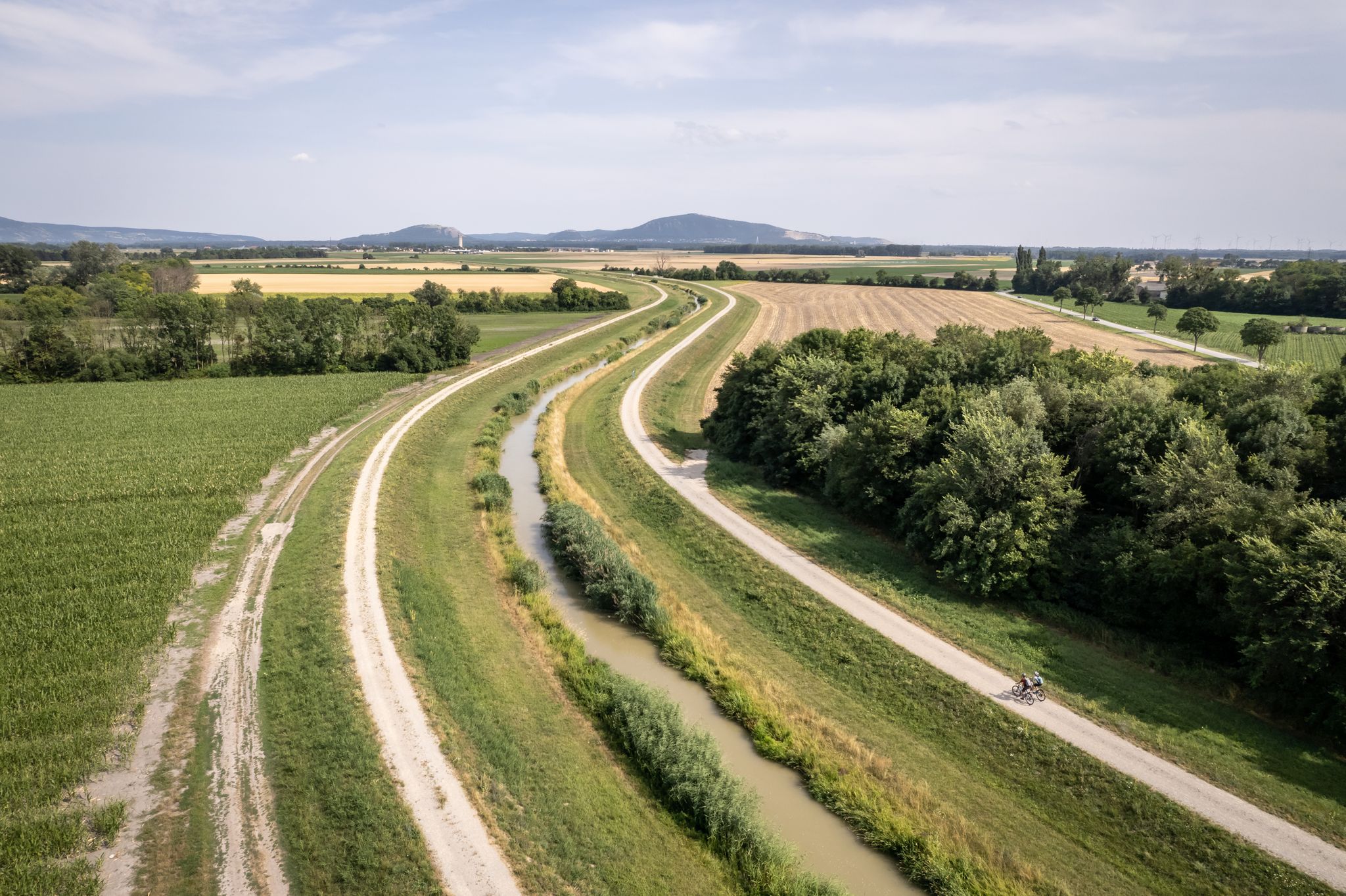
The Marchfeldkanal-Radweg is a flat and scenic route, approximately 60 to 65 km long, leading from Langenzersdorf or Vienna-Floridsdorf across the Marchfeld to Schloss Hof.
1
0
Word of mouth led me here during a bike tour. I can only recommend this place.
1
0
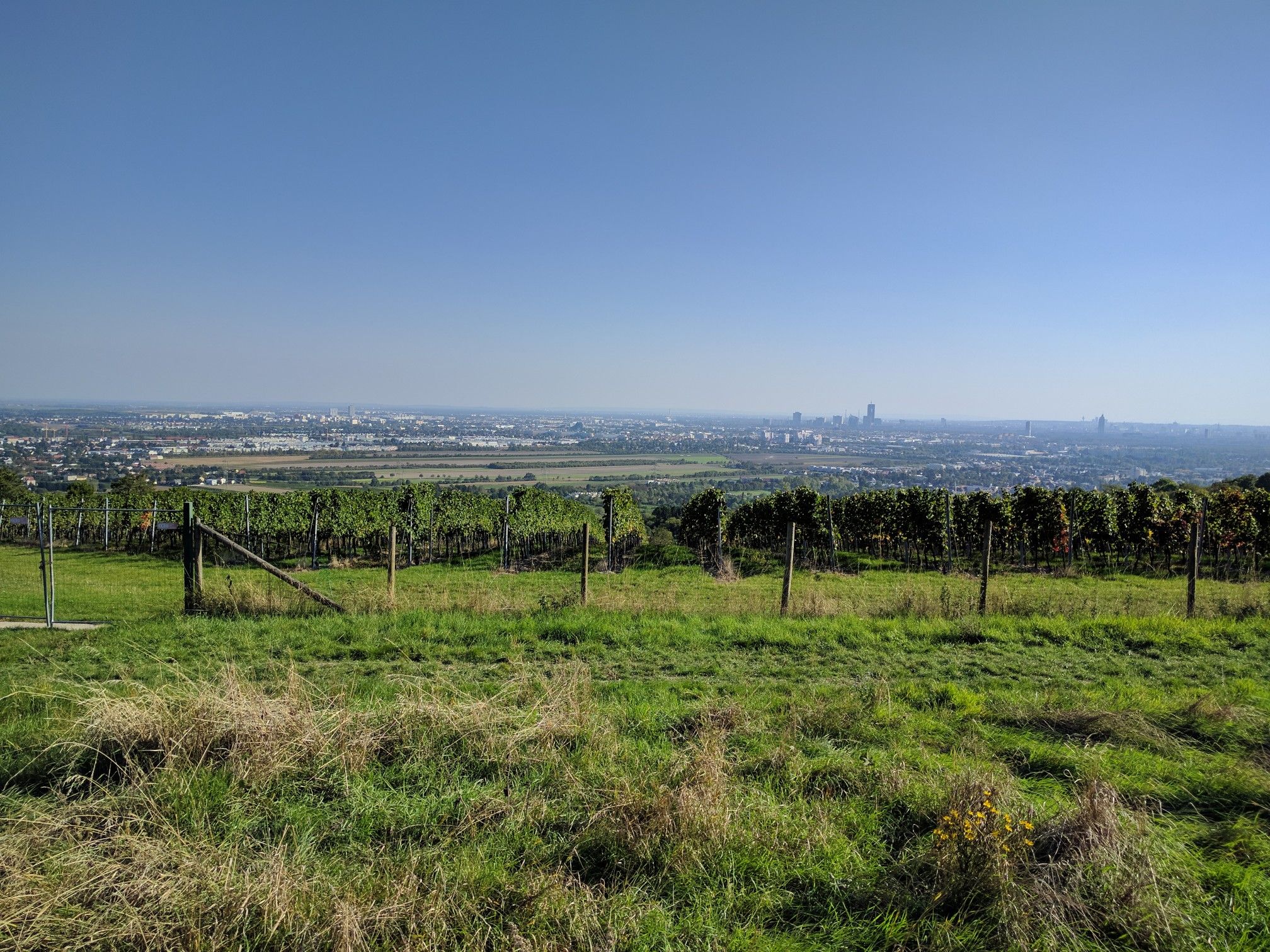
The Kellergasse begins at the intersection of Clessgasse – Hagenbrunner Straße and leads steeply uphill to the north. In numerous cellars, it repeatedly says „Ausg’steckt is“.
1
0

A welcome rest stop at the beginning of the Marchfeld Canal.
5
0

The Marchfeld Canal Cycle Path is a well-developed and popular cycling route in eastern Vienna and the adjacent Lower Austria. It runs largely directly alongside the canal and offers a consistently flat route, making it particularly suitable for everyday cyclists, families, and leisure tours. The car-free route along the canal ensures a quiet and low-traffic environment. It is bordered by green spaces, waterways, and agricultural landscapes, making it a pleasant option even on warm days. The Marchfeld Canal is an artificial waterway constructed in the 1980s and 1990s. Its primary purpose is to irrigate the intensively farmed Marchfeld region, replenish groundwater, and provide flood protection. In addition, the canal improves the local climate and creates valuable habitats for plants and animals.
1
0

Memorial plaque
1
0
The Kellergasse in Bisamberg, located in the Lower Austrian Weinviertel region at the foot of the Bisamberg mountain, is an idyllic street lined with historic wine cellars dating back to 1885. It is approximately 200 meters long, partly in a depression, partly on the slope, and consists of a total of 13 buildings. The surrounding area is particularly suitable for cycling through vineyards, meadows, and fields. Numerous Heurigen (wine taverns) offer regional specialties, and every September the Bisamberger Kellergassenfest (Cellar Lane Festival) takes place, where visitors can enjoy local wines, music, and a traditional atmosphere. The Kellergasse is a charming destination for wine lovers, nature enthusiasts, and anyone who wants to experience a tranquil, authentic Austrian winemaking tradition.
2
0

The Marchfeld Canal leads through the Marchfeld region, the "vegetable garden of Austria" (as the sign says), to Schloss Hof, 62.5 km away. The partially gravelled paths offer a leisurely ride without any major inclines. The Marchfeld Canal is used for irrigation, and cycling along it, you can clearly see the effort that goes into making sure the lettuce or asparagus turns out the way it should... The information boards, which are placed repeatedly along the route, provide interesting information about the region. Approximately halfway along the cycle path, there is also a dedicated information center where you can get maps, etc.
2
0
Frequently Asked Questions
How many urban hiking trails are available around Langenzersdorf?
Langenzersdorf offers a wide selection of urban hiking trails, with over 500 routes available. This includes a diverse range of options, from leisurely strolls to more challenging paths, ensuring there's something for every hiker.
What kind of terrain can I expect on urban hikes in Langenzersdorf?
The urban hikes in Langenzersdorf feature a varied terrain, blending natural beauty with urban elements. You'll find paths through light forests, along the Danube valley, and through picturesque vineyards. Some routes may include gentle ascents and descents, particularly around areas like Bisamberg, offering engaging experiences.
Are there easy urban hikes suitable for beginners or casual walkers?
Yes, Langenzersdorf has many easy urban hikes. Out of over 500 routes, more than 370 are classified as easy, making them perfect for beginners or those looking for a relaxed walk. An example is the Kellergasse Bisamberg loop from Langenzersdorf, which is an easy 5.1 km route.
Which urban trails offer the best scenic views?
Many urban trails in Langenzersdorf boast excellent scenic views. Routes around the Bisamberg often provide panoramic vistas over Vienna and its vineyards. The Elisabethhöhe is another popular viewpoint, offering great sights of the Danube. You can also find trails with views of the Vienna skyline, especially in areas with vineyards.
Are there any family-friendly urban walks in Langenzersdorf?
Absolutely. Many of the easy urban hikes are suitable for families. The region's diverse landscape includes paths through light forests and along the Danube, which are generally pleasant for all ages. For a shorter, easy option, consider The Sphinx by Anton Hanak – Saint John of Nepomuk Statue loop from Langenzersdorf, which is under 3 km.
Can I bring my dog on urban hikes in Langenzersdorf?
Yes, many urban hiking trails in Langenzersdorf are dog-friendly, allowing you to enjoy the outdoors with your canine companion. It's always a good idea to keep your dog on a leash, especially in more populated areas or near wildlife, and to check local regulations for specific trails.
What landmarks or points of interest can I see along the urban hiking routes?
Urban hikes in Langenzersdorf offer a mix of natural beauty and cultural sights. You might encounter picturesque cellar lanes, vineyards, and historical attractions. While hiking, you could explore highlights such as the Lourdes Grotto, Maria Gugging or the Underground Virgil Chapel beneath Stephansdom subway station, which are nearby attractions.
Are there any urban loop trails available?
Yes, Langenzersdorf features several urban loop trails, perfect for starting and ending your hike in the same location. Examples include the View of the Leopoldskirche – Marchfeld Canal loop from Langenzersdorf, a moderate 10 km route, or the shorter, easy View of the Leopoldskirche – Marchfeld Canal loop from Leopoldsberg.
What is the best time of year for urban hiking in Langenzersdorf?
The spring and autumn months are particularly recommended for urban hiking in Langenzersdorf. The mild climate and vibrant colors of the changing seasons enhance the experience, making for pleasant conditions. However, the diverse landscape offers enjoyable walks year-round.
What do other hikers enjoy most about urban hiking in Langenzersdorf?
The urban hiking experience in Langenzersdorf is highly rated by the komoot community, with an average score of 4.68 stars. Reviewers often praise the region's diverse landscape, the blend of natural beauty with historical attractions, and the well-maintained paths that cater to various fitness levels.
Are there any challenging urban hikes in the area?
While many urban hikes are easy or moderate, Langenzersdorf does offer some more challenging options for experienced hikers. There are 10 routes classified as difficult, which might include steeper ascents or longer distances, providing a good workout while still being close to urban amenities.
Is public transport available to access urban hiking trails in Langenzersdorf?
Langenzersdorf is well-connected, making it accessible via public transport. Many trails are designed to be reached easily, often starting near train stations or bus stops. For instance, the Kellergasse Bisamberg – Langenzersdorf Train Station loop from Langenzersdorf conveniently starts and ends near the train station.
Most popular routes around Langenzersdorf
Most popular attractions around Langenzersdorf

Get inspired with the komoot mobile app


Explore more
Browse the best Hikes in other regions.
