The best hikes from bus stations around Waldkirchen
4.6
(10013)
38,566
hikers
113
hikes
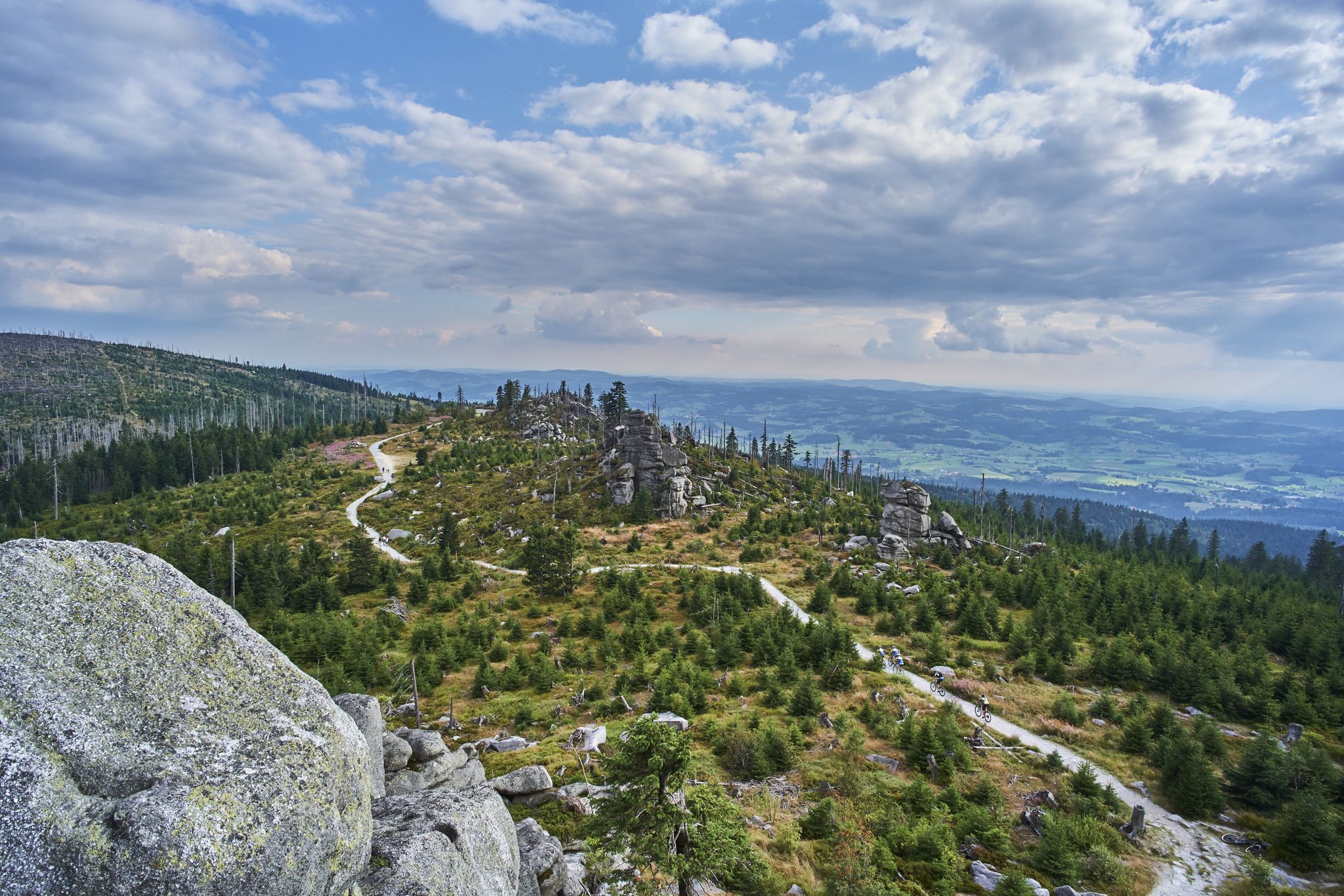
Bus station hiking trails around Waldkirchen explore the diverse landscape of the Bavarian Forest, characterized by low mountain ranges, dense woodlands, and river valleys. The region features natural spectacles such as the Saußbachklamm gorge with its waterfalls and rock formations, and the tranquil Erlauzwieseler See. Elevations vary, including the Oberfrauenwald peak, which offers panoramic views. The terrain provides a mix of gentle paths along waterways and more challenging ascents through forested areas.
Best bus station hiking trails around Waldkirchen
- The most popular bus station hiking route is Watercourse of the Saußbachklamm gorge over a sea of rocks – Saußbachklamm Gorge loop from Waldkirchen, a 4.2 miles (6.8 km) trail that takes 1 hour 53 minutes to complete. This easy route leads through the Saußbachklamm nature reserve, showcasing waterfalls and dramatic rock formations.
- Another top favourite among local hikers is Watercourse of the Saußbachklamm gorge over a sea of rocks – Saußbachklamm Gorge loop from Erlauzwiesel, a moderate 8.1 miles (13.0 km) path. This trail offers an extended exploration of the Saußbachklamm, featuring varied terrain and scenic views of the gorge and surrounding forest.
- Local hikers also love the Ledermüller Bee House – Oberfrauenwald Observation Tower loop from Oberfrauenwald, a 2.5 miles (4.0 km) trail leading through forested areas to the Oberfrauenwald peak, often completed in about 1 hour 13 minutes.
- Hiking around Waldkirchen is defined by wild gorges, panoramic peaks, and tranquil lake paths. The network offers options for various ability levels, from easy family-friendly walks to more challenging routes with significant elevation gain.
- The routes in Waldkirchen are highly rated by the komoot community with an average score of 4.5 stars from more than 9,800 reviews. More than 38,000 hikers have used komoot to explore Waldkirchen's varied terrain.
Last updated: May 14, 2026
4.7
(272)
1,032
hikers
Easy hike. Great for any fitness level. Easily-accessible paths. Suitable for all skill levels.
4.6
(42)
227
hikers
Hard hike. Great for any fitness level. Sure-footedness, sturdy shoes and alpine experience required.

Sign up for free
4.5
(20)
60
hikers
Moderate hike. Good fitness required. Easily-accessible paths. Suitable for all skill levels.
4.5
(21)
61
hikers
10.9km
03:09
290m
290m
Moderate hike. Good fitness required. Easily-accessible paths. Suitable for all skill levels.
4.5
(23)
70
hikers
10.6km
03:05
270m
270m
Moderate hike. Good fitness required. Easily-accessible paths. Suitable for all skill levels.
Get access to more routes and recommendations from other explorers.
Sign up for free
Already have an account?
Our route recommendations are based on thousands of hikes, rides, and runs completed by other people on komoot.
Start today with a free account
Your next adventure awaits.
Login or Signup


Tips from the Community

Every year on January 5th at 7 pm, the Rauhnacht (Twelve Nights) is celebrated in Waldkirchen. A fantastic spectacle: https://www.rauhnacht.de/
1
0


Beautiful rest areas to enjoy nature
1
0
Entrance to the gorge which you should definitely walk up
0
0
Crossing with a beautiful view of the stream
0
1

An easy hiking trail through the Saußbach Gorge, but not suitable for strollers. Hiking trail 1 through the gorge is very well marked.
0
0

Impressions of the former garden show grounds
1
0

Frequently Asked Questions
How many hiking trails are accessible from bus stations in Waldkirchen?
There are over 110 hiking trails around Waldkirchen that are easily accessible from local bus stations. These routes cater to various preferences, with more than 50 easy options, nearly 50 moderate trails, and a selection of challenging routes for experienced hikers.
What makes hiking from bus stations in Waldkirchen unique?
Hiking from bus stations in Waldkirchen offers unparalleled convenience, allowing you to explore the diverse landscapes of the Bavarian Forest without needing a car. You can easily reach trailheads for wild gorges, panoramic viewpoints, and tranquil lakes, immersing yourself in nature and local culture with public transport.
Are there easy hiking trails accessible from bus stations in Waldkirchen?
Yes, Waldkirchen offers numerous easy hiking trails perfect for a relaxed outing. A great option is the Watercourse of the Saußbachklamm gorge over a sea of rocks – Saußbachklamm Gorge loop from Waldkirchen, which is an easy 6.7 km circular route through the picturesque Saußbachklamm nature reserve, starting directly from Waldkirchen.
Are there challenging hikes from Waldkirchen's bus stations?
For those seeking a challenge, Waldkirchen also provides more demanding routes. The Ledermüller Bee House – Oberfrauenwald Observation Tower loop from Oberfrauenwald is a difficult 4 km hike that rewards you with stunning panoramic views from the Oberfrauenwald observation tower, the highest point in the municipal area.
Can I find circular hiking routes starting from bus stops in Waldkirchen?
Absolutely. Many trails in Waldkirchen are designed as circular routes, making them ideal for bus station access. The Saußbachklamm Gorge loop from Waldkirchen is a popular circular path, and the Marian Column, Waldkirchen – Osterbach Canal loop from Waldkirchen offers another scenic circular option.
Are there trails with waterfalls or gorges near Waldkirchen bus stations?
Yes, the region is famous for its natural spectacles. The wild and romantic Saußbachklamm (Saußbach Gorge) is a highlight, featuring waterfalls, cascades, and dramatic rock formations. The Saußbachklamm Gorge loop from Erlauzwiesel is a moderate 13 km route that allows you to fully experience this primeval landscape.
What natural landmarks or viewpoints can I see on these trails?
Hikers can discover several natural landmarks and viewpoints. The Oberfrauenwald peak, with its observation tower, offers expansive views over the Bavarian Forest and even to the Alps on clear days. The tranquil Erlauzwieseler Reservoir is also a beautiful spot for walks, often integrated into local routes.
Are there family-friendly hiking options from Waldkirchen bus stations?
Waldkirchen is very family-friendly. The Saußbachklamm Circular Route (Weg 1), easily accessible from the town center, is known for being exciting for children with its gorge sections. Additionally, the 'Anbindung Kurpark' (Weg 2) is a 5 km route suitable for strollers, leading along the Schwarzbach stream to the health resort park in Erlauzwiesel.
Are dogs allowed on the bus station hiking trails in Waldkirchen?
Generally, dogs are welcome on most hiking trails in the Waldkirchen area. However, it's always advisable to keep them on a leash, especially in nature reserves, near wildlife, or when passing through populated areas. Please be mindful of local regulations and clean up after your pet.
What do other hikers enjoy most about the trails around Waldkirchen?
The trails around Waldkirchen are highly rated by the komoot community, with an average score of 4.5 stars from nearly 10,000 ratings. Hikers frequently praise the region's diverse landscapes, from the dramatic Saußbachklamm gorge to the panoramic views from Oberfrauenwald, and the convenience of accessing these natural wonders via public transport.
Are there any historical routes accessible by bus in Waldkirchen?
Yes, Waldkirchen is directly situated on the Historical Golden Steig (Goldener Steig), an ancient salt trading route. You can follow in the footsteps of historical 'salt porters' through gentle hilly landscapes, experiencing a piece of regional history while enjoying unique views of the Bavarian Forest.
Can I find trails that lead to lakes or water bodies?
Certainly. The region features several beautiful lakes. The Erlauzwieseler Reservoir is a tranquil spot, and some winter hiking routes specifically lead to it. Other nearby lakes include Freudensee and Buchberger Reservoir, offering serene settings for walks.
Most popular routes around Waldkirchen
Most popular attractions around Waldkirchen

Get inspired with the komoot mobile app


Explore more
Browse the best Hikes in other regions.
