Easy hikes and walks around Waldkirchen
4.5
(10198)
38,514
hikers
196
hikes
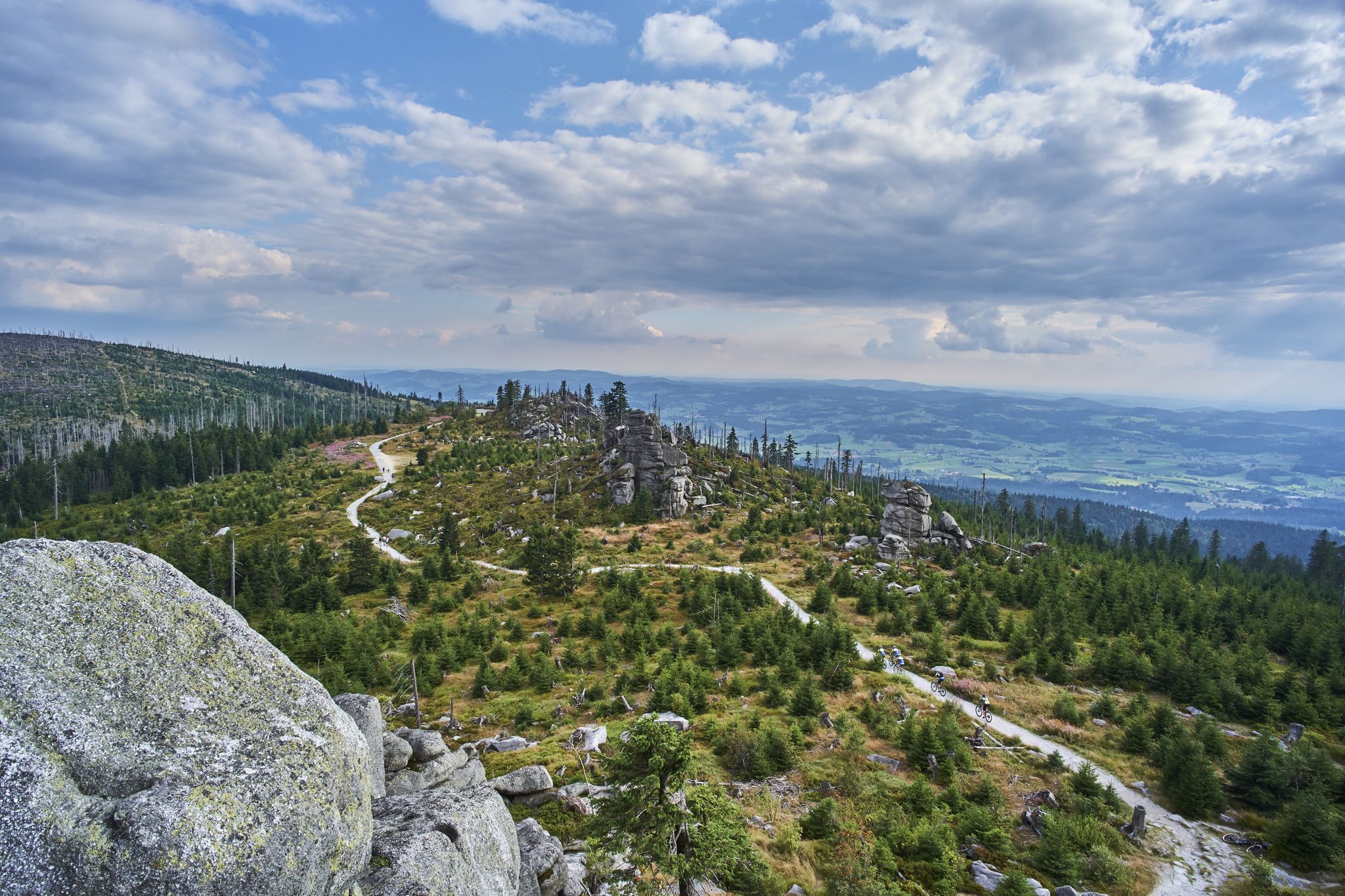
Easy hiking trails around Waldkirchen are situated within the Bavarian Forest, characterized by wooded, low-mountain terrain, rolling hills, and deep valleys. The region features natural highlights such as the Saußbachklamm Gorge with its waterfalls and rock formations, and the tranquil Erlauzwieseler See. These landscapes provide a scenic backdrop for various easy hiking routes.
Best easy hiking trails around Waldkirchen
- The most popular easy hiking route is Weir on the Saußbach – Saußbachklamm Gorge loop from Saußbachleite, a 3.7 miles (6.0 km) trail that takes 1 hour 40 minutes to complete. This route explores the "wild romantic" Saußbachklamm Gorge.
- Another top favourite among local hikers is Watercourse of the Saußbachklamm gorge over a sea of rocks – Saußbachklamm Gorge loop from Waldkirchen, an easy 4.2 miles (6.8 km) path. This trail offers views of the Saußbachklamm gorge's unique rock formations and cascades.
- Local hikers also love the Erlauzwieseler Reservoir – Lake Erlauzwiesel loop from Waldkirchen, a 3.9 miles (6.3 km) trail leading through the area around Lake Erlauzwiesel, often completed in about 1 hour 38 minutes.
- Hiking around Waldkirchen is defined by expansive forests, rolling hills, and deep valleys, including the Saußbachklamm Gorge and Lake Erlauzwiesel. The network offers options for various ability levels, with a focus on easy hiking trails.
- The routes in Waldkirchen are highly rated by the komoot community with an average score of 4.5 stars from more than 1,800 reviews. More than 8,000 hikers have used komoot to explore Waldkirchen's varied terrain.
Last updated: June 30, 2026
4.7
(367)
1,376
hikers
7.71km
02:09
150m
150m
Moderate hike. Good fitness required. Easily-accessible paths. Suitable for all skill levels.
4.6
(156)
646
hikers
10.3km
02:45
120m
120m
Moderate hike. Good fitness required. Easily-accessible paths. Suitable for all skill levels.

Sign up for free
4.9
(11)
111
hikers
Easy hike. Great for any fitness level. Easily-accessible paths. Suitable for all skill levels.
3.7
(23)
64
hikers
Easy hike. Great for any fitness level. Easily-accessible paths. Suitable for all skill levels.
4.7
(26)
170
hikers
Easy hike. Great for any fitness level. Easily-accessible paths. Suitable for all skill levels.
Get access to more routes and recommendations from other explorers.
Sign up for free
Already have an account?
Our route recommendations are based on thousands of hikes, rides, and runs completed by other people on komoot.
Start today with a free account
Your next adventure awaits.
Login or Signup


Tips from the Community

The Restaurant am See Erlauzwiesel welcomes you for a break at the Kurparksee (spa park lake). Located directly on the shore of Lake Erlauzwiesel, the restaurant invites you to linger with its sun terrace and beer garden. Enjoy traditional German cuisine, fresh snacks, cakes, or ice cream—all accompanied by a cold beer from the Hutthurm family brewery. https://www.restaurantamsee.com/
0
0


There is a charming reservoir very close to Waldkirchen.
0
0
very nice playground for the little ones 😉
0
0
Unfortunately, there was no water running here in the summer
0
0
just enjoy the peace and quiet here
0
0
Frequently Asked Questions
How many easy hiking trails are available around Waldkirchen?
Waldkirchen offers a wide selection of easy hiking trails, with over 90 routes specifically categorized as easy. In total, the region features nearly 200 hiking tours for various skill levels.
What kind of natural features can I expect to see on easy hikes in Waldkirchen?
The easy hiking trails around Waldkirchen are set within the beautiful Bavarian Forest, featuring wooded, low-mountain terrain, rolling hills, and deep valleys. A significant natural highlight is the "wild romantic" Saußbachklamm Gorge, known for its waterfalls, cascades, and unique rock formations. You can experience this on routes like the Watercourse of the Saußbachklamm gorge over a sea of rocks – Saußbachklamm Gorge loop from Waldkirchen. The tranquil Erlauzwieseler See (Lake Erlauzwiesel) is another prominent feature, perfect for leisurely walks.
Are there any easy circular routes around Waldkirchen?
Yes, many easy trails in Waldkirchen are circular. For example, the Weir on the Saußbach – Saußbachklamm Gorge loop from Saußbachleite is a popular 3.7-mile loop exploring the Saußbachklamm Gorge. Another option is the Erlauzwieseler Reservoir – Lake Erlauzwiesel loop from Waldkirchen, which is a 3.9-mile circular trail around the lake.
Can I find viewpoints on easy trails in Waldkirchen?
While many easy trails focus on the valleys and gorges, the region does offer viewpoints. The highest point in the municipal area, Oberfrauenwald (948 m), provides panoramic views over the Bavarian Forest from its observation tower. You can also find the Friedrichsberg Observation Tower as a highlight in the area.
Are the easy hiking trails in Waldkirchen suitable for families?
Yes, Waldkirchen offers family-friendly routes. Some trails, including a circular route through Waldkirchen, feature playgrounds, climbing and lookout points, water games, and themed gardens. Certain paths, especially those connecting to the spa park, are even suitable for strollers, making them ideal for families with young children.
What do other hikers enjoy most about the trails in Waldkirchen?
The hiking trails in Waldkirchen are highly rated by the komoot community, with an average score of 4.5 stars from over 1,800 reviews. Hikers often praise the expansive forests, rolling hills, and deep valleys, particularly highlighting the scenic beauty of the Saußbachklamm Gorge and the tranquility of Lake Erlauzwiesel.
Are there any easy winter hiking options in Waldkirchen?
Yes, Waldkirchen provides dedicated winter hiking trails. These allow visitors to experience the serene beauty of the snow-covered landscape, particularly around the Erlauzwieseler See, which is known for its winter walking routes.
Are there any lakes or reservoirs accessible on easy hikes?
Absolutely. The Erlauzwieseler Reservoir (Lake Erlauzwiesel) is a central feature for easy walks. You can explore its surroundings on routes like the Erlauzwieseler Reservoir – Lake Erlauzwiesel loop from Erlauzwiesel, a 2.8-mile easy path.
What are some interesting historical or cultural points along the trails?
Hikers can follow sections of the historic "Goldener Steig" (Golden Path), an ancient trade route, tracing the footsteps of the "Salzsäumer" (salt carriers). Additionally, you might encounter highlights like the Kohlstattbrunn pilgrimage chapel near some natural monuments.
Are there places to eat or rest near the easy hiking trails?
Yes, the region offers options for refreshments. You can find huts and restaurants such as Schrottenbaummühle or the Halleralm on the Saußbach, which are popular spots for hikers to take a break and enjoy local cuisine.
Is there an easy trail that is less crowded?
While popular spots like the Saußbachklamm can attract visitors, many of the 90+ easy trails offer a quieter experience, especially those venturing deeper into the Bavarian Forest. Exploring routes around the Erlauzwieseler See, such as the Lakeside Stage at Waldkirchen – Erlauzwiesel Reservoir loop from Erlauzwiesel, can provide a peaceful walk.
Most popular routes around Waldkirchen
Most popular attractions around Waldkirchen

Get inspired with the komoot mobile app


Explore more
Browse the best Hikes in other regions.
