The best hikes from bus stations around Bergheim
4.4
(1236)
7,043
hikers
193
hikes
Bus station hiking trails around Bergheim offer access to a diverse natural landscape in North Rhine-Westphalia. The region features rolling hills, dense forests, and river landscapes, particularly along the Erft. Recultivation areas from former lignite mining, such as Fortunafeld and Peringsmaar, provide unique hiking opportunities. The Glessener Höhe, Bergheim's highest point, offers panoramic views and a network of trails.
Best bus station hiking trails around Bergheim
- The most popular bus station hiking route is Stairway to Heaven, Glessener Höhe –…
Last updated: June 26, 2026
4.6
(29)
148
hikers
Easy hike. Great for any fitness level. Easily-accessible paths. Suitable for all skill levels.
4.6
(25)
108
hikers
Moderate hike. Good fitness required. Easily-accessible paths. Suitable for all skill levels.

Sign up for free
4.5
(24)
103
hikers
Easy hike. Great for any fitness level. Easily-accessible paths. Suitable for all skill levels.
4.5
(26)
102
hikers
Easy hike. Great for any fitness level. Easily-accessible paths. Suitable for all skill levels.
4.4
(14)
67
hikers
6.57km
01:43
50m
50m
Easy hike. Great for any fitness level. Easily-accessible paths. Suitable for all skill levels.
Get access to more routes and recommendations from other explorers.
Sign up for free
Already have an account?
Our route recommendations are based on thousands of hikes, rides, and runs completed by other people on komoot.
Start today with a free account
Your next adventure awaits.
Login or Signup

Tips from the Community


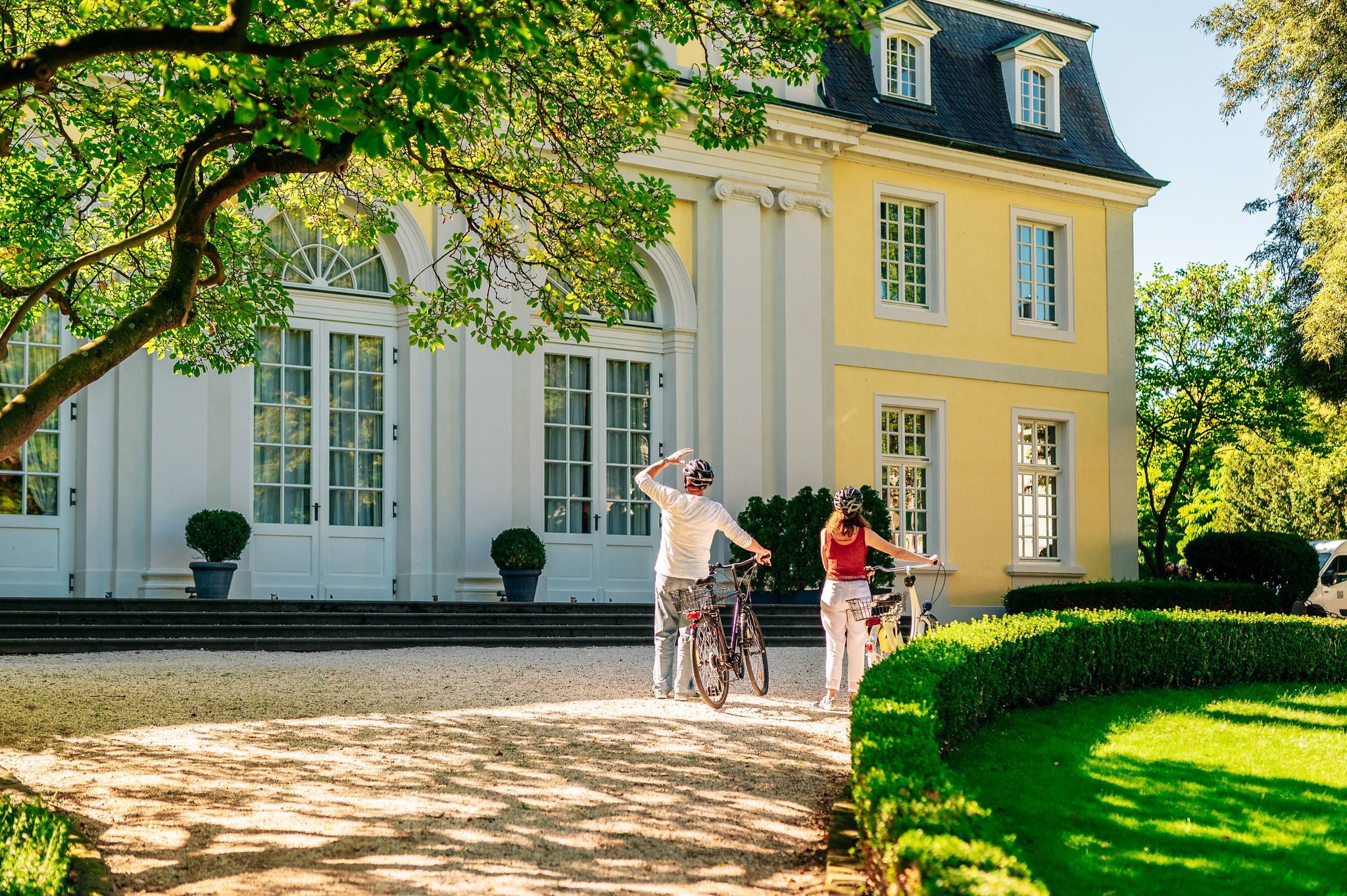
First mentioned in 1230 as the bailiwick of Paffendorf, this Renaissance-style moated castle is completely surrounded by water. Today, a brasserie invites visitors to enjoy coffee, cakes, and light meals. These can be savored either in the stylish interior or in the castle courtyard overlooking the park. The courtyard also serves as a venue for concerts and Christmas markets. The 7.5-hectare castle park delights visitors with its expansive water features, ancient sequoias and ginkgo trees, a stone pavilion, and numerous seating areas that invite relaxation.
1
0

Old brown coal railway wagons with tipping devices are rotting away. It's an interesting place to see how nature is reclaiming technology.
0
0

Walking up and then cycling down is also fun - or both walking and cycling also works.
1
0
It runs along the Erft river for a distance of 110 kilometers.
3
1

The Erft nature reserve between Bergheim and Bedburg is located in the city of Bedburg in the Rhein-Erft district in North Rhine-Westphalia. The area, which consists of four sub-areas, extends north and southeast of the core town of Bedburg and northwest of the core town of Bergheim along the Erft. The A 61 runs west of the area and the L 361 state road runs to the east. The L 279 crosses the area in the northern area and the B 477 in the southern area.
4
0
Frequently Asked Questions
How many bus-accessible hiking trails are there around Bergheim?
There are over 200 hiking routes around Bergheim that are easily accessible by bus, offering a wide range of experiences. Most of these, around 144, are considered easy, making them suitable for many hikers.
What kind of terrain can I expect on bus-accessible hikes in Bergheim?
The landscape around Bergheim is quite diverse, featuring rolling hills, dense forests, and picturesque river valleys, particularly along the Erft. You'll find trails through recultivated former lignite mining areas, offering unique perspectives, as well as routes ascending to viewpoints like the Glessener Höhe.
Are there any family-friendly bus-accessible hikes in Bergheim?
Yes, many of the routes are suitable for families. The paths along the Erft River are particularly popular for their gentle terrain and scenic views. For example, the Paffendorf Castle loop from Erft zwischen Bergheim und Bedburg is an easy option that explores the castle grounds and surrounding park.
Can I bring my dog on these bus-accessible hiking trails?
Most hiking trails in Bergheim are dog-friendly, provided your dog is kept on a leash, especially in nature protection areas or near wildlife. Always check local signage for specific regulations. The varied landscapes, from forests to open fields, offer plenty of enjoyable walks for you and your canine companion.
What are some notable landmarks or viewpoints I can reach by bus for a hike?
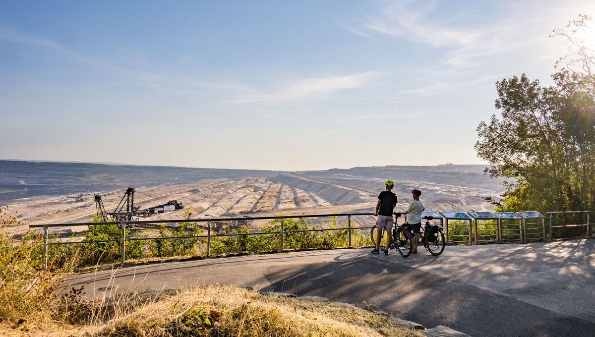
You can reach several interesting points. The Forum :terra nova offers breathtaking views into the Hambach open-pit mine. For a natural high point, consider a hike to the Glessener Höhe, which provides panoramic views. The Paffendorf Castle is also a beautiful destination accessible by bus, offering pleasant walks in its park.
Are there any circular routes accessible from bus stops?
Yes, many of the bus-accessible routes are circular, allowing you to start and end your hike at the same bus stop. An example is the Stairway to Heaven, Glessener Höhe – View from Glessener Höhe loop from Glessen, which takes you to Bergheim's highest point and back.
What is the best time of year to go hiking from bus stations in Bergheim?
Spring and autumn are generally the best seasons for hiking in Bergheim. The weather is mild, and nature is either in full bloom or displaying vibrant autumn colors. While winter hiking is possible, some paths might be muddy or icy, and summer can be quite warm, especially in open areas.
Are there any challenging bus-accessible hikes in Bergheim?
While most routes are easy to moderate, there are some options for those seeking a bit more challenge. For instance, the View from Glessener Höhe – Heaven's Ladder (200 steps) loop from Oberaußem is a moderate route that includes the famous 'Himmelsleiter' with over 350 steps, offering a good workout and rewarding views.
What do other hikers say about the bus-accessible trails in Bergheim?
The komoot community rates the hiking trails around Bergheim highly, with an average score of 4.44 out of 5 stars from over 1200 ratings. Hikers often praise the well-maintained paths, the peaceful natural surroundings, and the convenience of public transport access to diverse landscapes.
Are there opportunities to see water features or rivers on these hikes?
Absolutely. The Erft River flows through Bergheim, and many trails run alongside it, offering pleasant walks with views of green meadows and fields. You can also explore areas like Peringsmaar, a residual lake from former open-cast mining, which provides an easy circular route for a relaxing afternoon.
Can I find places to eat or drink near the bus-accessible hiking trails?
Yes, Bergheim and its surrounding villages offer various cafes, restaurants, and pubs where you can refuel after your hike. Many routes pass through or near these settlements, making it convenient to find refreshments. It's always a good idea to check opening hours in advance, especially in smaller villages.
What are the typical durations for bus-accessible hikes in Bergheim?
Hikes vary greatly in duration. Many easy routes, like the Paffendorf Castle loop from CM.Motorcycles, can be completed in under an hour. Moderate trails, such as the Oberaußem Wooden Bridge loop from Oberaußem, might take around two hours. Longer, more challenging routes can extend to several hours, so you can choose based on your available time and fitness level.
Most popular routes around Bergheim
Most popular attractions around Bergheim

Get inspired with the komoot mobile app


Explore more
Browse the best Hikes in other regions.
