The best traffic-free bike rides in Lexington Reservoir County Park
4.7
(49)
1,171
riders
24
rides
Touring cycling in Lexington Reservoir County Park offers routes through diverse landscapes, including redwood forests, chaparral, and grasslands, nestled in the foothills of the Santa Cruz Mountains. The area features varied terrain with both paved county roads and gravel paths, providing a mix of climbs and descents. The park is centered around the Lexington Reservoir, a significant man-made lake, with a portion of the San Andreas Fault running nearby. These physical features create a dynamic environment for no traffic touring cycling routes.
Best no traffic touring cycling routes in Lexington Reservoir County Park
- The most popular no traffic touring cycling route is Lake Ranch Reservoir – Lake Ranch Reservoir loop from Lexington Reservoir County Park, a 20.0 miles (32.1 km) trail that takes 2 hours 46 minutes to complete. This difficult route features significant elevation changes through varied forest and open terrain.
- Another top favourite among local touring cyclists is James J. Lenihan Dam – Lexington Reservoir loop from Santa Cruz Mountains, a moderate 11.1 miles (17.8 km) path. This route offers scenic views of the reservoir and surrounding hills, with a mix of paved and gravel surfaces.
- Local touring cyclists also love the Old Santa Cruz Highway – Summit Store loop from Lexington Reservoir County Park, a 25.5 miles (41.1 km) trail leading through redwood forests and open hillsides, often completed in about 2 hours 51 minutes.
- Touring cycling in Lexington Reservoir County Park is defined by redwood forests, chaparral, and the expansive Lexington Reservoir. The network offers options for easy, moderate, and difficult routes, catering to various ability levels.
- The routes in Lexington Reservoir County Park are highly rated by the komoot community with an average score of 4.7 stars from more than 60 reviews. More than 1500 touring cyclists have used komoot to explore Lexington Reservoir County Park's varied terrain.
Last updated: July 10, 2026
5.0
(1)
18
riders
17.8km
01:13
310m
310m
Moderate bike ride. Good fitness required. Mostly paved surfaces. Suitable for all skill levels.
11
riders
Moderate bike ride. Good fitness required. Mostly paved surfaces. Suitable for all skill levels.

Sign up for free
7
riders
Hard bike ride. Very good fitness required. Mostly paved surfaces. Suitable for all skill levels.
13
riders
12.5km
00:53
240m
240m
Moderate bike ride. Good fitness required. Mostly paved surfaces. Suitable for all skill levels.
52
riders
55.3km
04:10
1,270m
1,270m
Hard bike ride. Very good fitness required. Mostly paved surfaces. Suitable for all skill levels.
Get access to more routes and recommendations from other explorers.
Sign up for free
Already have an account?
Our route recommendations are based on thousands of hikes, rides, and runs completed by other people on komoot.
Start today with a free account
Your next adventure awaits.
Login or Signup
Popular around Lexington Reservoir County Park
Tips from the Community

If you make the summit a fantastic view awaits. Be aware the road goes down then up to the road about then up again to the summit!…
0
0

Still one of the highest points in the Santa Cruz Mountains, even though the military graded and flattened the actual summit to create an Air Force base. The summit was cleaned of hazardous material in 2009, then carefully restored after a lot of community input. It's a lovely place to visit now!
0
0

A scenic stop just off the winding roads of the Santa Cruz Mountains, Lexington Reservoir County Park is a great spot to catch your breath and enjoy the view. The smooth pavement along Alma Bridge Road makes it a popular stretch for cyclists, with rolling terrain and minimal traffic. There's parking, restrooms, and shaded areas if you need a break. From here, you can loop toward Los Gatos or push deeper into the climbs of Highway 17 and Old Santa Cruz Highway.
0
0

Vasona Reservoir, located on Los Gatos Creek, is surrounded by the 152-acre Vasona Lake County Park. Built in 1935 as one of six original reservoirs approved by voters in 1934. Vasona Reservoir holds 495 acre-feet of water and spans 57 acres. The park offers picnicking, catch-and-release fishing, and human-powered boating. Swimming is not permitted. It's a great spot for photography and sunrises.
1
0
Climbing Mount Umunhum is a tough but rewarding challenge. The road is steep, with sections reaching up to 18% grades, so pace yourself. The views from the top are spectacular, making the hard work worth it. Start early to avoid traffic and the heat, and be prepared for a long, demanding ascent.
0
0

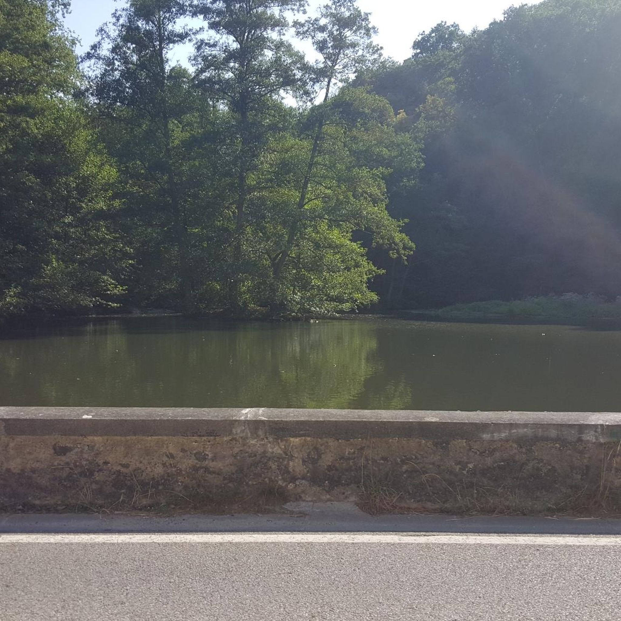
An excellent spot to take a break and enjoy the full breath of Lexington Reservoir. There is a Plaque dedicated to deputy Douglas B. Miller, who was fatally wounded while performing his duties.
0
0


From the top of the dam you get splendid views out across Lexington Reservoir. To the north you overlook the winding end of the Los Gatos Creek Trail, which connects to the Jones Trail across from the restroom just up the road. The dam itself was constructed in 1952 and stands at nearly 200 feet tall.
0
0
Frequently Asked Questions
How many no traffic touring cycling routes are available in Lexington Reservoir County Park?
There are nearly 30 dedicated no traffic touring cycling routes in Lexington Reservoir County Park. These routes offer a variety of experiences, from moderate to difficult, ensuring options for different skill levels.
What is the best time of year to go touring cycling in Lexington Reservoir County Park?
The park's diverse landscapes, including redwood forests and chaparral, make it enjoyable year-round. However, spring and fall generally offer the most pleasant temperatures for cycling, avoiding the heat of summer and potential winter rains. Always check local weather conditions before heading out.
Are there any family-friendly no traffic touring cycling routes?
Yes, there are several easier routes suitable for families. The Los Gatos Creek Trail, which leads to the reservoir, is a wide gravel path popular with cyclists and suitable for Class 1 and 2 e-bikes, offering a scenic and generally flat experience. For a moderate loop, consider the James J. Lenihan Dam – Lexington Reservoir loop from Santa Cruz Mountains, which covers about 17.8 km with manageable elevation.
What kind of terrain can I expect on these no traffic touring cycling routes?
The routes feature a mix of terrain. While many utilize paved county roads, some sections might include gravel or dirt paths, especially near the reservoir or on trails like the Los Gatos Creek Trail. You'll encounter varied landscapes from redwood forests to grasslands, often with a 'roller coaster' feel of climbs and descents.
Are there any challenging no traffic touring cycling routes for experienced riders?
Absolutely. For experienced touring cyclists seeking a challenge, routes like the Lake Ranch Reservoir – Lake Ranch Reservoir loop from Lexington Reservoir County Park offer significant elevation gain over 32 km. Another demanding option is the Lexington Reservoir – St. Joseph's Hill loop from Los Gatos, which features over 1000 meters of climbing.
What can I see along the no traffic touring cycling routes in Lexington Reservoir County Park?
Many routes offer scenic views of the Lexington Reservoir and the surrounding Santa Cruz Mountains. You can also pass by the impressive James J. Lenihan Dam, which provides splendid vistas. Keep an eye out for the diverse habitats, from redwood forests to grasslands, and if water levels are low, you might even spot remnants of the old towns of Lexington and Alma.
Are there any loop routes available for touring cyclists?
Yes, many of the no traffic touring cycling routes are designed as loops. For example, the Old Santa Cruz Highway loop from Lexington Reservoir County Park provides a moderate 22.4 km ride, while the Old Santa Cruz Highway – Summit Store loop from Lexington Reservoir County Park offers a more difficult 41.1 km option.
What do other touring cyclists enjoy the most about touring cycling in Lexington Reservoir County Park?
The area is highly rated by the komoot community, with an average score of 4.7 stars. Reviewers often praise the quiet, scenic routes that wind through diverse landscapes, the challenging climbs for those seeking them, and the overall sense of being immersed in nature away from traffic.
Is there parking available near the no traffic touring cycling routes?
Yes, parking is available at various access points around Lexington Reservoir County Park, providing convenient starting points for your touring cycling adventures. Specific parking details can often be found on individual route pages or park information.
Can I bring my e-bike on the no traffic touring cycling routes?
Class 1 and 2 e-bikes are generally permitted on trails like the Los Gatos Creek Trail, which is a popular access point to the reservoir area. Always check specific trail regulations for any restrictions on e-bike classes before you ride.
Are there any cafes or places to refuel near the cycling routes?
While the immediate vicinity of the reservoir is primarily natural parkland, you can find cafes and other amenities in nearby towns like Los Gatos, which is easily accessible from some of the routes. It's advisable to carry sufficient water and snacks, especially for longer rides.
Most popular routes in Lexington Reservoir County Park
Most popular attractions in Lexington Reservoir County Park

Get inspired with the komoot mobile app


Explore more
Browse the best Cycling routes in other regions.
