The best walks and hikes in Lexington Reservoir County Park
4.6
(135)
2,251
hikers
10
hikes
Hikes in Lexington Reservoir County Park are set in the Santa Cruz Mountains, centered around a large man-made reservoir. The park's trail network connects to the adjacent Sierra Azul and St. Joseph's Hill Open Space Preserves. The terrain consists of rolling hills with a mix of shaded oak woodlands and sun-exposed chaparral slopes, offering routes with varied elevation.
Best hiking trails in Lexington Reservoir County Park
- The most popular hiking route is Priest Rock & Limekiln Trails loop — Lexington Reservoir County Park, a 5.5 mile (8.9 km) trail that takes around 2 hours 45 minutes to complete. This moderate route combines two well-known trails with steady climbs and views over the reservoir.
- Another top favourite among local hiking enthusiasts is Saint Josephs Hill Summit — Saint Josephs Hill Open Space Preserve, an easy 3.3 mile (5.3 km) path. The trail leads to the summit of a 178-meter hill within the adjacent preserve.
- Local hiking enthusiasts also love the Flume Trail loop from Los Gatos, a 3.9 mile (6.3 km) trail leading through shaded woodlands, often completed in about 1 hour 50 minutes.
- Hiking in Lexington Reservoir County Park is defined by reservoir-side paths, chaparral-covered hills, and shaded oak woodlands. The interconnected trail system provides options for both shorter, easier walks and more challenging hikes with significant elevation gain.
- The routes in Lexington Reservoir County Park are highly rated by the komoot community with an average score of 4.6 stars from over 120 reviews. More than 2,000 hikers have used komoot to explore Lexington Reservoir County Park's varied terrain.
Last updated: August 18, 2026
2
hikers
6.77km
02:23
590m
30m
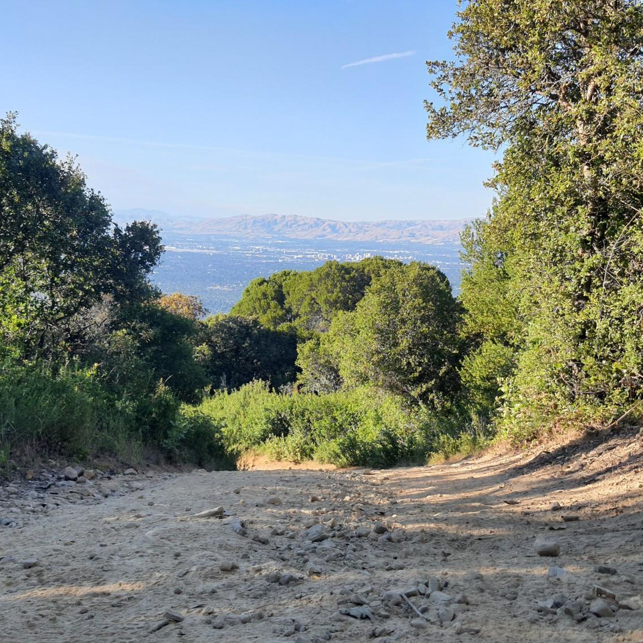
The Priest Rock Trail offers a demanding yet incredibly rewarding hiking experience, taking you through the Sierra Azul Open Space Preserve. You'll navigate a consistently steep service road, often loose and rocky underfoot, but the effort is well worth it. As you climb, you'll be treated to stunning panoramic views, including the Lexington Reservoir below and sweeping vistas of the Santa Cruz Mountains, with the Pacific Ocean visible on clear days.
This moderate 4.2-mile (6.8 km) route involves a significant 1923 feet (586 metres) of elevation gain, typically requiring about 2 hours and 23 minutes. It's a shared trail, so be mindful of mountain bikers and joggers. Plan your visit carefully; the trail can be very hot during summer months and muddy after rain, so bring ample water and appropriate footwear.
Known for its challenging ascent, the Priest Rock Trail is a fantastic workout that connects to other routes like the Kennedy Trail, offering options for extended adventures. It's a defining feature of the local trail network, providing some of the most expansive views in the Bay Area for those willing to tackle the climb.
7.94km
02:46
670m
40m
The Limekiln, Priest Rock and Kennedy Trail offers a rugged and rewarding hiking experience within the Sierra Azul Open Space Preserve. This moderate 4.9-mile (7.9 km) route features a substantial 2210 feet (674 metres) of elevation gain, typically taking around 2 hours and 45 minutes to complete. You'll traverse steep fire roads, moving from shaded bay laurel forests to exposed chaparral, with panoramic views of the Bay Area and Lexington Reservoir unfolding as you climb.
Planning your visit means preparing for a demanding ascent, especially on the Priest Rock Trail, which has very steep grades. The trails are popular with mountain bikers, so stay alert and share the path. Given the exposed sections, it's wise to carry ample water and consider an early start to avoid the heat, particularly during warmer seasons.
This trail is notable for providing a genuine wilderness feel close to the South Bay, offering challenging loop configurations for those seeking a strenuous day trip. The Priest Rock Trail also holds historical significance as a former service road, and the significant elevation ensures numerous points with breathtaking panoramic views of the surrounding region.

Sign up for free
4.4
(8)
79
hikers
8.89km
02:45
330m
330m
The Limekiln and Priest Rock Trail Loop offers a diverse hiking experience, transitioning from shaded bay laurel forests along a creek to open chaparral with sweeping views. You'll navigate challenging, steep sections, particularly on the Priest Rock Trail, but the reward is expansive vistas of the Bay Area and surrounding mountains as you gain elevation. It's a moderate 5.5-mile (8.9 km) route with 1076 feet (328 metres) of climbing, typically taking 2 hours and 45 minutes, perfect for those seeking a good workout and stunning scenery.
Planning your visit means being aware that this is a multi-use trail, so you'll share the path with mountain bikers and runners. The exposed sections can get quite hot, so consider an early start or visiting during cooler months to make the most of your hike. While specific parking details aren't always highlighted, arriving early is generally a good strategy for popular trailheads in the Sierra Azul Open Space Preserve.
This loop is a prime example of the varied terrain within Santa Clara County, showcasing both dense woodlands and sun-drenched chaparral. The significant elevation gains make it a popular choice for those looking for a strenuous workout, and the numerous viewpoints offer rewarding panoramic scenes. It's a great option if you're looking for challenging loop hikes in the Limekiln area with diverse ecosystems.
4.5
(12)
78
hikers
5.31km
01:36
180m
180m
If you're seeking a rewarding hike with diverse scenery and great views, the Manzanita and Novitiate Loop Trail delivers. This route winds through oak woodlands and chaparral, showcasing abundant manzanita plants and vibrant wildflowers in spring. You'll enjoy panoramic vistas of Lexington Reservoir and the surrounding hills, with the Saint Josephs Hill summit offering distant glimpses of the San Francisco Bay on clear days. Expect a mix of terrain, from dirt paths to rocky sections, with some steeper climbs on the Novitiate Trail portion.
This easy 3.3-mile (5.3 km) loop, featuring 585 feet (178 metres) of elevation gain, typically takes about 1 hour and 36 minutes to complete. It's a popular choice due to its accessibility from downtown Los Gatos, and parking is usually available at the trailhead. Consider visiting in spring to experience the trail at its most colorful, though it offers a pleasant outing year-round.
St. Joseph's Hill Open Space Preserve is known for its varied ecosystems, providing a habitat for local wildlife such as rabbits, lizards, and various bird species. While enjoying the natural beauty, be aware that mountain lions, bobcats, and rattlesnakes have also been reported in the preserve. The interconnected trail system here, including the Jones Trail and Range Trail, offers options for extending your adventure if you wish.
5.0
(4)
118
hikers
Easy hike. Great for any fitness level. Easily-accessible paths. Suitable for all skill levels.
Get access to more routes and recommendations from other explorers.
Sign up for free
Already have an account?
Our route recommendations are based on thousands of hikes, rides, and runs completed by other people on komoot.
Start today with a free account
Your next adventure awaits.
Login or Signup

Tips from the Community

Three of the most popular area trails come together here; depending on how ambitious you are, you might return to this juncture several times as you crank through the forested hills.
1
0

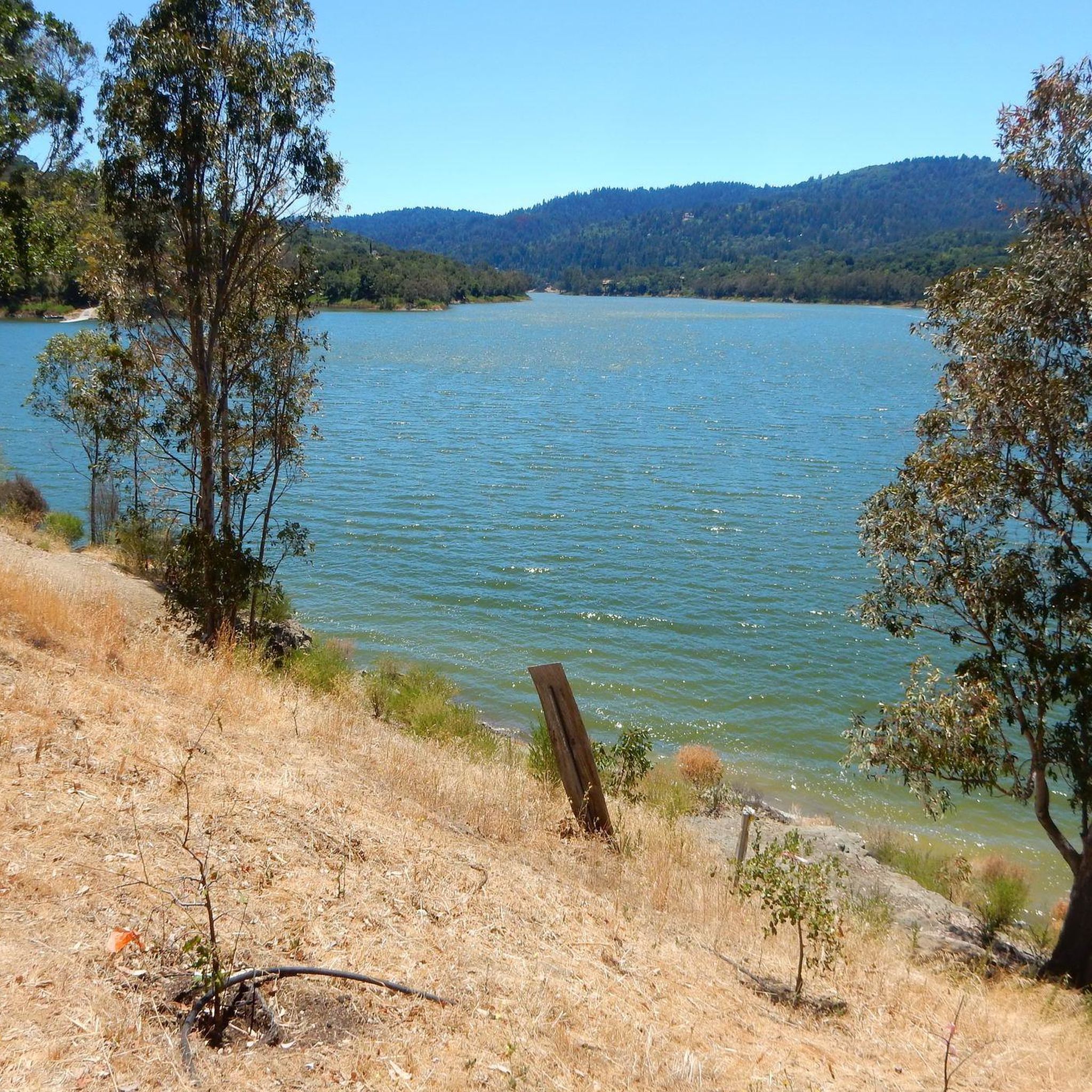
From the top of the dam you get splendid views out across Lexington Reservoir. To the north you overlook the winding end of the Los Gatos Creek Trail, which connects to the Jones Trail across from the restroom just up the road. The dam itself was constructed in 1952 and stands at nearly 200 feet tall.
0
0

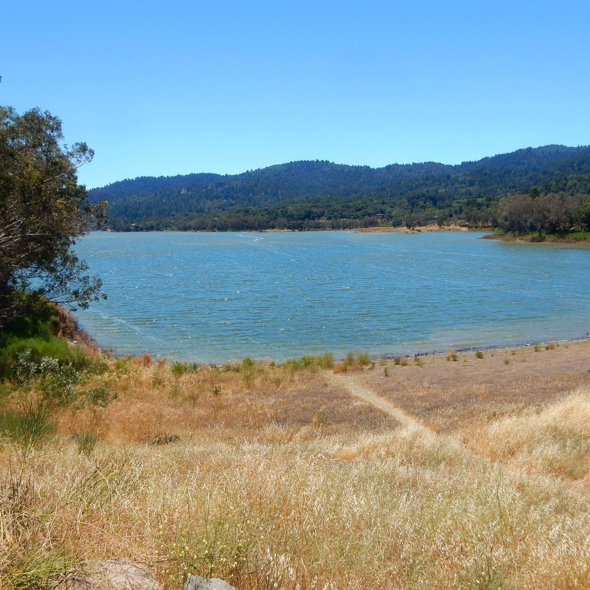
Ascending just a few hundred feet along Priestrock Trail toward Sierra Azul Open Space reveals expansive vistas overlooking the tranquil, turquoise-blue waters of Lexington Reservoir.
0
0

Serving as a scenic backdrop to the town of Los Gatos, St. Joseph's Hill is a 1,250-foot hill that looks down Los Gatos Creek valley and down over nearby Lexington Reservoir. It is also the summit of the Manzanita trail, which is a classic ride best done on a gravel bike.
0
0

Get an elevated view of the 338 acre man-made Lexington Reservoir
0
0

This is the third-largest reservoir in Santa Clara County. It sits at the foot of the Santa Cruz Mountains.
1
0

Ride a little (200m) past the intersection of Kennedy/PriestRock and you'll find a nice vantage point to your right: good for a rest and 360*-views.
2
0

Frequently Asked Questions
Are dogs allowed in Lexington Reservoir County Park?
Yes, dogs are welcome in the park but must be kept on a leash at all times. The area is a popular choice for dog owners, and many of the trails are suitable for hiking with your canine companion.
Is there parking available at the park?
Yes, there are several parking areas available to access the trails, including lots near the main park entrance and specific trailheads like the one for the Priest Rock Trail. Parking can fill up, especially on weekends, so arriving earlier in the day is recommended.
Are there any easy, family-friendly hikes?
Absolutely. For a gentler experience, the Flume Trail loop from Lexington Reservoir County Park is a great option. It's a relatively short walk through shaded woodlands, making it suitable for families and casual hikers.
What is the terrain like for hiking?
The terrain is quite varied. You'll find everything from paved, gentle paths like the Los Gatos Creek Trail to steep, rugged fire roads. Many trails wind through shaded oak woodlands, while others traverse sun-exposed chaparral on the hillsides, offering a mix of conditions and scenery.
How many hiking trails are in the Lexington Reservoir area?
There are over 60 designated hiking routes in and around Lexington Reservoir County Park. The trail system is extensive and connects to the neighboring Sierra Azul and St. Joseph's Hill Open Space Preserves, providing a wide range of options for distance and difficulty.
What do other hikers enjoy about this area?
The park is highly rated by the komoot community, with an average score of 4.6 stars. Hikers often praise the beautiful views of the reservoir, the variety of trails available, and the mix of shaded and sunny sections. The interconnectedness with larger preserves is also a frequently mentioned highlight.
Are there any challenging hikes for a good workout?
Yes, for those seeking a more strenuous hike, the park offers several options with significant elevation gain. A great example is the Sierra Azul Open Space – Limekiln Trail loop, which involves a climb of over 570 meters through rugged terrain, rewarding you with expansive views.
Can I get to the park using public transport?
Direct public transport to the main park entrance is limited. The most convenient way to access the trailheads is by car. Some trailheads, like those for the Los Gatos Creek Trail, are closer to the town of Los Gatos, which has better public transit connections.
What kind of wildlife might I see?
The park and its surrounding open spaces are home to a variety of wildlife. It's common to see deer, and the reservoir attracts waterfowl like ducks and egrets. Ospreys and even Bald Eagles are sometimes spotted hunting over the water. The adjacent Sierra Azul preserve is also habitat for bobcats and coyotes, though they are less commonly seen.
Are there any waterfalls in the park?
The park is not known for large, prominent waterfalls. However, after periods of rain, you can find small, rushing cascades along some of the creeks that feed into the reservoir, particularly along sections of the Los Gatos Creek Trail.
What are some popular places to hike near Lexington Reservoir?
The park's trails connect directly to other popular hiking areas.
St. Joseph's Hill Open Space Preserve is a highly-regarded adjacent area offering trails with wonderful views over Los Gatos and the South Bay. It's very popular with local hikers and dog walkers.
For a different experience, Vasona Lake County Park offers more paved and gentle paths around a lake, making it ideal for leisurely walks and family outings.
Is mountain biking allowed on the trails?
While hiking is the primary activity, some of the multi-use trails and service roads in and around the park are open to mountain bikers. Trails in the adjacent St. Joseph's Hill and Sierra Azul Open Space Preserves are particularly popular with cyclists. Always check trail signage for specific use restrictions.
Most popular routes in Lexington Reservoir County Park
Most popular attractions in Lexington Reservoir County Park

Get inspired with the komoot mobile app


Explore more
Browse the best Hikes in other regions.
