The best hikes from bus stations in Baie Du Mont Saint Michel
4.6
(7862)
58,717
hikers
32
hikes
Bus station hiking trails in Baie Du Mont Saint Michel offer access to a diverse coastal landscape shaped by significant tidal movements. The region features expansive sandbanks, salt marshes, and polders, alongside scenic coastal paths. Rivers like the Couesnon, Sée, and Sélune flow into the bay, contributing to its unique hydrology. The terrain is generally flat, providing continuous views of the iconic Mont Saint-Michel.
Best bus station hiking trails in Baie Du Mont Saint Michel
- The most popular bus station…
Last updated: September 2, 2026
4.8
(172)
1,445
hikers
Moderate hike. Good fitness required. Easily-accessible paths. Suitable for all skill levels.
4.6
(36)
527
hikers
Easy hike. Great for any fitness level. Easily-accessible paths. Suitable for all skill levels.

Sign up for free
4.4
(12)
233
hikers
Easy hike. Great for any fitness level. Easily-accessible paths. Suitable for all skill levels.
5.0
(2)
11
hikers
Moderate hike. Good fitness required. Easily-accessible paths. Suitable for all skill levels.
4.7
(3)
97
hikers
Easy hike. Great for any fitness level. Easily-accessible paths. Suitable for all skill levels.
Get access to more routes and recommendations from other explorers.
Sign up for free
Already have an account?
Our route recommendations are based on thousands of hikes, rides, and runs completed by other people on komoot.
Start today with a free account
Your next adventure awaits.
Login or Signup
Other adventures in Baie Du Mont Saint Michel


Tips from the Community

Heavily trodden and driven road embankment leading to Mont-Saint-Michel along the salt marshes. A little caution with heavy traffic and you will arrive at the Mont with good impressions.
3
0
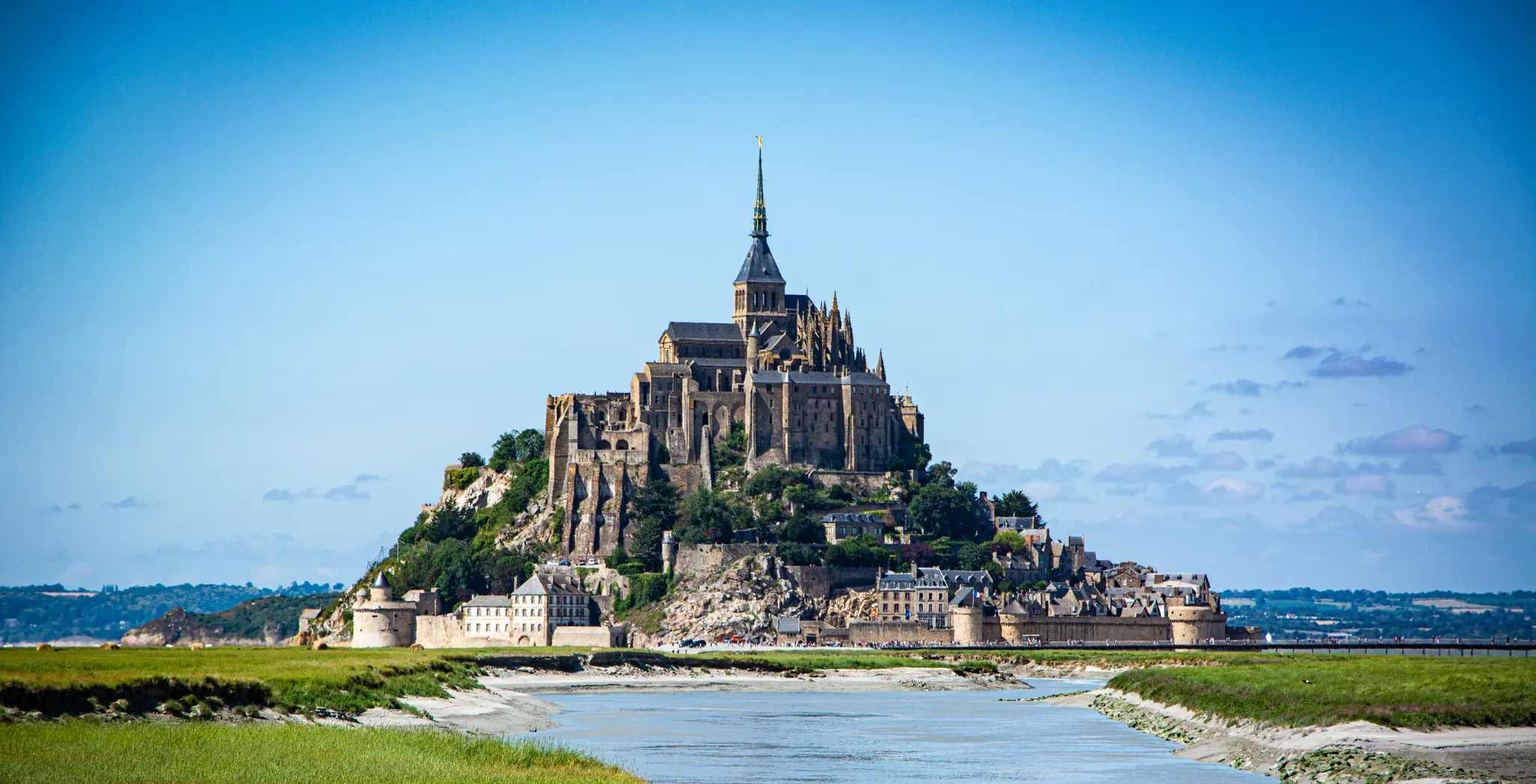
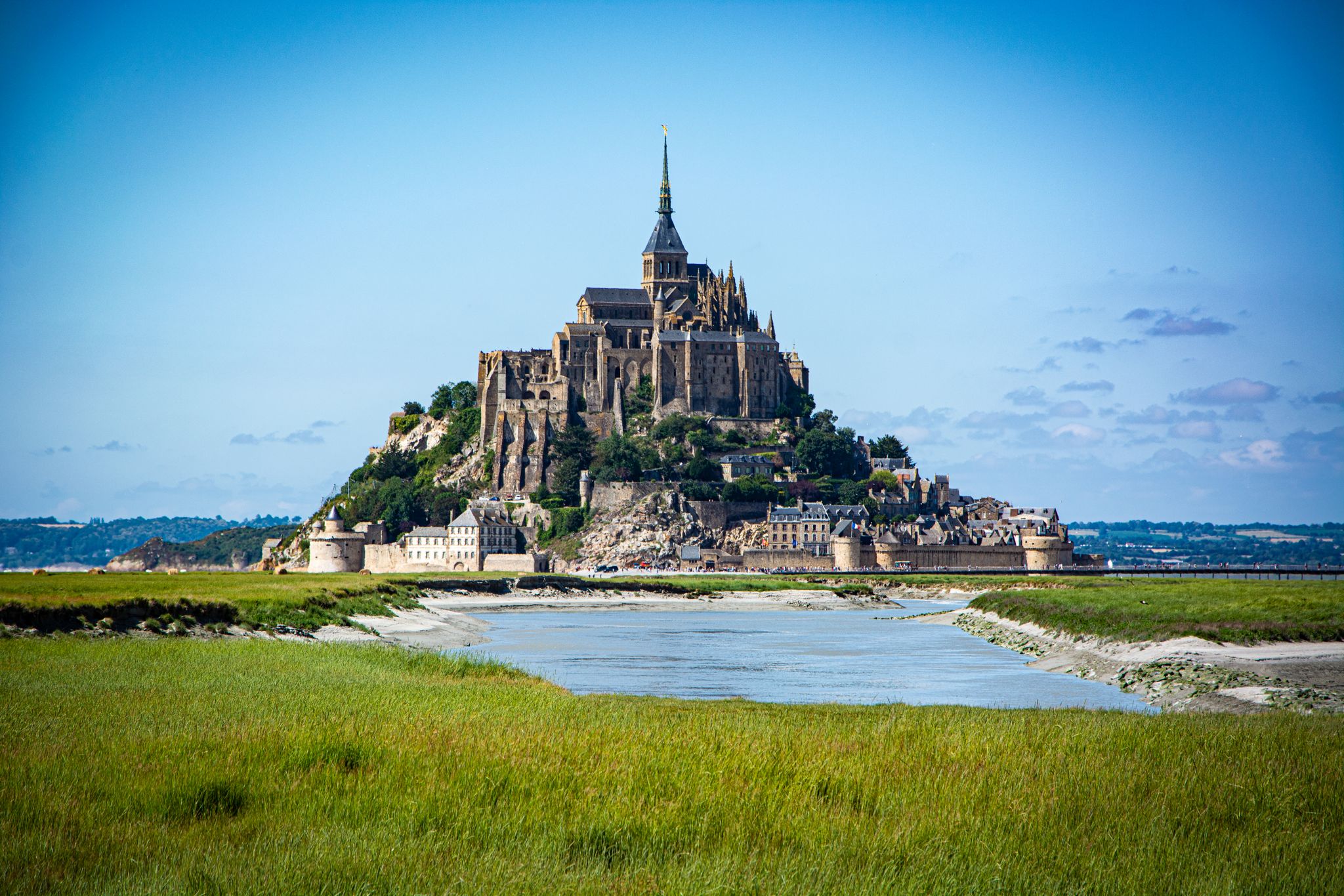
Mont-Saint-Michel is a world-famous rocky island and commune on the border between Normandy and Brittany in France. Crowned by a monumental, medieval Benedictine abbey, this architectural marvel has been a UNESCO World Heritage site since 1979. The bay of the mount is also known for Europe's strongest tides, with a tidal range of up to 14 meters.
1
0

The access bridge to Mont-Saint-Michel was opened in 2014, replacing the former road causeway that had impaired the natural movement of water and sediment in the bay. Built on stilts, the bridge allows for better exchange of tidal currents and helps to preserve the character of Mont-Saint-Michel as a tidal island. On the way to the island, there are wide views over the bay and an impressive sight of the abbey.
8
0
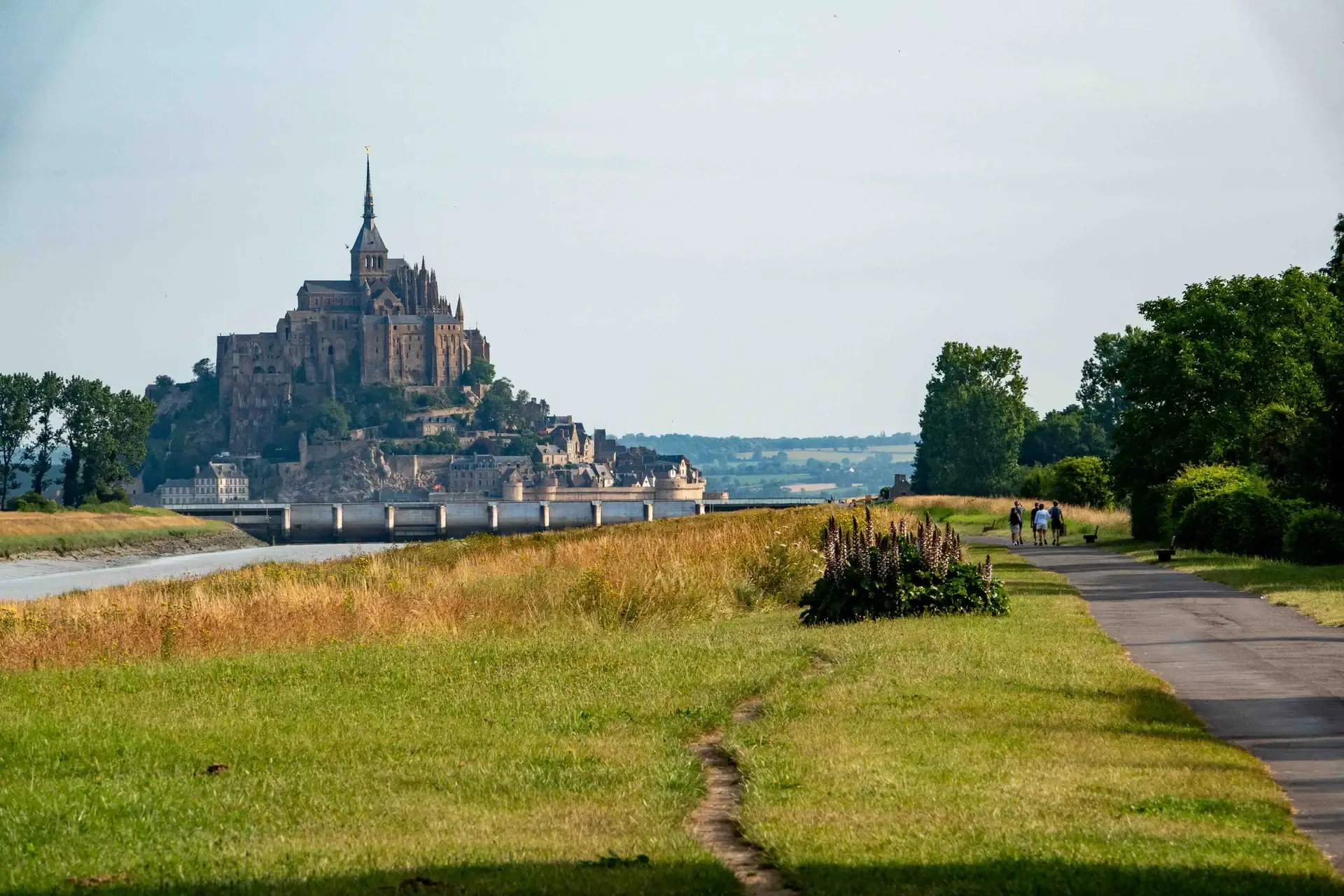
The footpath along the Couesnon to the dam already offers an impressive view of Mont-Saint-Michel. From here, the path with an unobstructed view leads across the salt marshes and the bay, with the landmark of Normandy impressively rising against the wide landscape. Especially in calm weather and with changing light, atmospheric views emerge of Mont-Saint-Michel, the course of the Couesnon river, and the tide-shaped surroundings.
11
0
The Couesnon dam (Barrage du Couesnon) was completed in 2009 and is part of the measures to preserve the bay of Mont-Saint-Michel. The facility regulates the water flow of the Couesnon and supports the natural removal of sediments by the tides. This is intended to counteract the increasing silting up of the bay and preserve the special character of Mont-Saint-Michel as a tidal island. The dam also offers a popular viewpoint with a view of Mont-Saint-Michel and the surrounding salt marshes.
1
0
The weir on the river **Couesnon** in front of Mont-Saint-Michel is part of a major project to restore its original island character. It regulates the flow of the Couesnon and helps transport sediment deposited in the bay back out to sea. At the same time, the structure is a popular promenade and viewpoint with an impressive view of Mont-Saint-Michel and the tide-shaped landscape.
35
0

Great what they had already created back then !!
0
2
From there it looks the strongest !!!
1
0
Frequently Asked Questions
How many bus-accessible hiking trails are there in Baie Du Mont Saint Michel?
There are over 30 hiking trails in Baie Du Mont Saint Michel that are accessible from bus stations, offering a variety of experiences for all skill levels.
Are there easy hiking trails accessible by bus in the Baie Du Mont Saint Michel?
Yes, you'll find 16 easy hiking trails that are accessible by bus. These routes are generally shorter and have minimal elevation gain, perfect for a relaxed outing. An example is The Couesnon at Beauvoir – Couesnon dike loop from Barrage du Mont Saint-Michel, which offers gentle terrain.
What is the best time of year to hike from bus stations in Baie Du Mont Saint Michel?
The Baie Du Mont Saint Michel is beautiful year-round, but spring and autumn offer pleasant temperatures and fewer crowds. Summer is popular but can be busy. Always check tide times, as they dramatically influence the landscape and accessibility of certain areas.
Are there any circular hiking routes accessible by bus?
Yes, many of the bus-accessible routes are circular, allowing you to start and end at the same point without needing to retrace your steps. For instance, consider Mont-Saint-Michel Abbey – Mont Saint-Michel loop from Le Mont-Saint-Michel for a circular walk around the iconic Mont.
What natural features can I expect to see on bus-accessible hikes in Baie Du Mont Saint Michel?
The region is renowned for its diverse natural landscapes. You can expect to see expansive sandbanks and mudflats during low tide, picturesque salt marshes with grazing sheep, and coastal paths offering stunning views. Keep an eye out for the Couesnon River and various viewpoints like Grouin du Sud.
What historical or cultural landmarks can I visit on bus-accessible hikes?
The most prominent landmark is the iconic Mont Saint-Michel itself, with its magnificent Gothic Benedictine abbey. Many trails offer spectacular views of it, and some even lead directly to its base. You might also encounter the Saint Aubert Chapel or the historic Cabane Vauban near Carolles.
Are the bus-accessible hiking trails in Baie Du Mont Saint Michel suitable for families?
Absolutely. Many trails are family-friendly, especially the easy ones, offering relatively flat terrain and shorter distances. These are ideal for walks with children, allowing them to enjoy the unique bay environment safely. Always ensure to check the difficulty and length of a specific route before heading out with young children.
Can I bring my dog on these bus-accessible hiking trails?
Many trails in Baie Du Mont Saint Michel are dog-friendly, but it's crucial to keep your dog on a leash, especially in areas with wildlife or grazing animals like the salt marsh sheep. Always check local regulations for specific routes or protected areas, as rules can vary.
What should I know about the tides when planning a bus-accessible hike in the bay?
The Baie Du Mont Saint Michel experiences some of Europe's highest tides, which can recede up to 15 kilometers and return very quickly. Venturing onto the sandbanks or mudflats during low tide requires extreme caution and ideally the accompaniment of a certified guide due to quicksand and rapid incoming tides. Always consult local tide tables before planning your hike.
What do other hikers enjoy the most about hiking in Baie Du Mont Saint Michel?
The area is highly rated by the komoot community, with an average score of 4.6 stars. Reviewers often praise the unparalleled views of Mont Saint-Michel, the unique tidal landscapes, and the rich biodiversity, including birdwatching opportunities. The well-maintained coastal paths and the sense of history also receive frequent commendation.
Are there opportunities for wildlife spotting on bus-accessible walks?
Yes, the Baie Du Mont Saint Michel is a haven for wildlife. The salt marshes and coastal areas are home to numerous bird species, including gulls, brent geese, and avocets. You might also be lucky enough to spot seals and even dolphins in the bay's waters, particularly during quieter times.
Where can I find less crowded hiking options accessible by bus?
While Mont Saint-Michel itself can be busy, exploring trails further along the bay, such as those near Carolles or the polder areas, can offer a more tranquil experience. Routes like Saint-Benoît-des-Ondes Beach – The Bay of Mont-Saint-Michel loop from Saint-Benoît-des-Ondes might provide a quieter alternative while still showcasing the bay's beauty.
Most popular routes in Baie Du Mont Saint Michel
Most popular attractions in Baie Du Mont Saint Michel

Get inspired with the komoot mobile app


Explore more
Browse the best Hikes in other regions.
