The best traffic-free bike rides in Laurel Creek Conservation Area
5.0
(1)
39
riders
5
rides
No traffic gravel bike trails in Laurel Creek Conservation Area are characterized by a diverse network of multi-use paths winding through 300 hectares of hardwood and pine forests. The terrain includes varied surfaces, from hard-packed to gravel paths, often alongside the Laurel Creek reservoir. The area's trail system also connects to regional routes, such as the Walter Bean Grand River Trail, expanding the potential for longer gravel rides.
Best no traffic gravel bike trails in Laurel Creek Conservation Area
- The…
Last updated: May 29, 2026
5.0
(1)
13
riders
52.1km
02:50
350m
350m
Moderate gravel ride. Good fitness required. Mostly paved surfaces. Suitable for all skill levels.
11
riders
55.8km
03:12
380m
380m
Moderate gravel ride. Good fitness required. Mostly paved surfaces. Suitable for all skill levels.

Sign up for free
2
riders
46.8km
02:48
250m
250m
Moderate gravel ride. Good fitness required. Mostly paved surfaces. Suitable for all skill levels.
11
riders
29.2km
01:44
240m
240m
Moderate gravel ride. Good fitness required. Mostly paved surfaces. Suitable for all skill levels.
2
riders
Easy gravel ride. Great for any fitness level. Mostly paved surfaces. Suitable for all skill levels.
Our route recommendations are based on thousands of hikes, rides, and runs completed by other people on komoot.
Start today with a free account
Your next adventure awaits.
Login or Signup
Popular around Laurel Creek Conservation Area
Tips from the Community

The Walter Bean Grand River Trail has its northern terminus here at Kiwanis Park and runs for over 25 kilometers to Doon Valley Golf Course in the south. It follows the river through many parks and neighbourhoods along the way and is a great link between opposite sides of the city.
0
0
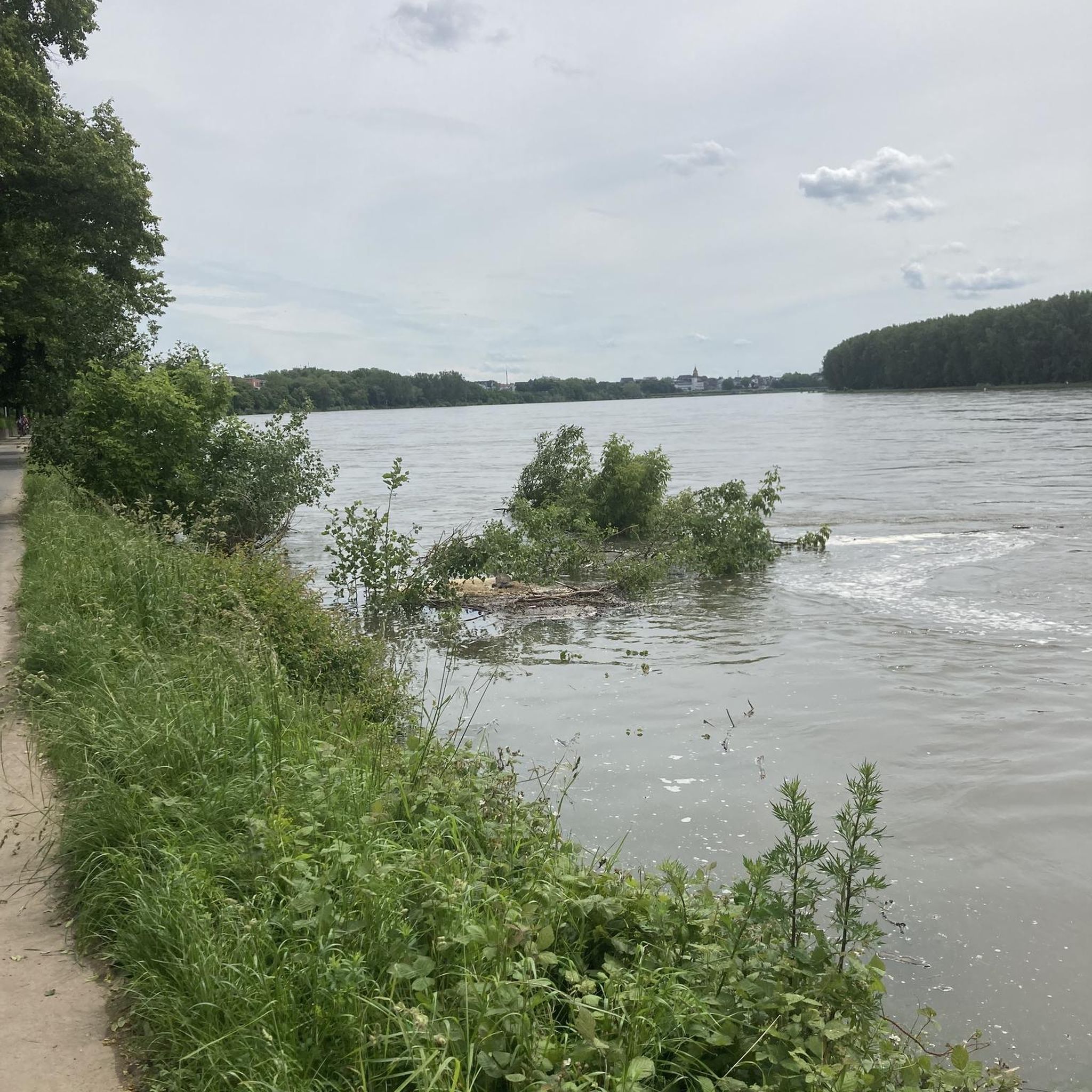
Formerly known as the River Ouse, the Grand River flows through Ontario before emptying into Lake Erie's northern shore. Here, on the edge of Kitchener, its riparian area is full of wildlife, including a wide array of birds that can be quite active, thus making it a great bird watching spot.
0
0

The Grand River flows through the heart of Kitchener and is one of the longest rivers entirely within southern Ontario. In this area, the river winds through forested banks and quiet green spaces, including nearby parks and trail systems.
0
0
The Grand River is a major waterway that stretches nearly 280 kilometers through the southern part of Ontario. It winds past farmland, forests, and historic towns before flowing into the Lake Erie. There are multiple ways to enjoy what the river has to offer such as hiking long-distance routes like the Grand Valley Trail, or paddling peaceful river stretches with access from several points. Wildlife is also abundant along its banks, making it a great pick for a nature-focused outing.
0
0
The Grand Valley Trail runs for roughly 250 kilometers through southwestern Ontario, following the Grand River through historic towns, quiet farmland, and scenic riverbanks, giving hikers a real taste of the province’s natural and rural beauty. The trail has a variety terrain, well-maintained paths, and green spaces for both short outings or a long thru-hike.
0
0

A pedestrian bridge across the Grand River with an interesting metal structure, offering open views of the water and a peaceful spot to watch the river flow. If you want to continue your walk, you can cross and stay on the Walter Bean Grand River Trail.
0
0
Stanley Park Conservation Area is a green space in the middle of Kitchener, featuring a straight, flat gravel path that winds through a tunnel of trees. The trail also passes by Kolb Creek and the wetland it forms. It’s an easy trail for a quiet walk, perfect for kids and dogs.
1
0
Homer Watson Park is a relaxed green space along the Grand River, known for its mix of quiet forest, open meadows, and easy walking paths. Named after Canadian landscape painter Homer Watson, the park has a bit of local history behind it, but most people come for the fresh air and wide, natural feel. The trails are mostly gentle and well-worn, making them good for walkers of all levels. You can wander under the trees, follow the river, or stop in the open areas to enjoy the views. It’s a nice spot for a peaceful walk, a bit of birdwatching, or a simple break from the city.
0
0
Frequently Asked Questions
How many no-traffic gravel bike trails are available in Laurel Creek Conservation Area?
Laurel Creek Conservation Area offers a selection of 7 dedicated no-traffic gravel bike routes. These routes range from easy to moderate difficulty, providing options for various skill levels.
What kind of terrain can I expect on the gravel bike trails in Laurel Creek Conservation Area?
The trails feature a diverse mix of surfaces, including gravel paths, doubletrack, and hard-packed terrain. While some routes may include paved segments, many offer unpaved sections perfect for gravel bikes. You might also encounter varied surfaces, including some singletrack sections like the 'Laurel Creek Forest Loop', and even some steep grades on more challenging routes.
Are there any family-friendly gravel biking options in Laurel Creek Conservation Area?
Yes, the conservation area has multi-use trails that are suitable for families. While specific 'easy' routes are available, it's always good to check the route details for distance and elevation to ensure it matches your family's comfort level. The area's natural setting and picnic spots make it a great destination for a family outing.
Can I bring my dog on the gravel bike trails in Laurel Creek Conservation Area?
Laurel Creek Conservation Area is generally dog-friendly, but specific rules may apply to certain trails or areas. It's always best to keep your dog on a leash and ensure you clean up after them. Check local signage upon arrival for the most current regulations regarding pets on trails.
What are some notable natural features or viewpoints I can experience while gravel biking?
The conservation area boasts 300 hectares of hardwood and pine forests, with the Laurel Creek reservoir as a central feature. You can also find a 'Lookout Tower Access' trail that leads to a scenic viewpoint, offering panoramic views of the surrounding landscape. The trails often wind through these scenic areas, providing a beautiful backdrop for your ride.
Are there any longer gravel bike routes for more experienced riders?
Yes, for riders looking for a longer challenge, routes like the Bingeman's Hills – Grand Valley Trail loop from Conestoga cover over 55 kilometers with significant elevation gain. Another substantial option is the Golf Course Bridge – Flower Garden with Fountain loop from University of Waterloo, which is over 52 kilometers long.
What is the best time of year to go gravel biking in Laurel Creek Conservation Area?
The conservation area is beautiful year-round. Spring and fall offer pleasant temperatures and vibrant foliage, making them ideal for gravel biking. Summer is also great, especially if you plan to combine your ride with a swim at the sandy beach. In winter, some trails are used for skiing and snowshoeing, so check conditions before heading out.
Are there any circular gravel bike routes available?
Many of the gravel bike routes in Laurel Creek Conservation Area are designed as loops, allowing you to start and end at the same point. For example, the City Cafe Bakery – Bingeman's Hills loop from Central Station is a moderate 28-kilometer circular route, perfect for a solid ride without retracing your steps.
What do other gravel bikers enjoy most about the trails in Laurel Creek Conservation Area?
The area is appreciated by the komoot community for its diverse trail network and natural beauty. Riders often praise the quiet woodlands, the varied terrain suitable for gravel bikes, and the opportunity to connect with nature away from traffic. The average rating for tours in this area is 3.0 stars, indicating a generally positive experience.
Is there parking available for cyclists at Laurel Creek Conservation Area?
Yes, Laurel Creek Conservation Area provides ample parking facilities for visitors. As a popular outdoor destination, it is well-equipped to accommodate cyclists and other outdoor enthusiasts. Specific parking areas are usually clearly marked upon entry to the conservation area.
Do any of the gravel routes connect to other regional trails?
Yes, the trail network within Laurel Creek Conservation Area connects to broader regional trails, such as the Walter Bean Grand River Trail. This allows for expanded gravel biking opportunities beyond the immediate conservation area, offering longer and more varied routes for exploration.
Most popular routes in Laurel Creek Conservation Area

Get inspired with the komoot mobile app


Explore more
Browse the best Gravel rides in other regions.
