The best traffic-free bike rides in Bischbrunner Forst
4.5
(384)
4,963
riders
3
rides
No traffic road cycling routes in Bischbrunner Forst traverse a hilly topography within the Spessart region, characterized by extensive forest sections and varied terrain. The area features elevations such as the Geiersberg, the highest point in the Spessart at 586 meters. Cyclists can find a mix of well-paved surfaces and more challenging routes with elevation changes. These routes offer diverse scenery throughout the forest landscape.
Best no traffic road cycling routes in Bischbrunner Forst
- The most popular no traffic road…
Last updated: July 7, 2026
2
riders
33.1km
01:35
410m
410m
Moderate road ride. Good fitness required. Mostly well-paved surfaces and easy to ride.
5.0
(12)
76
riders
40.8km
01:50
380m
380m
Moderate road ride. Good fitness required. Mostly well-paved surfaces and easy to ride.

Sign up for free
4.3
(12)
155
riders
Moderate road ride. Good fitness required. Mostly well-paved surfaces and easy to ride.
4
riders
35.7km
01:48
440m
440m
Moderate road ride. Good fitness required. Mostly well-paved surfaces and easy to ride.
3
riders
43.1km
02:17
630m
630m
Moderate road ride. Good fitness required. Mostly well-paved surfaces and easy to ride.
Our route recommendations are based on thousands of hikes, rides, and runs completed by other people on komoot.
Start today with a free account
Your next adventure awaits.
Login or Signup
Popular around Bischbrunner Forst
Tips from the Community

A stroll here is worthwhile - if possible with a climb to the castle.
0
0

Sit down for a drink 🍺 and watch the ships 🛥 on the Main river 🌊.
0
0

Wertheim's old town boasts beautiful architecture: quaint half-timbered houses, magnificent castles, and, of course, the Main and Tauber rivers.
0
0

Very nice sexton who showed us the church and opened it up to us.
0
0

The Hafenlohr is a 26.5 km long (27.7 km including the Tiergartenbach) right tributary of the Main River in the districts of Aschaffenburg and Main-Spessart in the Bavarian Spessart region. The Hafenlohr rises from two springs in the municipality of Rothenbuch. The longer and occasionally more water-rich branch is the Tiergartenbach, which often dries up on dry days. Officially, it is considered the upper course of the Hafenlohr main watercourse. The source, known as the Hafenlohr Spring, in the center of the village provides water almost year-round. The Hafenlohr Spring is located at Rothenbuch Castle. It was encased in sandstone during the road widening of the St 2317. Its water flows northwest through the castle moat and, after about 100 meters, flows from the left bank into the bed of the Tiergartenbach, which flows from the Tiergartengrund on the northern edge of the village and is already 1.3 km[7] long. It doesn't provide water year-round, but at times it provides more than the perennial spring at the castle. The spring at the castle was probably once a meeting place for hunters in the eastern Spessart, which is why construction of a hunting lodge began here in 1342. The spring water fed the castle moat and several surrounding trout lakes, which no longer exist. Source and further information: https://de.wikipedia.org/wiki/Hafenlohr_(Fluss)
1
0
The Hafenlohr is a 26.5 km long (27.7 km including the Tiergartenbach) right tributary of the Main River in the districts of Aschaffenburg and Main-Spessart in the Bavarian Spessart region. The Hafenlohr rises from two springs in the municipality of Rothenbuch. The longer and occasionally more water-rich branch is the Tiergartenbach, which often dries up on dry days. Officially, it is considered the upper course of the Hafenlohr main watercourse. The source, known as the Hafenlohr Spring, in the center of the village provides water almost year-round. The Hafenlohr Spring is located at Rothenbuch Castle. It was encased in sandstone during the road widening of the St 2317. Its water flows northwest through the castle moat and, after about 100 meters, flows from the left bank into the bed of the Tiergartenbach, which flows from the Tiergartengrund on the northern edge of the village and is already 1.3 km[7] long. It doesn't provide water year-round, but at times it provides more than the perennial spring at the castle. The spring at the castle was probably once a meeting place for hunters in the eastern Spessart, which is why construction of a hunting lodge began here in 1342. The spring water fed the castle moat and several surrounding trout lakes, which no longer exist. Source and further information: https://de.wikipedia.org/wiki/Hafenlohr_(Fluss)
1
0

Another new perspective on Wertheim Castle; from every perspective it is Wertheim's landmark and worth seeing.
2
0
Wertheim Castle is the ruin of a hilltop castle on a high, narrow promontory between the two valleys of the Main and Tauber rivers above the town of Wertheim. It is one of the oldest castle ruins in Baden-Württemberg. Wertheim Castle was first documented in 1183 and, "starting from the upper castle, was expanded over several construction periods into a spacious castle complex until its destruction in the Thirty Years' War." The keep (around 1200) and the palace from the second third of the 13th century still stand from the upper castle. Adjacent to the palace is another residential building, in which remnants of an older structure have been preserved. The town was a "planned foundation at the foot of the castle." Construction of the city fortifications must have begun as early as 1200; they eventually enclosed the castle and town with a ring of walls. Source: Wikipedia
1
0
Frequently Asked Questions
What kind of terrain can I expect on no-traffic road cycling routes in Bischbrunner Forst?
Bischbrunner Forst, nestled within the Spessart region, features a hilly topography. You'll encounter varied terrain, from well-paved surfaces suitable for smooth rides to more challenging sections with elevation changes. While the focus is on road cycling, some routes might include short, unpaved segments, adding to the adventure. The extensive forest sections provide diverse and scenic backdrops for your ride.
Are there routes suitable for beginners or those looking for an easier ride?
While many routes in the region offer moderate challenges with significant elevation, you can find options that are less demanding. For example, the Roadbike loop from Triefenstein is classified as easy, covering 21 km with over 200 meters of elevation gain, making it a good choice for a more relaxed experience.
What are some notable natural features or landmarks I might see while cycling?
The region is rich in natural beauty. You can cycle past the Geiersberg Summit, the highest point in the Spessart, offering a significant landmark. The Josefsteig Trail is also highlighted as a particularly beautiful section within the area. Additionally, the Weihersgrund Nature Reserve provides stunning natural scenery.
Are there any circular no-traffic road cycling routes available?
Yes, many of the no-traffic road cycling routes in Bischbrunner Forst are designed as loops, allowing you to start and end at the same point. An example is the Triefenstein Monastery – St. Josef Church, Wiebelbach loop from Bischbrunn, which offers a moderate 33 km ride with over 400 meters of elevation.
What do other cyclists say about road cycling in Bischbrunner Forst?
The komoot community highly rates the cycling experience in Bischbrunner Forst, with an average score of 4.55 out of 5 stars from over 350 ratings. Cyclists often praise the peaceful, traffic-free nature of the routes and the beautiful forest landscapes, making it an ideal destination for those seeking tranquility on two wheels.
Are there any places to eat or rest along the routes?
While specific cafes directly on every no-traffic route might vary, the broader Spessart region offers options. The rustic Hohewart-Haus near Hessenthal is a popular spot known for its local cuisine and home-brewed beer, serving as a good starting or ending point for tours. You can also find several huts and guesthouses like the Old Cellar Hut or Schleifmühle Guesthouse in the wider area.
What is the typical length and difficulty of these no-traffic road cycling routes?
The no-traffic road cycling routes in Bischbrunner Forst generally range from moderate to challenging. Distances typically vary from around 30 km to over 40 km, with elevation gains often exceeding 300-400 meters. For instance, the Hafenlohrtal Nature Reserve – Hafenlohrtalstraße loop from Rothenbuch is a moderate 40 km ride with 383 meters of ascent.
Are there any historical or cultural attractions nearby that I can visit?
Absolutely! The wider Spessart region offers rich history. You could visit the impressive Mespelbrunn Castle, a moated castle dating back to the 15th century, which has also been a filming location. The charming Old Town of Lohr am Main, known for its fairy-tale atmosphere and the Spessart Museum (where Snow White is said to have originated), is also a worthwhile stop.
When is the best time of year to go road cycling in Bischbrunner Forst?
The best time for road cycling in Bischbrunner Forst is generally from spring through autumn. During these seasons, the weather is more favorable, and the forest scenery is at its most vibrant. While winter cycling is possible, be prepared for colder temperatures and potentially icy or snowy conditions, especially on higher elevations or shaded forest paths.
Are there routes with panoramic views or scenic viewpoints?
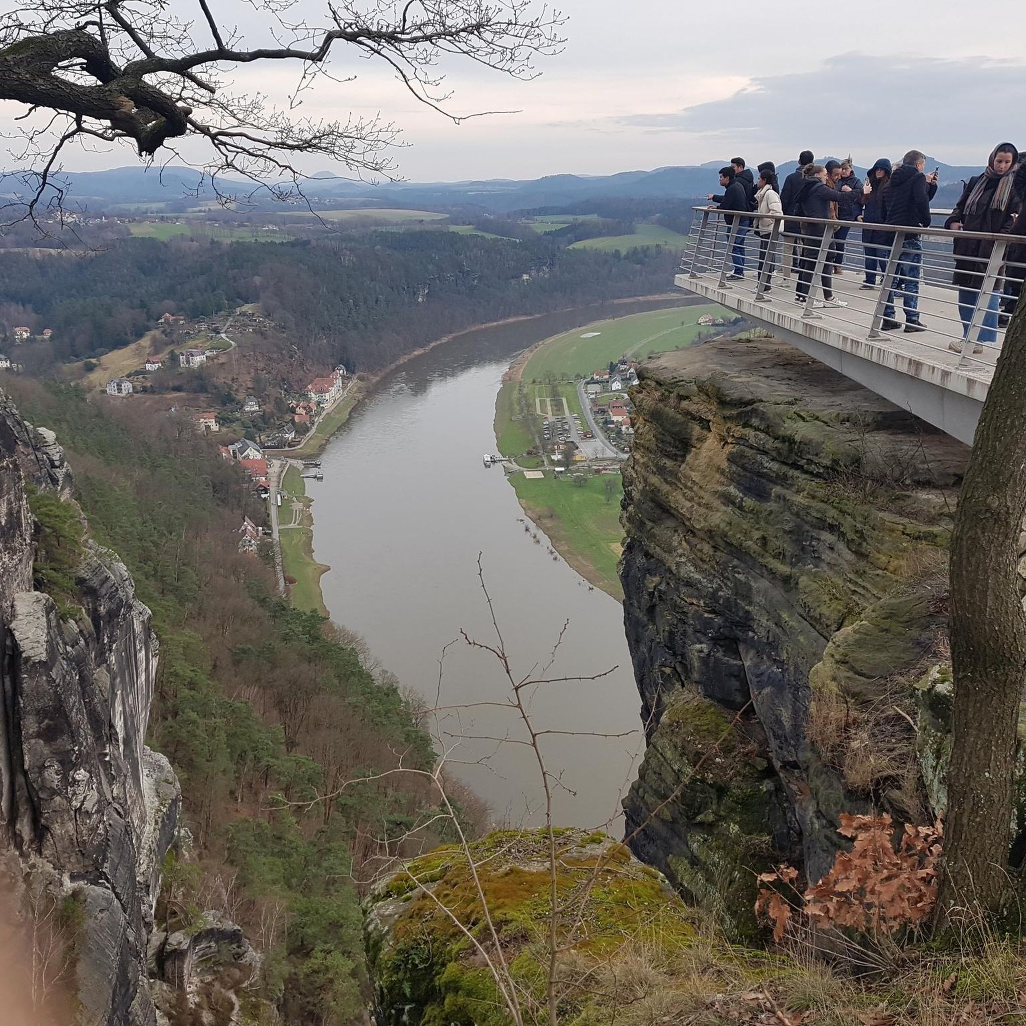
Given the hilly nature of Bischbrunner Forst and the Spessart, many routes offer rewarding scenic viewpoints. The Wertheim Old Town – Ridge With Panoramic View loop from Wertheim, for example, explicitly highlights a ridge with panoramic views, providing stunning vistas of the surrounding landscape during its 43 km journey.
Most popular routes in Bischbrunner Forst
Most popular attractions in Bischbrunner Forst

Get inspired with the komoot mobile app


Explore more
Browse the best Road cycling routes in other regions.
