The best hikes from bus stations in Foresta Demaniale Del Marganai
4.5
(1518)
7,109
hikers
10
hikes
Bus station hiking trails in Foresta Demaniale Del Marganai traverse a mountainous massif characterized by limestone and schistic rock formations, with peaks ranging from 200 to over 1,000 meters. The region features lush forests dominated by holm oaks and cork oaks, alongside areas of Mediterranean scrub. Deep furrows carved by erosion and impressive limestone formations define the landscape, which is also crisscrossed by seasonal streams. This diverse terrain offers varied hiking experiences.
Best bus station hiking trails in Foresta Demaniale Del Marganai
- The most popular bus station hiking route is Cala Lunga da Buggerru — Ring tour, an 8.4 miles (13.5 km) trail that takes 4 hours 1 minute to complete. This moderate route offers views of the coastline and surrounding natural features.
- Another top favourite among local hikers is Buggerru – Galleria Henry Trail loop from Bugerru/Buggerru, a moderate 7.2 miles (11.5 km) path. This trail explores the area's mining heritage and natural beauty, with an elevation gain of 1,453 feet (443 meters).
- Local hikers also love the Tunnel to Cala Lunga – Cala Lunga (Cala Grande) loop from Bugerru/Buggerru, a 6.6 miles (10.7 km) trail leading through coastal and forested areas, often completed in about 3 hours 4 minutes.
- Hiking in Foresta Demaniale Del Marganai is defined by dense woodlands, limestone formations, and coastal paths, with routes available for moderate and difficult ability levels.
- The routes in Foresta Demaniale Del Marganai are highly rated by the komoot community with an average score of 4.6 stars from over 1,200 reviews. More than 6,000 hikers have used komoot to explore Foresta Demaniale Del Marganai's varied terrain.
Last updated: July 6, 2026
4.6
(23)
82
hikers
13.5km
04:02
410m
410m
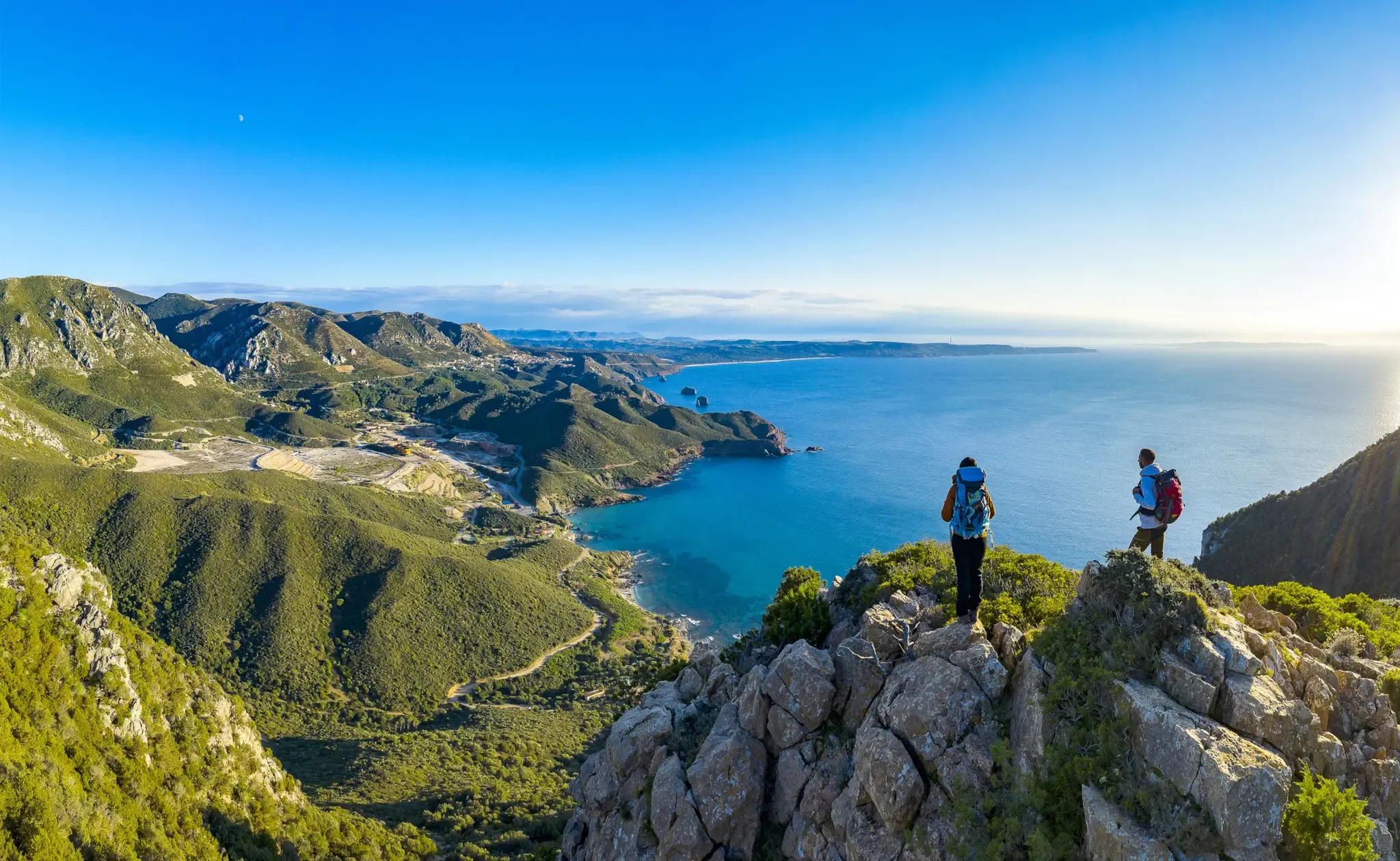
Embark on the Cala Lunga da Buggerru — Ring tour, a moderate hike that blends Sardinia's dramatic coastal beauty with its rich mining history. This loop trail covers 8.4 miles (13.5 km) with an elevation gain of 1333 feet (406 metres), typically taking around 4 hours and 2 minutes to complete. You will traverse diverse terrain, from rugged limestone paths and Mediterranean scrub to sections of unpaved road, all while enjoying breathtaking views of the sea. The route offers panoramic vistas of dramatic cliffs and picturesque sandy coves like Cala Lunga and Cala Domestica. Keep an eye out for the striking Pan di Zucchero rock formation rising from the water.
This trail is rated as moderate, so you should have good fitness and be sure-footed, especially on uneven and potentially slippery sections. While the research does not specify trailhead access or parking details, plan to start your hike early to make the most of the daylight and avoid the midday heat, particularly during warmer months. Always check local conditions before you go, as some paths may involve scree or steep ascents and descents over rough rock.
The Cala Lunga da Buggerru trail is deeply intertwined with the region's industrial past, offering a unique insight into Sardinia's mining heritage. You will pass significant historical sites, including the Henry Tunnel, originally built for mineral transport, and the ruins of the Pranu Sartu village. The trail also leads to secluded coves like Cala Lunga, historically used as a hideout from pirates, and is located within the protected SIC (Site of Community Importance) of the Nebida coast, highlighting its ecological significance.
4.6
(7)
27
hikers
Moderate hike. Good fitness required. Easily-accessible paths. Suitable for all skill levels.

Sign up for free
4.6
(5)
24
hikers
5.40km
01:33
130m
130m
Easy hike. Great for any fitness level. Easily-accessible paths. Suitable for all skill levels.
4.6
(27)
190
hikers
Moderate hike. Good fitness required. Easily-accessible paths. Suitable for all skill levels.
5.0
(2)
11
hikers
11.5km
03:35
440m
440m
Moderate hike. Good fitness required. Easily-accessible paths. Suitable for all skill levels.
Get access to more routes and recommendations from other explorers.
Sign up for free
Already have an account?
Our route recommendations are based on thousands of hikes, rides, and runs completed by other people on komoot.
Start today with a free account
Your next adventure awaits.
Login or Signup
Popular around Foresta Demaniale Del Marganai
Other adventures in Foresta Demaniale Del Marganai

Tips from the Community

The Planu Sartu mine is located on the limestone plateau west of Buggerru. Discovered in 1869, it reached its peak in the early 20th century, employing over 2,700 workers. Calamine, a zinc ore, was mined here, processed both open-pit and underground. The Henry Tunnel, still visible, connected the underground worksites to the Buggerru washery. Operation continued until the 1950s, when the deposits were exhausted and the mine closed permanently.
0
0

cala lunga topp.you can get there passing by cola domestica
0
0

The densely growing Euphorbia characias, with its bright yellow inflorescences and gray-green leaves, dominates the Mediterranean maquis of Sardinia. As an adaptation to summer drought, this spurge species has developed a white milky sap that, when damaged, oozes and contains toxic diterpenes. The complex inflorescences consist of seemingly simple flowers that are in fact specialized inflorescences (cyathia) with individual male and female flowers, surrounded by striking bracts. As an important component of Mediterranean sclerophyll vegetation, it contributes to biodiversity and provides food for specialized pollinators early in the year.
0
0

Cala Domestica, south of Buggerru, two kilometers away, is like an open-air museum of industrial archaeology, preserving ruins of warehouses, deposits and tunnels dug by miners. Until 1940, the minerals extracted from the mines were shipped from here. One of these tunnels on the right of the cove leads to a second secluded, almost intimate cove, called La Caletta. A deep inlet opens towards the sea, almost a fjord, with a wide and sheltered sandy beach in white, amber and golden tones, soft and compact. Small Mediterranean shrubs emerge on the dunes behind the expanse of sand.
3
1
Buggerru is a charming tourist village built on an ancient mining community founded in 1864. Today hosting around a thousand inhabitants, the town preserves the memory of its intense mining activity until 1979. It develops in a radiant manner along the suggestive mouth of the valley of Mount Caitas, baptized with the name of the famous Malfidano mine, the flagship of the mining industry between the late nineteenth and early twentieth centuries. This location was already known by the Romans for the presence of silver. The modern port is dominated by the entrance to the Henry tunnel, today an open-air museum, once crossed by a train used to transport the extracted mineral. It was nicknamed "petite Paris" for the environment recreated by the managers and their families, belonging to the French company that managed the mining activity. Its history is complex, marked by strikes and social tensions in the context of the mining industry. Its enchanting coastline, with Buggerru beach on the right of the port, offers breathtaking scenery over the blue sea.
3
0
The tunnel for Cala Lunga is a short excavated tunnel that was originally built to facilitate the transport of minerals to the more sheltered Cala Lunga, allowing boarding when the sea conditions at Cala Domestica were unfavorable. It has now become an evocative tourist attraction that allows you to quickly move from one beach to another. However, you need to be careful of the uneven and slippery terrain, both inside the tunnel and along the cliff path to reach it.
4
0

Frequently Asked Questions
How many bus-accessible hiking trails are available in Foresta Demaniale Del Marganai?
There are 6 hiking routes in Foresta Demaniale Del Marganai that are easily accessible from bus stations, allowing you to explore the region without a car.
What kind of landscapes can I expect on bus-accessible hikes in Foresta Demaniale Del Marganai?
The bus-accessible hikes in Foresta Demaniale Del Marganai traverse diverse landscapes, from lush forests dominated by ancient holm oaks and cork oaks to areas of Mediterranean scrub. You'll encounter mountainous terrain with limestone and schistic rock formations, deep furrows carved by erosion, and seasonal streams. The region offers a rich blend of natural beauty.
Are there any circular hiking routes accessible from bus stations?
Yes, several circular routes are accessible from bus stations. For example, the Cala Lunga da Buggerru — Ring tour offers a scenic loop, and the Buggerru – View of Buggerru and its coastline loop provides stunning coastal vistas.
What is the general difficulty level of bus-accessible hikes here?
The bus-accessible hikes in Foresta Demaniale Del Marganai range from moderate to difficult. Out of the 6 available routes, 4 are rated as moderate, and 2 are considered difficult, offering options for various fitness levels.
Are there historical sites or natural landmarks I can visit on these bus-accessible trails?
Absolutely. The region is rich in history and natural wonders. You can explore sites like the Temple of Antas, the Antas Nuragic Village, and ancient Roman Quarries. Natural highlights include the impressive Su Mannau Cave and the Ancient Cork Oak.
Can I find viewpoints with panoramic views on hikes starting from bus stations?
Yes, many trails offer spectacular panoramic views. The region's mountainous topography, with peaks reaching over 1,000 meters, ensures numerous vantage points. For instance, trails leading to Punta San Michele (909 m) provide expansive views over the entire Sulcis Iglesiente region.
What kind of wildlife might I encounter on bus-accessible trails in Foresta Demaniale Del Marganai?
Foresta Demaniale Del Marganai is home to diverse wildlife. Hikers might spot wild boar, wild cats, hares, and foxes. Birdwatchers can look out for peregrine falcons and, occasionally, the golden eagle. Efforts have also been made to reintroduce Corsican red deer and mouflon in certain areas.
Are there family-friendly hiking options accessible by bus?
While many routes are moderate to difficult, some sections or shorter loops can be suitable for families. The Linasia Mountain Garden, for example, offers an educational and accessible trail showcasing local flora, ideal for families and offering scenic viewpoints over the Oridda Valley.
Are dogs allowed on the bus-accessible hiking trails?
Generally, dogs are allowed on trails in Foresta Demaniale Del Marganai, but it's always recommended to keep them on a leash, especially due to the presence of wildlife and to respect other hikers. Please check local regulations for specific areas or nature reserves within the forest.
What is the best season to hike these bus-accessible trails in Foresta Demaniale Del Marganai?
Spring and autumn are generally the best seasons for hiking in Foresta Demaniale Del Marganai. In spring, the forest floor comes alive with blooming wild orchids, and temperatures are mild. Autumn offers pleasant weather and beautiful foliage. Summers can be hot, so early morning or late afternoon hikes are recommended, while winters are generally mild but can have seasonal streams.
What should I wear or bring for a bus-accessible hike in this region?
For hiking in Foresta Demaniale Del Marganai, wear sturdy hiking boots, layers of clothing suitable for changing weather conditions, and bring plenty of water, especially during warmer months. Sun protection (hat, sunscreen) is advisable, and a map or GPS device is recommended as some trails can be remote. Don't forget snacks and a camera to capture the stunning views.
What do other hikers say about the bus-accessible trails in Foresta Demaniale Del Marganai?
The komoot community highly rates the trails in Foresta Demaniale Del Marganai, with an average score of 4.6 out of 5 stars from over 1,200 ratings. Hikers frequently praise the region's diverse landscapes, the blend of natural beauty with historical sites, and the rewarding panoramic views.
Are there any trails that combine coastal views with historical mining heritage?
Yes, the region's mining past is evident along several routes. The Buggerru – Galleria Henry Trail loop is a great example, offering a unique blend of natural beauty, coastal scenery, and industrial archaeology, allowing you to explore abandoned mining facilities.
Most popular routes in Foresta Demaniale Del Marganai
Most popular attractions in Foresta Demaniale Del Marganai

Get inspired with the komoot mobile app


Explore more
Browse the best Hikes in other regions.
