Top 8 Natural Monuments around gmina gmina Szprotawa
Best natural monuments around gmina gmina Szprotawa are found in a region rich in natural heritage, boasting 53 registered sites. Located at the northern edge of the Lower Silesian Forest complex, the area features a diverse landscape including parts of the Dalkowskie Hills, the Lower Silesian Forests, and the Szprotawa Plain. The Odra river basin, with the Bóbr and Szprotawa rivers, also flows through the area. The gmina hosts 8 protected areas, including 4 Natura 2000 sites, a nature reserve,…
Last updated: June 29, 2026
Pustynia Kozłowska
Highlight • Natural Monument
Translated by Google •
Tip by

Railway Oaks by the Żagań–Wolsztyn Line
Highlight • Natural Monument
Translated by Google •
Tip by

Sign up now to discover places like this
Get recommendations on the best single tracks, peaks, & plenty of other exciting outdoor places.
Sign up for free
Silesian Ramparts
Highlight • Historical Site
Translated by Google •
Tip by

Cietrzewiowe Heather Moorland
Highlight • Natural
Area code: PLH020015, habitat area
Total area: 6,663.7 ha
Existing forms of nature protection:
Przemkowski Landscape Park,
ecological use "Cietrzewiowe Wrzosowisko"
Administrative location:
Bolesławiec commune,
Gromadka commune
Translated by Google •
Tip by
Chrobry Oak
Highlight • Natural Monument
Translated by Google •
Tip by

Sign up for free to discover even more natural monuments around gmina gmina Szprotawa.
Sign up for free
Already have an account?
Start today with a free account
Your next adventure awaits.
Login or Signup

Tips from the Community

The fastest route is from Leszno Górne. A little further from Przemków. Whichever route you choose, you'll still be riding on excellent gravel road.
2
0
The Kozłowska Desert is an area of exposed sand dunes located in the Lower Silesian Voivodeship, within the Lower Silesian Forest, approximately 17 km southeast of Szprotawa. The formation of the Kozłowska Desert was influenced by the activities of a German, and later Soviet, military training ground, which operated until 1992, when the dune served as a shield for rockets and artillery shells. At that time, the bare areas of exposed sand covered over 100 hectares. After 1992, vegetation succession occurred, but a section of the desert is undergoing conservation efforts to preserve its existing terrain.
1
0

The Silesian Ramparts are the longest archaeological site in Poland. This medieval structure is considered the equivalent of the famous Great Wall of China. These are the until-recently-mysterious Silesian Ramparts, built in the 14th and 15th centuries on the border of the former Duchy of Głogów. The medieval Szprotawa District (districtus sprotaviensis) bordered the Duchy of Żagań to the west and the Duchy of Jawor to the south. The structure was enormous considering the local conditions. A system of ramparts and ditches was painstakingly constructed over several dozen kilometers, terminating at rivers or marshes. Sometimes the fortifications were so strong that they consisted of up to four adjacent ramparts. Hedges were planted and maintained on their crests to prevent sudden intrusions into the duchy. To give you an idea, at some sites the fortification system was over 40 meters wide with the height of the ramparts being about 2.5 meters!
0
0

Along the former railway line, currently by the "Kolej na rower" bicycle path, there are 4 English oaks of outstanding size. The most impressive of them measures 320 cm at breast height. This thickness qualifies it for recognition as a natural monument. The others are not much worse. They were planted about 120 years ago. It is very likely that they are the same age as the railway line no. 371 Żagań - Wolsztyn. It is worth paying attention to them during a bicycle ride.
2
1
On foot or by bike (road bike can be taken from Piotrowice). There is a roofed shelter with a place for a bonfire by the tree.
0
0

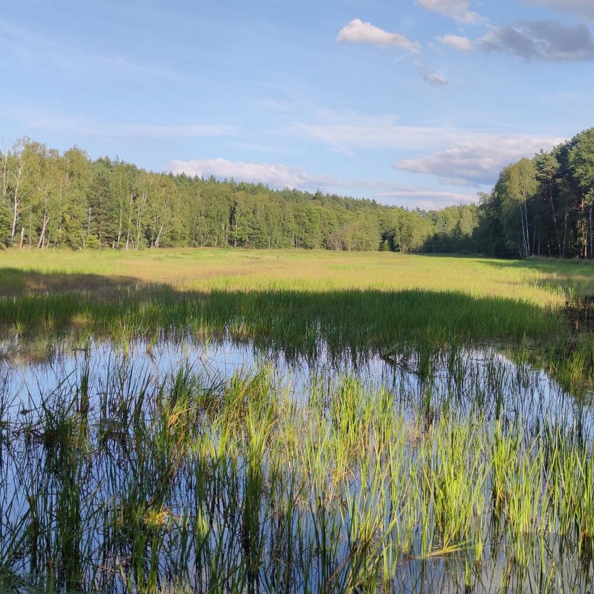
PRZEMKOWSKIE WRZOSOWISKO Area code: PLH020015, habitat area Total area: 6,663.7 ha Existing forms of nature protection: Przemkowski Landscape Park, ecological use "Cietrzewiowe Wrzosowisko" Administrative location: Bolesławiec commune, Gromadka commune General description of the entire area: The Special Protective Area "Wrzosowisko Przemkowskie" covers the area of the former Przemków military training ground, where, as a result of deforestation, biocenoses rarely found in our region were formed: a vast heath, inland dunes and sandy areas with psammophilous vegetation. The refuge stretches from the sands of the central part of the Przemkowski Landscape Park south-west to Trzebień. Open areas constitute approximately 70% of the area, the rest is covered with forests, mainly pine forests. https://gminaboleslawiec.pl/513/wrzosowisko-przemkowskie.html
0
1
Kozłowska Desert - an area of exposed sand dunes located in the Lower Silesian Voivodeship, in the Lower Silesian Forests, located approximately 17 km southeast of Szprotawa. The dunes in the Lower Silesian Forests are the product of aeolian processes, they were formed in the period after the end of the last ice age until they were covered with vegetation. The creation of the Kozłowska Desert was caused by the activity of a Soviet military training ground, operating until 1992, when the dune served as a shield for rockets and artillery shells.
2
0
Frequently Asked Questions
What types of natural monuments can I find in Gmina Szprotawa?
Gmina Szprotawa is home to a diverse range of natural monuments, including individual ancient trees, groups of trees, and unique surface monuments. You can explore sites like the Chrobry Oak, which is one of Poland's oldest oaks, and the geological rarity of the "Flins" Erratic Boulder. The region also features the Pustynia Kozłowska, an area of exposed sand dunes.
Are there any family-friendly natural monuments in Gmina Szprotawa?
Yes, several natural monuments are suitable for families. The Chrobry Oak is a great spot, offering a roofed shelter and a place for a bonfire. The Observation tower with a view of the Przemkowski Park Krajobrazowy wetlands is also family-friendly, providing beautiful views of marshes and ponds.
What are some unique trees to see in Gmina Szprotawa?
Beyond the famous Chrobry Oak, Gmina Szprotawa boasts several unique arboreal monuments. You can find Poland's oldest Kaukasian Wingnut on Kościuszki Street in Szprotawa, a group of 15 ancient oaks in the park on 3 Maja Street, and the distinctive Trumpet Beech along the road to Szprotawka. The Municipal Park of Szprotawa also features three ginkgo biloba trees, an ancient ivy on the Western Bastion, and a rare pyramidal English oak.
Where can I find interesting geological features in the region?
For geological interest, visit the "Flins" Erratic Boulder, located north of Długie village. This large boulder of gray granite gneiss, protected since 2019, has an informational board and a bench for visitors. Another unique geological site is the Pustynia Kozłowska, an area of exposed sand dunes with a history tied to military training grounds.
What outdoor activities can I do near the natural monuments?
The area around Gmina Szprotawa offers various outdoor activities. You can enjoy road cycling on routes like the 'Church in Rudawica – Kliczków Castle loop' or 'Park 1000-lecia loop'. For mountain biking, explore trails such as the 'Lake Żagańskie – Knight's Tower in Witków loop'. There are also touring bicycle routes like the 'Bóbr River at Szprotawa – Szprotawa Town Hall loop'. You can find more details on these and other routes in the Road Cycling Routes, MTB Trails, and Cycling around gmina gmina Szprotawa guides.
Are there any natural monuments accessible by bicycle paths?
Yes, the Railway Oaks by the Żagań–Wolsztyn Line are located along the former railway line, which is now the "Kolej na rower" bicycle path. This makes them easily accessible for cyclists looking to enjoy nature while riding.
What is the best way to experience the wetlands and viewpoints?
To experience the wetlands, visit the Observation tower with a view of the Przemkowski Park Krajobrazowy wetlands. This tower offers beautiful panoramic views of the marshes and ponds. It's a great spot to spend a few minutes appreciating the natural landscape.
What is the historical significance of the natural monuments in Gmina Szprotawa?
Many natural monuments in Gmina Szprotawa have historical significance. The Chrobry Oak, for instance, was protected as early as 1966 and is estimated to be around 750 years old. The "Flins" Erratic Boulder was recognized and protected even before World War II. Additionally, the Municipal Park of Szprotawa, which hosts several protected trees, was developed on the site of former defensive fortifications, blending natural beauty with local history.
Are there any protected areas or nature reserves near the natural monuments?
Yes, Gmina Szprotawa is rich in protected areas. The region hosts 8 protected areas, including 4 Natura 2000 sites, a nature reserve (Buczyna Szprotawska, near the Chrobry Oak), two protected landscape areas, and one natural and landscape complex. These areas contribute to the preservation of the diverse landscape and biodiversity of the Lower Silesian Forest complex.
What do visitors enjoy most about the natural monuments in Gmina Szprotawa?
Visitors appreciate the unique natural heritage and the opportunities for peaceful contemplation and educational outings. Highlights like the Observation tower with a view of the Przemkowski Park Krajobrazowy wetlands are praised for their beautiful views. The Pustynia Kozłowska offers a unique desert landscape, while the ancient Chrobry Oak provides a connection to historical natural grandeur. The community has shared more than 10 photos and given 14 upvotes, indicating a strong appreciation for the area's natural beauty.
Can I bring my dog to the natural monuments?
Yes, the Observation tower with a view of the Przemkowski Park Krajobrazowy wetlands is noted as dog-friendly, making it a good option for visitors with pets.
What kind of landscape can I expect to see in Gmina Szprotawa?
Gmina Szprotawa offers a diverse landscape. It is situated at the northern edge of the Lower Silesian Forest complex and includes parts of the Dalkowskie Hills in the north and the Szprotawa Plain in the south. The area is also part of the Odra river basin, with the Bóbr and Szprotawa rivers flowing through it, creating a varied environment of forests, plains, and riverine features.
Most popular routes around gmina gmina Szprotawa
Most popular attractions around gmina gmina Szprotawa

Get inspired with the komoot mobile app


Explore more
Extend your search for the best caves by checking out these guides of the top ones around gmina gmina Szprotawa:
