Top 10 Mountain Passes around Saint-Sauveur
Best mountain passes around Saint-Sauveur are found in the Laurentian Mountains of Quebec, a region characterized by scenic routes and elevated trails. The landscape features rolling hills, extensive forests, and numerous lakes, offering a variety of elevated routes and scenic viewpoints. These routes provide significant climbs and descents, offering experiences akin to traditional mountain passes. The area is popular for cycling, hiking, and mountain biking, showcasing the natural beauty of the Laurentian landscape.
Best mountain passes around Saint-Sauveur
- The most…
Last updated: July 4, 2026
Parpaillon Tunnel
Highlight • Trail
Tip by

Risoul
Highlight • Viewpoint
Translated by Google •
Tip by

Sign up now to discover places like this
Get recommendations on the best single tracks, peaks, & plenty of other exciting outdoor places.
Sign up for free
Col du Parpaillon
Highlight • Mountain Pass
Translated by Google •
Tip by
Ascent of the Col de Vars from Guillestre
Highlight (Segment) • Mountain Pass
Translated by Google •
Tip by
Gravel descent from the Parpaillon Tunnel
Highlight (Segment) • Trail
Translated by Google •
Tip by

Sign up for free to discover even more mountain passes around Saint-Sauveur.
Sign up for free
Already have an account?
Start today with a free account
Your next adventure awaits.
Login or Signup

Tips from the Community

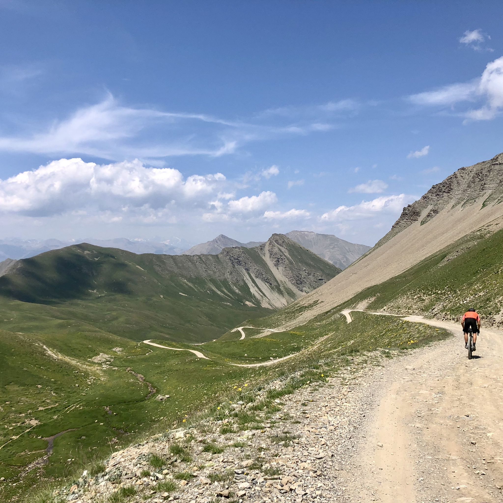
Here the asphalt road ends and you can no longer continue on the BDC.
18
0
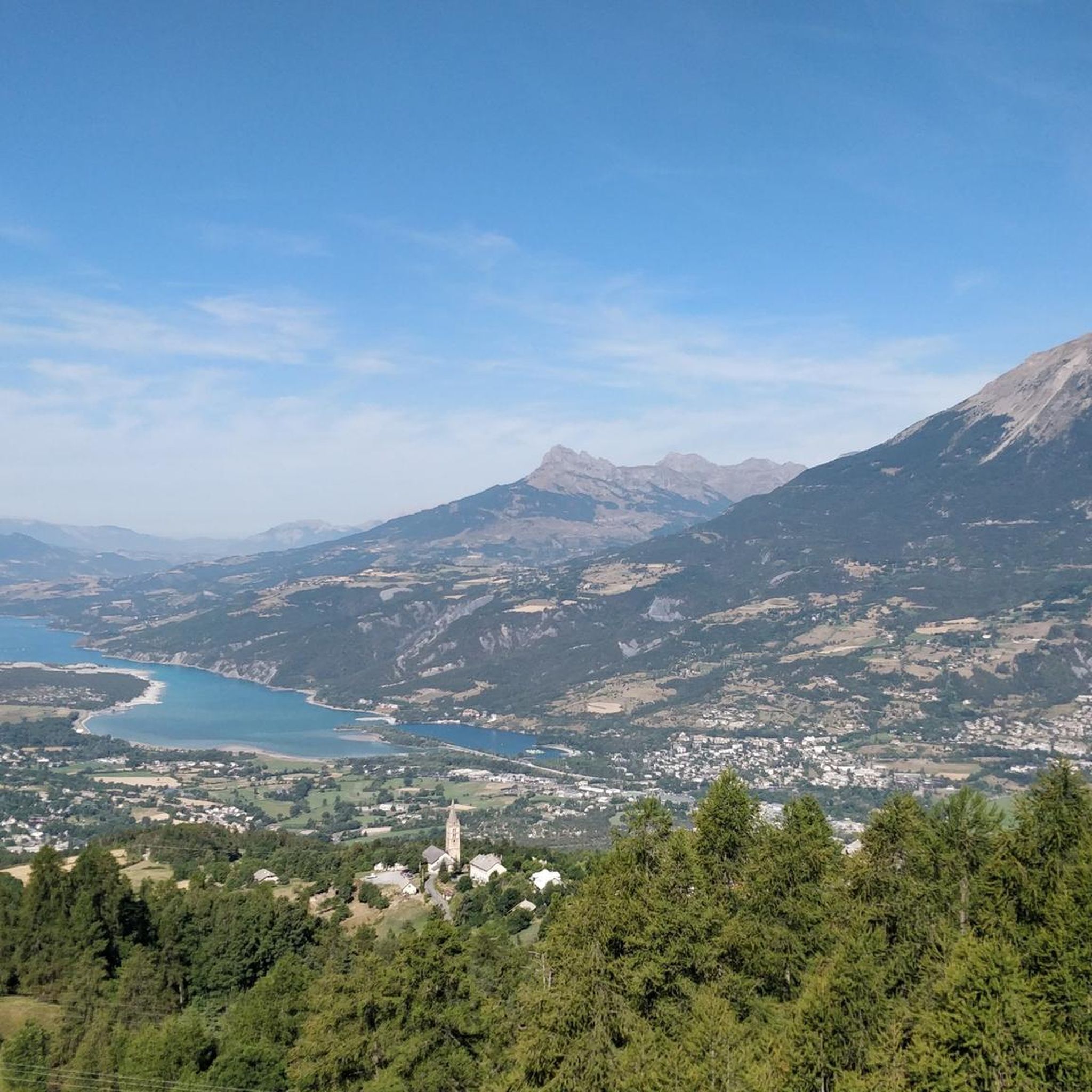
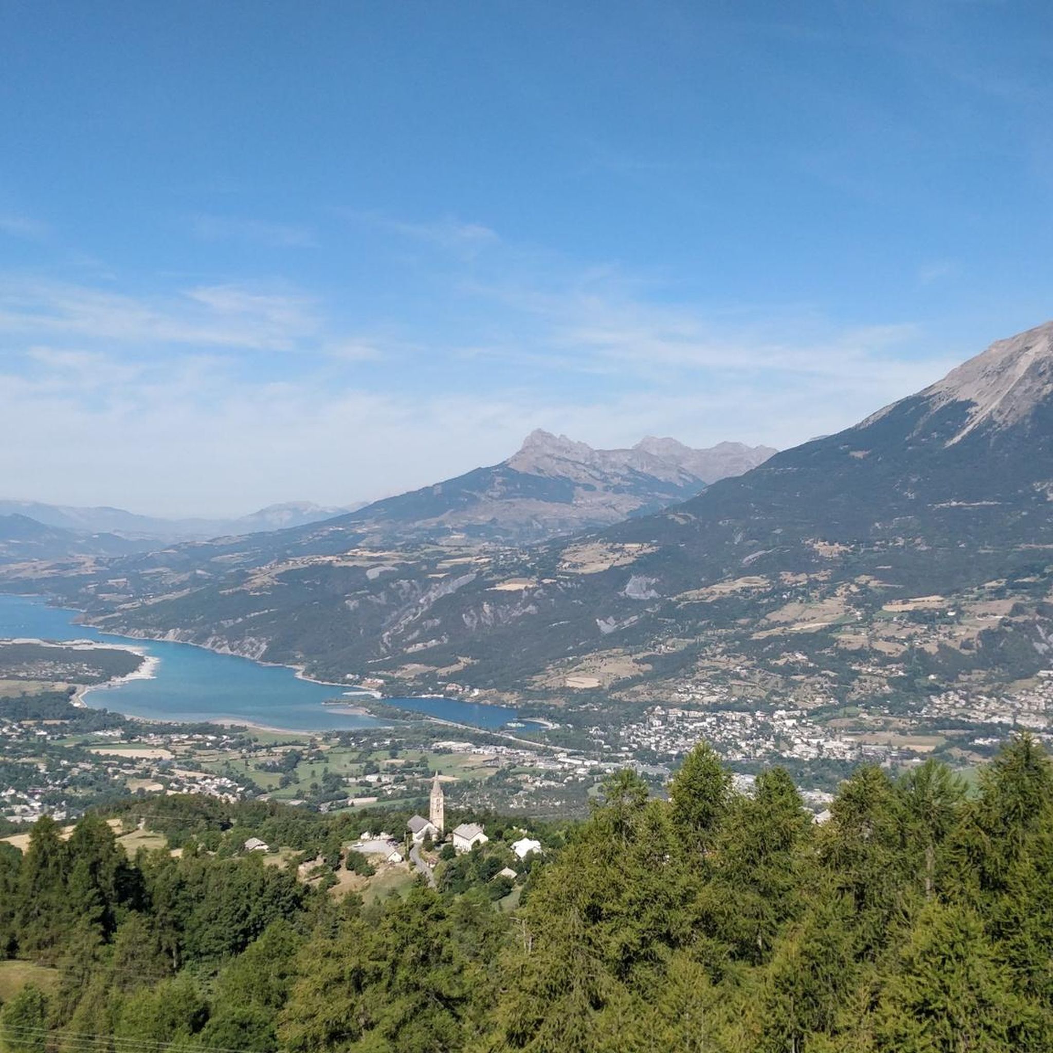
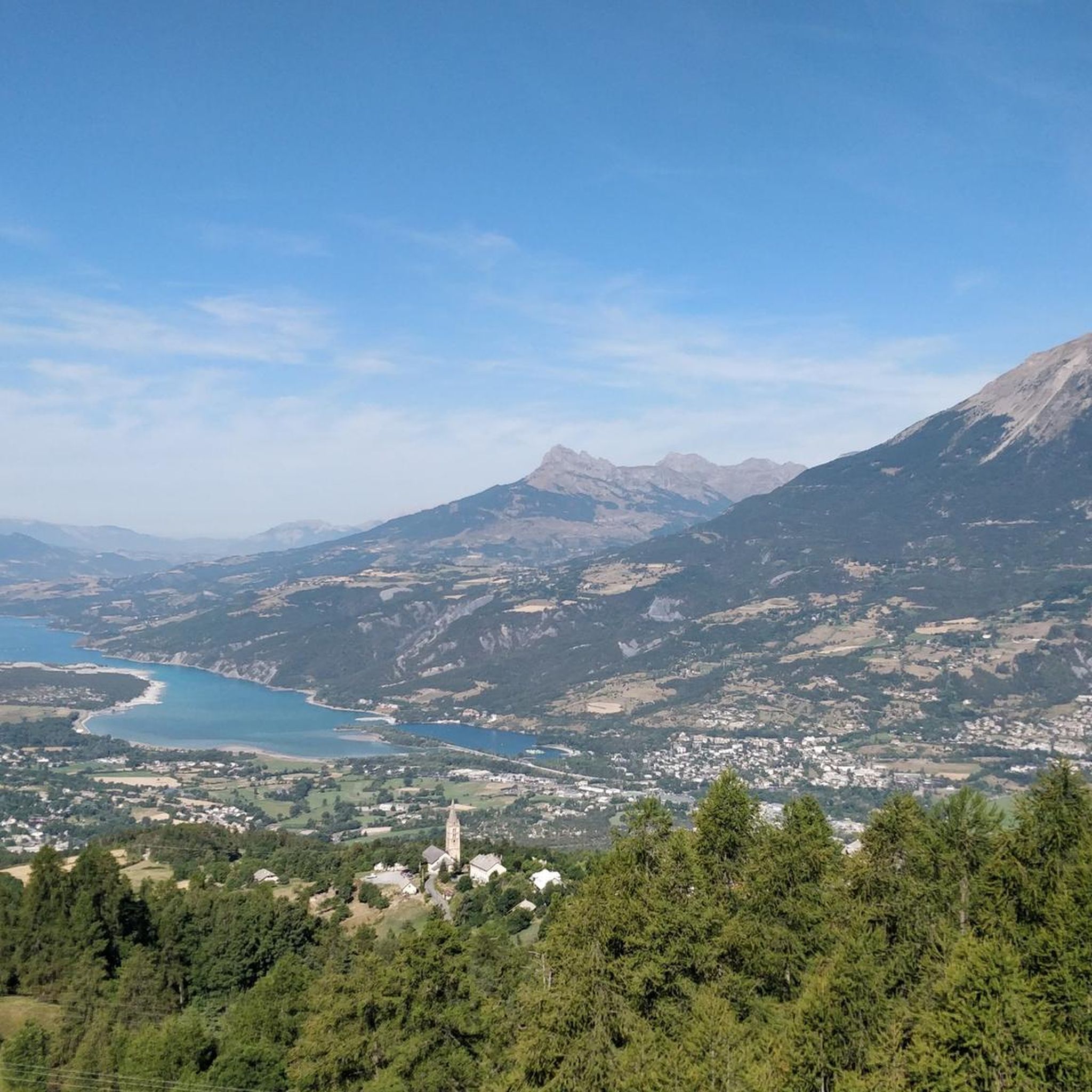
Once you reach the top of this long climb you can enjoy the beauty of Risoul and its landscapes.
4
0
Never too hard jump with exceptional views.
13
0

In the Greater Briançon region, the ascent of the Col de Vars from Guillestre is a first-category pass, 19 kilometers long, with an average gradient of 5.9%. Beware of steep sections that can reach 14%. A respite in the middle, however, at Saint-Marcellin, allows you to catch your breath.
2
0

Tunnel is at the moment not passable. It collapsed in the middle and the portale on the side of les pras is has a lot of rocks in front of it. Wait till or if the maintance will be done.
8
0

Very rolling track to climb or descend the Parpaillon tunnel. I recommend going up via Condamine and down via Crévoux because it is less rocky on the Crévoux side to go down. Either way, the views are breathtaking and you'll want to stop and enjoy the scenery.
0
0

Beautiful finish with an average of more than 8% over 2.5 km
0
0

Col du Parpaillon from Crevoux is a climb in the Serre Ponçon region. It has a length of 12 kilometers and an ascent of 989 vertical meters with an average gradient of 8.2%, which implies a difficulty level of 1,210. The top of the ascent is located at 2,628 meters above sea level.
1
1
Frequently Asked Questions
What types of outdoor activities can I enjoy on the elevated routes around Saint-Sauveur?
The elevated routes and scenic trails around Saint-Sauveur are perfect for a variety of outdoor activities. You'll find excellent opportunities for cycling, hiking, and mountain biking, all offering significant climbs and descents with impressive views of the Laurentian landscape.
Are there challenging cycling routes in the Saint-Sauveur area?
Yes, Saint-Sauveur offers several challenging cycling routes. For instance, the "des cotes" Route features a substantial 1,156 meters of elevation gain over 44.3 km. Another demanding option is the "Lost River Vallée de la Rouge", covering 76.8 km with 979 meters of elevation gain. The "St-Sauveur des Monts" Route also provides a significant challenge with 741 meters of elevation gain over 60.1 km, including steep gradient sections.
Where can I find hiking and mountain biking trails with good views near Saint-Sauveur?
Sommet Saint-Sauveur is a great destination for both hiking and mountain biking during warmer months. It offers trails for various skill levels, leading through lush forests to a summit viewpoint with expansive panoramic views of the surrounding mountains and valleys. For more challenging mountain biking, consider the Mont du Loup-Garou area or the Lac Saint-Amour Loop.
What are some popular hiking trails around Saint-Sauveur?
Popular hiking trails include the Sentier de la Montagne Noire Loop, which offers a moderate challenge over 6.7 miles. For a more difficult experience, the Pic White Loop via Grand Brûlé and Chemin Nansen spans 9.0 miles and provides a rewarding challenge for experienced hikers.
What is the best time of year to visit the mountain passes and trails around Saint-Sauveur?
The best time to visit for cycling, hiking, and mountain biking is typically during the warmer months, from late spring through early autumn. This period offers pleasant weather and ensures trails are clear of snow and ice, allowing full access to the scenic routes and elevated terrain.
Are there family-friendly outdoor options near Saint-Sauveur?
Yes, Sommet Saint-Sauveur is an accessible option for diverse groups, including families. It offers trails for various skill levels, allowing families to enjoy fulfilling outdoor experiences and rewarding panoramic views without being overly strenuous. Always check specific trail difficulties to match your family's capabilities.
What kind of terrain can I expect on the routes around Saint-Sauveur?
The terrain around Saint-Sauveur is characterized by the Laurentian Mountains, offering varied landscapes. You can expect significant elevation changes with both ascents and descents, lush forests, and open sections as you gain altitude. Routes like the "St-Sauveur des Monts" cycling route are known for their varied terrain.
What other outdoor activities are available near the mountain passes around Saint-Sauveur?
Beyond specific mountain pass-like routes, the Saint-Sauveur region offers a wide range of outdoor activities. You can find numerous options for cycling, running, and gravel biking. These guides provide details on various tours and trails suitable for different skill levels.
Are there any specific mountain biking trails for advanced riders?
Yes, advanced mountain bikers can tackle routes like the Mont du Loup-Garou loop from Lac Matley, which is 11.7 km with 200 meters of elevation gain and categorized as a hard ride. The Lac Saint-Amour Loop from Sainte-Anne-des-Lacs is another challenging option, spanning 14.1 km with 220 meters of elevation gain, requiring advanced riding skills.
What makes the Saint-Sauveur region unique for outdoor enthusiasts?
While not featuring traditional high-altitude mountain passes, Saint-Sauveur's mountainous terrain in the Laurentians provides ample opportunities for outdoor enthusiasts. Its network of scenic cycling, hiking, and mountain biking trails offers significant climbs and descents, allowing visitors to experience the region's natural beauty and elevation changes in a unique way.
Most popular routes around Saint-Sauveur
Most popular attractions around Saint-Sauveur

Get inspired with the komoot mobile app


Explore more
See even more epic mountain passes by checking out these guides around Saint-Sauveur:
