The best running trails around Saint-Sauveur
4.6
(57)
3,626
runners
14
runs
Jogging routes around Saint-Sauveur traverse the scenic Laurentian Mountains of Quebec, offering a diverse landscape for runners. The region features a mix of valleys, forests, and varied terrain, including the expansive Parc Linéaire Le P'tit Train du Nord. This area provides both gentle slopes and more challenging ascents, catering to different preferences. The natural environment, characterized by picturesque scenery, makes it an appealing location for outdoor running.
Best jogging routes around Saint-Sauveur
- The most popular jogging route is Pont Neuf…
Last updated: June 29, 2026
17
runners
18.6km
02:57
1,160m
1,160m
Hard run. Very good fitness required. Mostly accessible paths. Some sure footedness required.
6
runners
6.77km
00:59
330m
330m
Hard run. Very good fitness required. Mostly paved surfaces. Suitable for all skill levels.

Sign up for free
5
runners
8.73km
01:07
360m
350m
Hard run. Very good fitness required. Mostly paved surfaces. Suitable for all skill levels.
8
runners
11.8km
01:16
80m
80m
Moderate run. Good fitness required. Mostly paved surfaces. Suitable for all skill levels.
5
runners
3.23km
00:21
40m
40m
Easy run. Great for any fitness level. Mostly paved surfaces. Suitable for all skill levels.
Get access to more routes and recommendations from other explorers.
Sign up for free
Already have an account?
Our route recommendations are based on thousands of hikes, rides, and runs completed by other people on komoot.
Start today with a free account
Your next adventure awaits.
Login or Signup

Tips from the Community


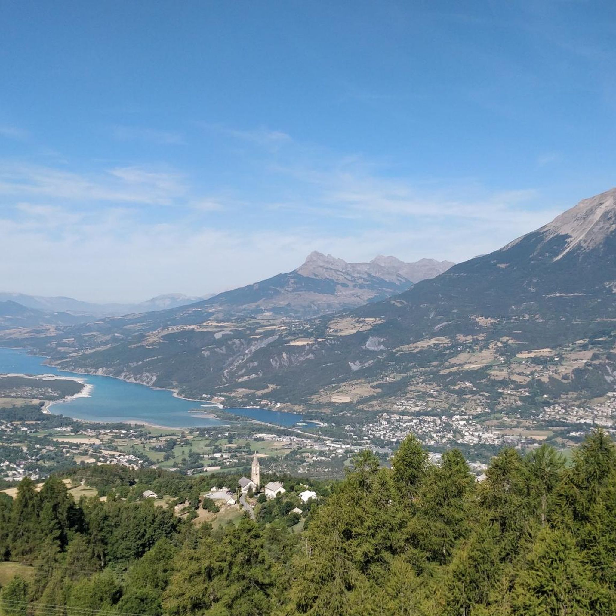
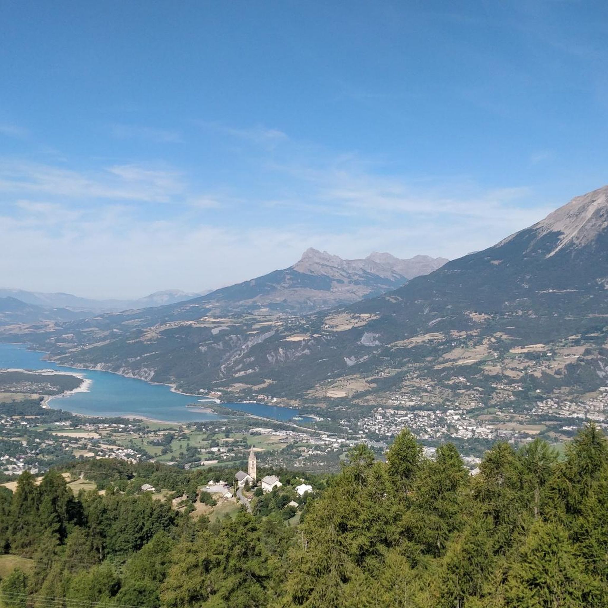
At 2,426 meters, the Méale is a summit of the Parpaillon massif which offers beautiful views of the Serre-Ponçon lake in particular. We can see the reservoir extending along its entire length.
2
0

A bridge that can be easily crossed without getting off the bike.
18
0

Lake Serre-Ponçon, located on the border between the departments of Hautes-Alpes and Alpes-de-Haute-Provence, is the largest artificial lake in mainland France and the second largest in Europe. Created by a huge dam in the 20th century, it offers turquoise waters, sunny beaches and a rich history. Explore the Muséoscope du Lac to discover how the dam was built and transformed the landscape and the lives of the inhabitants.
0
0
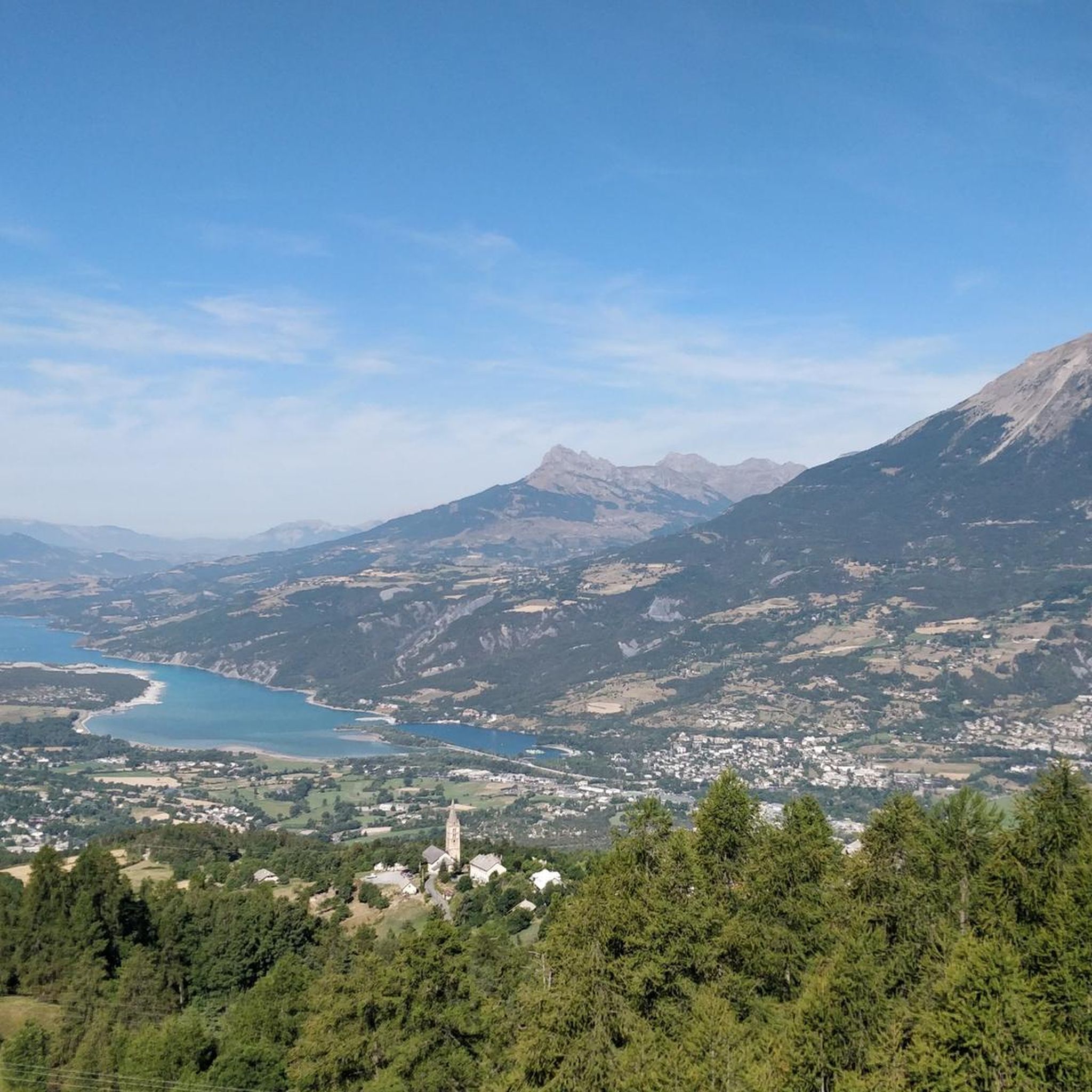
picturesque stroll with magnificent views of Lake Serre-Ponçon. It winds through unspoilt nature, offering walkers the opportunity to relax and enjoy the surrounding tranquility. The trail is ideal for walking, cycling or just admiring the peaceful scenery.
0
0

You can also ride a road bike.
0
0

Descending from the top, we have a beautiful view of the lake and the landscape.
0
0
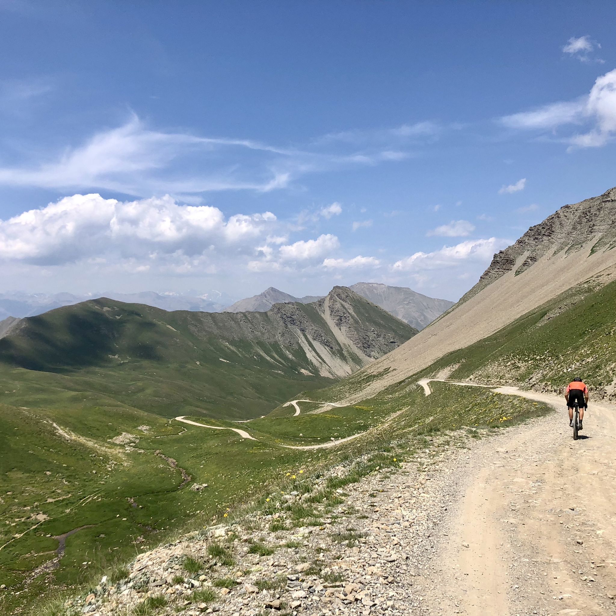
The Meale is located at an altitude of 2,426 m. From here we have a splendid view of the Embrunnais and the Parpaillon massif!
0
0
Frequently Asked Questions
How many running routes are available in Saint-Sauveur?
There are over 10 dedicated jogging routes around Saint-Sauveur listed on komoot, offering a diverse range of experiences. These routes are highly rated by the komoot community, with an average score of 4.7 stars.
What kind of terrain can I expect on jogging trails around Saint-Sauveur?
The jogging routes in Saint-Sauveur traverse the scenic Laurentian Mountains, offering a varied landscape. You'll find a mix of valleys, forests, and diverse terrain, from gentle slopes to more challenging ascents. The region's extensive trail networks, including the famous Parc Linéaire Le P'tit Train du Nord, provide options for all preferences, whether you prefer paved paths or more rugged mountain trails.
Are there any easy or beginner-friendly running routes in Saint-Sauveur?
Yes, Saint-Sauveur offers routes suitable for beginners. The Pont Neuf over the Durance – View of Embrun loop from Embrun is a moderate 4.8-mile (7.8 km) trail that provides a good introduction to the area's scenic beauty without extreme difficulty. The Parc Linéaire Le P'tit Train du Nord also features an average gradient of just 4% and is 86% paved, making it ideal for easier runs.
Where can I find challenging running trails with significant elevation gain?
For a more challenging experience, consider the Méale summit – The summit of Méale loop from Saint-Sauveur. This difficult 10.6-mile (17.0 km) path features significant elevation gain, leading to rewarding panoramic views of the Laurentians from the summit. Sommet Saint-Sauveur itself also offers opportunities for challenging uphill jogs.
Are there any scenic viewpoints or natural features to see along the running routes?
Absolutely! The region is rich in natural beauty. You can discover stunning sights like Lake Sainte-Marguerite, the impressive Morgon peak, and the picturesque Costeplane Waterfalls. Many trails offer views of the Laurentian Valley, especially vibrant during autumn with fall foliage.
Can I find running routes that are circular or loop trails?
Yes, many of the routes around Saint-Sauveur are designed as loops, allowing you to start and finish in the same location. Examples include the Pont Neuf over the Durance – View of Embrun loop from Embrun and the Pont Neuf over the Durance – View of the Durance River loop from Embrun, which offer varied scenery along their circular paths.
What is the best time of year to go jogging in Saint-Sauveur?
Saint-Sauveur is beautiful year-round, but the fall is particularly stunning when the Laurentian Mountains are vibrant with fall foliage, offering a magnificent backdrop for your runs. Spring brings budding greenery, and summer provides pleasant conditions for outdoor activities. Even winter offers opportunities for those equipped for cold-weather running, with dedicated trails available.
Are there any dog-friendly running trails in the Saint-Sauveur area?
While specific dog-friendly designations for each komoot route are not always listed, many natural trails in the Laurentian region generally welcome dogs on leash. It's always best to check local regulations or signage at trailheads for the most current information regarding pet access on specific paths.
Are there any waterfalls I can see while running in Saint-Sauveur?
Yes, the region features beautiful waterfalls. You can discover the Costeplane Waterfalls and the Jerusalem Spring, both of which are natural highlights in the area and can be incorporated into or viewed from various trails.
What is the Parc Linéaire Le P'tit Train du Nord, and is it good for running?
The Parc Linéaire Le P'tit Train du Nord is a 234-kilometer multifunctional trail built on an old railway line that winds through the Laurentians. It's an excellent option for running, offering an accessible experience for all skill levels with an average gradient of just 4% and an 86% paved route. Joggers can enjoy scenic routes alongside picturesque villages, sparkling lakes, and winding rivers.
Are there any running routes near Saint-Sauveur that offer river views?
Yes, several routes provide beautiful river views. The Pont Neuf over the Durance – View of the Durance River loop from Embrun is a 7.6-mile (12.3 km) trail that leads through river valleys, offering picturesque scenery along the Durance River.
What do other runners enjoy most about jogging in Saint-Sauveur?
The area is highly rated by the komoot community, with an average score of 4.7 stars from over 70 reviews. Runners often praise the diverse terrain, from peaceful forest paths to challenging mountain ascents, and the stunning natural beauty of the Laurentian Mountains. The well-maintained trails and variety of options for all skill levels are also frequently highlighted.
Most popular attractions around Saint-Sauveur

Get inspired with the komoot mobile app


Explore more
Browse the best Running Trails & Routes in other regions.
