Top 11 Natural Monuments around La Calahorra
Best natural monuments around La Calahorra are found in a region characterized by its diverse natural landscape. Situated in the province of Granada, La Calahorra benefits from its proximity to the Sierra Nevada National Park and the Granada Geopark. This area features unique "badlands" landscapes with impressive gullies and geological formations, alongside high-alpine environments. The region offers a variety of natural features, from mountain peaks to river systems.
Best natural monuments around La Calahorra
- The most popular natural monuments is…
Last updated: May 20, 2026
Chullo Peak
Highlight • Summit
Translated by Google •
Tip by

Benéjar River
Highlight • River
Translated by Google •
Tip by

Sign up now to discover places like this
Get recommendations on the best single tracks, peaks, & plenty of other exciting outdoor places.
Sign up for free
Confluence of the Rivers (Cruce de Los Ríos) – El Horcajo
Highlight • River
Translated by Google •
Tip by
Source of the Benéjar River in El Horcajo
Highlight • River
Translated by Google •
Tip by

Sulayr Trail GR-240
Highlight • Trail
Translated by Google •
Tip by

Sign up for free to discover even more natural monuments around La Calahorra.
Sign up for free
Already have an account?
Start today with a free account
Your next adventure awaits.
Login or Signup
Popular around La Calahorra
A legendary journey – Tour of the Sierra Nevada

Andalusia without limits – Tarifa to La Puebla de Don Fabrique on the GR 7
Running Trails around La Calahorra
Hiking around La Calahorra
MTB Trails around La Calahorra
Cycling around La Calahorra
Road Cycling Routes around La Calahorra

Gravel biking around La Calahorra


Tips from the Community

a wonder to behold with the Sierra Nevada in the background
0
1

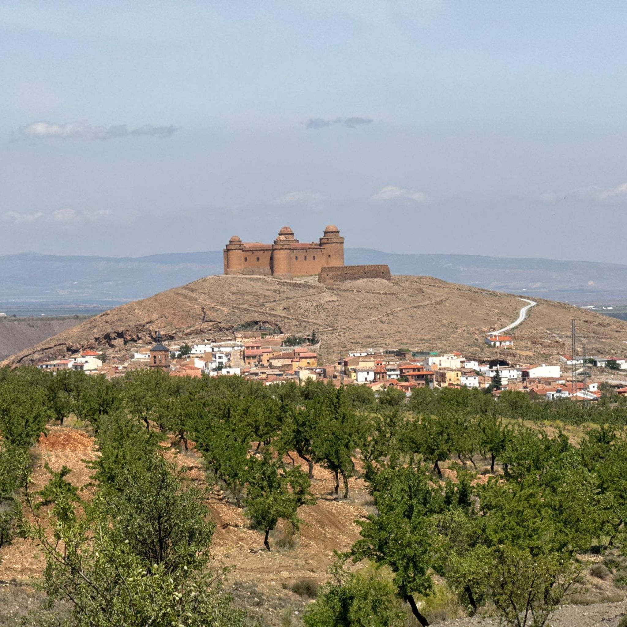
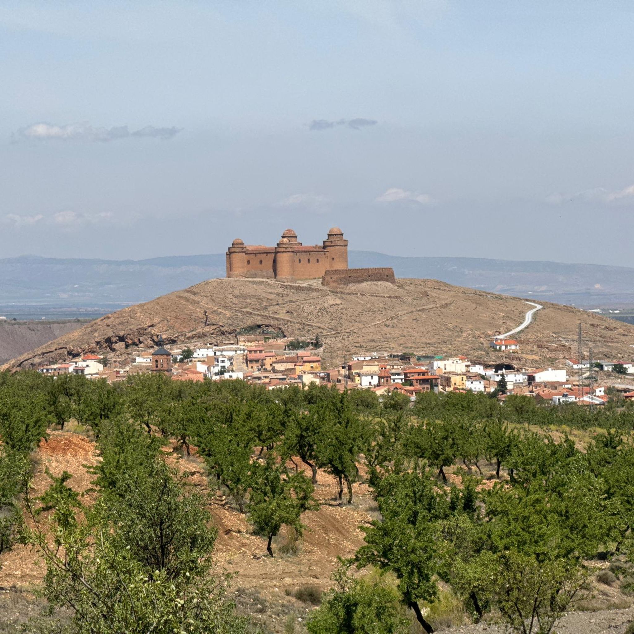
Very nice hike with a great panoramic view. Finally, a detour to the castle of La Calahorra, which is unfortunately only open on Wednesdays. Nevertheless, the beautiful view is worth it!
0
1

The trail follows the route of the GR-240, the long-distance trail named after Sulayr, the “mountain of the sun”, as the settlers who inhabited these magnificent mountains called it centuries ago. The name of the Lastonar pass describes the type of alpine pasture that usually covers these rough mountain terrains, accompanied by pilgrims, hawthorns and barberries. The GR-240 section is the most comfortable part to run, ideal for lovers of fast and easy tracks, without unevenness. The path passes by the cattle buildings of the Corral de Prado Largo and continues skirting the mountains along the edge of the pine forests. At Morrón del Tío Justo, the track turns to the left and descends from the mountains. The trail continues straight ahead through the Sulayr and returns to the technical and fun trail, passing through the bottom of a ravine and down to Refugio de las Chorreras, suitable for hikers and mountaineers. At the door of the refuge there are signs for the GR-240 and signs for the PR-A 333 path that goes down to the town of Aldeire. Las Chorreras is the lowest point of the trial, now it remains to go up to the Cabañuela pass through the pine forests of the mountains. The hardest slope is the forks of La Rinconada, then the path leaves the forest and ends the ascent on the slope of Morrón de la Cabañuela.
0
0

Mega beautiful view of the Sierra Nevada and a great short tour from the parking lot. Here in the video you can marvel at the whole tour in short: https://youtu.be/DxUrMbFJmow
1
0

Place where the Benéjar river is born, perfect for taking a break to enjoy the landscape and, in very hot seasons, take the opportunity to cool off.
2
1

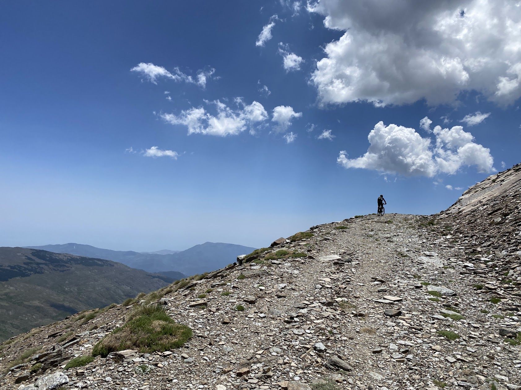
From El Chullo, at 2612 meters above sea level, you have very good views of Sierra Nevada and Almería.
2
0
You will do much of the race along the river, crossing it on more than one occasion in different ways.
2
1
It is the highest peak in Almería. The views of Sierra Nevada and Almería from the top are beautiful and you can even see the Mulhacén peak.
2
0
Frequently Asked Questions
What kind of natural features can I expect to see around La Calahorra?
The region around La Calahorra offers a diverse range of natural features. You'll find the unique 'badlands' landscape of the Granada Geopark and Gorafe Desert, characterized by impressive gullies, canyons, and geological formations with striking reddish and ochre tones. Additionally, La Calahorra sits at the foot of the Sierra Nevada National Park, providing access to high-alpine environments, glacial valleys, and diverse ecosystems. Specific natural monuments include mountain peaks like Chullo Peak and various river systems such as the Benéjar River.
Are there family-friendly natural monuments or trails near La Calahorra?
Yes, there are options suitable for families. The Source of the Benéjar River in El Horcajo is noted as family-friendly, offering a pleasant spot to enjoy the landscape and cool off. While specific family-friendly trails are not detailed for all monuments, many areas within the Granada Geopark and lower Sierra Nevada offer accessible paths. Always check the difficulty of a specific route before heading out with children.
What are some popular hiking trails near the natural monuments?
You'll find several popular hiking trails that allow you to explore the natural monuments. For instance, the Sulayr Trail GR-240 is a long-distance route passing through alpine pastures and pine forests, suitable for hikers and mountaineers. The area around the Benéjar River also features routes where you can walk along or even through the river. For more hiking options, you can explore the various routes listed in the Hiking around La Calahorra guide, which includes trails like the 'Río Benéjar and Castillo de la Caba Loop' and routes to 'Chullo Peak'.
What is the best time of year to visit the natural monuments around La Calahorra?
The best time to visit largely depends on the activity you plan. Spring (April-May) and Autumn (September-October) generally offer pleasant temperatures for hiking and exploring the Geopark and lower Sierra Nevada. Summer can be very hot, especially in the arid 'badlands' areas, though higher altitudes in the Sierra Nevada provide cooler conditions. Winter offers opportunities for snow activities in the Sierra Nevada, but some higher trails may be inaccessible due to snow and ice. Always check local weather forecasts before your visit.
Are there any natural monuments that offer panoramic views?
Absolutely. Chullo Peak, the highest peak in Almería, offers spectacular panoramic views of the Sierra Nevada, including Mulhacén peak, and the wider Almería region. Many viewpoints along the Sulayr Trail GR-240 also provide expansive vistas of the surrounding mountains and forests. The dramatic landscapes of the Granada Geopark and Gorafe Desert also present numerous opportunities for breathtaking views of unique geological formations.
Can I bring my dog to the natural monuments and on trails?
While many natural areas in Spain are generally dog-friendly, it's important to check specific regulations for national parks and protected areas like the Sierra Nevada National Park and the Granada Geopark. On trails, it's usually recommended to keep dogs on a leash to protect wildlife and ensure the safety of other visitors. Always carry water for your dog, especially in arid or high-altitude environments, and be prepared to clean up after them.
What kind of wildlife might I encounter in the natural monuments?
The diverse ecosystems around La Calahorra support a variety of wildlife. In the Sierra Nevada National Park, you might spot species like the Iberian ibex, various birds of prey, and numerous endemic plant species. The more arid regions of the Granada Geopark and Gorafe Desert are home to adapted flora and fauna, including various reptiles, birds, and small mammals. Observing wildlife often requires patience and a keen eye, especially during quieter times of day.
Are there opportunities for cycling near the natural monuments?
Yes, the region offers excellent opportunities for cycling. You can find various road cycling routes, such as those around La Ragua Pass and La Calahorra Castle, which are often challenging due to the mountainous terrain. For more general cycling, there are routes that explore the wider area, including the 'Cave town Guadix' loop. You can find detailed routes and guides for both Road Cycling and Cycling around La Calahorra.
What makes the Granada Geopark and Gorafe Desert unique?
The Granada Geopark, which includes the Gorafe Desert, is unique for its dramatic 'badlands' landscape. This area features extensive gullies, ravines, and geological formations sculpted by erosion, creating a visually stunning arid environment with striking reddish and ochre tones. Beyond its geological beauty, it's rich in paleontological and archaeological sites, including a high concentration of cave dwellings and over 240 dolmens in the Gorafe Megalithic Park, offering a blend of natural wonder and historical significance.
Are there any hidden gems or less-known natural monuments worth exploring?
While the main highlights are well-known, the vastness of the Granada Geopark and Sierra Nevada means there are always less-traveled paths. Exploring the lesser-known sections of the Sulayr Trail GR-240 or venturing into the deeper parts of the 'badlands' can reveal secluded viewpoints and unique geological formations away from the crowds. The region's extensive network of trails often leads to quiet spots perfect for contemplation and photography.
What should I pack for a visit to the natural monuments, especially considering the weather?
Given the diverse landscapes, packing layers is key. For the Sierra Nevada, even in summer, temperatures can drop significantly at higher altitudes, so bring warm clothing, a windbreaker, and rain gear. In the Geopark and desert areas, sun protection (hat, sunglasses, high-SPF sunscreen) and plenty of water are essential due to the arid conditions. Sturdy hiking boots are recommended for all terrains. Always check the specific weather forecast for your chosen destination within the region before you go.
Where do the rivers around La Calahorra originate?
The rivers in the area, such as the Benéjar River, originate from the Sierra Nevada mountains. A notable spot is the Source of the Benéjar River in El Horcajo, where the river is born. The Confluence of the Rivers (Cruce de Los Ríos) – El Horcajo is another significant point where waters descending from the Sierra meet to form the Benéjar River.
Most popular routes around La Calahorra
Most popular attractions around La Calahorra

Get inspired with the komoot mobile app


Explore more
Extend your search for the best caves by checking out these guides of the top ones around La Calahorra:
