The best walks and hikes around La Calahorra
4.6
(156)
866
hikers
55
hikes
Hiking around La Calahorra offers access to varied landscapes within the Sierra Nevada region. The terrain is characterized by significant elevation changes, encompassing high mountain passes, river valleys like the Río Benéjar, and historical sites such as Castillo de la Caba. Trails often traverse mountainous areas, providing views of peaks and natural features. The region's geology includes both rugged mountain paths and more gentle riverside routes.
Best hiking trails around La Calahorra
- The most popular hiking route is Parque Nacional…
Last updated: July 9, 2026
4.8
(17)
101
hikers
Hard hike. Very good fitness required. Sure-footedness, sturdy shoes and alpine experience required.
4.7
(15)
58
hikers
12.4km
03:38
360m
360m
Hike a moderate 7.7-mile loop from Aldeire, exploring the Río Benéjar, ancient chestnut groves, and the historic Castillo de la Caba.

Sign up for free
4.4
(16)
118
hikers
8.50km
04:26
550m
550m
Hard hike. Good fitness required. Sure-footedness, sturdy shoes and alpine experience required.
4.4
(8)
33
hikers
6.66km
01:56
170m
170m
Easy hike. Great for any fitness level. Easily-accessible paths. Suitable for all skill levels.
4.5
(2)
16
hikers
9.35km
02:58
370m
370m
Moderate hike. Good fitness required. Easily-accessible paths. Suitable for all skill levels.
Get access to more routes and recommendations from other explorers.
Sign up for free
Already have an account?
Our route recommendations are based on thousands of hikes, rides, and runs completed by other people on komoot.
Start today with a free account
Your next adventure awaits.
Login or Signup
Popular around La Calahorra




Tips from the Community


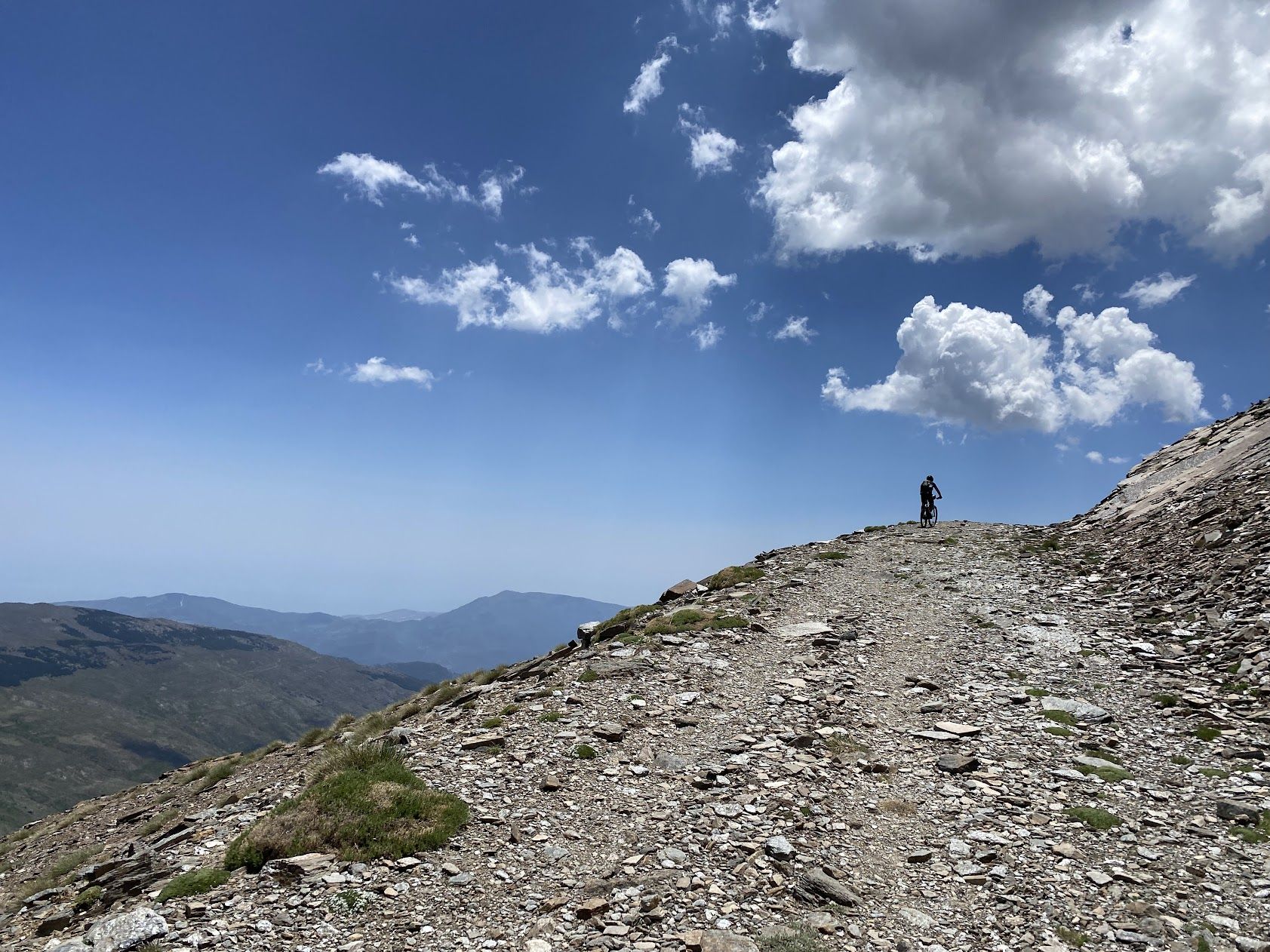
The Puerto de la Ragua marks the border between the provinces of Granada and Almería. The Sierra Nevada stretches on both sides, with the 3000m peaks on the Granada side. The highest mountain in the province of Almería, El Chullo, is, however, easily accessible from the Puerto de la Ragua. The Puerto de la Ragua is just over 2000m.
0
0

a wonder to behold with the Sierra Nevada in the background
0
1


This car park, rest area and starting point for walks is located at an altitude of 2000 metres.
19
0

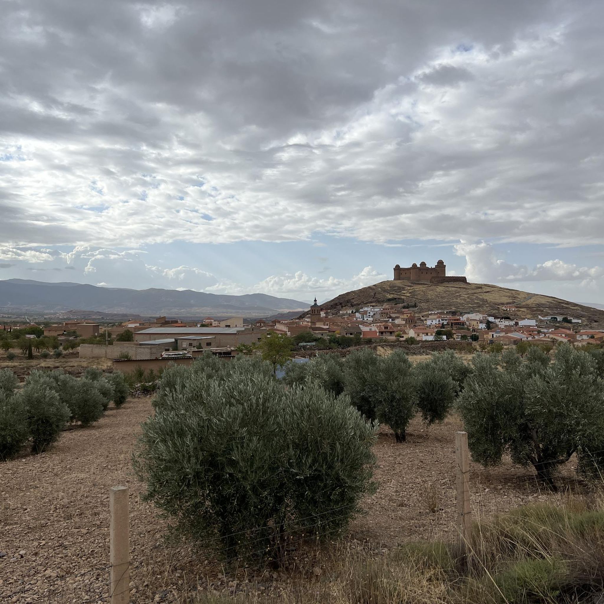
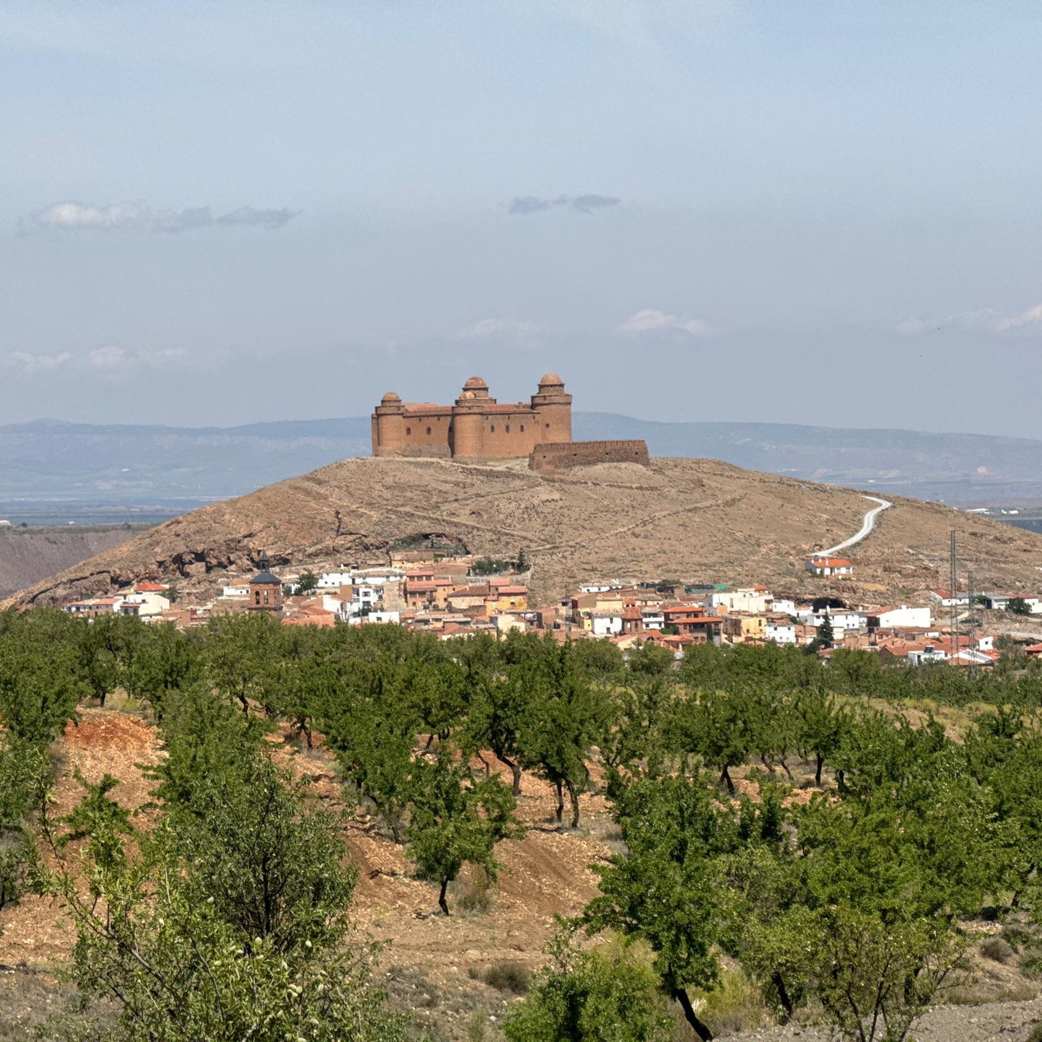
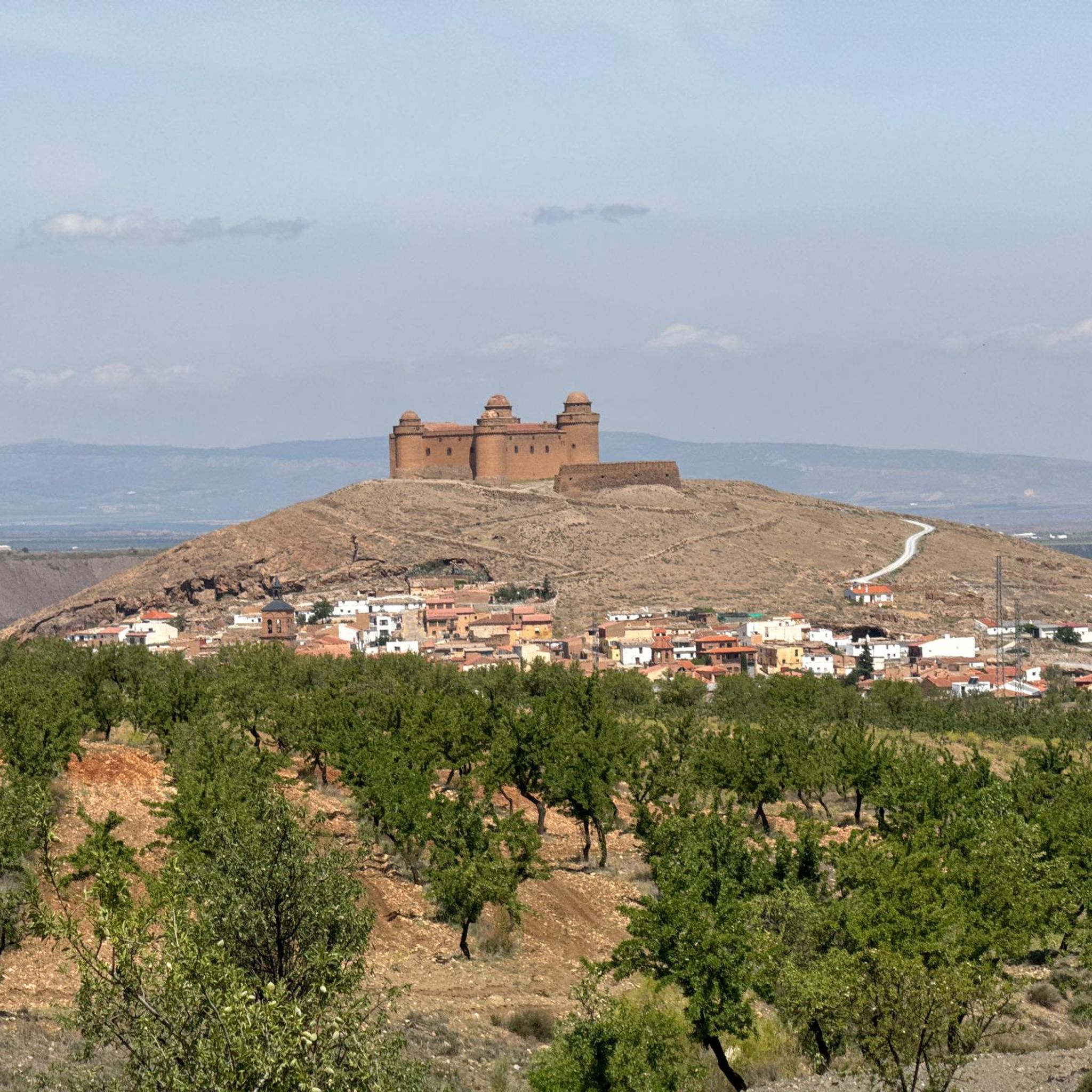
Very nice hike with a great panoramic view. Finally, a detour to the castle of La Calahorra, which is unfortunately only open on Wednesdays. Nevertheless, the beautiful view is worth it!
0
1

One of the few asphalt passes over 2,000m in the region. You just have to take it with you, even if it's not particularly "exciting" IMHO.
2
0

Located right at the highest point of the Raga pass (2000 meters), the Ragua refuge is a mountain refuge with a guard and capacity for 32 bunk beds. Currently (September 2023) it remains closed and waiting to carry out renovations in the facilities, which had been very deteriorated due to lack of maintenance.
0
0
Frequently Asked Questions
How many hiking trails are available around La Calahorra?
There are over 50 hiking routes in the La Calahorra area, catering to various skill levels. You'll find a good mix of easy, moderate, and difficult trails to explore.
Are there any easy or family-friendly hiking trails in La Calahorra?
Yes, La Calahorra offers several easy trails suitable for families. One option is the Waterfall – Benéjar River loop from Aldeire, which is 3.9 miles (6.3 km) long and features pleasant river scenery.
What kind of natural attractions can I expect to see on hikes near La Calahorra?
The region is rich in natural beauty. You can encounter features like the Benéjar River, its source at El Horcajo, and the dramatic Chullo Peak. Many trails offer stunning views of the Sierra Nevada landscape.
Are there any historical sites or landmarks to visit while hiking?
Absolutely. The area combines natural beauty with historical interest. For example, the Río Benéjar and Castillo de la Caba Loop passes by the historic Castillo de la Caba. Nearby, you can also explore the unique Cave town Guadix or the impressive Guadix Cathedral.
What is the best time of year to go hiking in La Calahorra?
The best time for hiking in La Calahorra generally depends on the altitude. Spring (April-June) and autumn (September-November) offer pleasant temperatures for most trails. In summer, higher altitude routes like those around La Ragua Pass can be more comfortable, while lower trails might be very warm. Winter hiking is possible, especially at lower elevations, but higher routes may require snowshoes or specialized gear due to snow.
Are there any circular hiking routes available?
Yes, many routes in the area are circular. A challenging option is the Parque Nacional de Sierra Nevada – circular by El Chullo and Lagunilla Seca from La Ragua, which offers high-altitude trekking. Another popular loop is the Chullo Peak – View from Puerto de la Ragua loop from Puerto de la Ragua.
Can I bring my dog on the hiking trails?
Many trails in the Sierra Nevada region are dog-friendly, but it's always best to check specific regulations for each route, especially within the National Park boundaries. Generally, dogs should be kept on a leash to protect wildlife and ensure a pleasant experience for all hikers.
What do other hikers enjoy most about hiking in La Calahorra?
The area is highly rated by the komoot community, with an average score of 4.6 stars from over 140 reviews. Reviewers often praise the diverse landscapes, from river valleys to high mountain passes, and the opportunity to experience the rugged beauty of the Sierra Nevada.
Are there any trails that feature waterfalls?
Yes, the Waterfall – Benéjar River loop from Aldeire is an easy trail that specifically highlights a waterfall along the Benéjar River. Another route, the Benéjar River – Waterfall loop from Aldeire, also features this natural attraction.
Where can I find parking for the hiking trails?
Parking is typically available at the start points of many popular trails, especially near villages like Aldeire or at significant access points like Puerto de la Ragua. It's advisable to check the specific tour details on komoot for parking information related to your chosen route.
What is the typical elevation gain on hikes in La Calahorra?
The elevation gain varies significantly across the region due to its mountainous terrain. Easy trails might have minimal gain, while more challenging routes, such as those leading to peaks, can involve several hundred meters of ascent. For instance, the Parque Nacional de Sierra Nevada – circular by El Chullo and Lagunilla Seca from La Ragua has an elevation gain of over 640 meters.
Are there any long-distance trails that pass through the area?
Yes, the Sulayr Trail GR-240, a renowned long-distance route, traverses parts of the Sierra Nevada, including areas near La Calahorra. This trail offers extensive multi-day hiking opportunities for experienced trekkers.
Most popular routes around La Calahorra
Most popular attractions around La Calahorra

Get inspired with the komoot mobile app


Explore more
Browse the best Hikes in other regions.
