Villafranca De La Sierra
Villafranca De La Sierra
Top 6 Mountain Passes around Villafranca De La Sierra
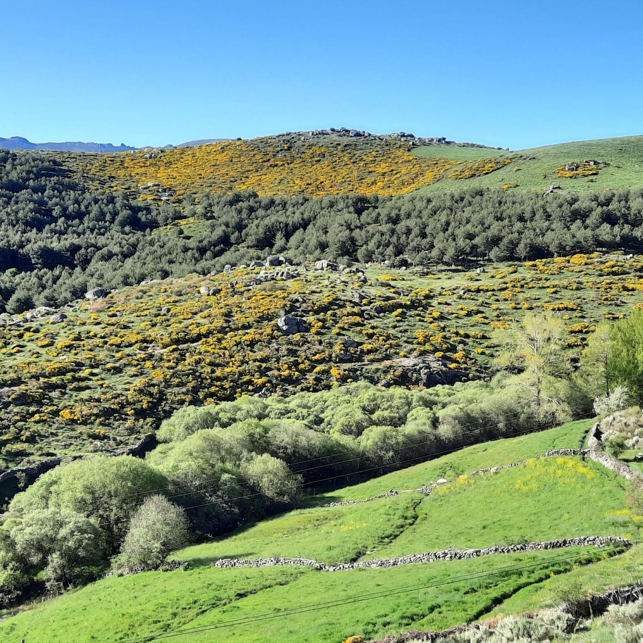
Best mountain passes around Villafranca De La Sierra are found within the province of Ávila, Spain, nestled in the Sierra de Villafranca. This region provides access to notable mountain passes and scenic landscapes, forming part of the Central System. The area features diverse terrain, including peaks like Coto Blanco, and offers opportunities for outdoor activities. More than half of its territory is environmentally protected, ensuring well-preserved natural habitats.
Best mountain passes around Villafranca De La Sierra
- The most popular mountain…
Last updated: November 1, 2026
Peña Negra Pass
Highlight • Mountain Pass
Translated by Google •
Tip by

Chía Pass (1,663 m)
Highlight (Segment) • Mountain Pass
Translated by Google •
Tip by
Sign up now to discover places like this
Get recommendations on the best single tracks, peaks, & plenty of other exciting outdoor places.
Puerto de la Cañada del Horno
Highlight • Mountain Pass
Translated by Google •
Tip by
Villatoro
Highlight • Settlement
Translated by Google •
Tip by
Collado de la Honda
Highlight • Mountain Pass
Translated by Google •
Tip by
Sign up for free to discover even more mountain passes around Villafranca De La Sierra.
Already have an account?
Start today with a free account
Your next adventure awaits.
Tips from the Community

Beautiful views, on a good day you can see people taking off on paragliders.
0
0

Small tack between Navarreonda de Gredos and San Martín De la Vega del Alberche of just 4 km, being harder in the northern area than in the southern area. It is also known by the name of Alto de Barajas. Like all secondary roads in the Gredos area, the asphalt is irregular and rough, of acceptable width, without a shoulder and with very little traffic. Despite the little traffic, it is highly recommended to have your rear light because locals usually travel quickly and hardly expect to encounter cyclists. This small limit can be used on many routes in the northern area of Gredos.
0
0
This slope is gentler than the northern slope and much shorter, with just 4 km and 2 of them hard, with some considerable ramps in the pair of horseshoe curves that there are. The road is inhospitable and therefore with very little traffic. The asphalt is uneven and rough, which adds hardness to the climb. Most of the secondary roads in this area are like this, which gives it a lot of charm. The landscape in summer is dry land, very typical of the northern area of Gredos and the northern plateau in general. I climbed the pass one early morning in August and I really enjoyed the solitude and silence of nature.
0
0

A large port, 15 km long if we start from Piedrahita, and with a constant slope of 6% except for a couple of short sections that are less and some sections that reach 9%, but very punctual. The condition of the asphalt is good, it is one of the few ports in the area with a surface in good condition. Upstairs it has very good views and there are usually people doing paragliding (if the weather conditions allow it)
0
0

The Collado de la Honda is the final part of an old glacier that ends at this point. The glacier is the result of ancient times when the glacial movements were more southern and this is an example of how in this area of the middle of the Meseta there were.
1
0
The relief of the municipality is formed by two mountainous areas separated by the Amblés valley, through which the Adaja river runs, which is born in the territory. The northern area is called Sierra de Villanueva, a branch of the Sierra de Ávila.
0
0
It is 1,663 meters above sea level and connects the Corneja Valley (Valdecorneja) with the Alto Valle del Alberche through a local road that connects the towns of Navacepedilla de Corneja and San Martín de la Vega del Alberche. It separates the Sierra de Villafranca and the massif of La Serrota.
0
0
The port of Peña Negra, on its north face, starts from the town of Piedrahita, at the turnoff to Pesquera. Already in the same streets of Piedrahita the slopes stabilize around 5-6%, which will be the usual trend. Because Peña Negra, as can be seen in the altimetric profile, is a really regular port, except for a few short breaks in the second half.
0
0
Frequently Asked Questions
What kind of views can I expect from the mountain passes around Villafranca De La Sierra?
The mountain passes in this region offer diverse and panoramic views. From Chía Pass (1,663 m), you can enjoy sweeping vistas of the colorful Corneja valley. Peña Negra Pass is also renowned for its beautiful views, often with paragliders taking off, adding to the spectacle. The broader Sierra de Villafranca provides stunning natural landscapes, and on clear days, it's even visible from Salamanca.
Are there any historically significant mountain passes in the area?
Yes, the Puerto de Chía, located at an altitude of 1,700 meters, historically served as a crucial communication route. It connected Valdecorneja with the lands of Talavera and Oropesa, via the Puerto del Pico, highlighting its importance in past regional travel and trade.
What outdoor activities can I do near the mountain passes around Villafranca De La Sierra?
The region is excellent for various outdoor activities. You can find numerous hiking trails, including moderate routes like the Tío Alberto Mill loop from Villafranca de la Sierra, and more challenging ascents like La Serrota. For cyclists, there are road cycling routes that traverse passes like Cañada del Horno and Chía Pass, as well as mountain biking trails, such as the Villatoro and Garganta de los Hornos Loop.
When is the best time to visit the mountain passes around Villafranca De La Sierra?
The region is particularly appealing during autumn, when the natural beauty is enhanced by vibrant colors. However, the diverse terrain offers opportunities for exploration throughout much of the year. For winter hiking, it's important to be aware of potential conditions in the Sierra de Gredos passes, which can include snow and ice at higher altitudes.
What kind of wildlife can be observed around the mountain passes?
The Sierra de Villafranca, being part of the environmentally protected LIC Natural Area of the Sierras de la Paramera and Serrota, is home to diverse wildlife. Visitors can spot a variety of bird species, including passerines and birds of prey, as well as mammals characteristic of the Central System.
Are there family-friendly options among the mountain passes or nearby areas?
While many passes offer intermediate challenges, the area around Villatoro is noted as family-friendly. When planning, look for trails with gentler slopes or shorter distances. The general natural beauty and opportunities for wildlife spotting can also make for an engaging family outing.
What are the road conditions like on the mountain passes?
Many secondary roads leading to and over the passes, such as those around Chía Pass (1,663 m) and Puerto de la Cañada del Horno, can have uneven and rough asphalt. While this adds to the charm and reduces traffic, it's something to consider, especially for road cyclists. Peña Negra Pass, however, is noted for having a good surface in well-maintained condition.
Are there challenging hikes available in the Villafranca De La Sierra mountain area?
Yes, the region offers challenging hikes, particularly in the broader Sierra de Villafranca and towards La Serrota. Examples include the 'Ascent to La Serrota — circular from Cepeda de la Mora' and 'Cerro del Santo – Serrota loop from Cepeda la Mora', both listed as difficult. These routes provide significant elevation gain and rugged terrain for experienced hikers.
Can I find less crowded mountain trails in the Sierra de Gredos passes area?
Yes, many of the secondary roads and trails in this area, particularly those connecting smaller towns or less frequented passes like Chía Pass (1,663 m) and Puerto de la Cañada del Horno, are known for very little traffic and offer a sense of solitude and silence in nature. This is ideal for those seeking a more tranquil outdoor experience.
What makes the Sierra de Villafranca region unique for mountain passes?
The Sierra de Villafranca is unique for its diverse terrain, encompassing several peaks like Coto Blanco and Mojón del Guillén, and numerous passes. More than half of its territory is environmentally protected as part of the LIC Natural Area of the Sierras de la Paramera and Serrota, ensuring well-preserved natural habitats and stunning vistas. This protection contributes to its rich biodiversity and scenic beauty.
Are there any mountain passes known for paragliding opportunities?
Yes, Peña Negra Pass is particularly known for paragliding. On good weather days, you can often see people taking off from the pass, making it a popular spot for this aerial sport and a great place for spectators to enjoy the activity against a scenic backdrop.
Most popular routes around Villafranca De La Sierra
Most popular attractions around Villafranca De La Sierra

Get inspired with the komoot mobile app


Explore more
See even more epic mountain passes by checking out these guides around Villafranca De La Sierra:
