Top 14 Natural Monuments around Galve De Sorbe
Best natural monuments around Galve De Sorbe are situated within the Sierra de Pela and the Sierra Norte de Guadalajara Natural Park in Spain. This region features rugged terrain, extensive pine forests, and the meandering Sorbe River. The landscape offers diverse natural features for exploration.
Best natural monuments around Galve De Sorbe
- The most popular natural monuments is Pico Ocejón, a summit that is one of the highest and most popular peaks for hiking in the region. At 2049…
Last updated: July 1, 2026
Pico Ocejón
Highlight • Summit
Translated by Google •
Tip by

Despeñalagua Waterfall
Highlight • Waterfall
Translated by Google •
Tip by
Sign up now to discover places like this
Get recommendations on the best single tracks, peaks, & plenty of other exciting outdoor places.
Sign up for free
The ridge meadow
Highlight • Mountain Pass
Translated by Google •
Tip by
Source of the Aguisejo River
Highlight • River
Translated by Google •
Tip by
Puente del Cerezo
Highlight • Bridge
Translated by Google •
Tip by

Sign up for free to discover even more natural monuments around Galve De Sorbe.
Sign up for free
Already have an account?
Start today with a free account
Your next adventure awaits.
Login or Signup

Tips from the Community

The source of the Aguisejo River is located in the Ayllón Mountains and rises from the confluence of several small rivers that originate on the peaks of this mountain range, which serves as a natural border between the provinces of Guadalajara, Segovia and Madrid.
0
0

The most popular route to ascend Pico Ocejón begins in Valverde de los Arroyos and is known for its scenic beauty and moderate difficulty. The hike is approximately 14.74 km and typically takes around 6 hours with stops. Along the way, hikers can enjoy spectacular views and the rich biodiversity of the area.
6
0

The climb is hard, but it is worth it. Although we were not lucky enough to see all the scenery that should be seen from that height. The descent is almost harder than the ascent.
1
0
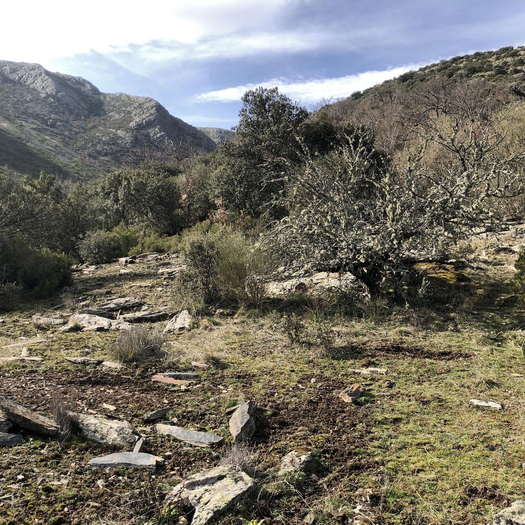
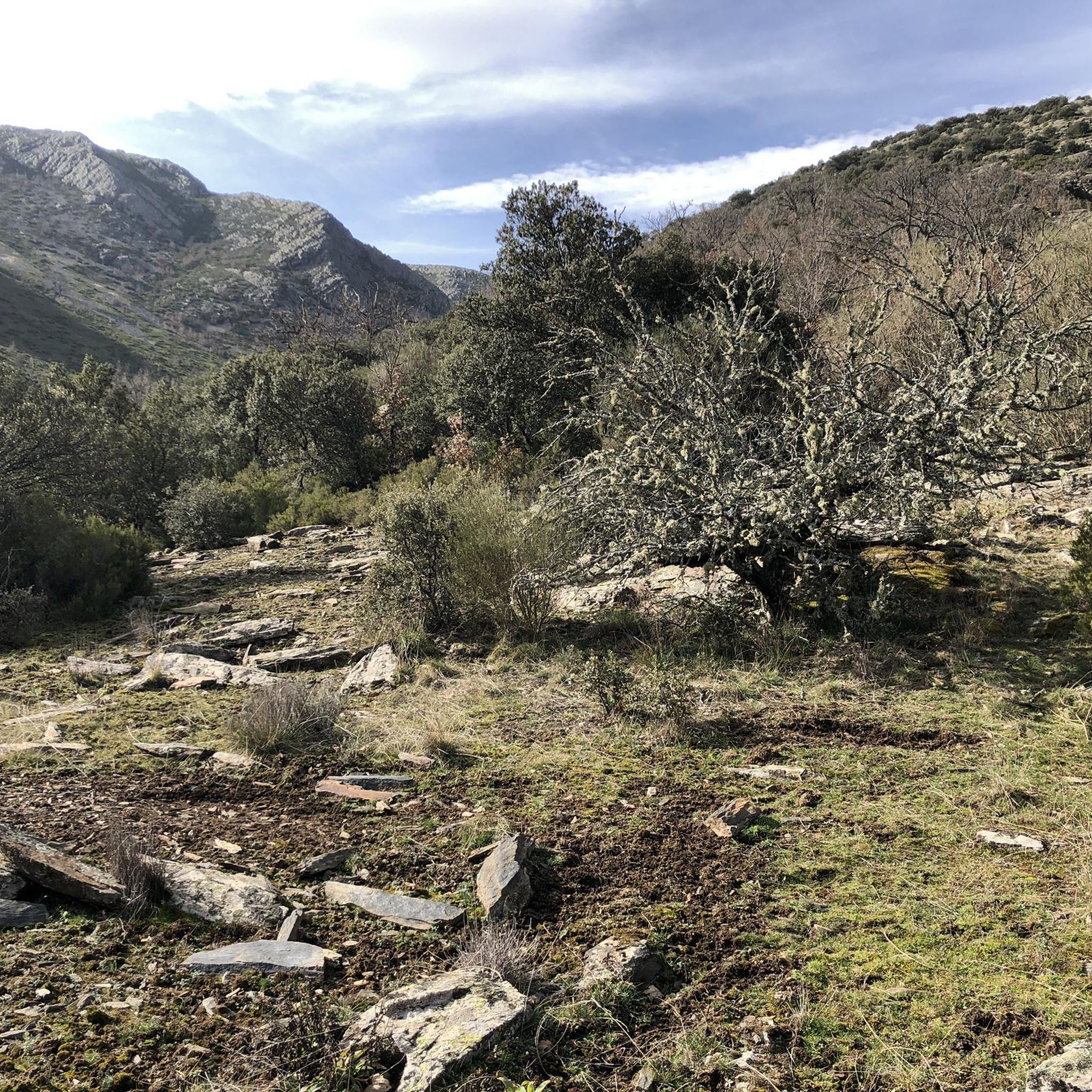
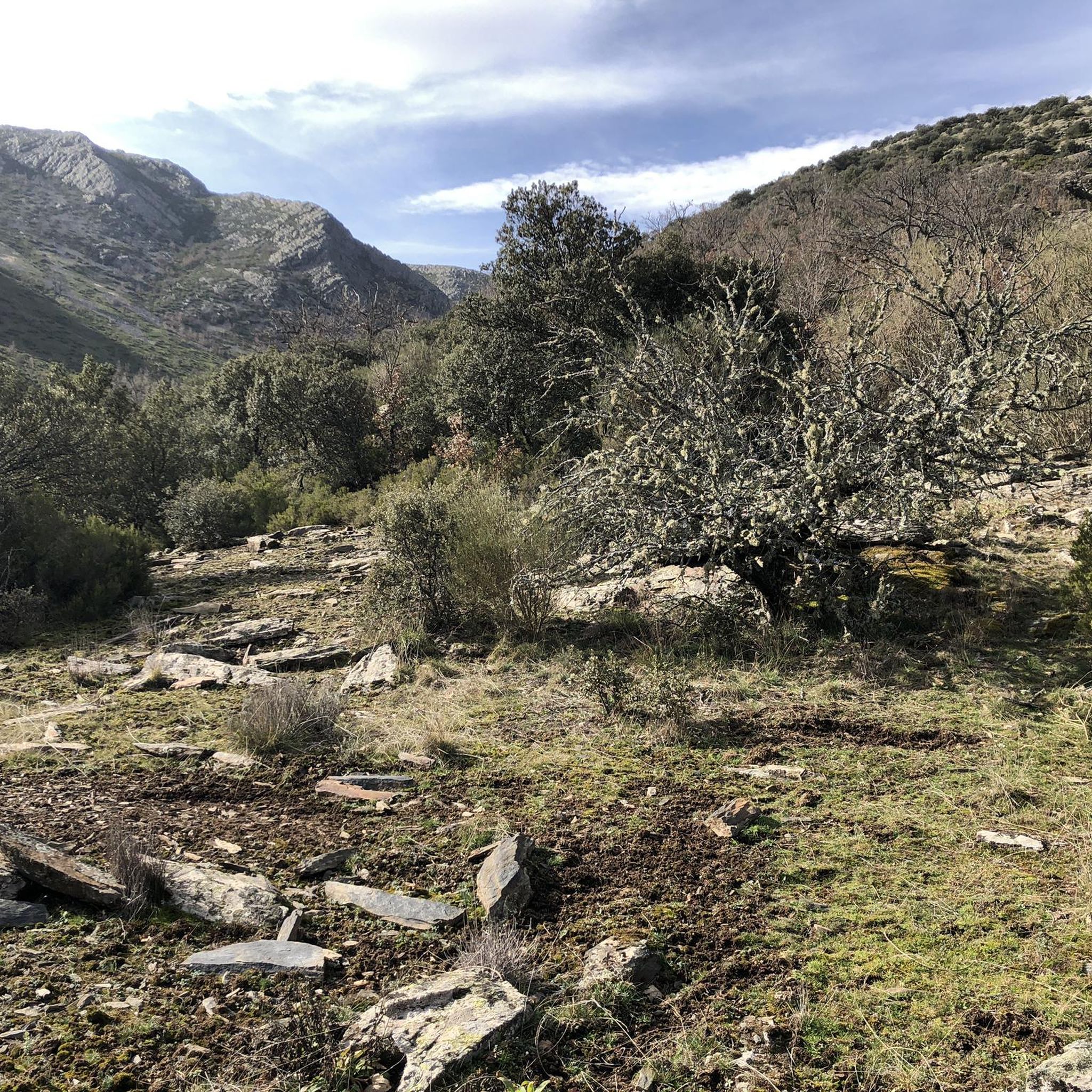
The ridge meadow in Majaelrayo is a very popular hiking route in the Sierra Norte de Guadalajara, Castilla-La Mancha. This route is known for its impressive views and its connection to Pico Ocejón, one of the highest peaks in the area at 2,049 meters above sea level.
4
0
At 2049 metres above sea level, it is one of the highest and most popular peaks for hiking in the region. There are several routes to climb Pico Ocejón, the most common being those starting from Majaelrayo and Valverde de los Arroyos. Both routes offer stunning landscapes and the opportunity to enjoy nature at its best.
6
0
The Chorreras de Despeñalagua are an impressive set of waterfalls located in the Chorrera stream, a tributary of the Sorbe river, on the northern slope of the Ocejón peak near Valverde de los Arroyos. The waterfall has a height of about 120 meters and flows throughout the year, especially during the thaw season. In winter, frost is often found, which adds a magical touch to the landscape. The route to visit the Chorreras de Despeñalagua is simple and suitable for the whole family. The path, approximately 4.5 km, offers spectacular views and allows you to explore the streets and buildings of Valverde de los Arroyos. Also, on the way to the town, you will pass through other charming black towns such as Palancares, Almiruete and Tamajón. Definitely a destination worth exploring! 😊
8
0

Once the effort of the climb has passed, and the required photos have been taken, it is advisable to sit in the sun on the blackboards and enjoy the restorative food. But... if it's cold, quickly begin the descent to more protected heights.
2
1
A beautiful waterfall, with several sections of falls that bring the water down about 70 meters in height.
1
0
Frequently Asked Questions
What are some prominent natural landmarks to visit near Galve de Sorbe?
The region around Galve de Sorbe, nestled in the Sierra Norte de Guadalajara Natural Park, offers several notable natural monuments. You can explore the impressive summit of Pico Ocejón, the stunning Despeñalagua Waterfall, and the tranquil Source of the Aguisejo River. Each offers unique natural beauty and opportunities for exploration.
Are there family-friendly natural monuments around Galve de Sorbe?
Yes, several natural monuments are suitable for families. The route to visit the Despeñalagua Waterfall is considered simple and enjoyable for the whole family. Additionally, the Source of the Aguisejo River is an ideal place for a walk or bike ride with pets and children.
What is the best time of year to visit the natural monuments in Galve de Sorbe?
The natural monuments around Galve de Sorbe can be enjoyed throughout the year. Autumn is particularly stunning, especially if you visit the nearby Hayedo de Tejera Negra beech forest, when the leaves change color. Spring and summer offer pleasant weather for hiking, while winter can transform the Despeñalagua Waterfall with magical icy touches.
Can I hike to Pico Ocejón, and what should I expect?
Yes, Pico Ocejón is one of the highest and most popular peaks for hiking in the region, reaching 2049 meters above sea level. Expect challenging but rewarding ascents with impressive landscapes and unparalleled views of the Sierra Norte de Guadalajara. Popular starting points include Majaelrayo and Valverde de los Arroyos. You can find challenging hiking routes in the area, such as the "Pico Ocejon via the Chorrera Despenalagua - circular from Valverde de los Arroyos" route, which is approximately 11.3 km long. For more hiking options, check the Hiking around Galve De Sorbe guide.
Where can I see impressive waterfalls near Galve de Sorbe?
The most impressive waterfall in the area is the Despeñalagua Waterfall. Located near Valverde de los Arroyos, these waterfalls plunge approximately 120 meters and flow consistently throughout the year. The route to reach them is suitable for the entire family, offering spectacular views.
Are there opportunities for hiking near the natural monuments?
Absolutely. The region is rich in hiking opportunities. You can find numerous trails that lead to or pass by natural monuments. For example, there are routes like "Despeñalagua Waterfall – Valverde de los Arroyos loop" which is about 15.4 km. Explore more options in the Hiking around Galve De Sorbe guide.
What kind of natural features can I expect to see along the Sorbe River?
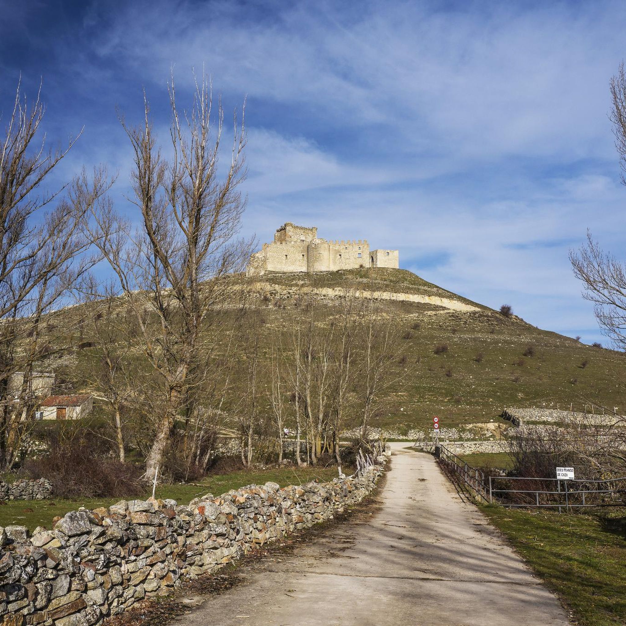
The Sorbe River carves through a landscape of abrupt terrains and vast pine forests, creating exceptionally beautiful panoramas. The area known as "El Osar" near Galve de Sorbe is particularly noted for its natural beauty, including smaller waterfalls and the source of the river. You can also find the Puente del Cerezo, a rustic bridge where the Lillas and Sorbe rivers meet.
Are the natural monuments around Galve de Sorbe accessible for dogs?
Many natural areas and trails in the region are dog-friendly. For instance, the Source of the Aguisejo River is an ideal place to visit with pets. It's always recommended to keep dogs on a leash, especially within the Sierra Norte de Guadalajara Natural Park, to protect wildlife and ensure a pleasant experience for all visitors.
Is there a natural monument that offers panoramic views?
Yes, Pico Ocejón is renowned for its impressive landscapes and unparalleled panoramic views from its summit. Another spot offering great vistas is The ridge meadow (Collado de La Madita), which provides a mosaic of surrounding hills.
What is 'The ridge meadow' and what can I do there?
The ridge meadow, also known as Collado de La Madita, is a mountain pass connecting different parts of the Sierra Norte de Guadalajara. It's a popular spot for hikers, offering impressive views and a place to rest amidst slate rocks. From here, you can continue along the crest towards Campachuelo Peak or Pico Ocejón.
Are there any unique natural formations like bridges or river sources to explore?
Yes, you can explore the Puente del Cerezo, a rustic bridge where the Lillas and Sorbe rivers converge, offering an idyllic setting. Additionally, the Source of the Aguisejo River, located in the Ayllón Mountains, is a fascinating spot where several small rivers merge.
Do I need permits for hiking in the Sierra Norte de Guadalajara Natural Park?
Generally, you do not need specific permits for hiking on established trails within the Sierra Norte de Guadalajara Natural Park. However, it's always advisable to check local regulations, especially for specific activities or if you plan to venture off marked paths. Respecting the natural environment and following park guidelines is essential.
What other outdoor activities can I do near these natural monuments?
Beyond hiking, the area offers various outdoor activities. You can find numerous running trails, such as the "GR 60 Pueblos de la Arquitectura Negra - Senderos GR" route, which is over 11 km long. Road cycling is also popular, with routes like the "Borderlands Loop from Galve de Sorbe" covering nearly 84 km. For more details on these activities, refer to the Hiking around Galve De Sorbe, Running Trails around Galve De Sorbe, and Road Cycling Routes around Galve De Sorbe guides.
Most popular attractions around Galve De Sorbe

Get inspired with the komoot mobile app


Explore more
Extend your search for the best caves by checking out these guides of the top ones around Galve De Sorbe:
