The best running trails around Galve De Sorbe
203
runners
12
runs
Jogging routes around Galve De Sorbe are set within the diverse natural landscapes of the Sierra de Pela, offering a blend of mountains, forests, and river valleys. The region features expansive natural settings with wide meadows and extensive pine forests, particularly around the birth of the Sorbe River. Varied terrain, including paths through the Sierra Norte de Guadalajara Natural Park, provides options for different running experiences. This area is characterized by its natural beauty and established network of trails.
Best…
Last updated: June 28, 2026
12
runners
11.3km
02:14
760m
760m
Hard run. Very good fitness required. Sure-footedness, sturdy shoes and alpine experience required.
36
runners
14.2km
02:40
840m
840m
Hard run. Very good fitness required. Sure-footedness, sturdy shoes and alpine experience required.

Sign up for free
36
runners
11.8km
02:06
700m
700m
Hard run. Very good fitness required. Sure-footedness, sturdy shoes and alpine experience required.
21
runners
21.6km
04:02
1,300m
1,300m
Hard run. Very good fitness required. Sure-footedness, sturdy shoes and alpine experience required.
18
runners
Hard run. Very good fitness required. Sure-footedness, sturdy shoes and alpine experience required.
Get access to more routes and recommendations from other explorers.
Sign up for free
Already have an account?
Our route recommendations are based on thousands of hikes, rides, and runs completed by other people on komoot.
Start today with a free account
Your next adventure awaits.
Login or Signup
Tips from the Community

The most popular route to ascend Pico Ocejón begins in Valverde de los Arroyos and is known for its scenic beauty and moderate difficulty. The hike is approximately 14.74 km and typically takes around 6 hours with stops. Along the way, hikers can enjoy spectacular views and the rich biodiversity of the area.
6
0
The most popular route to ascend Pico Ocejón begins in Valverde de los Arroyos and is known for its scenic beauty and moderate difficulty. The hike is approximately 14.74 km and typically takes around 6 hours with stops. Along the way, hikers can enjoy spectacular views and the rich biodiversity of the area.
6
0
The parking lot in front of the Lillas River is an ideal starting point for exploring the Sierra Norte de Guadalajara Natural Park. Several signposted routes start from here, such as the Senda de Carretas and the Senda del Robledal.
5
0

The climb is hard, but it is worth it. Although we were not lucky enough to see all the scenery that should be seen from that height. The descent is almost harder than the ascent.
1
0
A picturesque village among the black villages of Guadalajara. The food is great and it is a good starting point for hiking and mountain biking excursions.
1
0
The ridge meadow in Majaelrayo is a very popular hiking route in the Sierra Norte de Guadalajara, Castilla-La Mancha. This route is known for its impressive views and its connection to Pico Ocejón, one of the highest peaks in the area at 2,049 meters above sea level.
4
0
At 2049 metres above sea level, it is one of the highest and most popular peaks for hiking in the region. There are several routes to climb Pico Ocejón, the most common being those starting from Majaelrayo and Valverde de los Arroyos. Both routes offer stunning landscapes and the opportunity to enjoy nature at its best.
6
0

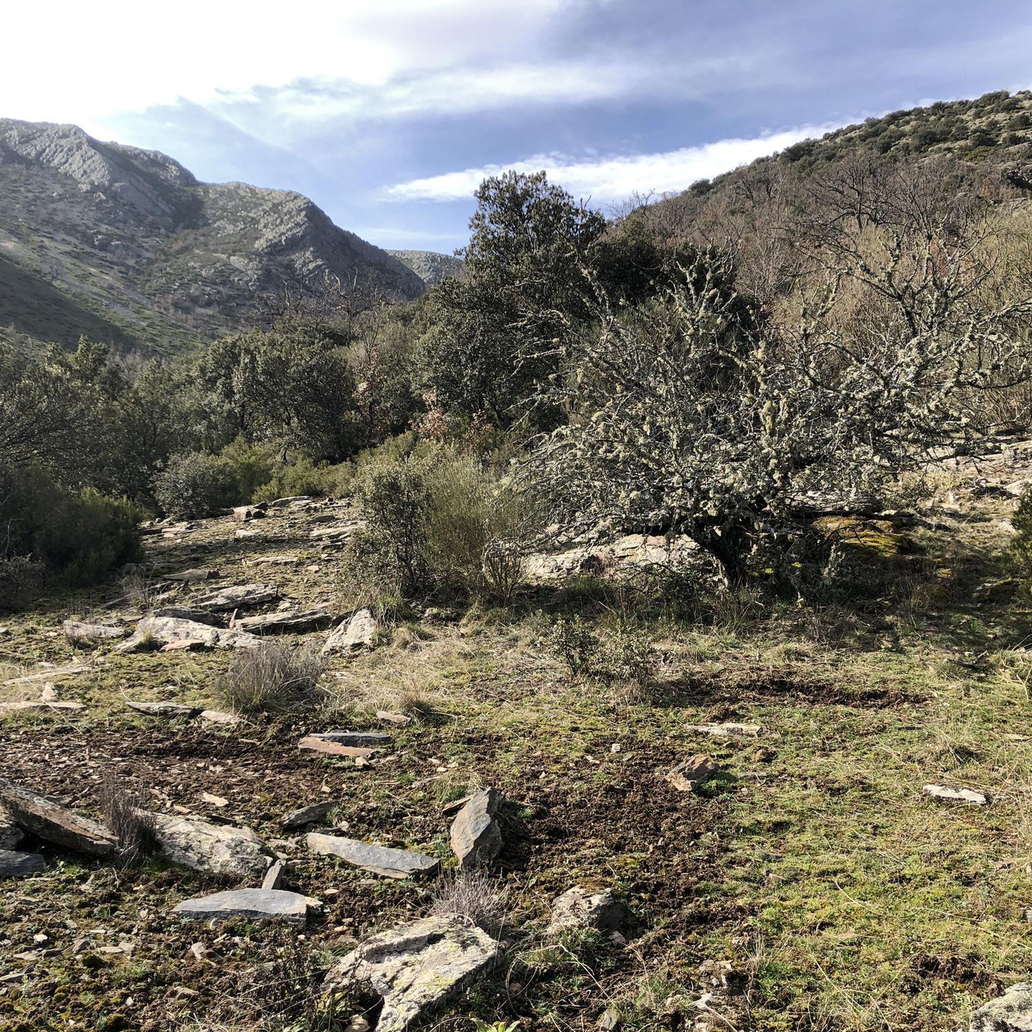
A hill between mountains and at the same time a crossroads of various paths. Strategic point in El Hayedo de Tejera Negra.
0
0
Frequently Asked Questions
How many running routes are available around Galve de Sorbe?
There are 10 distinct running routes available around Galve de Sorbe. These trails offer a variety of experiences, from moderate to difficult, set within the diverse natural landscapes of the Sierra de Pela.
What kind of terrain can I expect on the running trails in Galve de Sorbe?
The running trails in Galve de Sorbe feature varied terrain, including wide meadows, extensive pine forests, and river valleys, particularly around the birth of the Sorbe River. Many routes traverse mountainous areas, especially those leading towards Pico Ocejón, offering challenging ascents and panoramic views. You'll find paths through the Sierra Norte de Guadalajara Natural Park, providing a mix of natural surfaces.
Are there any easy jogging routes for beginners in Galve de Sorbe?
While Galve de Sorbe is known for its more challenging terrain, with 8 out of 10 routes rated as difficult, there are 2 moderate routes that might be suitable for those looking for a less strenuous run. The region's natural beauty, with wide meadows and forests, still offers enjoyable experiences for all levels, though beginners should check route details carefully.
Are there any waterfalls I can see while jogging near Galve de Sorbe?
Yes, you can encounter beautiful natural features like waterfalls. The area known as El Osar is noted for its waterfalls. Specifically, the Despeñalagua Waterfall is a prominent natural monument that can be a highlight along some of the longer running routes, such as the Pico Ocejón – Chorrera de Despeñalagua loop from Majaelrayo.
What natural landmarks or viewpoints can I discover on a run?
Runners can discover several natural landmarks and viewpoints. Pico Ocejón, one of the highest peaks in Castilla-La Mancha, offers breathtaking panoramic views. Other notable features include the source of the Sorbe River, picturesque pine forests, and various mountain passes like The ridge meadow or Collado del Puerto de los Infantes.
Can I combine my run with cultural exploration in Galve de Sorbe?
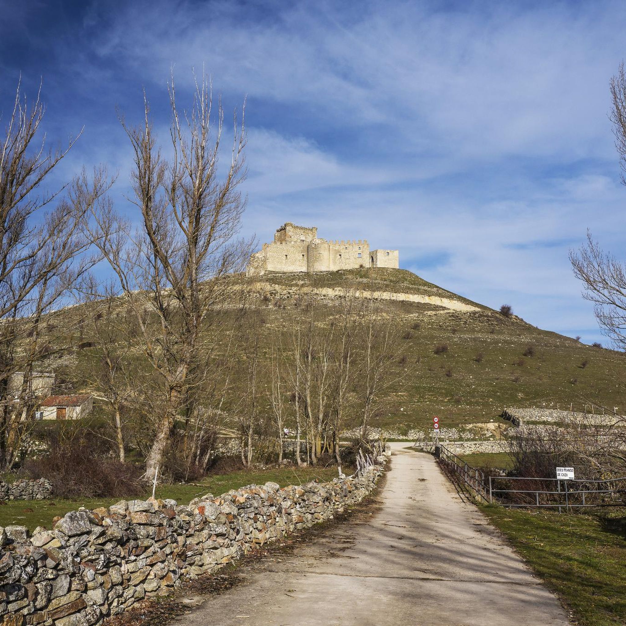
Absolutely! Galve de Sorbe is part of the "ruta de la arquitectura negra" (black architecture route). You can combine your exercise with cultural exploration by passing through historic villages with their distinctive stone and slate buildings. The GR 60 Pueblos de la Arquitectura Negra - Senderos GR route is an excellent option for this, allowing you to experience both natural beauty and cultural heritage. The village itself also features a 14th-century castle (Castillo de los Zúñigas).
Are there any circular running routes in the area?
Yes, several running routes in the Galve de Sorbe area are designed as loops, allowing you to start and end at the same point. Examples include the challenging Pico Ocejón – Pico Ocejón loop from Majaelrayo and the Pico Ocejón – Pico Ocejón loop from Valverde de los Arroyos, both offering extensive mountain experiences.
What is the best time of year for running in Galve de Sorbe?
The tranquil environment of Galve de Sorbe, with its diverse natural landscapes, makes it suitable for outdoor activities across various seasons. However, for optimal running conditions, spring and autumn generally offer milder temperatures and vibrant scenery. Summer can be warm, especially at lower elevations, while winter might bring colder conditions and potential snow in mountainous areas like around Pico Ocejón.
Can I bring my dog on the running trails in Galve de Sorbe?
Many natural areas in Spain, including those suitable for jogging, are generally dog-friendly, especially if dogs are kept on a leash and owners clean up after them. Given the expansive natural settings and varied terrain, it's likely that many trails around Galve de Sorbe would welcome dogs. However, always check local signage or specific park regulations within the Sierra Norte de Guadalajara Natural Park to ensure compliance.
What do other runners enjoy about the trails in Galve de Sorbe?
The komoot community highly values the running experiences in Galve de Sorbe. Over 179 runners have explored the area, often praising the region's diverse natural landscapes, from wide meadows to extensive pine forests and river valleys. The challenging mountain terrain and panoramic views, particularly around Pico Ocejón, are frequently highlighted as major draws for those seeking vigorous runs.
Are there any long-distance running options for endurance training?
Yes, Galve de Sorbe offers several routes suitable for longer runs and endurance training. For instance, the Pico Ocejón – Pico Ocejón loop from Valverde de los Arroyos covers 13.4 miles (21.5 km), and the Tejera Negra Beech Forest – Parking in front of the Lillas River loop is 13.1 miles (21 km), providing ample distance and elevation for a challenging workout.
Most popular attractions around Galve De Sorbe

Get inspired with the komoot mobile app


Explore more
Browse the best Running Trails & Routes in other regions.
