Top 20 Natural Monuments around Terragnolo
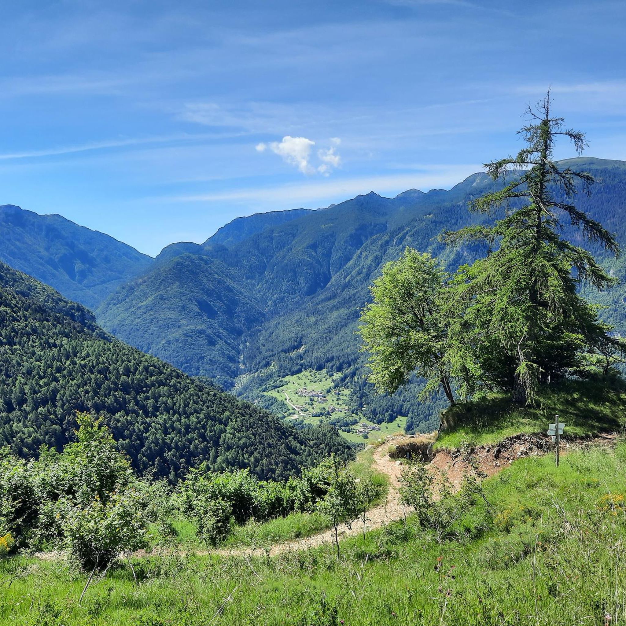
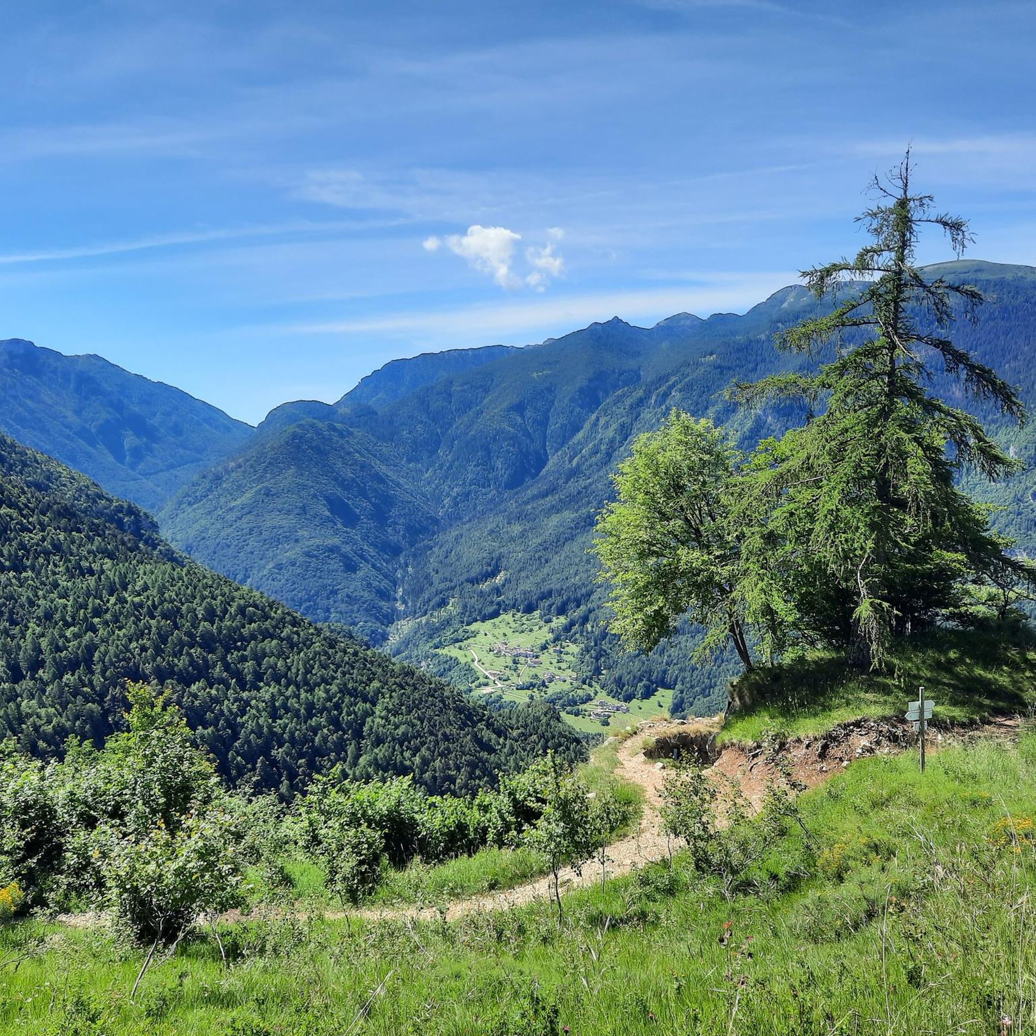
Best natural monuments around Terragnolo are found within a fluvio-glacial valley shaped by the Leno stream, deeply set into calcareous rocks. This region combines natural beauty with historical significance, particularly from World War I. The valley features an unspoilt landscape with an extensive network of nature itineraries and surrounding forests. Terraced fields and dry-stone walls showcase a long-standing relationship between human activity and the natural environment.
Best natural monuments around Terragnolo
- The most popular natural monuments is Forra del Lupo…
Last updated: June 28, 2026
Vaia Winged Dragon Sculpture
Highlight • Monument
Translated by Google •
Tip by

Forra del Lupo – World War I Trench
Highlight • Historical Site
Translated by Google •
Tip by

Sign up now to discover places like this
Get recommendations on the best single tracks, peaks, & plenty of other exciting outdoor places.
Sign up for free
Lake Lavarone
Highlight • Lake
Translated by Google •
Tip by

Italian Tooth
Highlight • Summit
Translated by Google •
Tip by

Austrian Tooth
Highlight • Historical Site
Translated by Google •
Tip by

Sign up for free to discover even more natural monuments around Terragnolo.
Sign up for free
Already have an account?
Start today with a free account
Your next adventure awaits.
Login or Signup

Other adventures around Terragnolo

Tips from the Community

Wolf's Gorge Trench
0
0

Beautiful and interesting, not only from a naturalistic point of view, but also from a historical one
0
0

The Dente Italiano and the Dente Austriaco are two rocky towers of equal altitude facing each other, separated by a saddle but sadly united by history: during the First World War, they were the point on Pasubio where enemy lines were closest. With the Strafexpedition of 1916, the imperial army reached the Dente Austriaco, but was blocked by royal troops who had arrived on the Dente Italiano. A grueling and bloody standoff began, with several attempts to break through, all in vain. The impending winter prevented further fighting, and both sides began to fortify their positions and make them more livable... In the Dente Italiano, the Army Corps of Engineers created a veritable underground citadel. It could accommodate 500 men, with all the necessary means of subsistence: shelters, storage facilities, a cistern for drinking water, a generator for lighting, dressing stations, and command posts. The armament consisted of five machine guns, two cannons, and one flamethrower, supported by artillery from the nearby Palon and Cogolo Alto peaks. In contrast, the Austrian Tooth was transformed into an impregnable fortress, thanks to its elongated, square shape, with fire on three sides. There were 10 machine gun emplacements and six artillery emplacements in the cave, complemented by the armament arrayed along the trenches at the summit: 18 grenade launchers, 12 grenade launchers, four flamethrowers, five cannons, and 10 machine guns. Here, too, the bowels of the mountain housed the troops with all the logistical and survival equipment: shelters, storage facilities, lighting, ventilation, a cistern, a telephone exchange, searchlights, etc. Faced with the impossibility of advancing, both commands believed the only solution was to blow up the enemy stronghold from the ground up: thus began the war of mines and countermines, with a dense network of underground tunnels. Between the autumn of 1917 and the spring of 1918, there were 10 explosions, five Austrian and five Italian, until the gigantic 50-ton Austrian dynamite charge on March 13, 1918, which shattered the northern slope of the Dente Italiano, altering its morphology and causing casualties on both sides. After years of war and thousands of deaths, the great war on Pasubio ended with the front line virtually unchanged! To pass between the two Denti, one passes through the chasm created by the mine, amidst enormous boulders and debris: impressive.
0
1
The Dente Italiano and the Dente Austriaco are two rocky towers of equal altitude facing each other, separated by a saddle but sadly united by history: during the First World War, they were the point on Pasubio where enemy lines were closest. With the Strafexpedition of 1916, the imperial army reached the Dente Austriaco, but was blocked by royal troops who had arrived on the Dente Italiano. A grueling and bloody standoff began, with several attempts to break through, all in vain. The impending winter prevented further fighting, and both sides began to fortify their positions and make them more livable... In the Dente Italiano, the Army Corps of Engineers created a veritable underground citadel. It could accommodate 500 men, with all the necessary means of subsistence: shelters, storage facilities, a cistern for drinking water, a generator for lighting, dressing stations, and command posts. The armament consisted of five machine guns, two cannons, and one flamethrower, supported by artillery from the nearby Palon and Cogolo Alto peaks. In contrast, the Austrian Tooth was transformed into an impregnable fortress, thanks to its elongated, square shape, with fire on three sides. There were 10 machine gun emplacements and six artillery emplacements in the cave, complemented by the armament arrayed along the trenches at the summit: 18 grenade launchers, 12 grenade launchers, four flamethrowers, five cannons, and 10 machine guns. Here, too, the bowels of the mountain housed the troops with all the logistical and survival equipment: shelters, storage facilities, lighting, ventilation, a cistern, a telephone exchange, searchlights, etc. Faced with the impossibility of advancing, both commands believed the only solution was to blow up the enemy stronghold from the ground up: thus began the war of mines and countermines, with a dense network of underground tunnels. Between the autumn of 1917 and the spring of 1918, there were 10 explosions, five Austrian and five Italian, until the gigantic 50-ton Austrian dynamite charge on March 13, 1918, which shattered the northern slope of the Dente Italiano, altering its morphology and causing casualties on both sides. After years of war and thousands of deaths, the great war on Pasubio ended with the front line virtually unchanged! To pass between the two Denti, one passes through the chasm created by the mine, amidst enormous boulders and debris: impressive.
0
0

beautiful walk
0
0

Stunning route. Great work of man and nature.
2
0

cozy for a break,☕or feet in the water
0
0

Lake Lavarone, Blue Flag, is located at 1,079 m above sea level. and, with a surface area of 64,000 m², it reaches a maximum depth of 17 metres. Immersed in the nature of the Lavarone plateau, this bathing lake is a much loved destination for both athletes and those looking for relaxation. On its banks there are two equipped beaches where it is possible to swim.
1
0
Frequently Asked Questions
What are the most significant natural monuments to visit in Terragnolo?
The Terragnolo region offers a blend of natural beauty and historical significance. Key natural monuments include the Forra del Lupo – World War I Trench, known for its narrow ravines and historical passages. Another notable site is Lake Lavarone, a serene body of water on Alpe Cimbra, and the Italian Tooth, a summit with profound World War I history and panoramic views.
What unique natural features define the Terragnolo Valley?
The Terragnolo Valley is a distinctive fluvio-glacial valley, deeply carved into calcareous rocks by the Leno stream. It features an unspoilt landscape with extensive nature itineraries, surrounding forests, and a harmonious blend of natural elements with centuries-old terraced fields and dry-stone walls. The Leno stream itself is a symbol of the valley, contributing to its reflective atmosphere and historical importance.
Do any natural monuments in Terragnolo have historical significance?
Yes, many natural monuments in Terragnolo are deeply intertwined with history, particularly from World War I. The Forra del Lupo – World War I Trench is a prime example, featuring a route through ravines and passages carved into rock that served as a military trench. Similarly, the Italian Tooth and Austrian Tooth summits were critical front-line positions during the war, marked by intense conflict and underground fortifications.
Are there hiking opportunities around Terragnolo's natural monuments?
Absolutely. The Terragnolo region offers a variety of hiking opportunities. You can explore routes like the Forra del Lupo Trail loop from Piazza, or longer, more challenging routes such as the General Achille Papa Refuge – Mount Palon loop. For more options, you can find detailed running trails around Terragnolo on our dedicated guide page: Running Trails around Terragnolo.
What kind of terrain can I expect on trails near Terragnolo's natural monuments?
Trails around Terragnolo's natural monuments feature varied terrain. For instance, the Forra del Lupo involves narrow ravines, deep gorges, and staircases carved into rock. Other areas, particularly within the valley, offer paths through forests and along the Leno stream, often with terraced fields and dry-stone walls. Expect a mix of natural paths, historical fortifications, and some steep sections, especially near mountain summits.
Are there any easy walks or beginner-friendly natural monuments in Terragnolo?
Yes, for easier experiences, the area around Lake Lavarone offers relaxing strolls suitable for families. While some natural monuments like the Forra del Lupo involve intermediate difficulty, the overall Terragnolo Valley has an extensive network of nature itineraries that can be adapted for various fitness levels, including gentle walks through its hamlets and forests.
Are Terragnolo's natural monuments suitable for families with children?
Many natural monuments in Terragnolo are family-friendly. Lake Lavarone is particularly popular, offering swimming, pedalo rentals, and equipped beaches in summer. The Vaia Winged Dragon Sculpture is also a captivating artistic monument that children often enjoy. When visiting historical sites like the Forra del Lupo, parental discretion is advised due to some challenging sections, but the historical context can be engaging for older children.
Can I bring my dog to the natural monuments and trails in Terragnolo?
Generally, dogs are welcome on many trails and in natural areas around Terragnolo. However, it's always best to keep them on a leash, especially in protected areas, near wildlife, or where historical structures might be sensitive. Specific rules may apply to certain sites or during peak seasons, so checking local signage is recommended.
What is the best time of year to visit Terragnolo's natural monuments?
The best time to visit Terragnolo's natural monuments largely depends on your preferred activities. Spring and autumn offer pleasant temperatures for hiking and exploring the historical sites, with vibrant foliage in autumn. Summer is ideal for enjoying Lake Lavarone and longer outdoor excursions. Winter transforms the landscape into a snowy wonderland, suitable for snowshoeing or ice skating on the lake, though some higher trails may be less accessible.
Are there cycling or mountain biking routes near these natural monuments?
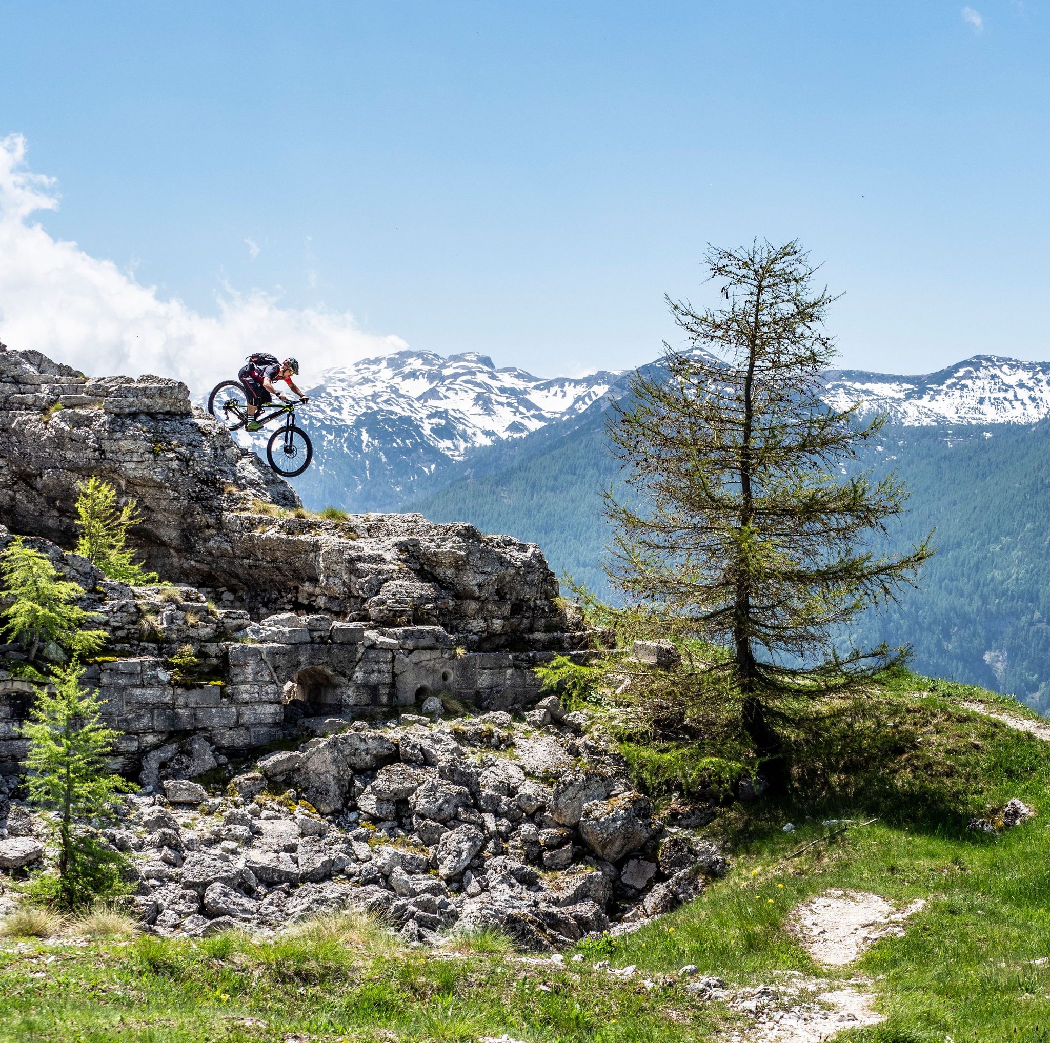
Yes, the Terragnolo area is well-suited for cycling and mountain biking. You can find various routes, from moderate to difficult, that pass through scenic landscapes and near some natural monuments. For mountain biking, consider routes like the Forte Dosso delle Somme loop. For road cycling, there are routes connecting historical forts. Explore more options on our dedicated guides: MTB Trails around Terragnolo and Cycling around Terragnolo.
What do visitors enjoy most about the natural monuments around Terragnolo?
Visitors frequently praise the unique blend of natural beauty and profound historical significance. The Forra del Lupo is often described as a 'stunning route' and a 'great work of man and nature,' offering breathtaking views and an evocative journey through World War I relics. The serene environment of Lake Lavarone and the poignant history at sites like the Austrian Tooth also receive high acclaim for their immersive experiences.
Are there any viewpoints offering panoramic vistas of the Terragnolo Valley?
Yes, several natural monuments and trails offer spectacular panoramic views. The Forra del Lupo provides exciting vistas of the Terragnolo Valley, the Borcola Pass, and the Pasubio massif. Summits like the Italian Tooth also serve as viewpoints, allowing visitors to appreciate the vastness of the landscape and its historical context.
Most popular routes around Terragnolo
Most popular attractions around Terragnolo

Get inspired with the komoot mobile app


Explore more
Extend your search for the best caves by checking out these guides of the top ones around Terragnolo:
