Top 3 Natural Monuments around Stausee Obermaubach
Best natural monuments around Stausee Obermaubach are found within the Rureifel region of North Rhine-Westphalia, Germany. This area features rolling hills, lush forests, and the tranquil Eifel landscape, providing significant natural beauty and recreational opportunities. The Stausee Obermaubach itself, an artificial lake, serves as a central feature, offering wide views and a serene atmosphere. The surrounding environment changes with the seasons, making it appealing for activities like hiking and cycling.
Best natural monuments around Stausee Obermaubach
- The most popular natural…
Last updated: September 30, 2026
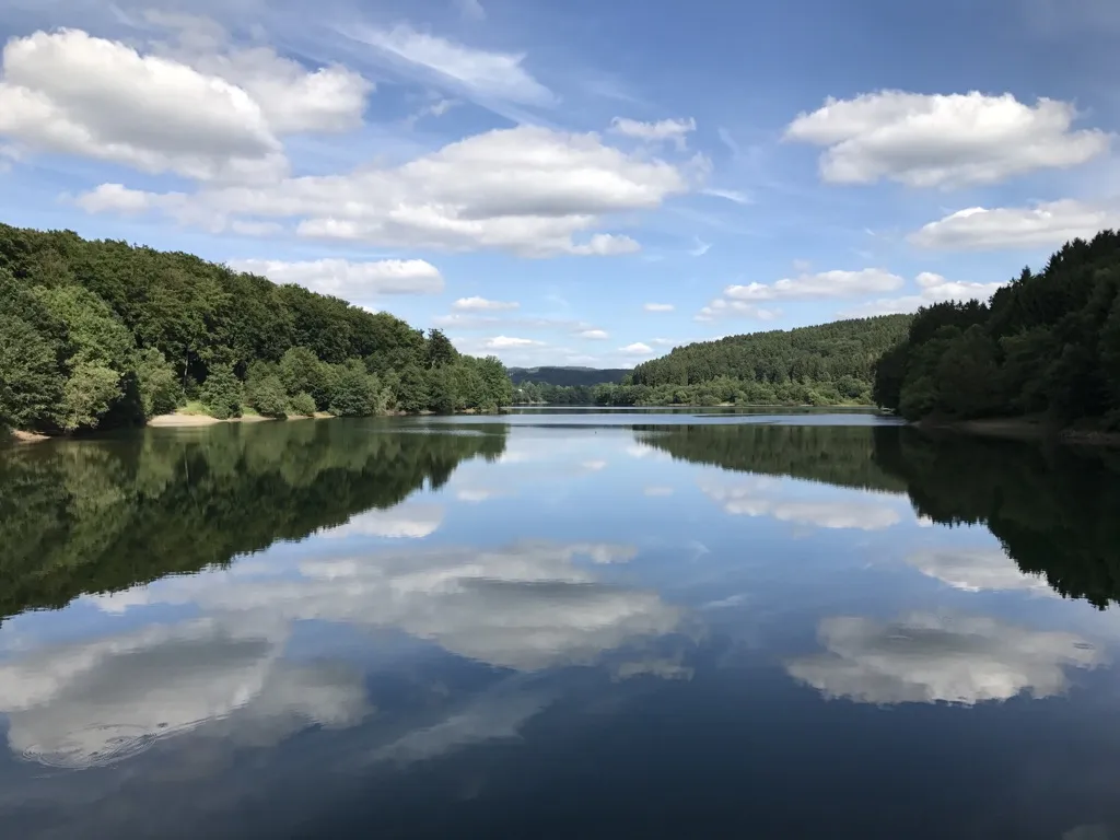
Obermaubach Reservoir
Highlight • Lake
Translated by Google •
Tip by

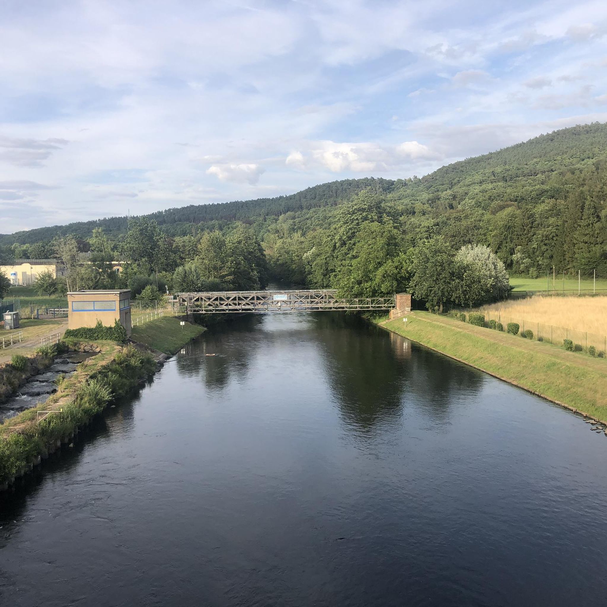
Obermaubach Fish Pass
Highlight • Structure
Translated by Google •
Tip by

Sign up now to discover places like this
Get recommendations on the best single tracks, peaks, & plenty of other exciting outdoor places.
Buntsandstein Route
Highlight (Segment) • Trail
Translated by Google •
Tip by

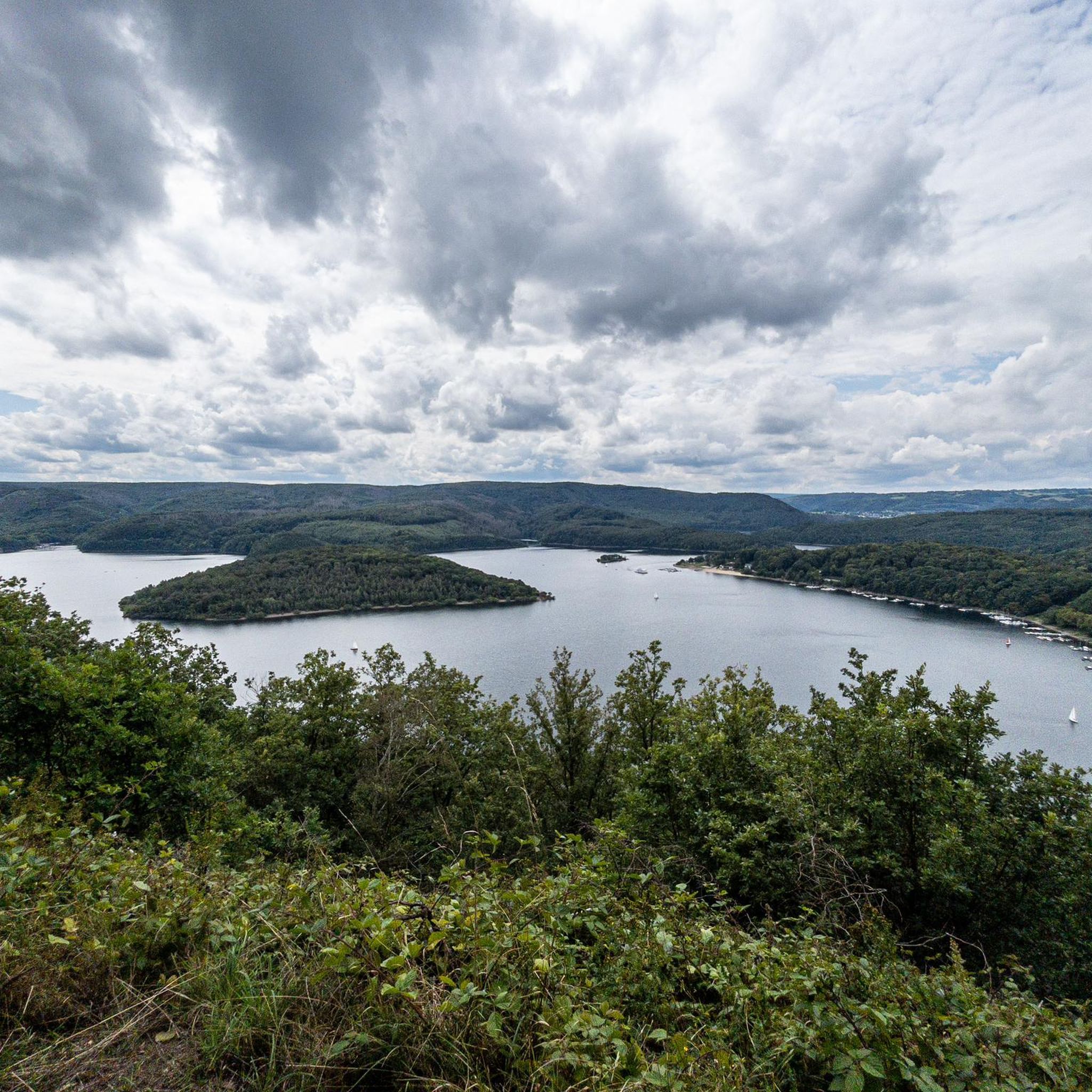
View of the Rursee
Highlight • Viewpoint
Translated by Google •
Tip by

Start today with a free account
Your next adventure awaits.
Popular around Stausee Obermaubach
Auszeiten im Grünen – Entspannte Wanderungen im Rheinland
Hiking around Stausee Obermaubach
Running Trails around Stausee Obermaubach
Cycling around Stausee Obermaubach
Road Cycling Routes around Stausee Obermaubach
MTB Trails around Stausee Obermaubach
Gravel biking around Stausee Obermaubach
Mountain Hikes around Stausee Obermaubach
Other adventures around Stausee Obermaubach

Tips from the Community

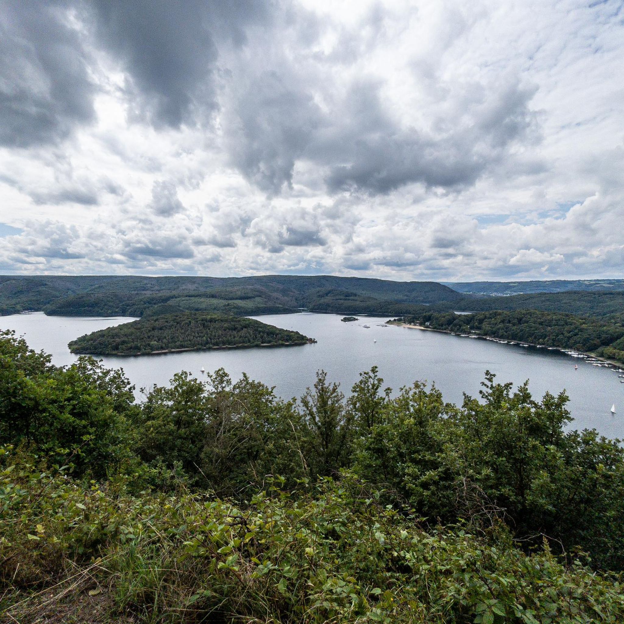
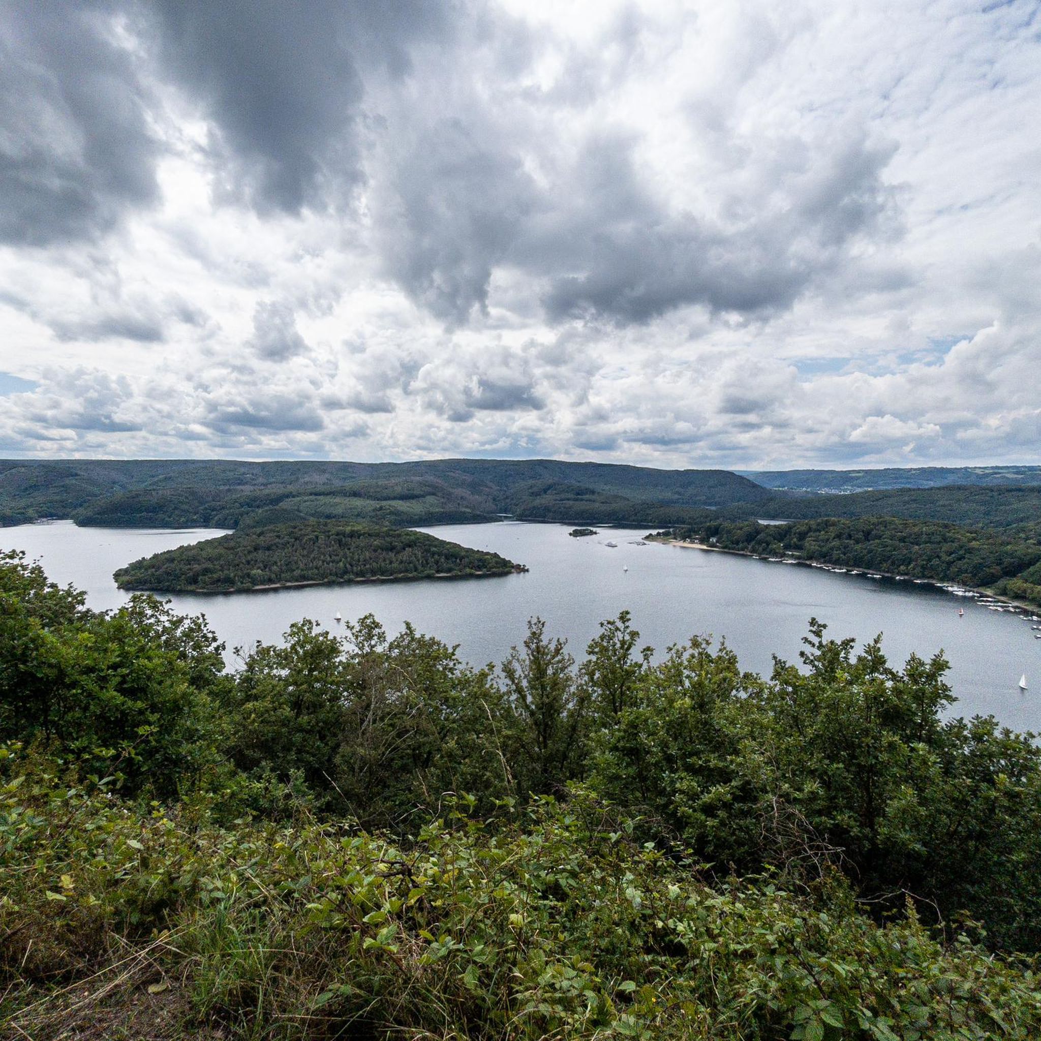
The Rursee viewpoint is one of the most beautiful panoramic views in the Eifel region (North Rhine-Westphalia, Germany). It's a vast reservoir (Rursee or Rurlake) surrounded by forests, slopes, and hiking trails. It's not only a focal point of the Eifel National Park but also offers spectacular views of the water and the surrounding valleys from several locations. The Rursee is a large reservoir of approximately 780 hectares, created by the dam at Schwammenauel on the Rur River. The lake is part of a chain of reservoirs in the Eifel region used for water regulation, energy generation, recreation, and nature experiences. Around the lake, you'll find cycling routes, hiking trails, and viewpoints, offering ever-changing perspectives of the water and the surrounding landscape. 🏞️ Famous viewpoints on Lake Rur 1. Eifel View "Hirschley" (Heimbach) From this elevated spot, approximately 512m above sea level, you have a spectacular panorama of Lake Rur and the steep slopes of its northern shore. The viewpoint is located in the Wilder Kermeter area of the Eifel National Park and is accessible via hiking trails from a parking lot on the Kermeter. 2. Eifel View Kierberg (Simmerath-Woffelsbach) At an altitude of approximately 455m, the viewpoint at Kierberg offers a wide view over Lake Rur, with views towards the Eifel National Park. This viewpoint is located along a country road (L128) between Steckenborn and Woffelsbach and is an excellent place for a short stop during a tour or hike. 3. Eifel View Beautiful View (Nideggen/Simmerath-Einruhr) This viewpoint on the Simonsley slope (approximately 415m) offers a panoramic view of Lake Rursee, clearly showing the wooded core of the Eifel National Park. It is a classic spot for many hikers who walk around the lake, especially beautiful at sunset or in autumn. 4. Eifel View Youth Hostels (Simmerath-Rurberg) Near the youth hostel in Rurberg, there is a viewing point at an altitude of approximately 470m. From here, you can see the lake and the forests of the Eifel National Park in the distance, with panoramic panels for orientation. 5. Eifel-Blick Wolfshügel (Simmerath-Einruhr) This viewpoint above Einruhr overlooks the village of Obersee and the Rur River valleys beyond. It is situated on a small plateau (approximately 360m above sea level) and can be reached via a short, slightly steep hike from the Rur Bridge in Einruhr. Several hiking trails around Lake Rur are specially designed to offer the most beautiful views of the lake. The Rurseeblick route, for example, is a circular walk of approximately 6.5km with several photogenic viewpoints and panoramic stops along the way, ideal for an afternoon stroll with water views. The longer Eifeler Steilküste route also takes you along cliffs and elevated paths with beautiful views of the dam and the lake. Along the way, you'll see not only the water but also the deeply incised valleys and wooded landscape of the Eifel. 🌄 Tips for the best view • Morning and evening light often create the most beautiful interplay of colors across the lake. • Walk along the shores or on the slopes surrounding the lake to gain ever-changing perspectives on the water and vegetation. • In autumn and spring, the views are often clearer because the air is cleaner and the forests have a rich contrast in color.
0
0

Viewpoint of the reservoir located there
0
0

"...We finally reach the Obermaubach reservoir via field paths. We pass the dam and decide to take a coffee break on the other side of the Rur. Right next to the café we discover a fish ladder that is supposed to enable the 'migratory fish' to overcome the hydroelectric plant. The highlight of this fish ladder: an observation station has been built here, through the glass pane of which you can see the migrating fish passing by..." Find out more about the wonderful RurUfer cycle path: https://www.netreisetagebuch.de/rurufer-radweg/
3
1

unfortunately you can get closer than view from the bridge
4
1

The term Buntsandstein (in the sense of "colorful sandstone" in contrast to "red sandstone" = Rotliegend) goes back to Abraham Gottlob Werner, who used it from about 1780 in his lectures at the Bergakademie in Freiberg. In 1834, when the system of the Triassic was established by Friedrich August von Alberti, the term "colorful sandstone" was already generally recognized. Since the 1990s, the Buntsandstein has been considered as a group in terms of the lithostratigraphic hierarchy and divided into formations whose boundaries and relative positions to other formations are precisely defined. Alternatively, the allostratigraphy divides the Buntsandstein into sequences whose boundaries, however, in this case also correspond to the formations of the Buntsandstein. Allostratigraphy and lithostratigraphy are slightly different methods of subdividing rock units.
7
0

The Obermaubach dam in Obermaubach in the municipality of Kreuzau in the district of Düren, North Rhine-Westphalia, was built in 1933 and 1934 and serves as a compensating reservoir for the Rur inflows of varying strength and to control the most even possible discharge of water into the Rur. The reservoir is located in the area of the municipality of Kreuzau as well as in the upper area in the area of the municipalities of Hürtgenwald and Nideggen.
19
1

Very nice fish ladder, it is the longest in the whole of NRW.
4
1
The Obermaubach reservoir is approx. 3 km long and has a storage height of approx. 5 m. There is also a circular hiking trail around the reservoir.
13
0
Frequently Asked Questions
What are the most notable natural monuments around Stausee Obermaubach?
The region around Stausee Obermaubach offers several beautiful natural monuments. Key highlights include the Obermaubach Reservoir itself, which is the centerpiece of the area, the unique Obermaubach Fish Pass with its underwater viewing window, and the expansive View of the Rursee, offering panoramic vistas of the larger reservoir system.
Are there family-friendly natural monuments to visit near Stausee Obermaubach?
Yes, several natural monuments in the area are great for families. The Obermaubach Fish Pass is particularly popular, as children can watch fish migrate through an observation window. The Obermaubach Reservoir and the View of the Rursee also offer easy access and scenic spots suitable for all ages, with many trails around them designed for family outings.
What kind of natural features can I expect to see around Stausee Obermaubach?
The region is characterized by its tranquil Eifel landscape, featuring rolling hills, lush forests, and the prominent Stausee Obermaubach reservoir. You'll encounter diverse natural elements such as the Rur River, various viewpoints offering expansive vistas, and the unique geological formations along the Buntsandstein Route, which showcases colorful sandstone.
What outdoor activities can I do near these natural monuments?
The area around Stausee Obermaubach is perfect for various outdoor activities. You can enjoy hiking on well-maintained trails, cycling around the reservoir, or even fishing. For more specific routes, explore our guides for easy hikes, running trails, and MTB trails in the region.
Are there easy hiking trails near the natural monuments?
Yes, there are several easy hiking trails that allow you to explore the natural monuments. For instance, you can take a pleasant walk from the Obermaubach Fish Pass to the Circular Benches by the Lake, offering comfortable resting spots with great views. Many routes around the Obermaubach Reservoir are also suitable for leisurely strolls. Find more options in our guide to easy hikes.
What is the best time of year to visit the natural monuments around Stausee Obermaubach?
The natural monuments around Stausee Obermaubach are beautiful year-round, with each season offering a unique experience. Spring brings vibrant greens, summer is ideal for water activities, autumn showcases rich colors in the forests, and winter offers a tranquil, serene atmosphere. Many visitors find spring and autumn particularly appealing for hiking due to the pleasant temperatures and scenic beauty.
Are the natural monuments accessible for visitors with limited mobility or wheelchairs?
While many trails around the reservoir are well-maintained, specific accessibility for wheelchairs can vary. The main paths around the Obermaubach Reservoir and access to the Obermaubach Fish Pass are generally more accessible. However, some viewpoints and forest trails may involve uneven terrain or inclines. It's advisable to check specific route details for accessibility information before your visit.
Can I bring my dog to the natural monuments and trails?
Yes, the Stausee Obermaubach area is generally dog-friendly, and many trails around the natural monuments welcome dogs. It's common to see visitors enjoying walks with their canine companions. Please ensure your dog is kept on a leash, especially in nature protection areas, and remember to clean up after them to preserve the natural beauty for everyone.
Where can I find the best viewpoints of the reservoir and surrounding landscape?
The region offers several excellent viewpoints. The Circular Benches by the Lake provide comfortable spots with direct views of the Obermaubach Reservoir. For broader panoramic vistas, the View of the Rursee offers expansive scenes of the larger Rursee system. Other notable spots like Waldkapelle Eifel-Blick and Engelsblick (mentioned in nearby routes) also provide breathtaking views of the valley and reservoir.
What do visitors enjoy most about the natural monuments around Stausee Obermaubach?
Visitors frequently praise the serene atmosphere and the beautiful views over the water and surrounding forests. The Obermaubach Fish Pass is often highlighted for its unique underwater viewing experience, especially by families. Many appreciate the well-maintained trails and the opportunity to find peaceful resting spots like the Circular Benches by the Lake, perfect for a break with a scenic backdrop.
Are there any geological features of interest in the area?
Yes, the region is known for its geological significance, particularly along the Buntsandstein Route. This trail highlights the colorful sandstone formations that give the route its name, offering insights into the area's geological history. The term 'Buntsandstein' refers to the distinct 'colorful sandstone' that is a prominent feature of the landscape.
Most popular routes around Stausee Obermaubach
Most popular attractions around Stausee Obermaubach

Get inspired with the komoot mobile app


Explore more
Extend your search for the best caves by checking out these guides of the top ones around Stausee Obermaubach:
