The best gravel rides around Abejuela
5.0
(1)
7
riders
2
rides
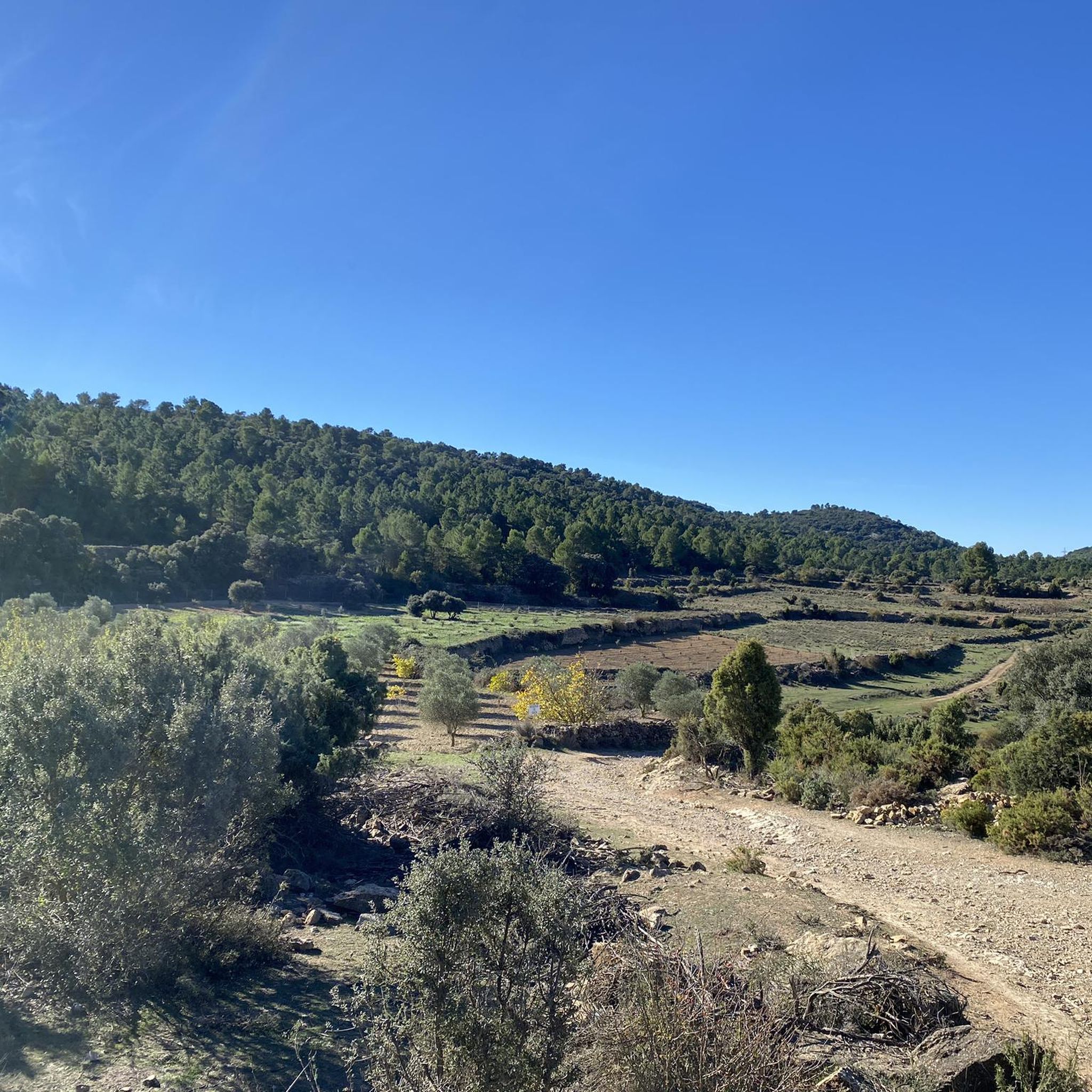
Gravel biking around Abejuela offers diverse landscapes characterized by significant elevation changes and extensive wooded areas. The region features numerous tracks and trails winding through dense pine and holm oak forests, and over rolling hills. Riders can expect terrain dotted with ravines and peaks, providing challenging climbs and scenic descents. This varied environment makes Abejuela a suitable location for gravel biking.
Best gravel bike trails around Abejuela
- The most popular gravel bike trail is El Toro Castle Ruins – El…
Last updated: July 4, 2026
1
riders
33.6km
02:57
750m
750m
Hard gravel ride. Very good fitness required. Mostly paved surfaces. Suitable for all skill levels.
2
riders
Hard gravel ride. Very good fitness required. Mostly paved surfaces. Suitable for all skill levels.

Sign up for free
5.0
(1)
2
riders
48.0km
04:11
1,080m
1,080m
Hard gravel ride. Very good fitness required. Mostly paved surfaces. Suitable for all skill levels.
1
riders
51.1km
04:45
1,440m
1,450m
Hard gravel ride. Very good fitness required. Mostly paved surfaces. Suitable for all skill levels.
1
riders
54.9km
04:01
1,010m
1,010m
Hard gravel ride. Very good fitness required. Mostly paved surfaces. Suitable for all skill levels.
Our route recommendations are based on thousands of hikes, rides, and runs completed by other people on komoot.
Start today with a free account
Your next adventure awaits.
Login or Signup
Tips from the Community

This spot, in addition to the typical photo opportunity with Sarrion in the background, is one of the few places where you can refill your drinking water. There are also picnic tables. I recommend taking a stroll through the village before continuing the route.
0
0
South entrance to the Albentosa Tunnel. It's part of the Ojos Negros Greenway. It has automatic lighting upon entering. Next to this entrance, there's a rest area with a couple of picnic tables. There's no water point. A good place to rest and enjoy excellent views.
0
0
North entrance of the Albentosa Tunnel. It's part of the Ojos Negros Greenway.
0
0
It is currently under reconstruction (2025). It is worth visiting and seeing the progress of the reconstruction, especially inside.
0
0

The road is in perfect condition, 8 meters wide, with vertical signs. Light traffic, although on weekends it is heavily used by bikers until Alcublas. From this point on, traffic is light, and after Sacañet, it is practically nonexistent. There may be snow restrictions in winter from Sacañet onwards. From Sacañet onwards, the last 4.2 km are the toughest, with a gradient of 250 meters at an average of 6%, and with sections that reach 12%. The most interesting aspect is being able to link the three mountain passes starting from Lliria (Port d'Alcublas, Alto de la Cruz del Collado, and finally Puerto de La Bellida) for a total of almost 30 km and 1,400 m+. You can also climb up a dirt track (quite broken, difficult with a skinny one, even if it's gravel) to Col de La Bellida and the geodetic vertex, along the path that branches off to the left after passing the mountain pass (another 2 km at 3% but with ramps that go up to 15%).
0
0
Leaving from Lliria and linking the Port d'Alcublas and the Alto de la Cruz del Collado you end up with a great climb of almost 30km and 1,250m+ that is worth the effort.
0
0
Impressive old entrance to the town. In addition to the walled entrance, I recommend strolling through the old town, within the walls. In summer, the park in front of the wall invites you to rest in the shade of its enormous trees or lie on the grass. There are multiple mountain bike routes starting from Manzanera.
0
0

A shelter with a fountain right at the door and with benches and a table, surrounded by olive trees a few meters from a small road that goes from Toras to Bejís, I imagine it will be little traveled.
0
0
Frequently Asked Questions
How many gravel bike trails are there in Abejuela?
There are several gravel bike routes around Abejuela, with komoot currently featuring 5 distinct tours. These routes offer a variety of experiences for gravel biking enthusiasts.
What kind of terrain can I expect on gravel bike trails around Abejuela?
The region around Abejuela is characterized by significant elevation changes and extensive wooded areas, offering varied terrain. You'll find numerous tracks and trails winding through dense pine and holm oak forests, over rolling hills, and through ravines. Expect challenging climbs and scenic descents, with some routes reaching over 1,400 meters high.
What is the best time to visit Abejuela for gravel biking?
Abejuela's climate, typical of a mountain village in the Sierra de Gúdar-Javalambre, suggests that spring and autumn would be ideal for gravel biking, offering pleasant temperatures. Summer mornings and evenings could also be suitable, while winters might present colder conditions and potential snow at higher elevations.
Are there any challenging gravel bike routes in Abejuela?
Yes, Abejuela offers several challenging gravel routes. For instance, the Approach to Peñas del Diablo – Hermitage of Santa Margarita loop from Bejís is a demanding ride covering over 51 km with significant elevation gain. Another challenging option is the Descent to the Río Palancia – Puerto de La Bellida loop from Bejís, which spans over 48 km with substantial climbing.
Are there any circular gravel bike routes around Abejuela?
Yes, many of the gravel routes in the Abejuela area are designed as loops. Examples include the El Toro Castle Ruins – El Pozo Junco loop from El Toro and the Albentosa Picnic Area – Panoramic View of Albentosa loop from Hotel Balneario El Paraiso (Spa). These circular routes allow you to start and finish at the same point, making logistics easier.
What interesting places can I see along the gravel bike trails in Abejuela?
While gravel biking around Abejuela, you can encounter several points of interest. You might pass by the picturesque Alpuente Village or the historic Hermitage of Santa Margarita. The area also features natural landmarks like the Peñas de Dios Pass, offering scenic views. For a dedicated cycling stop, the Biketrails Valencia Recreational Area provides facilities and pump tracks.
Where can I park my car when gravel biking in Abejuela?
Parking is generally available in and around the villages that serve as starting points for many routes. For example, the Biketrails Valencia Recreational Area is noted to have a dedicated parking area, which can be a convenient spot to begin your ride.
Can I reach the gravel trails around Abejuela by public transport?
While Abejuela is a mountain village, public transport options directly to trailheads might be limited. It's advisable to check local bus schedules for services to Abejuela or nearby towns like Bejís or El Toro, which are common starting points for routes. However, a car is often the most convenient way to access the more remote gravel trails in the region.
Are there any family-friendly gravel bike routes in Abejuela?
The region offers a wide array of routes, from easy excursions to more demanding rides. While specific 'family-friendly' routes are not explicitly detailed in the provided data, the diverse trail network suggests that easier, flatter sections or forest tracks could be suitable for families. It's recommended to check individual route profiles for elevation and surface details to determine suitability for children.
Are dogs allowed on the gravel bike trails in Abejuela?
Generally, dogs are permitted on public trails in natural areas in Spain, especially if kept on a leash and under control. However, specific regulations can vary, particularly in protected natural parks or private lands. It's always best to check local signage or park authority guidelines for any specific restrictions in the Abejuela area to ensure a pleasant experience for everyone.
Are there places to eat or drink near the gravel bike trails in Abejuela?
Abejuela and nearby villages like Alpuente and Andilla offer local amenities, including places to eat and drink. These charming villages provide opportunities to refuel and experience local cuisine after your ride. It's a good idea to plan your route to pass through or near these villages for refreshment stops.
What do other gravel bikers enjoy most about Abejuela?
The komoot community highly rates the gravel biking experience around Abejuela, with an average score of 5.0 stars. Reviewers often praise the region's rugged beauty, varied terrain, and the extensive network of tracks and trails that wind through dense forests and over scenic hills, offering both challenging climbs and rewarding descents.
Most popular attractions around Abejuela

Get inspired with the komoot mobile app


Explore more
Browse the best Gravel rides in other regions.
