Top 13 Lakes around Santa Lucía De Tirajana
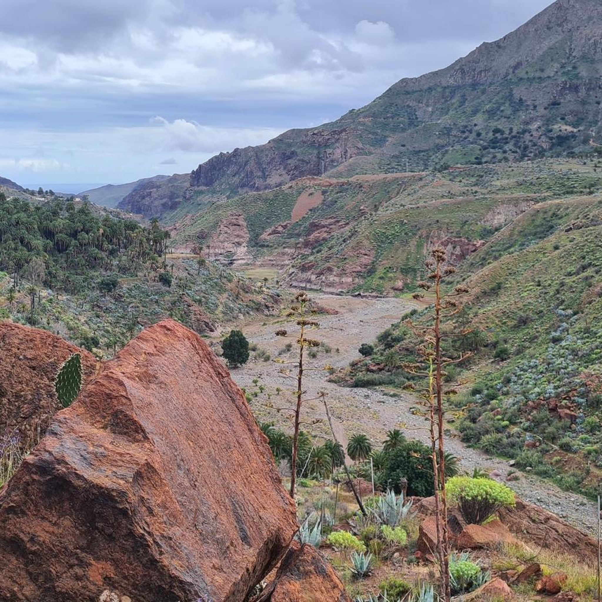
Best lakes around Santa Lucía De Tirajana are primarily man-made reservoirs, reflecting Gran Canaria's water conservation efforts. The region is characterized by dramatic ravines, such as Barranco de Tirajana, and extensive palm groves, creating a unique natural landscape. These water bodies are set amidst picturesque reddish stone and Canary Island palms. The area holds ecological importance, providing habitat for diverse local fauna and offering opportunities for nature observation.
Best lakes around Santa Lucía De Tirajana
- The most popular lakes is…
Last updated: July 4, 2026
Ayagaures Dam
Highlight • Lake
Showing Translation
Tip by

Los Hornos Dam
Highlight • Lake
Translated by Google •
Tip by

Sign up now to discover places like this
Get recommendations on the best single tracks, peaks, & plenty of other exciting outdoor places.
Sign up for free
Chira Dam
Highlight (Segment) • Lake
There is also construction work going on at the moment, we actually wanted to go back up to the reservoir.
But still a nice round.
Translated by Google •
Tip by

Presa de La Gambuesa
Highlight • Lake
Translated by Google •
Tip by

El Charco de la Paloma
Highlight • Waterfall
Translated by Google •
Tip by

Sign up for free to discover even more lakes around Santa Lucía De Tirajana.
Sign up for free
Already have an account?
Start today with a free account
Your next adventure awaits.
Login or Signup
Popular around Santa Lucía De Tirajana

Trail aux îles Canaries — Découvrez les courses mythiques de l'archipel !
Hiking around Santa Lucía De Tirajana
Road Cycling Routes around Santa Lucía De Tirajana
MTB Trails around Santa Lucía De Tirajana
Cycling around Santa Lucía De Tirajana
Running Trails around Santa Lucía De Tirajana

Mountain Hikes around Santa Lucía De Tirajana

Gravel biking around Santa Lucía De Tirajana
Other adventures around Santa Lucía De Tirajana

Tips from the Community

The 'presa' or reservoir of La Gambuesa is located at an altitude of approximately 330 meters above sea level and has a capacity of 47,000 cubic meters of water. The reservoir forms an inseparable whole with the Presa de la Angostura, sharing with it the watershed of the Barranco de Ayagaures and a landscape of exceptional ecological, scenic, and cultural value.
0
0

After the recent rainfall, there is currently plenty of water for the small waterfall.
0
0

Los Hornos Dam Viewpoint The Los Hornos Dam or Cumbre Dam has a height of 1,565 meters above sea level. It dates from 1933, but was later enlarged. Made of ordinary masonry, it reached a height of 27 m and had a capacity of 697,000 m3 of water, which flows between ditches and tunnels towards the municipalities of Arucas and San Mateo.
3
1
The waterfall and the filled reservoir in front of it are probably best admired during the "rainy season" in autumn and winter. Since it doesn't rain often on the island, no water flows here from spring to autumn.
3
1
Los Hornos Dam Viewpoint The Los Hornos Dam or Cumbre Dam has a height of 1,565 meters above sea level. It dates from 1933, but was later enlarged. Made of ordinary masonry, it reached a height of 27 m and had a capacity of 697,000 m3 of water, which flows between ditches and tunnels towards the municipalities of Arucas and San Mateo.
6
0

Beautifully located dam and reservoir. You can drive over the dam wall.
3
0

Very long tour, often shadeless and lonely but very charming
0
0

The history of the Chira Dam begins on August 30, 1932, in the middle of the 2nd Republic, when the Cabildo de Gran Canaria requested the concession of the discontinuous public water flowing through the Barranco de Chira to fill the Soria reservoir, whose license was applied for in the same procedure. The original proposal called for a diversion dam (its goal was to raise water levels to allow for later diversion). The inquiries were answered positively in 1934. The difficulties encountered in processing the Soria Dam project led the chief engineer of the province to order the replacement of the diversion dam with a dam (in order to concentrate the objective on water storage) and to order the preparation of a new project, which began in 1941 was approved. Work began in the same year, but had to be stopped three years later due to a lack of budget. More than five years after the first project, another technical document is being prepared to complete the paralyzed foundation. This defines the dam as we know it today, standing 32 meters above the riverbed and 41 meters from its foundation with a circular plan. In 1955, the final project and its budget were approved, allowing the work to be completed and inaugurated just a decade later. Source: https://www.canarias7.es/canarias/gran-canaria/historia-futuro-presas-20201129100447-nt.html
1
0
Frequently Asked Questions
What makes the lakes around Santa Lucía De Tirajana unique?
The lakes in Santa Lucía De Tirajana are primarily man-made reservoirs, nestled within dramatic ravines like Barranco de Tirajana. They are often surrounded by extensive Canary palm groves and unique rock formations, creating a striking landscape. These water bodies are crucial for water conservation on Gran Canaria and offer important habitats for local fauna.
Are there any natural lakes in Santa Lucía De Tirajana?
Gran Canaria, including Santa Lucía De Tirajana, is not known for natural lakes. The prominent 'lakes' in the region, such as La Sorrueda Dam, Ayagaures Dam, and Los Hornos Dam, are all man-made reservoirs built for water management and conservation.
What natural features can I expect to see around these lakes?
You'll encounter stunning landscapes characterized by Canary palm groves, various types of cacti, and reddish volcanic rock formations. Around Los Hornos Dam, you'll find reforested pine groves, broom, and sage. La Sorrueda Dam is particularly notable for a huge rock formation rising from its waters and being encircled by a vibrant palm oasis.
When is the best time to visit the lakes in Santa Lucía De Tirajana?
The best time to visit is typically during winter and spring. This is when rainfall is more likely, ensuring the reservoirs, especially La Sorrueda Dam, are at fuller water levels, showcasing their full splendor and enhancing the scenic views.
Are there hiking opportunities around the lakes?
Yes, the areas around the reservoirs offer excellent hiking opportunities. The surroundings of La Sorrueda Dam and the nearby La Fortaleza archaeological site are popular starting points for varied and impressive trails. You can find more hiking options in the region by exploring the Running Trails around Santa Lucía De Tirajana guide, which includes routes near these water bodies.
What other outdoor activities can I do near the lakes?
Beyond hiking, the region offers diverse outdoor activities. You can explore Road Cycling Routes around Santa Lucía De Tirajana or try Gravel biking around Santa Lucía De Tirajana. Many routes pass by or offer views of the reservoirs and the dramatic landscapes.
Are there family-friendly options for visiting the lakes?
Yes, some areas are suitable for families. For instance, Ayagaures Dam is listed as family-friendly. Additionally, the small lake and waterfall at El Charco de la Paloma can be an enjoyable spot for families, especially during the rainy season when the waterfall is active.
Can I find viewpoints to enjoy panoramic scenery?
Absolutely. The region is rich in viewpoints offering spectacular panoramic views. The Guriete Viewpoint and La Sorrueda Viewpoint provide breathtaking vistas of the Tirajana canyon, La Sorrueda Dam, and its surrounding palm groves. Los Hornos Dam also features a dedicated viewpoint.
What historical or cultural sites are near the lakes?
La Sorrueda Dam is located near La Fortaleza, a significant archaeological site that symbolizes aboriginal resistance. An interpretation center at La Fortaleza offers insights into ancient Canarian life. The nearby village of Santa Lucía de Tirajana also provides a glimpse into traditional Canarian life with its historic center and well-preserved architecture.
What do visitors enjoy most about the lakes in Santa Lucía De Tirajana?
Visitors frequently praise the tranquil serenity and refreshing atmosphere these reservoirs offer. The dramatic scenery, especially the palm groves and unique rock formations, is a major draw. Many appreciate the opportunity for peaceful relaxation and the breathtaking views of the canyons and dams, often describing them as cinematic.
Is there a specific lake known for its unique appearance?
La Sorrueda Dam stands out for its unique appearance. It's encircled by lush Canary palm groves and various cacti, and a huge rock formation impressively rises from the middle of the water, making it one of the most picturesque dams in Gran Canaria.
Are there any facilities or amenities near the lakes?
While many lake areas are remote, some may have limited facilities. For example, near Ayagaures Dam, there is a kiosk offering drinks. It's always advisable to carry your own supplies, especially water, as amenities can be sparse in these natural settings.
Most popular routes around Santa Lucía De Tirajana
Most popular attractions around Santa Lucía De Tirajana

Get inspired with the komoot mobile app


Explore more
Still not found your perfect lake around Santa Lucía De Tirajana? Check out the guides of these regions to see even more beautiful places.
