The 20 Most Amazing Peaks around Bjerkreim
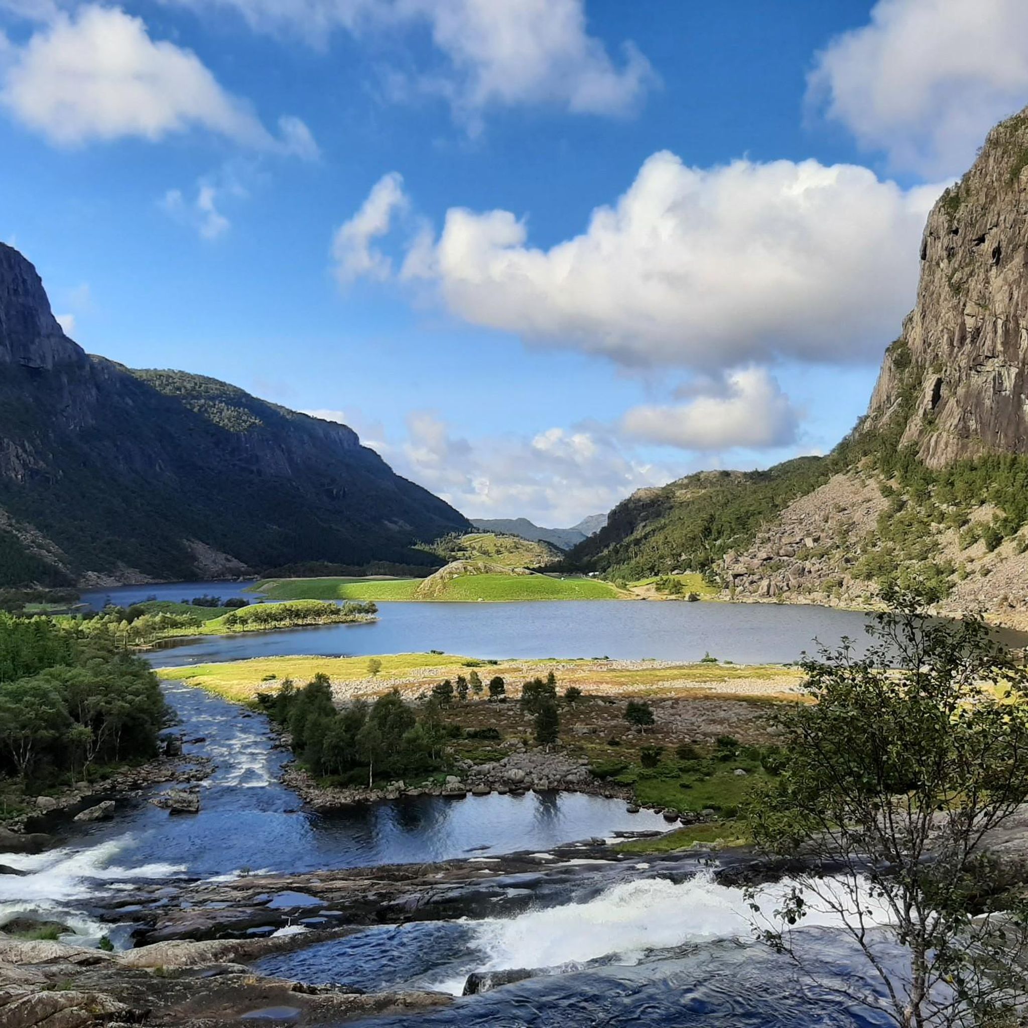
Best mountain peaks around Bjerkreim offer a diverse landscape with numerous mountain peaks. The region provides varied hiking experiences, from high points to accessible climbs with panoramic views. Many trails cater to different fitness levels, ensuring a rich experience for visitors. Bjerkreim features approximately 420 km of marked hiking trails.
Best mountain peaks around Bjerkreim
- The most popular mountain peaks is Vinjakula Summit, a summit that is the highest peak in Southern Norway's Magma Geopark. This strenuous hike offers…
Last updated: May 19, 2026
Storafjellet hikers' shelter
Highlight • Mountain Hut
Translated by Google •
Tip by

Selvigstakken Peak
Highlight • Summit
Tip by

Sign up now to discover places like this
Get recommendations on the best single tracks, peaks, & plenty of other exciting outdoor places.
Sign up for free
Vinjakula Summit
Highlight • Summit
Tip by

Synesvarden
Highlight • Summit
Translated by Google •
Tip by
View of Frafjord from Launesknuden
Highlight • Viewpoint
Translated by Google •
Tip by

Sign up for free to discover even more peaks around Bjerkreim.
Sign up for free
Already have an account?
Start today with a free account
Your next adventure awaits.
Login or Signup
Tips from the Community

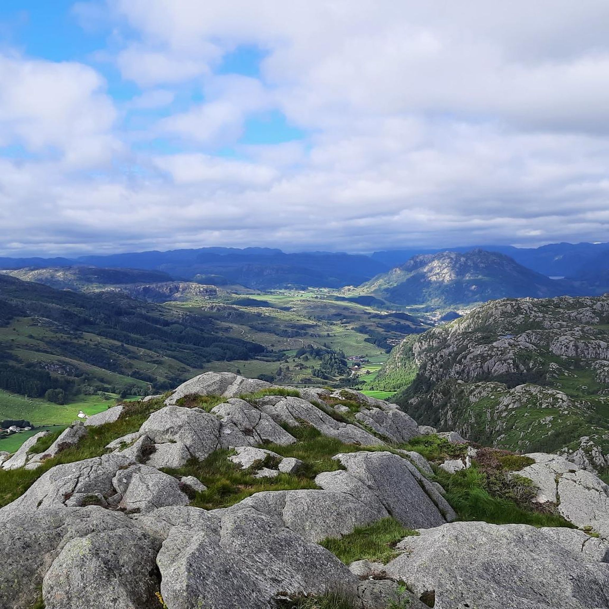
Free parking. The drift road is easy to follow. The red markings will take you onto a path that is wet and rough. But they are easy to see, so if you don't have a map (or komoot😃) you can choose to be on the safe side. By the way, the mountain next to Selvigstakken is NOT called Dalsnuten, but Bynuten. Dalsnuten is located by Dale by Gandsfjorden and is another much-visited peak…
0
0

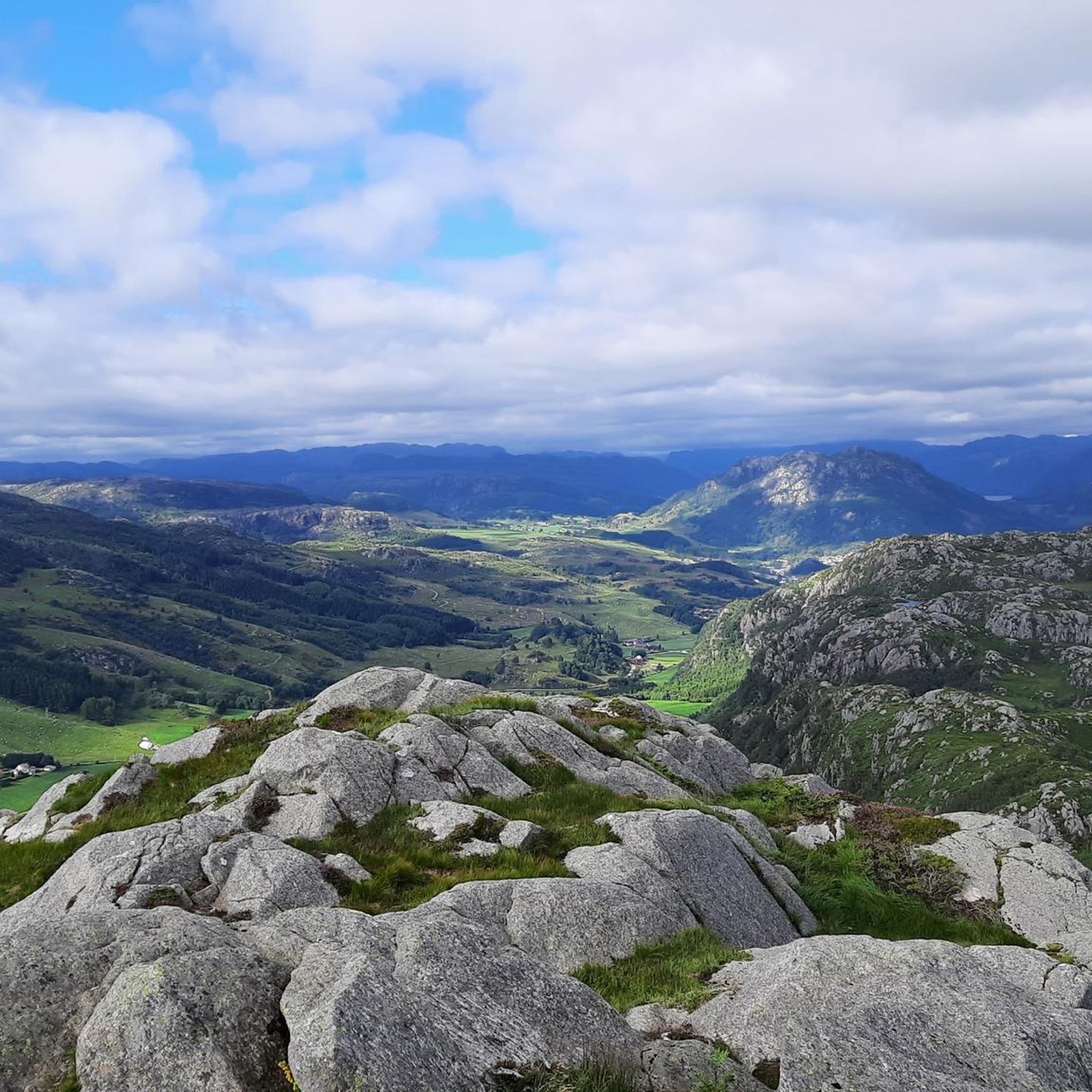
Vinjakula is the highest peak in Southern Norway's Magma Geopark. A strenuous hike but well worth the effort to experience the views.
1
0

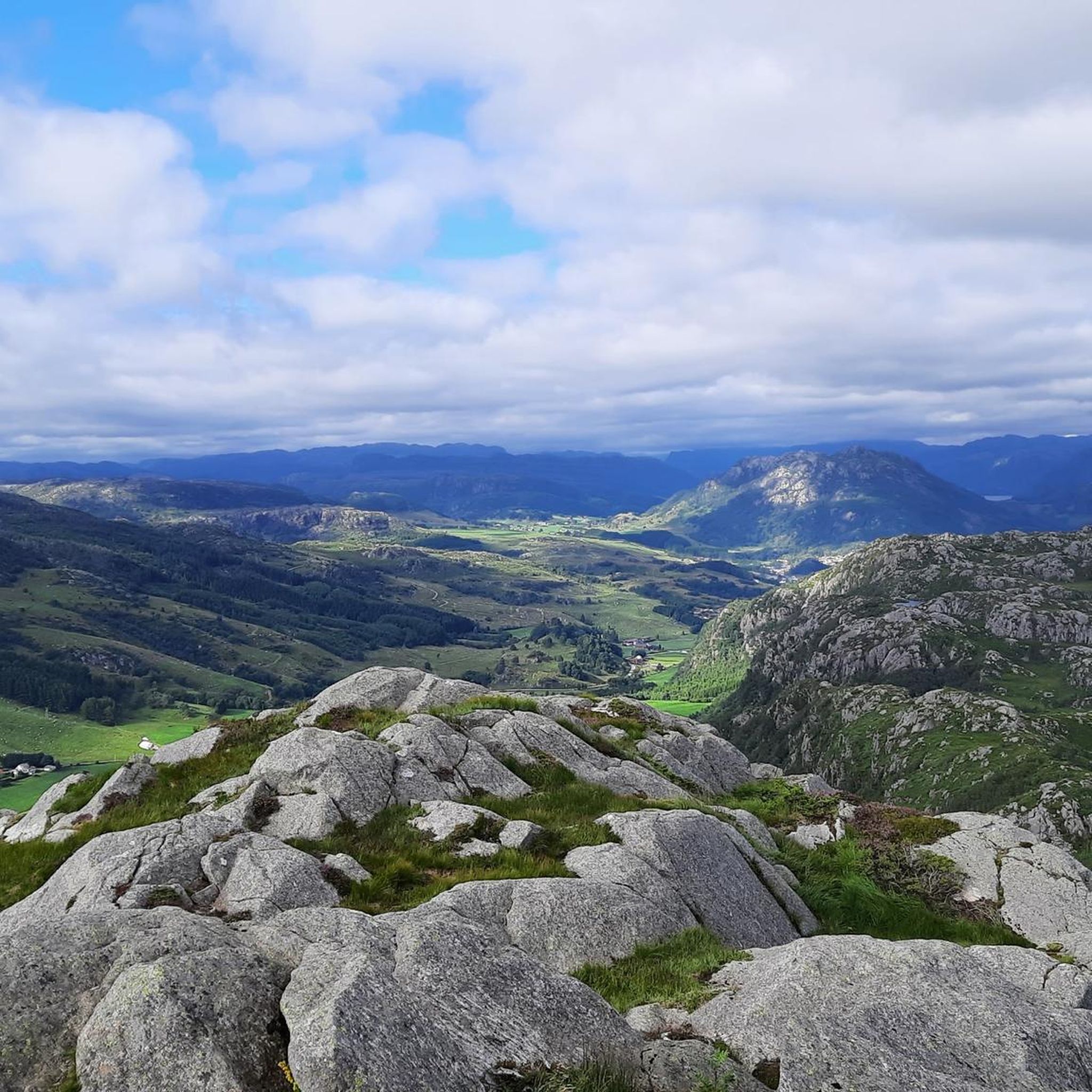
Short climb, big views – Synnesvarden’s a solid choice for a quick adventure.
0
0
Parking: Several options; Hompen/Technical department, by Storafjellet kindergarten (not between 06:30 and 17:00 on weekdays) Vikeså school, Samfunnshuset/Bjerkreimshallen - all signposted with exit from Fv 503 after exit from E39 at Vikeså Storafjellet is a mountain peak most people have driven past and undoubtedly seen along the E39. From Vikeså there is a red-marked hiking trail up to the top. In 2020, a great gapahuk/hut was built at the top of the mountain - out on a promontory which gives a very nice view down towards Vikeså.
0
0
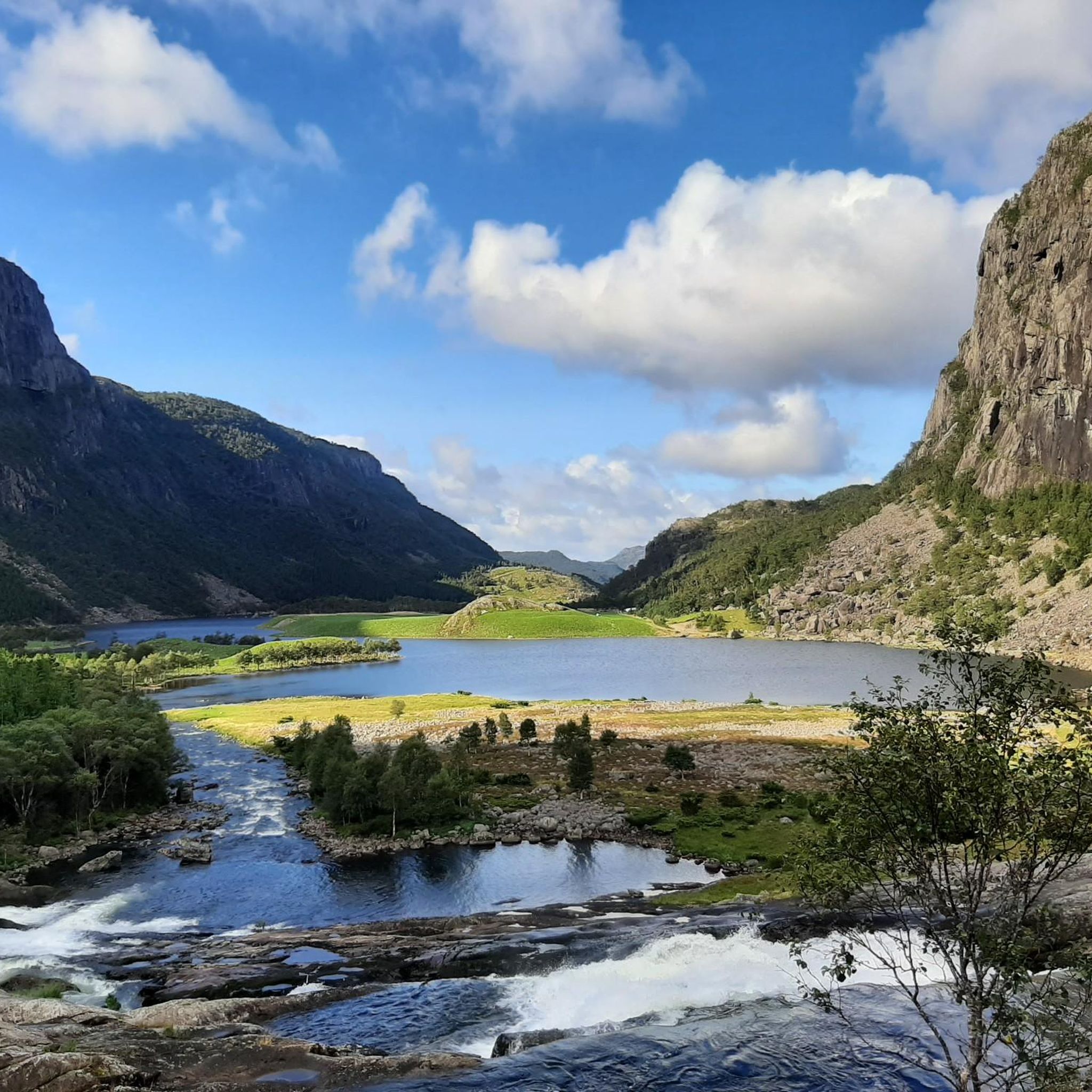
Easy top hike in open terrain. Great and spacious parking by Holmavatn. The area is well laid out, and a round trip to Steinkjerringa is recommended. Nice with landscaped natural stone fords.
0
0


Top view of the Frajord. Somewhat arduous ascent, but which leads to the goal after a short time. Junction is signposted
0
0

Enter the trail from Vikeså and fallow the signs (look for the red dots/ stones) using hiking rails, timber bridges nad steps made last year. Small shelter on top of the mountain (485 m above the sea level) is provided with great view, binoculars, electricity from solar pannels, fire stove nad cettle.
0
1
Frequently Asked Questions
What are some of the most popular mountain peaks to explore around Bjerkreim?
Visitors frequently enjoy Vinjakula Summit, known as the highest peak in Southern Norway's Magma Geopark, offering strenuous but rewarding views. Another favorite is Storafjellet hikers' shelter, which provides a great view towards Vikeså and has a well-equipped shelter at the top. Selvigstakken Peak is also popular for its challenging climb and rewarding vistas.
Are there family-friendly mountain peaks in Bjerkreim?
Yes, Synesvarden is an excellent choice for families. It offers an easy top hike in open terrain with great views, and the area is well-laid out with natural stone fords. A round trip to Steinkjerringa is also recommended from here.
Which mountain peaks offer the best panoramic views in Bjerkreim?
Many peaks in Bjerkreim boast fantastic views. Vinjakula Summit provides a fantastic view of the entire area from Bjerkreim's highest point. Solbjørgnipa, though not in the highlights, is regionally known for its views stretching far out to sea and across large parts of Eigersund, Jæren, and Bjerkreim. Storafjellet hikers' shelter also offers a very nice view down towards Vikeså.
What are the highest mountain peaks in Bjerkreim?
The highest peak in Bjerkreim is Vinjakula, standing at 907 meters. Skykula is another significant high point at 906 meters, located between Ørsdalen and Gyadalen. Both offer challenging hikes to their summits.
Are there challenging hikes for experienced trekkers in Bjerkreim?
Absolutely. Hikes to Vinjakula Summit and Selvigstakken Peak are described as strenuous and challenging, respectively, offering rewarding views after steep climbs. Mjåvassknuten in Ørsdalen also presents a challenging ascent, starting with a suspension bridge and involving a steep 4.5 km climb.
Where can I find parking for mountain peak hikes in Bjerkreim?
Parking options vary by peak. For Storafjellet hikers' shelter, there are several signposted options in Vikeså, including Hompen/Technical department, Vikeså school, and Samfunnshuset/Bjerkreimshallen. For Synesvarden, there's a great and spacious parking area by Holmavatn. For Solbjørgnipa, parking is available at Solbjørg farm or Kløgetvedttunet. For Svartaknuten, parking can be found at a farm or in Svela.
What other outdoor activities can I do near the mountain peaks in Bjerkreim?
Beyond hiking, Bjerkreim offers a variety of outdoor activities. You can explore numerous cycling routes, including moderate and difficult options like the 'Old Railway Trail in Norway' loops. Mountain biking is also popular, with trails such as the 'Synnesvarden Tour'. For runners, there are challenging routes like the 'Trollpikken – Trollpikken rock formation loop'. You can find more details on these activities in the Cycling around Bjerkreim, MTB Trails around Bjerkreim, and Running Trails around Bjerkreim guides.
Can I hike in Bjerkreim's mountains during winter?
Yes, some peaks offer unique winter experiences. Skykula, for instance, is often considered a winter destination, suggesting it provides distinct opportunities during the colder months. Always ensure you have appropriate gear and check weather conditions before undertaking winter hikes.
Which mountain peaks are easily accessible or suitable for beginners?
Synesvarden is an excellent choice for beginners, offering an easy top hike in open terrain. Ramnafjellet is also known for being an easily accessible mountain peak with fantastic views, and it offers multiple routes to the top, allowing hikers to choose one that suits their preference and fitness level.
What kind of natural features can I expect to see on these mountain peaks?
Bjerkreim's mountain peaks offer diverse natural beauty. You'll find stunning panoramic viewpoints, open heathland, and areas within the Magma Geopark, such as Vinjakula Summit. Many trails pass by lakes, like Ørsdalsvatnet visible from Eikeknuten, and feature natural stone fords and marshland sections.
Are there any less crowded mountain trails in Bjerkreim?
While specific crowd levels can vary, Eikeknuten is described as a 'hidden gem' in Ørsdalen, suggesting it might offer a quieter hiking experience compared to more well-known peaks. Exploring some of the less frequently mentioned peaks in the region research, like Mjåvassknuten or Svartaknuten, might also lead to less crowded trails.
What do visitors particularly enjoy about the mountain peaks in Bjerkreim?
Visitors consistently praise the rewarding views after challenging climbs, the well-marked trails, and the diverse landscapes. The presence of facilities like the hikers' shelter at Storafjellet, complete with binoculars and a fire stove, enhances the experience. The area is appreciated for catering to various skill levels, from strenuous ascents to family-friendly walks.
Are there mountain peaks near Vikeså?
Yes, Storafjellet hikers' shelter is very close to Vikeså. It's visible from the E39 and has a red-marked hiking trail leading to the top directly from Vikeså, offering a very nice view down towards the town.
How long do hikes to Bjerkreim's mountain peaks typically take?
Hiking durations vary significantly based on the peak and your fitness level. For instance, the hike to Mjåvassknuten involves a steep 4.5 km ascent followed by another 4.9 km to the cairn, suggesting a longer, more demanding day trip. Shorter climbs like Synesvarden are described as 'short climbs, big views,' indicating they can be completed in a shorter timeframe. Always check specific route details for estimated durations.
Are there any historical or cultural points of interest on the mountain peaks?
Yes, Solbjørgnipa features a cairn that was historically used as a sailing mark by seafarers, adding a touch of maritime history to your hike. Additionally, Vinjakula Summit is part of the Magma Geopark, highlighting its geological significance.
Most popular routes around Bjerkreim
Most popular attractions around Bjerkreim

Get inspired with the komoot mobile app


Explore more
See even more amazing summits around Bjerkreim with these guides:
