Top 16 Caves around Terragnolo
Caves around Terragnolo offer a unique blend of natural beauty and historical significance within the Trentino region of Italy. The area is characterized by its natural landscapes, including canyons and nature trails. While natural show caves are not a primary feature, the valley is notable for its extensive network of World War I tunnels and fortifications. These man-made structures provide a distinctive "cave-like" exploration experience, integrated into the Terragnolo hiking trails.
Best caves around Terragnolo
- The most popular caves is…
Last updated: October 3, 2026
Street of Heroes
Highlight (Segment) • Trail
Translated by Google •
Tip by

Corno Battisti
Highlight • Summit
Showing Translation
Tip by

Sign up now to discover places like this
Get recommendations on the best single tracks, peaks, & plenty of other exciting outdoor places.
Command Saddle
Highlight • Historical Site
Translated by Google •
Tip by

The WWI Fort
Highlight • Historical Site
With the great Spring Offensive of 1916—nicknamed the 'Strafexpedition,' or Punitive Expedition—the Imperial Army aimed to break through the …
Translated by Google •
Tip by
Gorgo Santo
Highlight • Cave
Rainwater and snow water are not retained by the Luserna Plateau due to the karst composition of the …
Translated by Google •
Tip by
Sign up for free to discover even more caves around Terragnolo.
Already have an account?
Start today with a free account
Your next adventure awaits.

Other adventures around Terragnolo

Tips from the Community

During the First World War, the Selletta Comando was a particularly critical and delicate point of the Italian defense line: its collapse could have allowed the Austro-Hungarian army to break through the Italian defenses. The area was subjected to incessant bombardments by imperial artillery, to the point that it was impossible to keep it stably occupied by troops: the soldiers took shelter in the numerous caves or in the masonry barracks built in more sheltered positions. On the Italian side, just behind the Selletta, was the Sector Command, housed in a large cave reinforced with reinforced concrete. A long trench came from Cima Palon and continued along the ridge towards Corno del Pasubio and Nodo d’Aquila, forming a frontline barrier. The position was also effectively defended by the crossfire of light artillery and machine guns positioned on both the Palon and the Corno.
0
0

The strategic position of Corno Battisti was the source of bloody battles for its possession during the Great War. To this end, it was equipped with numerous tunnels dug into the rock, with three separate entrances and numerous firing positions. The tunnels can be accessed with great caution, with a torch and preferably a via ferrata kit. Currently (2025), the upper entrance is closed.
0
0

Il Corno Battisti, an isolated rocky spur of the Pasubio Group, sheer above Vallarsa, offers a spectacular panorama of the long valley and the surrounding mountains: Pasubio, Sengio Alto, Carega, Monte Zugna. Precisely because of its strategic position, it was fiercely contested during the First World War: the possibility of controlling all troop and supply movements in the valley from above made the Corno a crucial point to occupy and defend at all costs... it was indeed nicknamed 'the eye of the Pasubio' or 'the spy of Vallarsa'. At the beginning of the conflict, it was a garrison of the Italian army, but with the Strafexpedition in 1916, it was occupied by the Austro-Hungarians. The Italians, unable to recapture it, dug a mine gallery from below to pierce the Corno and blow up the summit; the imperialists in turn dug a counter-mine gallery from above. Everything was ready for detonation, but a daring raid by a few commandos allowed the summit to be recaptured by the Royal Army, which held it until the end of the war. In 1916, near the summit, the Austro-Hungarians captured the irredentists Cesare Battisti and Fabio Filzi, who were immediately taken to Trento and hanged at the Castello del Buonconsiglio as traitors: for this reason, the summit, known at the time as 'Corno della Vallarsa', was renamed 'Corno Battisti' after the war. The Austro-Hungarian observatory survives on the summit. The bowels of the Corno, on the other hand, are excavated by a surprising labyrinth of dark and damp tunnels with steep steps: they are passable, but to reach them from the summit, one must go around the spur following a narrow, steep path; furthermore, to complete the loop of the tunnels, one must face a short, equipped and exposed section, and descend a metal ladder of about fifteen meters which is by no means trivial (EE). https://it.wikipedia.org/wiki/Monte_Corno_Battisti https://www.esercito.difesa.it/storia/pagine/monte-corno.aspx
3
0

The Road of Heroes owes its name to the twelve plaques affixed along it in honor of the twelve gold medals for military valor who fought on Pasubio during the Great War. The twelve people remembered are: Lieutenant Cesare Battisti, Captain Aldo Beltricco, Bersagliere Torquato Cardelli, Lieutenant Umberto Cerboni, Major Felice Chiarle, Second Lieutenant Fabio Filzi, Colonel Antonio Gioppi, Second Lieutenant Giordano Ottolini, Major Mario Rossani , Colonel Eduardo Suarez, Second Lieutenant Ferdinando Urli, Lieutenant Carlo Sabatini.
1
0
A stretch of road on the Pasubio massif, in the Vicenza Pre-Alps, the Strada degli Eroi was built following the First World War to provide the summit area of the mountain with a safe access route. The actual Road of Heroes is the approximately two kilometer long stretch that connects the Giuseppe d'Havet Gallery to the Achille Papa refuge: this stretch is in a certain sense the appetizer.
1
0
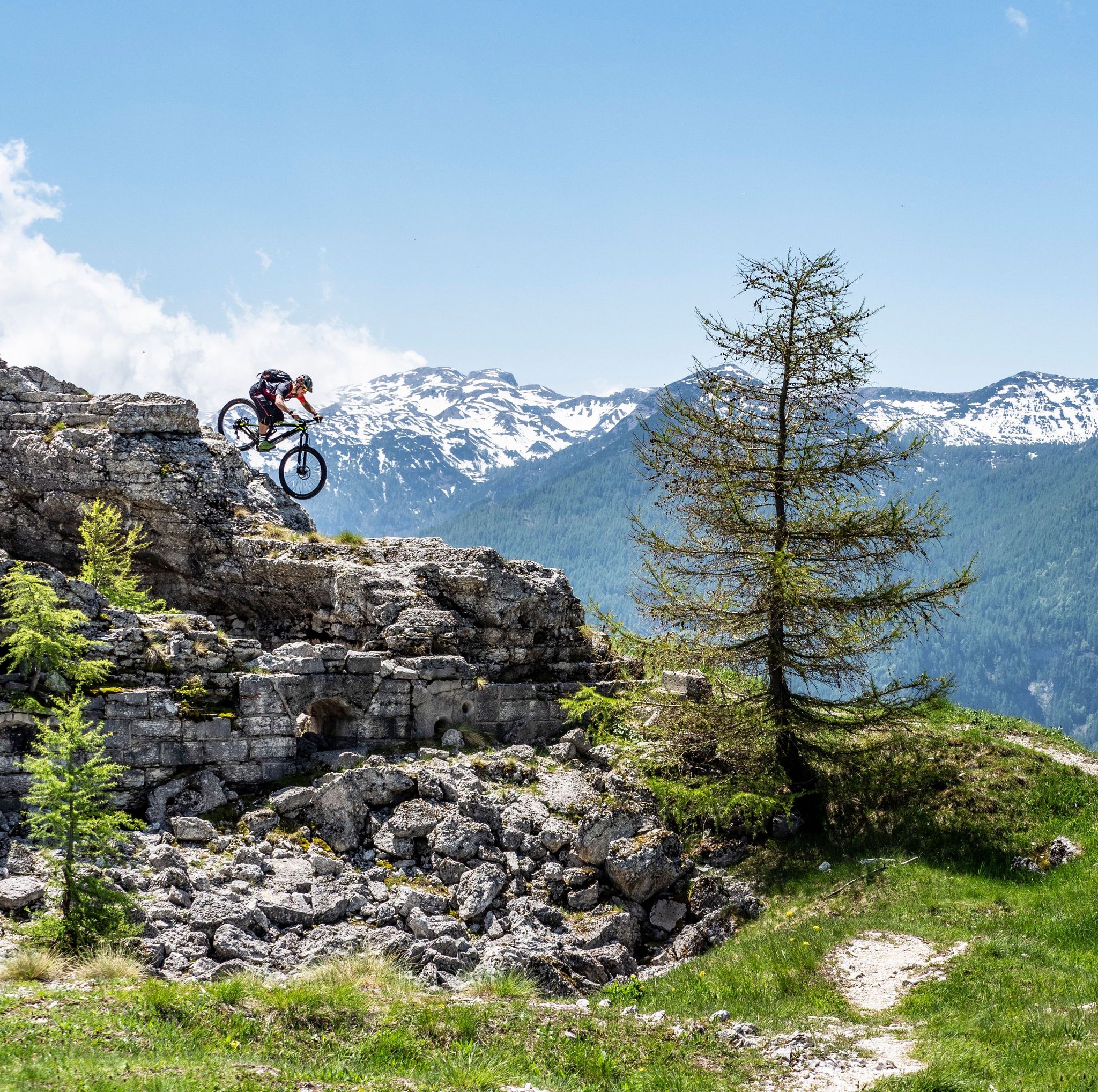
Austro-Hungarian artillery emplacement from World War I, dug into the rock. With the great Spring Offensive of 1916—nicknamed the 'Strafexpedition,' or Punitive Expedition—the Imperial Army aimed to break through the Italian barrier and invade the Po Valley through the valleys of the Vicenza Prealps. Obviously, the first prerequisite for this plan to be feasible was to dominate the surrounding peaks that controlled the access routes below, driving out the enemy. On May 21, 1916, Austro-Hungarian troops passed through an empty and desolate Tonezza: the inhabitants, faced with imminent danger, had quickly abandoned the town and its surrounding countryside to take refuge in the plains, facing exile lasting only a few weeks, but which lasted until the end of the conflict due to the escalation of hostilities. The Italian army, in disadvantaged and indefensible positions, had retreated, barricading itself on Mount Cimone, the last and indispensable bastion of resistance. To defend and maintain the positions they had conquered on the Tonezza Plateau, the Austro-Hungarian units built trenches, walkways, cave shelters, and artillery emplacements everywhere, like this fort: dug into a natural rock formation, it housed a 105 mm gun to dominate the Rio Freddo Valley below. The trees, now dense, were gone over a hundred years ago, having been felled by soldiers who needed a clear line of sight. Not far away, continuing along the steep path that descends to the valley toward the climbing wall, there is a second fort, dug into a cave, which housed another 105 mm gun.
0
0

Located along the itinerary of the 5 cemeteries, starting from Camporovere
0
0
Frequently Asked Questions
What kind of "caves" can I expect to find around Terragnolo?
The Terragnolo area is primarily known for its extensive network of man-made World War I tunnels and fortifications, which offer a unique "cave-like" exploration experience. You can also find some natural karst formations, springs, and grottoes.
What is the historical significance of the caves and tunnels in Terragnolo?
The tunnels and fortifications around Terragnolo are significant historical sites from World War I. They were strategic positions, shelters, and communication routes for both Italian and Austro-Hungarian forces during the "White War." Exploring them offers a tangible understanding of the brutal conditions faced by soldiers.
Which historical WWI tunnels are notable to visit?
You can explore several significant WWI sites. The Tunnel of the Riflemen is an Austro-Hungarian defensive tunnel with posts aimed at Val Terragnolo. The Campiglia Gun Emplacement, built in 1917, is located in a cave along the Scarubbi road. Additionally, Corno Battisti features a labyrinth of dark, damp tunnels fiercely contested during the war.
Are there any natural caves or unique geological features to see?
Yes, you can visit Gorgo Santo, a unique spring where rainwater and snowmelt flow through underground passages. In heavy rain or snowmelt, water can emerge from both lower and upper caves, acting as a natural safety valve. It also features a foaming waterfall.
What should I wear or bring when exploring the tunnels and caves?
When exploring the historical tunnels, it is highly recommended to bring a headlamp or flashlight as they are completely dark. Dress warmly, as temperatures inside can be cold even in summer. Consider wearing a helmet due to low ceilings and potentially sharp rock, and be prepared for potentially wet and slippery floors with appropriate footwear.
What is the best time of year to visit the caves and tunnels?
The WWI tunnels can be visited throughout the warmer months, but be aware that temperatures inside are consistently cool. For natural features like Gorgo Santo, the best time to see a strong flow of water is after periods of rain or during snowmelt in the mountains.
Are the caves and tunnels suitable for families?
Many of the WWI tunnels are integrated into hiking trails and can be explored by families, though some sections might be steep or challenging. Always check the specific trail difficulty. For natural sites like Gorgo Santo, access is generally via trails that vary in difficulty.
What outdoor activities can I combine with visiting the caves?
The historical tunnels and natural features are often part of extensive trail networks. You can combine your visit with mountain hikes, road cycling, or running. For more ideas, explore the Mountain Hikes around Terragnolo, Road Cycling Routes around Terragnolo, or Running Trails around Terragnolo.
Are there hiking trails that specifically include cave exploration?
Yes, many of the WWI tunnels are integrated into thematic trails dedicated to the Great War. For example, routes starting from Piazza di Terragnolo lead to a gorge overlooking the valley and include such historical structures. The Corno Battisti tunnels are part of a challenging hiking route.
What do visitors enjoy most about the caves and tunnels in Terragnolo?
Visitors appreciate the unique blend of history and adventure offered by the WWI tunnels, gaining a powerful glimpse into the past. The panoramic views from the tunnel exits over the Terragnolo Valley and Pasubio massif are also highly valued. The natural beauty of the region, including canyons and nature trails, adds to the experience.
Are there any less crowded cave-like experiences near Terragnolo?
While specific natural show caves are not a primary feature, the extensive network of WWI tunnels and fortifications offers numerous exploration opportunities. Many of these are integrated into hiking trails, allowing for varied experiences away from typical tourist crowds, especially on less-trafficked routes.
Can I find information about the history of the WWI tunnels on site?
Yes, along many of the routes that include WWI tunnels and fortifications, you will find information panels. These panels often share stories of the soldiers and provide context about the historical significance of the sites, enhancing the educational aspect of your visit.
Most popular routes around Terragnolo
Most popular attractions around Terragnolo

Get inspired with the komoot mobile app


Explore more
Extend your search for the best caves by checking out these guides of the top ones around Terragnolo:
