The 4 Most Amazing Peaks around Meyrieux-Trouet
Mountain peaks around Meyrieux-Trouet, located in the Savoie department of the Auvergne-Rhône-Alpes region in south-eastern France, offers a mountainous landscape with elevations ranging from 359 meters to 1480 meters. The area is known for its natural attractions and opportunities for outdoor activities, particularly hiking and cycling. It is part of the broader "Aire d'attraction de Chambéry," which features diverse landscapes including various mountain formations.
Best mountain peaks around Meyrieux-Trouet
- The most popular mountain peaks is Épine Pass, a summit…
Last updated: July 3, 2026
Épine Pass
Highlight • Summit
The pass is closed in winter
Translated by Google •
Tip by

Signal du Mont du Chat
Highlight • Summit
Translated by Google •
Tip by

Sign up now to discover places like this
Get recommendations on the best single tracks, peaks, & plenty of other exciting outdoor places.
Sign up for free
Mont du Chat lookout (1504 m)
Highlight • Lake
The view at the top is worth it and in high season there is a restaurant bar for refueling.
Translated by Google •
Tip by

Cat's Tooth
Highlight • Summit
The piece on the dent - requires a head for heights and surefootedness.
It goes over ladders, heed the warning notices!
Translated by Google •
Tip by

Molard Noir
Highlight • Summit
Showing Translation
Tip by

Sign up for free to discover even more peaks around Meyrieux-Trouet.
Sign up for free
Already have an account?
Start today with a free account
Your next adventure awaits.
Login or Signup


Tips from the Community

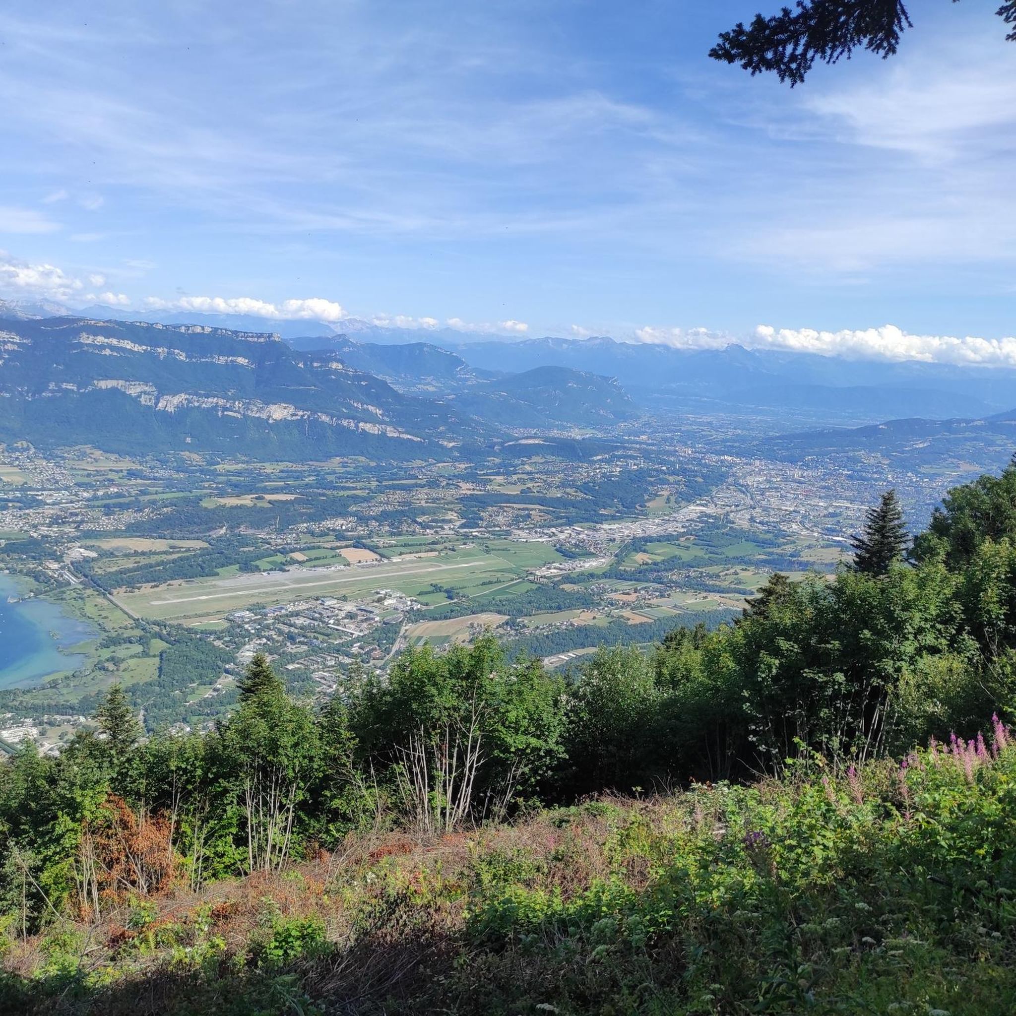
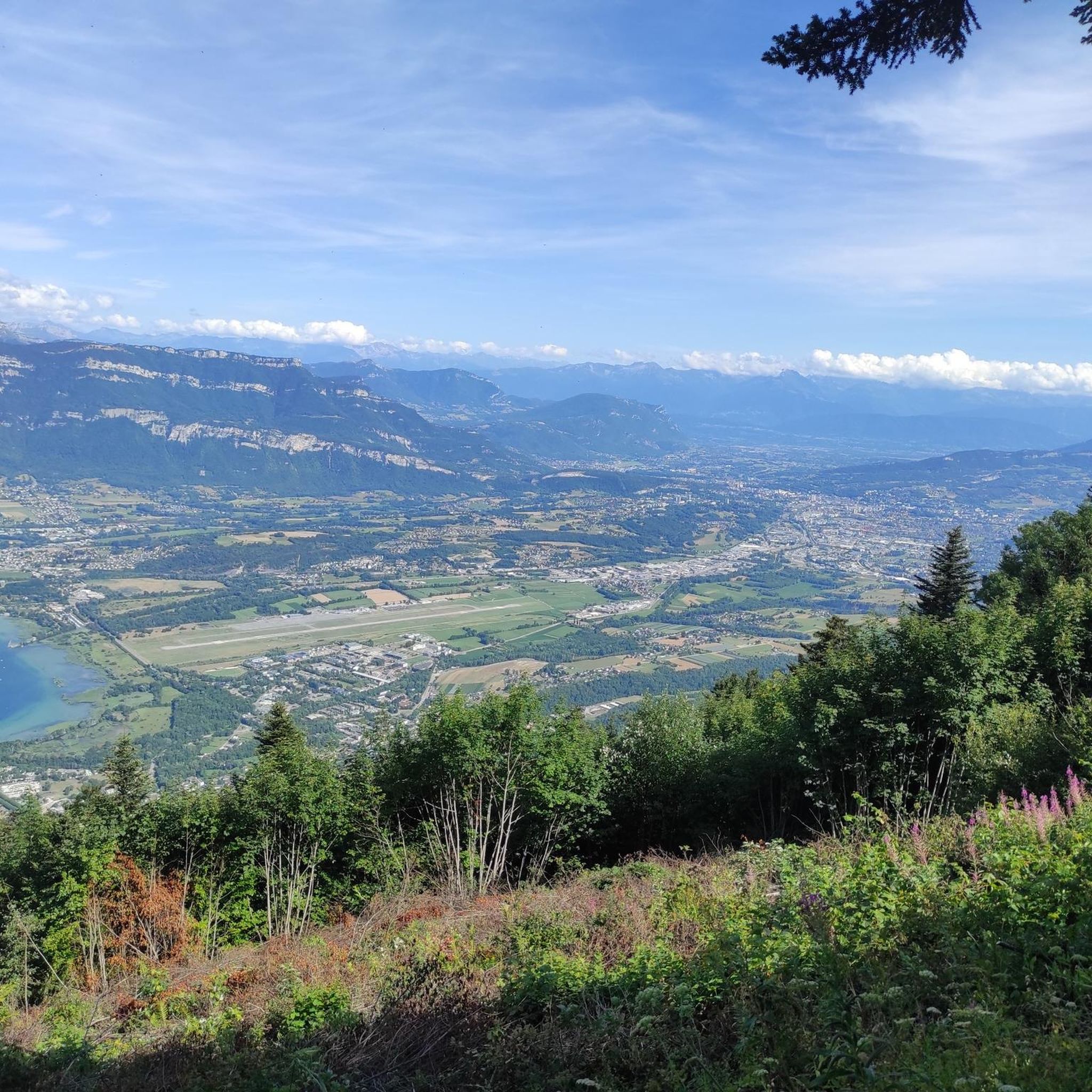
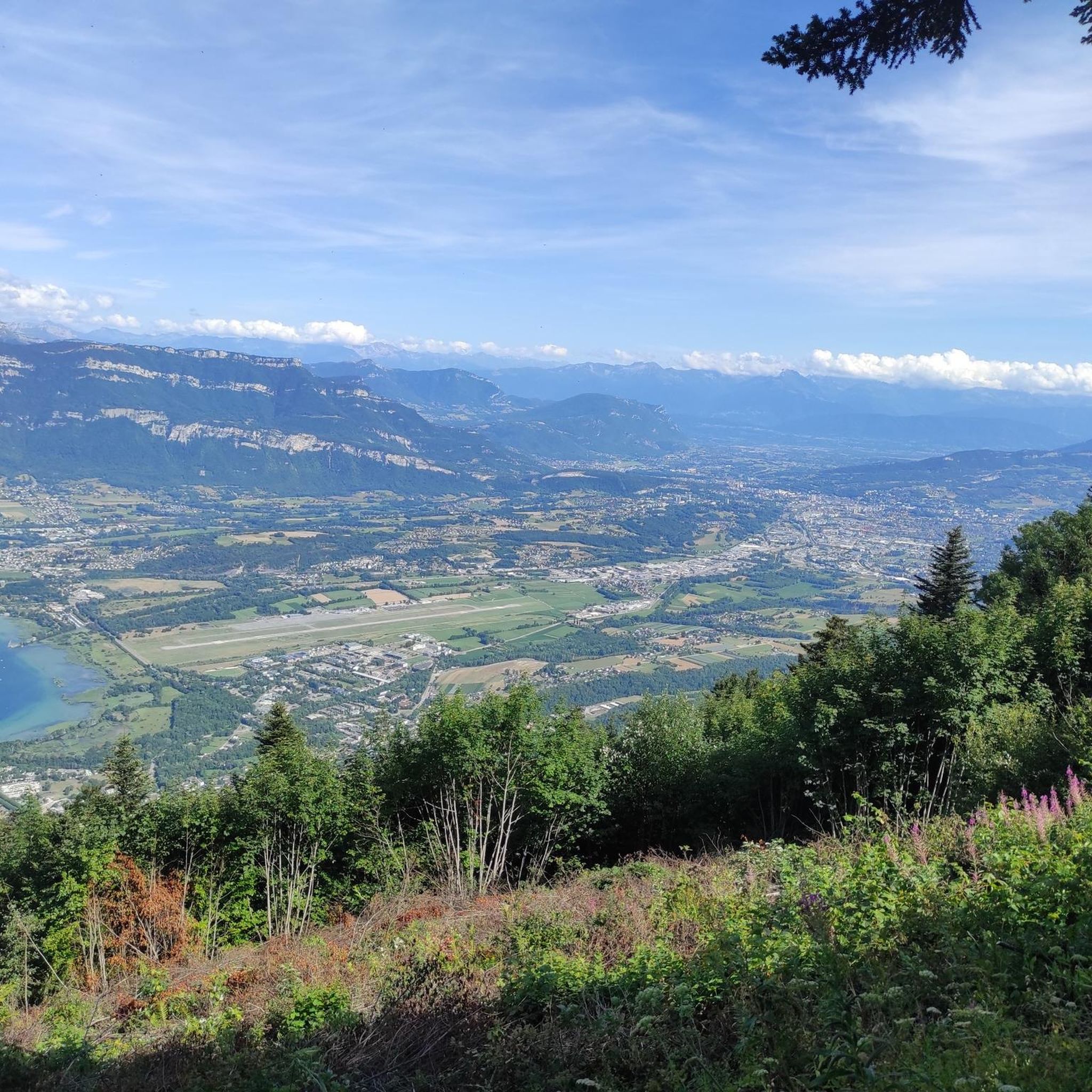
Panoramic view, over the Savoyard pre-Alps, the lake, the Dent du Chat, le Revard, Croix du Nivollet and in clear weather even as far as Mont Blanc! The route does not require any particular physical condition but requires vigilance to place your feet well in order to avoid rocks and roots on the path.
0
0


A very quiet and pleasant road. On the Chambéry side, a good part is in the shade, the slope of the main road is rather constant around 7-8%. On the Novalaise side, the mineral aspect with the cliff is more present in the middle of the climb. This side is quite steep with kilometers at 8-9%. On each side, 1 belvedere offers a breathtaking view of Lake Aiguebelette (approx. 2 km from the summit) and on the other side of Chambéry, the Bauges, Belledonne, the Chartreuse (500 m from the summit). The summit is in the forest.
1
0

Leaving from Chambery, the beginning hurts a little, but the rest is quite good
0
1

There is a mistake about the valleys!
2
0

A pass and a viewpoint that is worth it. Very little respite, mostly 10-11%. 13km of climbing.
0
0
Frequently Asked Questions
What are the most popular mountain peaks and viewpoints around Meyrieux-Trouet?
The region offers several notable peaks and viewpoints. Among the most popular are Épine Pass, which provides panoramic views of Chambéry, Lake Bourget, and the Bauges massif. Another prominent summit is Cat's Tooth, known for its beautiful lake views, and the challenging Mont du Chat lookout (1504 m), offering extensive vistas after a demanding ascent.
Are there challenging mountain routes for experienced hikers or cyclists?
Yes, the area features several challenging routes. The ascent to the Mont du Chat lookout (1504 m) is particularly demanding, with an average 10% gradient over 12 km. Similarly, reaching the Cat's Tooth summit requires surefootedness and a head for heights, involving ladders. For cyclists, the Signal du Mont du Chat is a very hard climb with fantastic views.
What kind of views can I expect from the mountain peaks in this region?
From various peaks and viewpoints, you can expect diverse and stunning vistas. Épine Pass offers breathtaking views of Chambéry, the southern part of Lake Bourget, the Bauges massif, and Lake Aiguebelette. The Cat's Tooth provides beautiful views of the lake, while the Mont du Chat lookout (1504 m) rewards a strenuous climb with extensive panoramic views. Even the lower Mont de Cordon Viewpoint offers spectacular views over the Rhône.
What is the best time of year to visit the mountain peaks around Meyrieux-Trouet?
The best time to visit for hiking and cycling is generally from spring through autumn. Some passes, like Épine Pass, are closed in winter due to snow. During the summer season, you might encounter more car traffic on certain routes, but also benefit from amenities like the restaurant/bar at the Mont du Chat lookout.
Are there any specific tips for hiking or cycling the passes in the area?
When tackling passes like Épine Pass, be aware that it can have a steep start to reach Saint Sulpice, with the rest being more regular. For the Cat's Tooth, be prepared for sections with ladders and heed warning notices, as it requires a head for heights and surefootedness. The climb to Mont du Chat lookout is known for its sustained 10% ramps, so pace yourself. Many routes offer shaded sections, which can be a relief during warmer months.
What outdoor activities can I do near these mountain peaks?
Beyond exploring the peaks themselves, the region around Meyrieux-Trouet is excellent for various outdoor activities. You can find numerous road cycling routes, including loops around Lac d'Aiguebelette and Lac du Bourget. There are also dedicated mountain hikes and general hiking trails, ranging from moderate to difficult, often offering stunning views of the surrounding landscapes and lakes.
Are there any family-friendly hiking options near Meyrieux-Trouet?
While many of the prominent peaks involve challenging ascents, the broader region around Meyrieux-Trouet, being part of the Chambéry area, offers diverse landscapes. For specific family-friendly options, it's best to explore the hiking guides for the area, which include routes with varying difficulty levels. Look for trails categorized as 'easy' or 'moderate' that might offer less elevation gain and shorter distances.
What are the elevation ranges for the mountain peaks in the Meyrieux-Trouet area?
The mountainous area around Meyrieux-Trouet features elevations ranging from 359 meters to 1480 meters. Specific highlights include Épine Pass at 987 meters, and the Mont du Chat lookout and Signal du Mont du Chat both reaching 1504 meters. Even lower viewpoints like Mont de Cordon Viewpoint offer impressive vistas from 401 meters.
Can I find places to eat or stay near the mountain trails?
Yes, especially during high season. For example, the Mont du Chat lookout (1504 m) has a restaurant and bar at the summit, perfect for refueling after a challenging climb. The commune of Meyrieux-Trouet itself and the broader Chambéry area offer various accommodation and dining options. For specific locations near trailheads, it's advisable to check local listings.
Are there any specific natural features to look out for near Lac du Bourget?
Lac du Bourget is a significant natural feature in the region, and several peaks offer stunning views of it. From Épine Pass, you can enjoy a view of the south of Lake Bourget. The Cat's Tooth also provides beautiful views of the lake. The lake itself is a popular spot for various water activities and offers picturesque lakeside trails.
What are the options for parking when accessing mountain trails?
Parking availability varies by trailhead. For popular spots like the Col du Chat or access points for the Mont du Chat and Dent du Chat trails, there are typically designated parking areas. It's recommended to check specific route details on komoot or local signage for the most accurate parking information for your chosen starting point.
Are dogs allowed on the mountain trails around Meyrieux-Trouet?
Generally, dogs are permitted on many outdoor trails in the Savoie region, but rules can vary, especially within protected natural areas or specific reserves. It's always best to keep dogs on a leash and ensure they are well-behaved to respect wildlife and other hikers. For specific trails, look for local signage or check detailed route descriptions for any restrictions.
Most popular routes around Meyrieux-Trouet
Most popular attractions around Meyrieux-Trouet

Get inspired with the komoot mobile app


Explore more
See even more amazing summits around Meyrieux-Trouet with these guides:
