The best cycling routes around Cedar Highlands
5.0
(26)
32
riders
5
rides
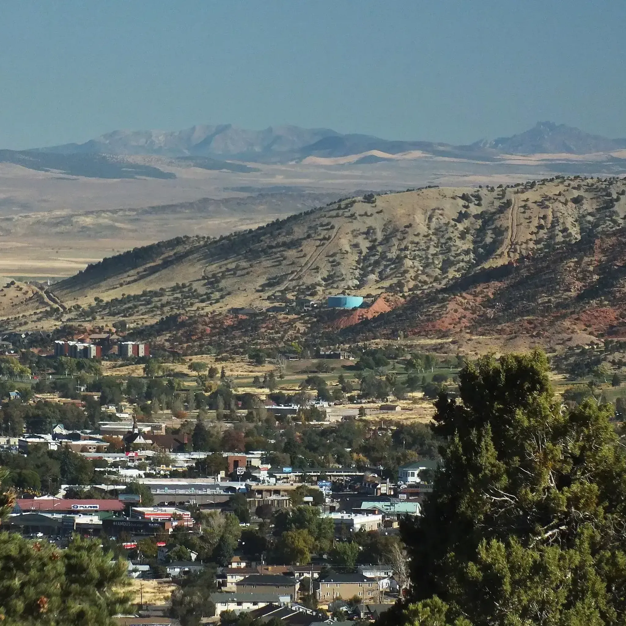
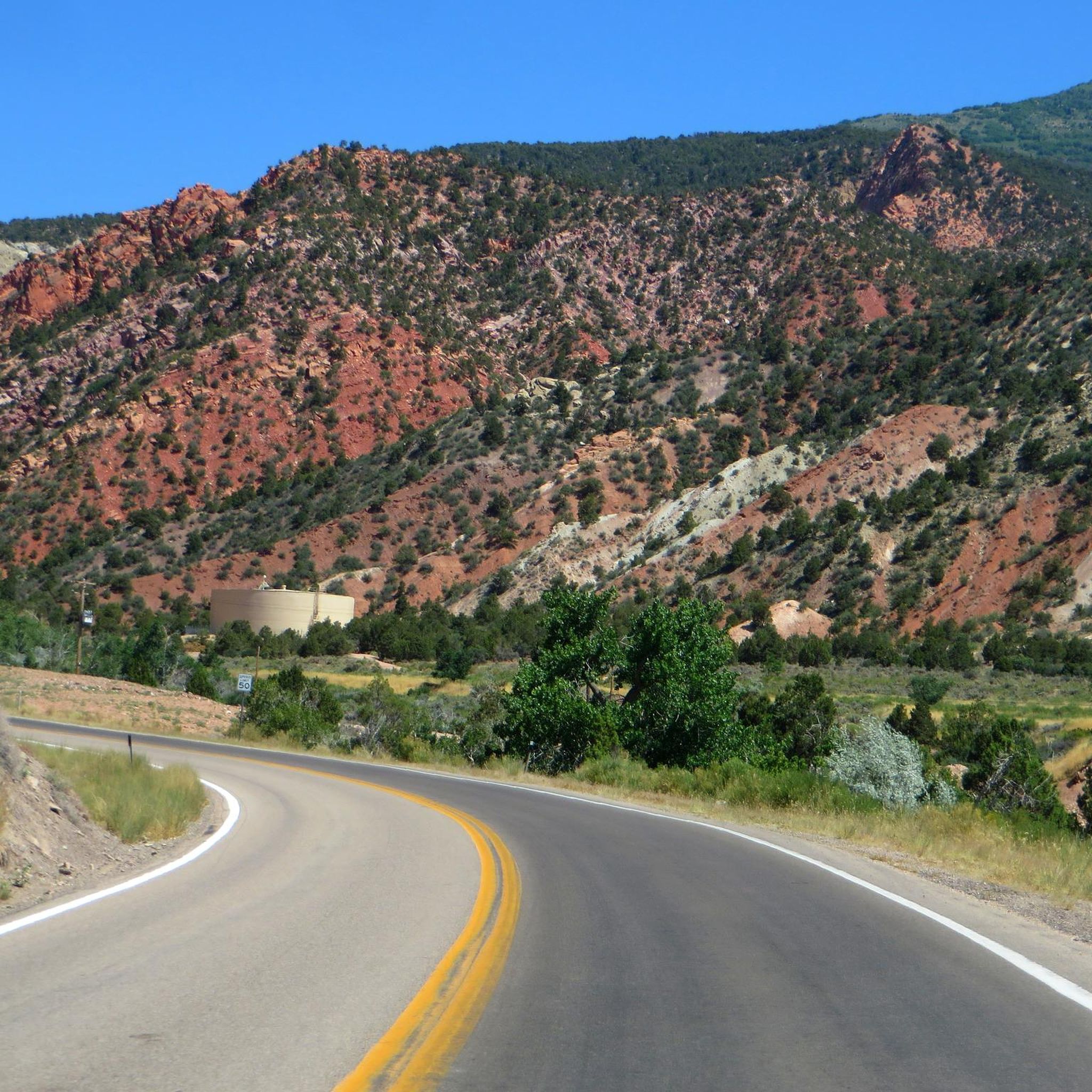
Touring cycling routes around Cedar Highlands traverse a diverse landscape characterized by red rock canyons, sandstone cliffs, high plateaus, and alpine forests within the Dixie National Forest. The region offers varied topography, with juniper trees at lower altitudes transitioning to pine trees at higher elevations. Cyclists can experience significant elevation changes and panoramic views of valleys and distant mountains. The area provides access to scenic byways and a network of trails suitable for touring cyclists.
Best touring cycling routes around…
Last updated: October 5, 2026
5.0
(26)
13
riders
21.1km
01:22
210m
210m
Moderate bike ride. Good fitness required. Mostly paved surfaces. Suitable for all skill levels.
12
riders
7.71km
00:47
150m
150m
Easy bike ride. Great for any fitness level. Mostly paved surfaces. Suitable for all skill levels.

4
riders
33.0km
02:25
740m
740m
Hard bike ride. Very good fitness required. Mostly paved surfaces. Suitable for all skill levels.
2
riders
12.4km
00:47
110m
110m
Easy bike ride. Great for any fitness level. Mostly paved surfaces. Suitable for all skill levels.
1
riders
12.3km
00:45
100m
100m
Easy bike ride. Great for any fitness level. Mostly paved surfaces. Suitable for all skill levels.
Our route recommendations are based on thousands of hikes, rides, and runs completed by other people on komoot.
Start today with a free account
Your next adventure awaits.


Tips from the Community

A convenient overnight hub with everything you might need: groceries, shops, restaurants, and plenty of lodging. If you’re riding or hiking in the region, this is an ideal place to rest, resupply, and tune up. If you enjoy mountain biking, several nearby trails are worth exploring—even for first-timers. There are also plenty of hiking trails just outside town.
0
0
Coal Creek Trail is a paved path that runs alongside the river and passes by Veterans Park, connecting with the park and other trails in the area. The park serves as a memorial to those who fought in various wars, with dedicated sections, including one honoring the 240 Korean soldiers who won a battle against a much larger army without any casualties.
0
0
This is a smooth paved trail following the river all the way. It’s a perfect trail to contemplate the landscape and see the different layers of rock that form the canyon. Along the way, you can find informative boards explaining the geology.
0
0

The East Bench Trail is a paved, 5.5-mile trail that runs along the eastern part of Cedar City. It is a popular trail, so there is a good chance you will see others out on the trail.
0
0
Cedar City is a small community located in a valley surrounded by canyons. East Bench Trail goes around the city and offers views to the surrounding mountains and canyons. This can be a good hike during winter, as other trails can be covered by snow, this one offers a relaxing walk on a paved surface with scenic views of the snow covering the surroundings.
1
0
Lichen It Trail is a well-maintained trail that is partially shaded, going between forests. The trail has a lot of switchbacks that make the way up more gradual and smooth. It’s a nice path to appreciate the beauty of the flora and fauna.
0
0
East Bench Trail is paved all the way, offering a low-key hike around Cedar City. It's a great option for a peaceful walk while enjoying views of the colorful cliffs around. It has benches along the way if you want to stop for a picnic or just to stop and enjoy the moment.
0
0
This viewpoint gives a panoramic view of Cedar City and its surroundings. There are informative boards along the overlook telling the history of the city.
0
0
Frequently Asked Questions
How many touring cycling routes are available in Cedar Highlands?
There are 7 touring cycling routes documented around Cedar Highlands on komoot, offering a range of experiences from easy to difficult. These routes traverse diverse landscapes including red rock canyons, sandstone cliffs, and alpine forests.
What kind of terrain and elevation changes can I expect on touring cycling routes in Cedar Highlands?
The terrain in Cedar Highlands is highly varied, featuring red rock formations, high plateaus, and alpine forests within the Dixie National Forest. Cyclists can expect significant elevation changes, with some routes reaching over 10,000 feet, offering panoramic views of valleys and distant mountains. Routes range from gentle paths to challenging climbs.
Are there any easy touring cycling routes suitable for beginners in Cedar Highlands?
Yes, Cedar Highlands offers several easy touring cycling routes. For example, the Lichen It Trail loop from Cedar Highlands is an easy 4.8-mile path that winds through natural landscaping. Another accessible option is the East Bench Trail – Coal Creek Trail loop from Cedar City, an easy 7.7-mile route with moderate elevation gain.
What are some notable landmarks or natural features I can see along the touring cycling routes?
Touring cycling routes in Cedar Highlands offer access to stunning natural features. You can experience the dramatic red rock formations and canyons, high plateaus, and alpine forests. Specific highlights include the Coal Creek Trail and East Bench Trail, which are part of several routes. The region is also near Cedar Breaks National Monument, known for its colorful geologic amphitheater, accessible via scenic byways like S.R. 143 and S.R. 148.
Are there any circular touring cycling routes in Cedar Highlands?
Yes, many touring cycling routes in Cedar Highlands are designed as loops. Examples include the Coal Creek Trail – East Bench Trail loop from Cedar City, a 12.3-mile route, and the View from Bicentennial Park – East Bench Trail loop from Cedar City, which is 11.0 miles long. These loops provide varied scenery without retracing your path.
What is the best time of year for touring cycling in Cedar Highlands?
The best time for touring cycling in Cedar Highlands is generally from late spring through early fall. During these months, the weather is most favorable, allowing cyclists to fully enjoy the diverse landscapes from lower juniper-filled altitudes to higher pine forests. Winter can bring snow and colder temperatures, making some higher elevation routes inaccessible or challenging.
Are there family-friendly touring cycling options in Cedar Highlands?
Yes, Cedar Highlands offers routes suitable for families, particularly the easier, less strenuous paths. The Lichen It Trail loop from Cedar Highlands is an easy option that winds through natural scenery, making it a good choice for a family outing. When planning, consider the distance and elevation profile to match your family's ability.
What do other touring cyclists say about their experience in Cedar Highlands?
The touring cycling routes around Cedar Highlands are highly rated by the komoot community, with an average score of 5.0 stars from more than 10 reviews. Cyclists often praise the varied terrain, from red rock formations to alpine forests, and the panoramic views of valleys and distant mountains. The network offers options for different ability levels, ensuring a rewarding experience for many.
Is public transport available to reach the touring cycling trailheads in Cedar Highlands?
While Cedar Highlands itself is a mountain community, it is only about a 15-minute drive from Cedar City. For specific public transport options to trailheads, it's best to check local services in Cedar City. Many routes, like the Cedar City – Coal Creek Trail loop from Cedar City, start directly from Cedar City, making them more accessible.
Are there amenities like cafes or accommodation near the touring cycling routes?
Cedar Highlands offers a secluded mountain living experience, but it is conveniently close to Cedar City, which is about a 15-minute drive away. In Cedar City, you'll find a full range of amenities including cafes, restaurants, and various accommodation options to support your cycling trip.
Can I find routes that offer significant challenges for experienced touring cyclists?
Absolutely. Cedar Highlands is known for its challenging and scenic routes, some mirroring those used in professional cycling events. Routes with significant elevation gains, such as the Cedar City – Coal Creek Trail loop from Cedar City, which covers 20.5 miles with over 2,400 feet of elevation gain, provide a demanding experience for seasoned touring cyclists. Scenic byways like S.R. 143 and S.R. 148 also offer substantial climbs.
Are there any specific trails that offer great viewpoints?
Many routes in Cedar Highlands provide breathtaking viewpoints due to the region's diverse topography and significant elevation changes. As you ascend into Cedar Highlands, you're treated to panoramic vistas of the valley below and distant mountains. The C-Overlook is a specific highlight known for its views. Routes that incorporate scenic byways also offer numerous opportunities for stunning overlooks, particularly those leading towards Cedar Breaks National Monument.
Most popular attractions around Cedar Highlands

Get inspired with the komoot mobile app


Explore more
Browse the best Cycling routes in other regions.
