The best road cycling routes around Cedar Highlands
27
riders
9
rides
Road cycling routes around Cedar Highlands traverse a landscape characterized by significant elevation changes, red rock canyons, and high-altitude alpine forests within the Dixie National Forest. This region offers demanding routes that transition from desert to pine and aspen woodlands, providing diverse ecosystems and climates. Cyclists can experience vibrant red rock formations along routes that skirt the Hurricane Cliffs and lead towards Kolob Canyons. High-altitude plateaus like the Markagunt Plateau offer extensive views and winding roads through pine and aspen…
Last updated: October 5, 2026
3
riders
16.8km
00:45
160m
160m
This easy 10.4 miles (16.8 km) road cycling loop in Cedar City offers scenic views along Coal Creek and the East Bench Trail.
5
riders
16.5km
00:48
180m
180m
Moderate road ride. Great for any fitness level. Some segments of this route may be unpaved and difficult to ride.

6
riders
47.3km
02:41
840m
850m
Moderate road ride. Good fitness required. Mostly well-paved surfaces and easy to ride.
3
riders
32.6km
01:30
270m
270m
Moderate road ride. Great for any fitness level. Some segments of this route may be unpaved and difficult to ride.
5
riders
15.0km
00:44
130m
130m
Easy road ride. Great for any fitness level. Mostly well-paved surfaces and easy to ride.
Get access to more routes and recommendations from other explorers.
Already have an account?
Our route recommendations are based on thousands of hikes, rides, and runs completed by other people on komoot.
Start today with a free account
Your next adventure awaits.


Tips from the Community

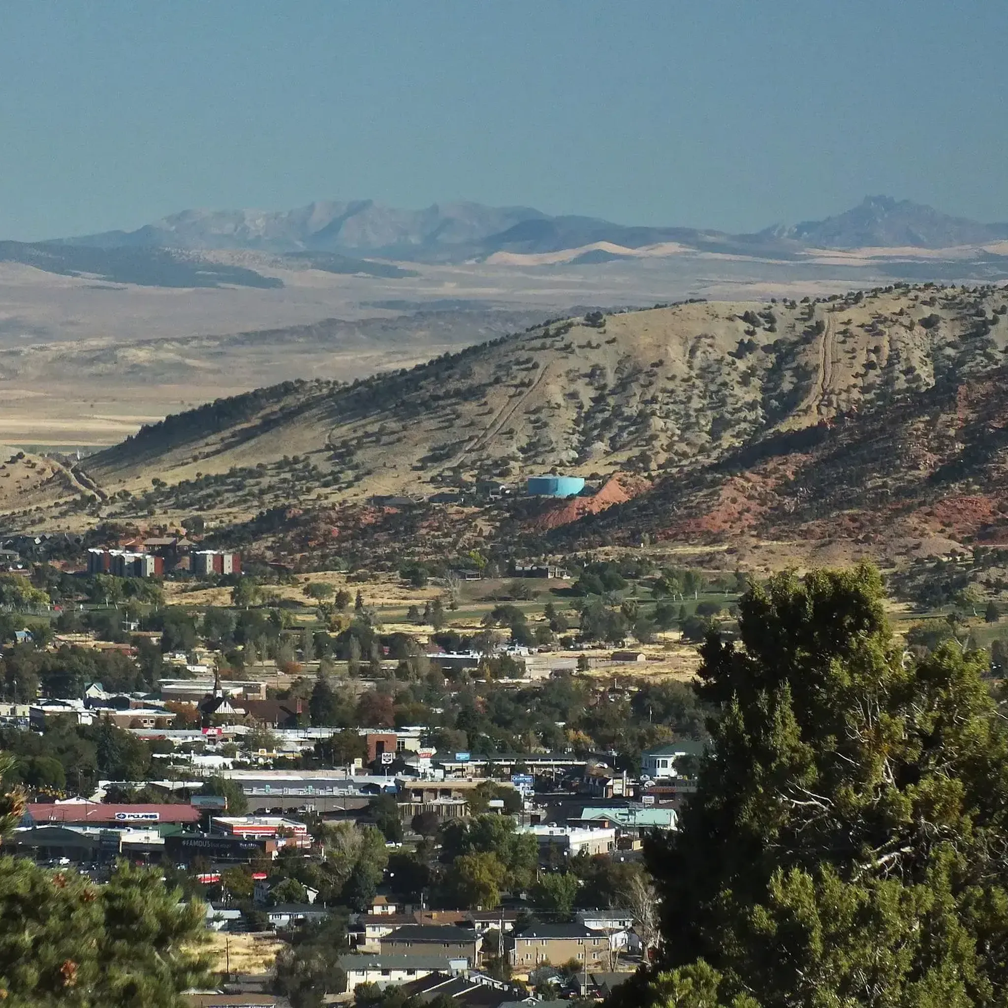
A convenient overnight hub with everything you might need: groceries, shops, restaurants, and plenty of lodging. If you’re riding or hiking in the region, this is an ideal place to rest, resupply, and tune up. If you enjoy mountain biking, several nearby trails are worth exploring—even for first-timers. There are also plenty of hiking trails just outside town.
0
0
Coal Creek Trail is a paved path that runs alongside the river and passes by Veterans Park, connecting with the park and other trails in the area. The park serves as a memorial to those who fought in various wars, with dedicated sections, including one honoring the 240 Korean soldiers who won a battle against a much larger army without any casualties.
0
0
This is a smooth paved trail following the river all the way. It’s a perfect trail to contemplate the landscape and see the different layers of rock that form the canyon. Along the way, you can find informative boards explaining the geology.
0
0

Great view from Bicentennial Park of the mountains in the distance. The park also has a pavilion and restrooms.
0
0
The East Bench Trail is a paved, 5.5-mile trail that runs along the eastern part of Cedar City. It is a popular trail, so there is a good chance you will see others out on the trail.
0
0
Cedar City is a small community located in a valley surrounded by canyons. East Bench Trail goes around the city and offers views to the surrounding mountains and canyons. This can be a good hike during winter, as other trails can be covered by snow, this one offers a relaxing walk on a paved surface with scenic views of the snow covering the surroundings.
1
0
East Bench Trail is paved all the way, offering a low-key hike around Cedar City. It's a great option for a peaceful walk while enjoying views of the colorful cliffs around. It has benches along the way if you want to stop for a picnic or just to stop and enjoy the moment.
0
0
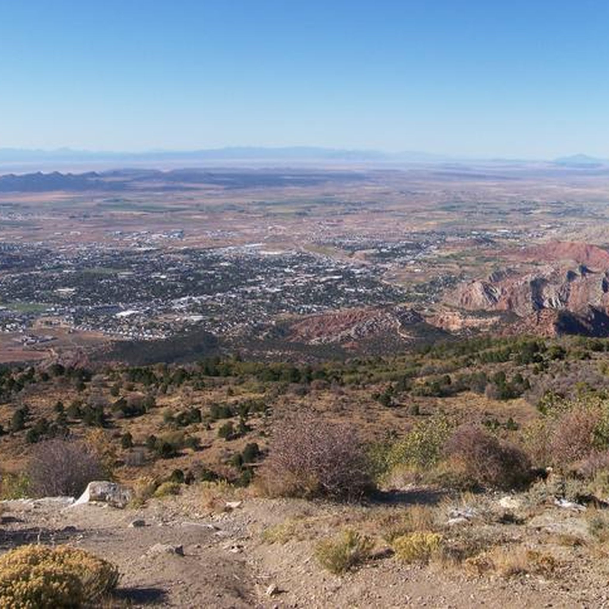
This viewpoint gives a panoramic view of Cedar City and its surroundings. There are informative boards along the overlook telling the history of the city.
0
0
Frequently Asked Questions
How many road cycling routes are available in Cedar Highlands?
There are 8 road cycling routes around Cedar Highlands listed on komoot. These routes offer a range of experiences, from easy loops to more challenging climbs through varied terrain.
What kind of terrain and landscapes can I expect on road cycling routes around Cedar Highlands?
Road cycling around Cedar Highlands offers incredibly diverse terrain. You'll experience significant elevation changes, transitioning from vibrant red rock canyons and sandstone cliffs to high-altitude alpine forests within the Dixie National Forest. Routes often feature breathtaking red rock scenery, especially along the Hurricane Cliffs and towards Kolob Canyons, as well as winding roads through pine and aspen woodlands on high-altitude plateaus like the Markagunt Plateau.
Are there routes with significant elevation gain for experienced cyclists?
Yes, the region is known for its demanding climbs. For instance, the climb on State Route 143 (Patchwork Parkway) involves an ascent of approximately 4,500 feet in under 20 miles, reaching elevations above 10,000 feet. Similarly, the Cedar and Right Hand Canyon Roads climb features a total elevation gain of 3,358 feet over 12.4 miles. The Markagunt High Plateau Scenic Byway (SR 14) also includes a sustained ascent of approximately 17 miles, gaining over 4,000 feet to reach elevations near 10,000 feet.
What are some scenic highlights or viewpoints I can expect to see along the routes?
Cyclists can enjoy panoramic views of Cedar City and distant mountain ranges. Notable scenic highlights include the vibrant red and pink cliffs of Cedar Canyon along Highway 14, and the majestic formations of Cedar Breaks National Monument. You can also explore the C-Overlook for expansive vistas. The region is rich with unique geological formations like arches, hoodoos, and spires.
Are there any easy, family-friendly road cycling options?
Yes, there are easier options suitable for families. The Coal Creek and East Bench Trail Loop is an easy 10.4-mile route offering scenic views along Coal Creek and the East Bench Trail. Another easy option is the View from Bicentennial Park – Cedar City loop from Cedar City.
What is the best time of year for road cycling in Cedar Highlands?
The diverse elevations mean that while lower desert areas can be warm, higher alpine routes offer cooler temperatures. Generally, late spring through early fall provides the most favorable conditions, allowing access to high-altitude plateaus and forests. Always check local weather conditions, especially for higher elevations, as they can change rapidly.
Where can I find parking for road cycling routes in the area?
Cedar City serves as a convenient basecamp for cyclists, offering various amenities. While specific parking for every route isn't detailed, Cedar City itself provides access points to many routes and is equipped with general parking facilities. For routes starting directly from Cedar City, you can typically find parking within the city.
Is public transport available to access cycling routes around Cedar Highlands?
Information on specific public transport options directly to trailheads in Cedar Highlands is limited. However, Cedar City acts as a central hub for the region, and many routes are accessible from there. For detailed regional transport information, it's advisable to check local Cedar City transit services.
Are there any permits required for road cycling in the Cedar Highlands area?
Generally, permits are not required for road cycling on public roads and scenic byways in the Cedar Highlands area. However, if your route takes you into specific national parks or monuments, such as Cedar Breaks National Monument or Kolob Canyons (Zion National Park), entrance fees may apply. Always check the specific requirements for any protected areas you plan to enter.
Where can I find amenities like cafes or accommodation near the cycling routes?
Cedar City is the primary hub for amenities in the region. It offers a range of options including bike shops for tune-ups or rentals, art galleries, shops, restaurants, and various accommodation choices. While Cedar Highlands itself provides a mountain living experience, Cedar City is the best place to find cafes, pubs, and hotels to support your cycling trip.
Are there any circular road cycling routes in Cedar Highlands?
Yes, many of the routes in the area are designed as loops. For example, the East Bench Trail loop from Cedar City and the East Bench Trail – East Bench Trail loop from Cedar City are popular circular options. The broader region also features challenging loops like the Cedar City to Cedar City 90-Mile Cycling Loop, which incorporates three scenic byways.
What unique geological features can I see while cycling?
The region is renowned for its stunning geological formations. You'll encounter vibrant red rock canyons, sandstone cliffs, and unique structures like arches, hoodoos, and spires, particularly prominent along routes that skirt the Hurricane Cliffs and lead towards Kolob Canyons. Cedar Breaks National Monument, accessible via scenic byways, offers spectacular views of its half-mile-deep geologic amphitheater of colorful sandstone and limestone.
What do other cyclists enjoy most about road cycling in Cedar Highlands?
Cyclists frequently praise the region's stunning landscapes, diverse terrain, and the opportunity to experience challenging climbs. The transition from desert to pine and aspen woodlands, the breathtaking red rock formations, and the panoramic views from high-altitude plateaus are often highlighted as favorite aspects. The variety of routes, catering to different ability levels, also makes it a popular destination.
Most popular routes around Cedar Highlands
Most popular attractions around Cedar Highlands

Get inspired with the komoot mobile app


Explore more
Browse the best Road cycling routes in other regions.
