The best road cycling routes in Villapinzón
5.0
(4)
126
riders
4
rides
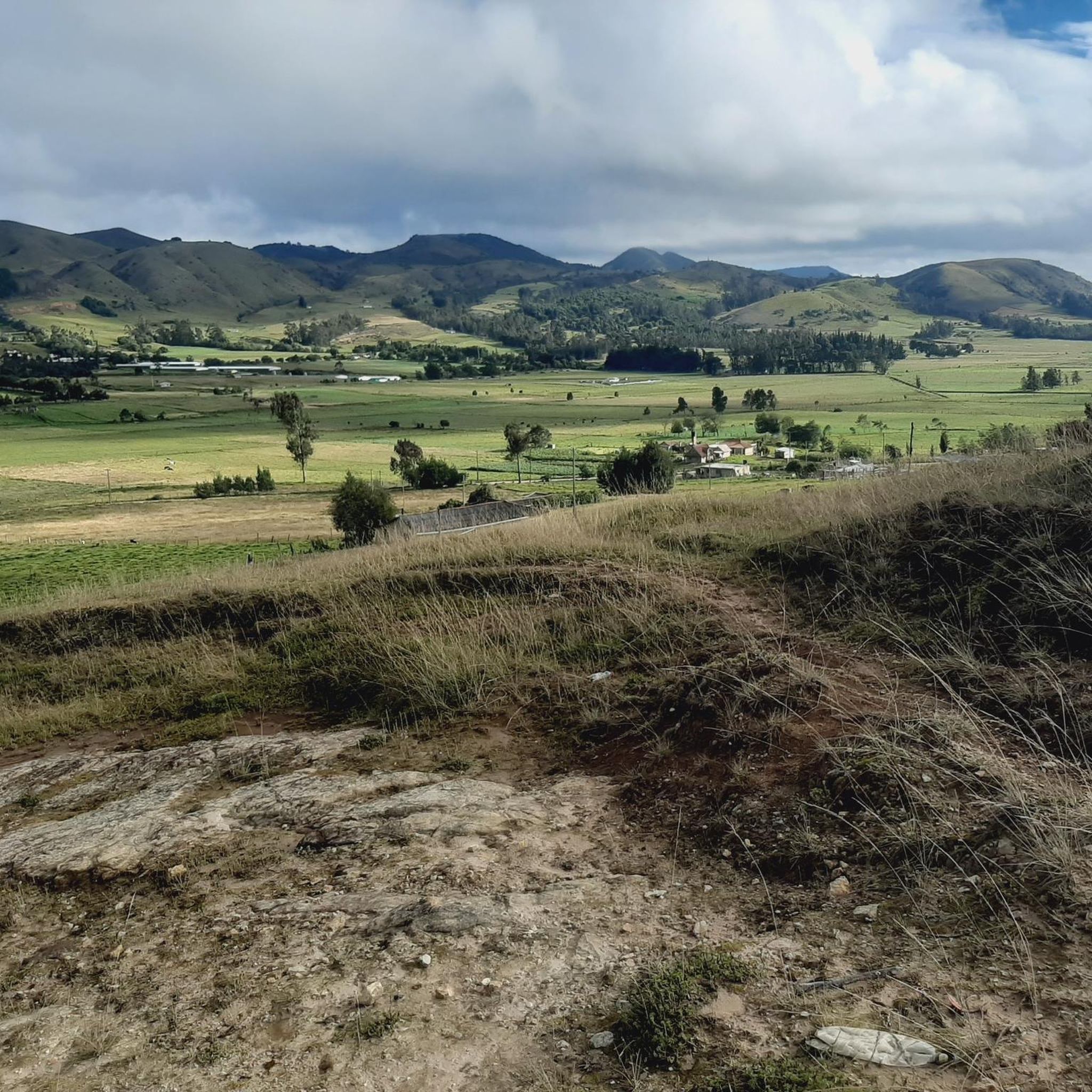
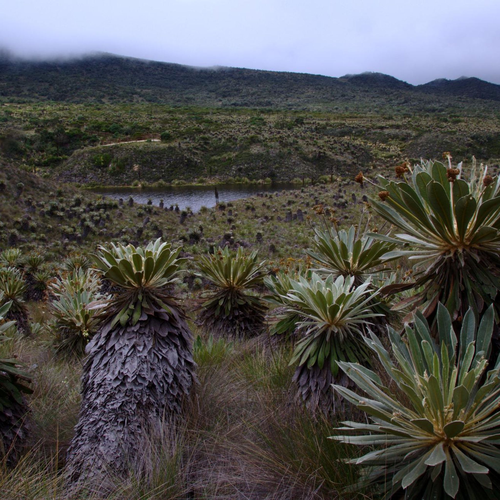
Road cycling routes in Villapinzón are characterized by the challenging topography of the Cundiboyacense Altiplano, offering significant elevation gains. The region features expansive green vistas and mountainous backdrops, ideal for demanding ascents. Cyclists will encounter varied terrain, including routes that pass by natural landmarks such as the Páramo de Guacheneque and the Represa del Sisga.
Best road cycling routes in Villapinzón
- The most popular road cycling route is View of the Sisga Reservoir – Machetá Town Sign loop from Villapinzón…
Last updated: July 7, 2026
5.0
(1)
39
riders
87.7km
04:45
1,530m
1,530m
Hard road ride. Very good fitness required. Some segments of this route may be unpaved and difficult to ride.
37
riders
91.4km
04:27
1,360m
1,360m
Hard road ride. Very good fitness required. Mostly well-paved surfaces and easy to ride.

Sign up for free
5.0
(1)
26
riders
78.8km
04:43
1,940m
1,940m
Hard road ride. Very good fitness required. Mostly well-paved surfaces and easy to ride.
31
riders
115km
06:21
2,200m
2,200m
Hard road ride. Very good fitness required. Some segments of this route may be unpaved and difficult to ride.
5.0
(2)
5
riders
66.9km
03:41
1,230m
1,230m
Hard road ride. Very good fitness required. Some segments of this route may be unpaved and difficult to ride.
Our route recommendations are based on thousands of hikes, rides, and runs completed by other people on komoot.
Start today with a free account
Your next adventure awaits.
Login or Signup
Popular around Villapinzón
Tips from the Community

good way by the berm, calmly, no problem. I suggest not using headphones on the highway, to be aware of the trucks and buses that come.
0
0
A place of passage, the store and the restaurant seem a bit expensive to me. Just for reference point, 5 photos and on.
0
0
Be careful with the trucks, because the road from the dual carriageway is narrow and in fair condition. Beautiful landscapes
0
0

crossing from pte de Boyacá to Samacá, a different tone within the landscape is easy to see, the mountains and the proximity to Villa de Leyva begin to be noticed, yellow and reddish tones, sandstone and cliffs..
0
0
One of the many swings on Route 55, Vetaquemada famous for its arepas and chorizos
0
0
Emblematic tourist site where one of the battles of Simón Bolívar was fought. You have to go down and visit it, free to the public.
0
0
Very good quality pavement, verma and food sectors all along the way.
0
0
Good ascent, very comfortable, on the trip to Villa de Leyva. Be careful on the descent towards Sámaca, sometimes with dense fog, always wear good front and rear lights.
0
0
Frequently Asked Questions
What kind of road cycling experience can I expect in Villapinzón?
Villapinzón offers a challenging road cycling experience, characterized by its high altitude (over 2,700 meters above sea level) and demanding ascents. The region's topography, part of the Cundiboyacense Altiplano, provides significant elevation gains and a consistently cool climate, ideal for improving performance on technically demanding routes. You'll find expansive green vistas and mountainous backdrops throughout your ride.
Are there any easy or moderate road cycling routes in Villapinzón?
The road cycling routes in Villapinzón are primarily designed for experienced cyclists seeking demanding challenges. All available routes are rated as difficult, featuring significant elevation gains and distances. For example, the Puente de Boyacá – La Cumbre Ascent via Sámaca loop from Ventaquemada, while being one of the shorter difficult options at 66.9 km, still includes over 1,200 meters of climbing.
What natural features or landmarks can I see along the road cycling routes?
Villapinzón's routes often pass by significant natural landmarks. You might encounter views of the Represa del Sisga, a notable reservoir, or experience the unique high-altitude páramo ecosystems. The region is also home to the Páramo de Guacheneque, the birthplace of the Bogotá River, and the distinctive Laguna del Mapa, known for its map-like shape. While not directly on all cycling routes, these natural wonders define the area's landscape.
What is the best time of year to go road cycling in Villapinzón?
Given Villapinzón's high altitude and consistently cool climate, road cycling is generally possible year-round. However, it's always advisable to check local weather forecasts, as mountain weather can be unpredictable. The challenging altimetry means you should be prepared for cooler temperatures, especially on descents or during early morning rides.
Are there any circular road cycling routes available?
Yes, many of the road cycling routes in Villapinzón are designed as loops, allowing you to start and finish in the same location. Examples include the challenging Alto de Ventaquemada – Alto La Parroquia loop from Chocontá, which covers 111.6 km with nearly 2,000 meters of climbing, or the Las Juntas Bridge loop from Machetá, a 79.4 km route through the Altiplano.
What do other road cyclists enjoy most about road cycling in Villapinzón?
The area is highly rated by the komoot community, with an average score of 5.0 stars from over 4 reviews. Cyclists often praise the challenging ascents, the stunning panoramic views over the Cundiboyacense Altiplano, and the opportunity to test their endurance in a high-altitude environment. The unique natural landscapes, such as those around the Páramo de Guacheneque, also contribute to a memorable experience.
Are there any family-friendly road cycling options in Villapinzón?
Due to the region's challenging topography and the difficult rating of all available road cycling routes, Villapinzón is not typically recommended for family-friendly road cycling with young children or beginners. The routes feature significant distances and elevation gains, making them more suitable for experienced adult cyclists.
What kind of surface conditions can I expect on the road cycling routes?
The road cycling routes in Villapinzón are primarily on paved roads, suitable for race bikes. However, some rural areas might feature varying road conditions. While the region is known for its challenging altimetry, it's always good practice to be aware of potential changes in pavement quality, especially on less-trafficked roads.
Are there places to eat or stay near the road cycling routes in Villapinzón?
Villapinzón, as a municipality, offers local amenities including places to eat and stay. After a day of cycling, you can find local gastronomy with typical dishes like carne a la llanera or ají de papa sabanera. The town center, with its San Juan Bautista Church and old railway station, provides options for refreshments and accommodation. It's advisable to check specific locations and opening hours in advance.
What are the typical elevation gains on Villapinzón's road cycling routes?
Road cycling in Villapinzón is characterized by significant elevation gains. For instance, the View of the Sisga Reservoir – Machetá Town Sign loop from Villapinzón, a 115.4 km route, features over 2,200 meters of climbing. Even shorter difficult routes like the Puente de Boyacá – La Cumbre Ascent via Sámaca loop from Ventaquemada include over 1,200 meters of ascent, making them a true test of endurance.
Are there any specific viewpoints or scenic spots along the routes?
Yes, the Cundiboyacense Altiplano offers spectacular views from various points. While specific viewpoints may vary by route, the region is known for its expansive green and mountainous vistas. The Mirador de la Princesa, featuring a giant sculpture, is a notable viewpoint in the area, capitalizing on these exuberant landscapes and providing impressive panoramic views.
Most popular routes in Villapinzón

Get inspired with the komoot mobile app


Explore more
Browse the best Road cycling routes in other regions.
