The best gravel rides around Area I (Youbou / Meade Creek)
5.0
(3)
62
riders
4
rides
Gravel biking around Area I (Youbou / Meade Creek) offers diverse terrain, including wide, compacted old railway beds and maintained gravel logging roads. The region is characterized by the expansive Lake Cowichan, the picturesque Cowichan River, and extensive forested areas, with Bald Mountain providing panoramic views. This mix of landscapes provides varied surfaces suitable for gravel bikes, from flat, accessible routes to more challenging excursions through varied elevations. The area's natural features create a compelling backdrop for outdoor activities.
Best…
Last updated: November 12, 2026
5.0
(1)
23
riders
55.8km
03:49
500m
500m
Hard gravel ride. Very good fitness required. Mostly paved surfaces.
14
riders
100km
08:17
1,280m
1,280m
Hard gravel ride. Very good fitness required. Mostly paved surfaces.

5.0
(1)
6
riders
31.7km
01:51
230m
230m
Moderate gravel ride. Good fitness required. Mostly paved surfaces.
5.0
(1)
13
riders
Hard gravel ride. Very good fitness required. Mostly paved surfaces.
6
riders
91.7km
06:12
970m
970m
Hard gravel ride. Very good fitness required. Mostly paved surfaces.
Our route recommendations are based on thousands of hikes, rides, and runs completed by other people on komoot.
Start today with a free account
Your next adventure awaits.
Popular around Area I (Youbou / Meade Creek)
Tips from the Community

Great rest stop with drinking water, flush toilets and sheltered tables.
0
0

This section of the Cowichan Valley Trail runs between Waters Road and Mountain Park, following the former railway corridor through the Cowichan Valley. It’s a beautiful, mostly flat route that passes through forest and rural surroundings, with plenty of access to several parks and waterways along the way.
0
0

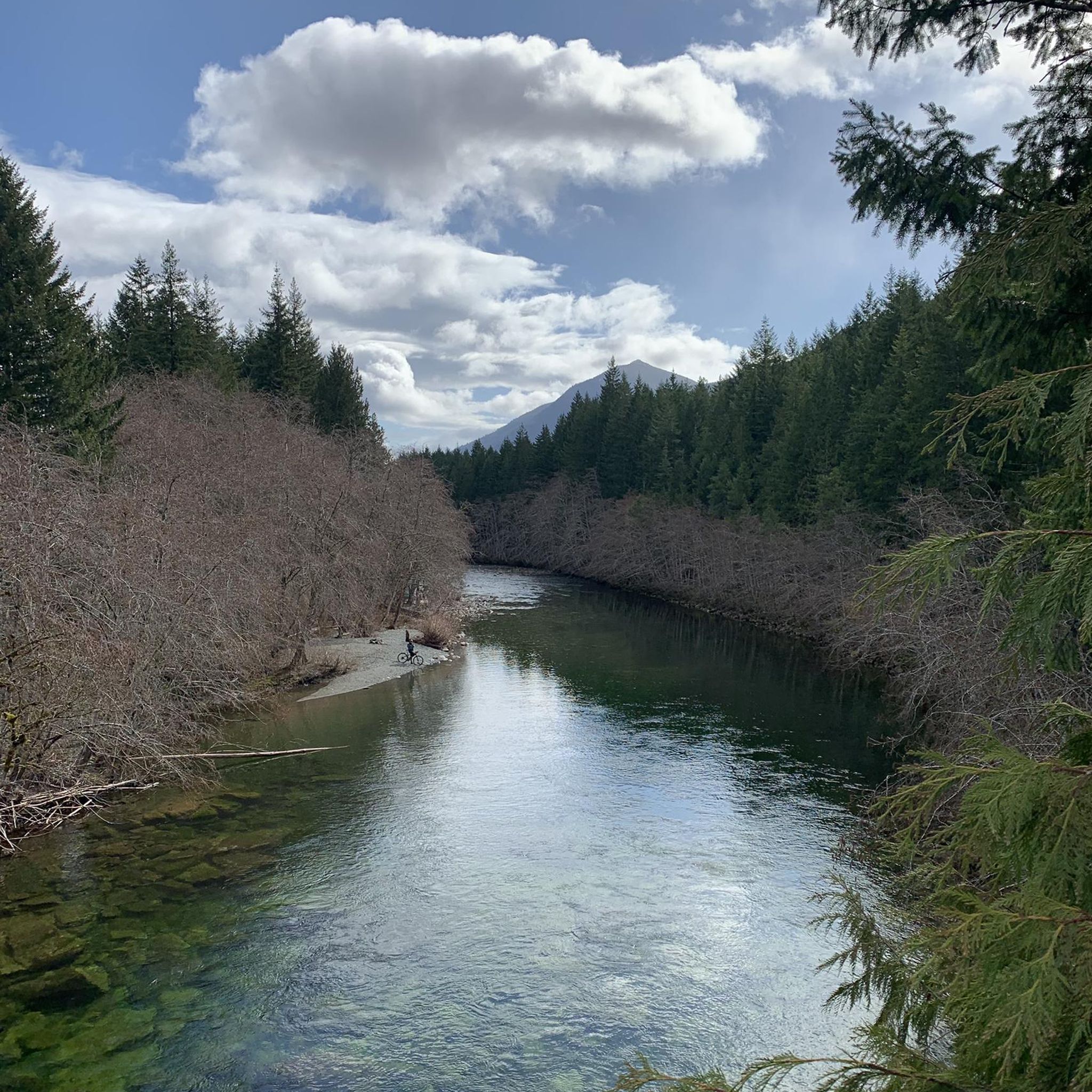
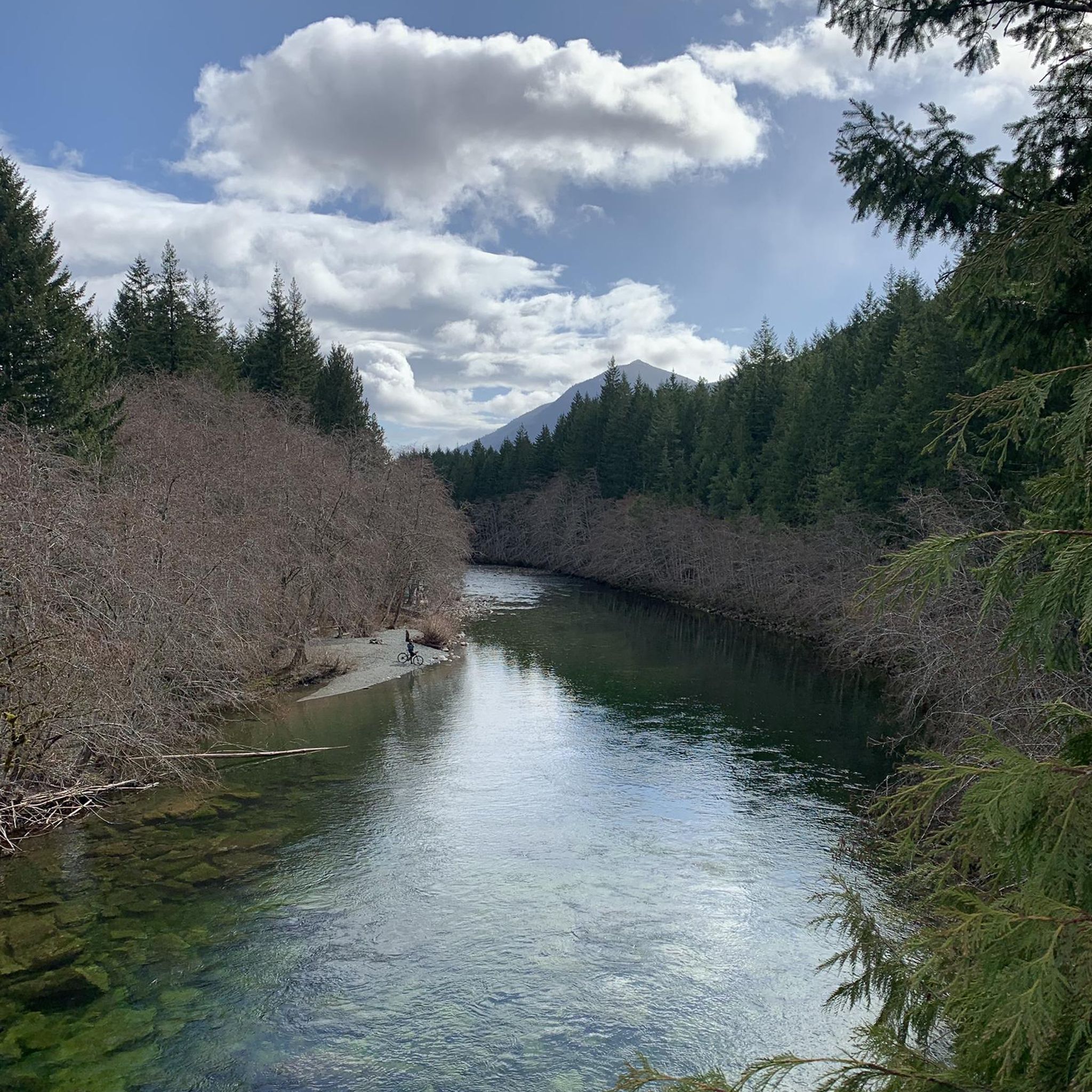
The Greendale Trestle Bridge was once part of the Canadian Pacific Railway, and has now been converted into a pedestrian and cyclist footbridge, part of the Cowichan Valley Trail and Trans Canada Trail. Beneath the bridge is crystal-clear water. In summer, the water is dotted with colourful inner tubes. In the autumn, it's a great vantage point to peer down and watch salmon spawning in the Cowichan River gravels.
0
0
The Cowichan Valley Trail, which spans 122 kilometres, is divided into a handful of sections. The Malahat to Shawnigan Lake stretching 19 kilometres, Shawnigan Lake to Duncan spanning 25 kilometres, and the Duncan to Lake Cowichan section coming in the longest, 28 kilometres. There are also the northern extensions of the trail, Duncan to Chemainus, and then Chemainus to Saltair. This is the Duncan to Lake Cowichan segment which follows the 1913 CN railway grade up to the Trans Canada Trail western terminus. It passes through Cowichan River Provincial Park, crosses the Holt Creek and Marie Canyon trestles. The surface of the trail is made up of mostly hard-packed crushed gravel, rather than pavement or loose dirt. The trail is also pretty wide and flat since it's a rail trail.
0
0
This is one of two Trans Canada Trail Western Terminus. This one, in the town of Lake Cowichan, is the westernmost physical point of the contiguous Trans Canada Trail network. There is a designated monument and pavilion marking the spot right across from the local visitor centre. The other Western Terminus is in Clover Point. This spot is also a sharp turn on the Cowichan Valley Trail, which spans 122 kilometres. This is about the halfway point and the trail turns from heading east to back west again. The town of Lake Cowichan has restaurants, hotels and is a recreation hub for bikers, walkers, and runners using its trails and boaters and kayakers on the lakes water.
0
0

You can park along the gated R Branch logging road near Little Shaw Campsite on the north side of Cowichan Lake before continuing up the forestry road network toward Heather Mountain. Parking is informal with no facilities, and access conditions can change depending on active logging operations, washouts and gate closures along the surrounding roads.
0
0

Information about the Kinsol Trestle can be found on the Cowichan Valley Regional District (CVRD) website, including a fact sheet on its history and a brochure. https://www.cvrd.ca/1379/Kinsol-Trestle
2
0
This trestle was closed for repair until recently, but is now open. Trail widening and surfacing was also done near the trestle.
0
0
Frequently Asked Questions
What kind of gravel biking experiences can I expect in Area I (Youbou / Meade Creek)?
Area I (Youbou / Meade Creek) offers a diverse range of gravel biking experiences, from wide, compacted old railway beds like sections of the Cowichan Valley Trail to more challenging gravel logging roads. You'll find routes with scenic lake views, paths alongside the Cowichan River, and rides through dense forests, often with panoramic mountain outlooks. The terrain varies, providing options for different skill levels.
Are there any family-friendly gravel biking options in Area I (Youbou / Meade Creek)?
Yes, the region offers sections suitable for families. The 66 Mile Trestle – Holt Creek Trestle loop from Lake Cowichan, while rated difficult overall due to its length (55.8 km), utilizes old railway beds which are generally wide and compacted, making parts of it accessible for a more relaxed ride. The Cowichan Valley Trail, which forms part of many routes, is known for its flat, accessible nature.
What are some notable natural attractions I can see while gravel biking in this area?
While gravel biking in Area I (Youbou / Meade Creek), you'll encounter stunning natural features. The expansive Lake Cowichan is a prominent feature, offering beautiful views. The picturesque Cowichan River is also a highlight, and you might even find a swimming spot and wild campsite at the river. For panoramic vistas, routes near Bald Mountains First Summit provide breathtaking views of the lake and surrounding areas.
Are there any long-distance or challenging gravel routes for experienced riders?
Absolutely. For experienced riders seeking a challenge, the Lake Cowichan – Lake Cowichan loop from Lake Cowichan is a difficult 100.3 km path that circumnavigates the lake, offering extensive views and varied terrain. Another demanding option is the Cowichan Valley Trail – Kinsol Trestle loop from Gordon Bay Provincial Park, a 110.1 km trail through forested areas and along the Cowichan Valley Trail.
Can I find any shorter or moderate gravel bike trails in Area I (Youbou / Meade Creek)?
Yes, for a moderate option, consider the Lake Cowichan – 66 Mile Trestle loop from Skutz Falls. This route is 31.7 km long and offers a less strenuous ride compared to the longer loops, while still allowing you to experience the area's gravel paths and scenery.
What is the best time of year for gravel biking in Area I (Youbou / Meade Creek)?
The warmer months are generally ideal for gravel biking in Area I (Youbou / Meade Creek), particularly for enjoying features like the Cowichan River's tubing opportunities and lake activities. However, the diverse terrain, including maintained gravel logging roads, can offer enjoyable riding in spring and fall as well, with cooler temperatures and vibrant foliage. Always check local conditions before heading out.
Are there any circular gravel bike routes available?
Yes, many of the gravel routes in Area I (Youbou / Meade Creek) are designed as loops. For example, the 66 Mile Trestle – Holt Creek Trestle loop from Lake Cowichan and the extensive Lake Cowichan – Lake Cowichan loop from Lake Cowichan are both excellent circular options, allowing you to start and end at the same point without retracing your path.
What do other gravel bikers say about the trails in Area I (Youbou / Meade Creek)?
The gravel biking routes in Area I (Youbou / Meade Creek) are highly regarded by the komoot community, holding an average score of 5.0 stars from over 4 reviews. Riders often praise the varied terrain, from historic railway beds to challenging logging roads, and the stunning natural backdrops of Lake Cowichan and the surrounding forests.
Is there parking available for gravel bikers in the Area I (Youbou / Meade Creek) region?
Yes, for routes like the Cowichan Valley Trail – Kinsol Trestle loop, you can often find parking at starting points such as Gordon Bay Provincial Park. For other routes around Lake Cowichan, look for public access points or designated parking areas near trailheads, especially in towns like Youbou or Lake Cowichan itself.
Are there opportunities to combine gravel biking with other outdoor activities?
Absolutely. The region is rich in outdoor activities. Lake Cowichan offers opportunities for swimming, boating, fishing, canoeing, and kayaking. The Cowichan River is popular for tubing in warmer months. Additionally, numerous hiking trails, such as those on Bald Mountain, provide options for exploring on foot. Camping facilities are also available at sites like Heather Campsite and Pine Point Recreation Site for multi-day adventures.
What kind of terrain can I expect on the gravel logging roads in Area I (Youbou / Meade Creek)?
The gravel logging roads in Area I (Youbou / Meade Creek) offer a varied experience. West of Youbou, these roads extend towards areas like Nitinat Lake and Bamfield. Their condition can vary depending on recent logging activity, ranging from well-maintained to more rugged sections. They often feature ascents and descents, providing a more challenging ride than the flatter railway beds, and lead through dense forested areas.
Most popular routes around Area I (Youbou / Meade Creek)
Most popular attractions around Area I (Youbou / Meade Creek)

Get inspired with the komoot mobile app


Explore more
Browse the best Gravel rides in other regions.
