The best running trails around Fonfría
5.0
(1)
26
runners
6
runs
Jogging routes around Fonfría traverse a mountainous landscape in Galicia, characterized by varied terrain and traditional stone architecture. The region features diverse topography, including rolling hills, ascents, and descents, providing engaging running experiences. Trails often lead through lush forested areas, offering natural shade and a verdant environment. Many paths are integrated with the historic Camino de Santiago, connecting small villages and showcasing the area's natural features.
Best jogging routes around Fonfría
- The most popular jogging route is The Rivera de los Molinos de Brandilanes — running circular from Castro de Alcañices, a 5.4 miles (8.6 km) trail that takes 1 hour 4 minutes to complete. This moderate route features gentle elevation changes through rural landscapes.
- Another top favourite among local runners is Pino de Oro Village – Pino del Oro loop from Pino del Oro, a moderate 8.6 miles (13.9 km) path. This route offers a mix of forest trails and country roads, with some more significant climbs.
- Local runners also love the Running loop from Samir de los Caños, a 5.1 miles (8.2 km) trail leading through varied terrain with rolling hills, often completed in about 1 hour.
- Jogging around Fonfría is defined by mountainous surroundings, forested paths, and rolling hills. The network offers options for different ability levels, with all routes currently rated as moderate.
- The guide includes highly-rated routes that showcase the best of the region's landscape. More than 20 runners have used komoot to explore Fonfría's varied terrain.
Last updated: July 13, 2026
2
runners
Moderate run. Good fitness required. Mostly paved surfaces. Suitable for all skill levels.
5.0
(1)
10
runners
12.8km
01:36
200m
200m
Moderate run. Good fitness required. Mostly paved surfaces. Suitable for all skill levels.

Sign up for free
4
runners
8.20km
01:00
90m
90m
Moderate run. Good fitness required. Mostly paved surfaces. Suitable for all skill levels.
4
runners
8.25km
01:01
120m
120m
Moderate run. Good fitness required. Mostly paved surfaces. Suitable for all skill levels.
4
runners
9.62km
01:15
210m
210m
Moderate run. Good fitness required. Mostly paved surfaces. Suitable for all skill levels.
Our route recommendations are based on thousands of hikes, rides, and runs completed by other people on komoot.
Start today with a free account
Your next adventure awaits.
Login or Signup
Tips from the Community

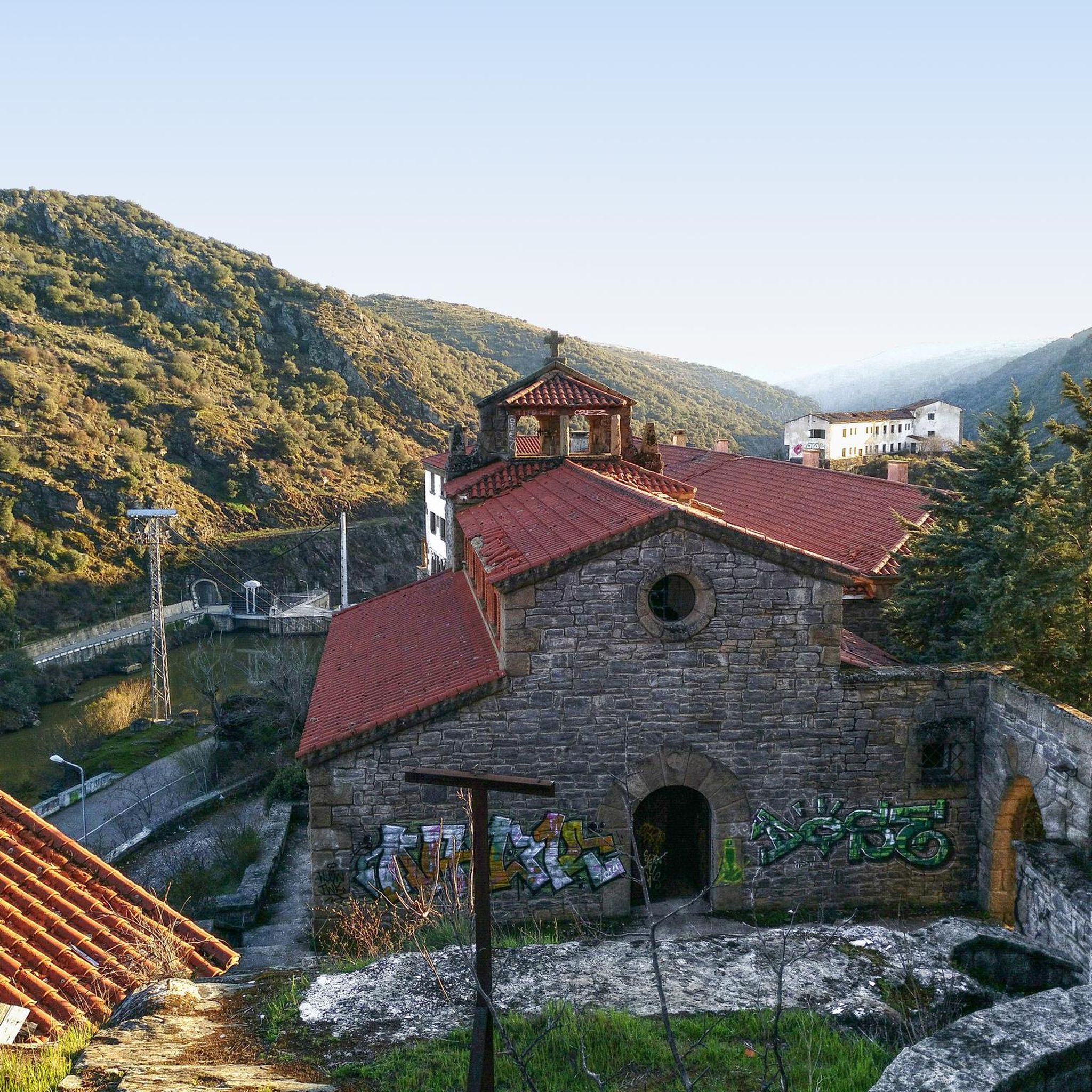
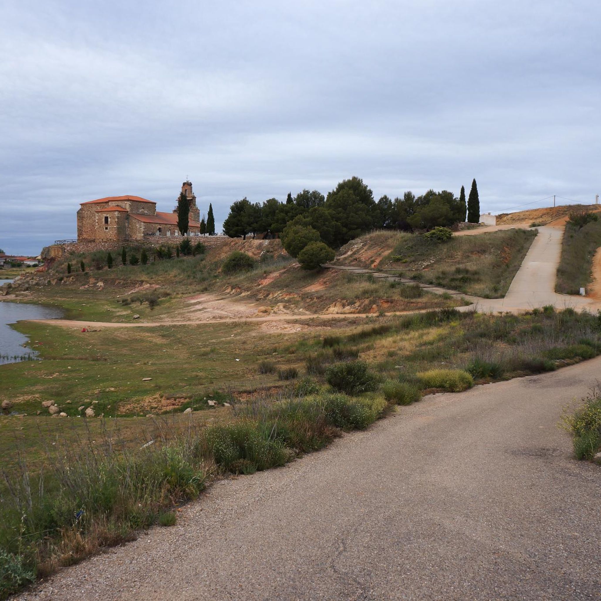
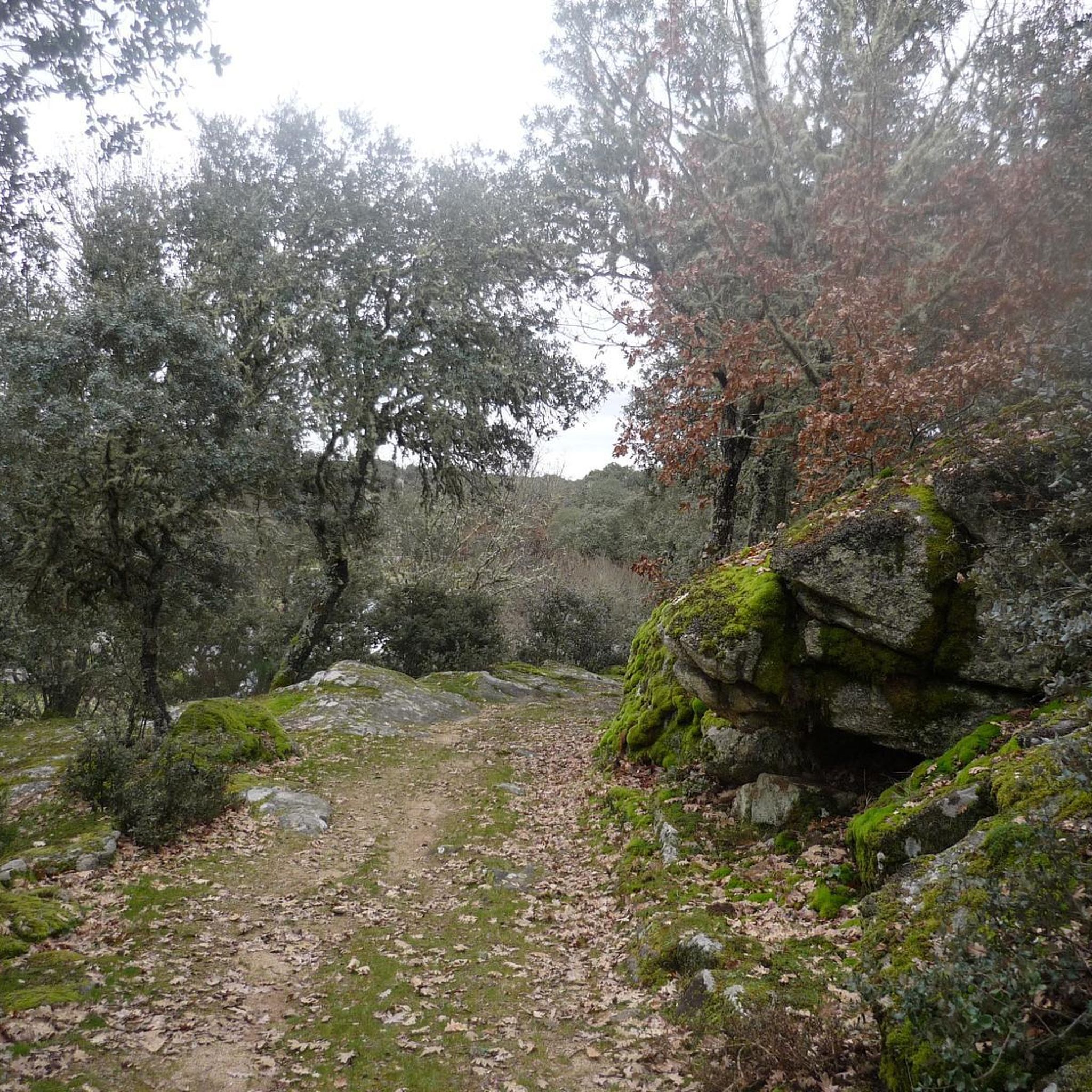
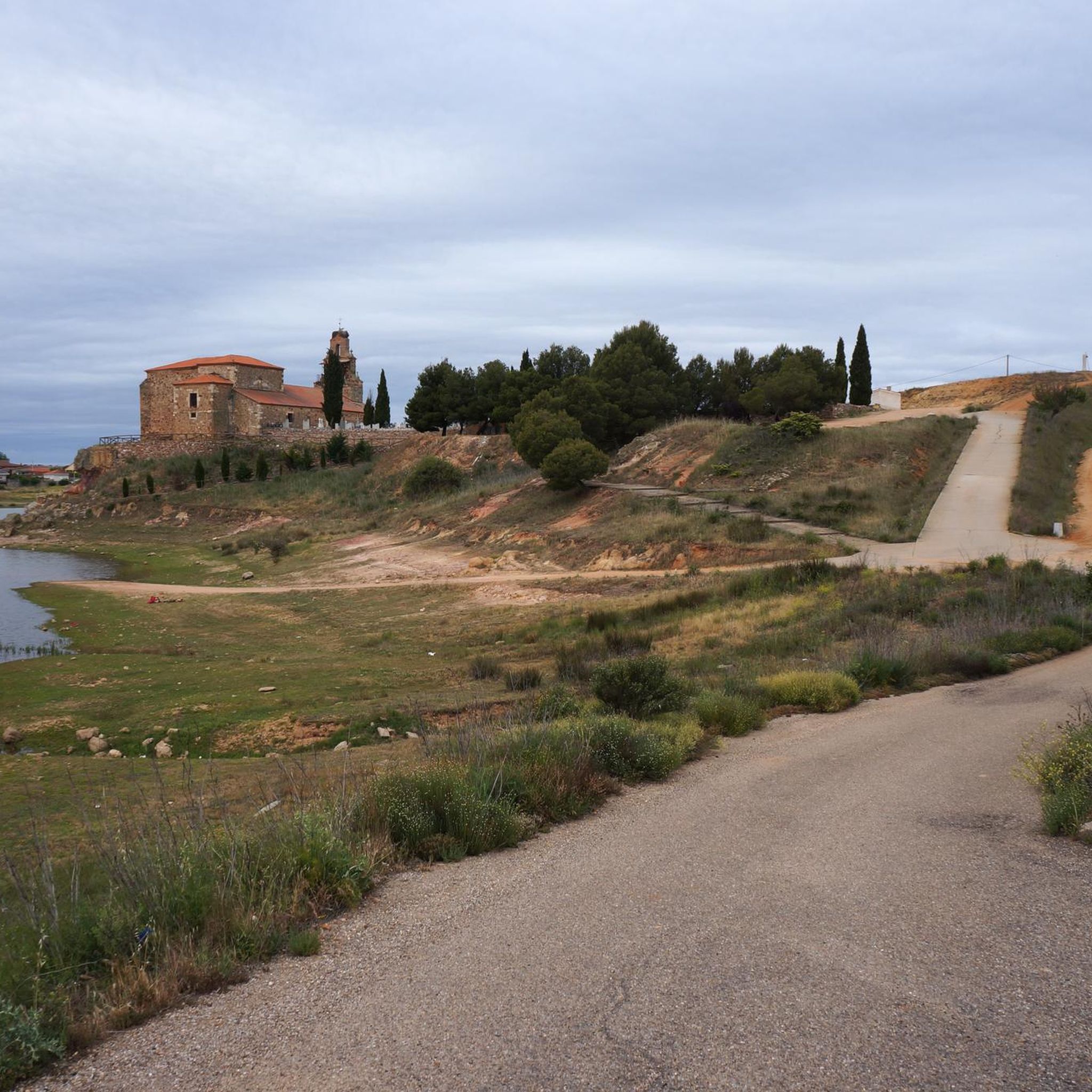
Peña el Pingón is a prominent natural landmark on the hiking trails of Alcañices. Located in a spectacular setting, it is one of the most highly recommended spots by both local and visiting hikers. At the base of Peña el Pingón, or in its immediate vicinity, lies a cave, seamlessly integrated into the surrounding rocky landscape. It adds to the area's charm and is a popular stopping point on hiking routes.
2
0
The La Ribera Stream Bridge in Fonfría is a picturesque spot perfect for hiking and nature lovers. It's a stone bridge that allows you to cross the La Ribera Stream. The area offers several scenic trails to enjoy the nature and scenery.
5
0
The Molino de los Carbajos is an old mill located in the Aliste region, near Fonfría, in the province of Zamora. This mill is a popular point of interest for hiking and nature lovers. It is located on a marked trail that runs from Brandilanes to Castro, following the white and yellow signs. The Molino de los Carbajos is perfect for a short excursion and to enjoy the natural beauty of Aliste.
5
0
The Molino de los Tejeros is located on the hiking route that goes from Castro de Alcañices to Brandilanes, in the Aliste region, Zamora. This route, known as the Rivera de los Molinos, is famous for its natural beauty and its ethnological heritage, since along the route you can see several old water mills.
8
0
The urban center of Pino del Oro preserves samples of its traditional stone architecture, its main building being the parish church of San Juan Bautista. Furthermore, along the Fuentelarraya stream, there is an old mining area with numerous structures for extracting and handling minerals to obtain gold, built by the Romans around the 1st and 2nd centuries AD.
2
0

Small town located on the outskirts of the Arribes del Duero natural park and a good starting point for hiking through the viewpoints of the meanders of the Duero.
1
0

On the border with Portugal, Castro de Alcañices is a small historic town on the banks of the Duero River.
1
0
A small town in the Aliste region crossed by the Arribes del Duero Natural Park.
1
0
Frequently Asked Questions
What kind of terrain can I expect on running routes around Fonfría?
Running routes in Fonfría traverse a diverse, mountainous landscape typical of Galicia. You'll encounter varied topography, including rolling hills, ascents, and descents, providing an engaging experience. Many paths lead through lush forested areas with oak and chestnut trees, offering natural shade, while others follow country roads. The region's location on the Camino de Santiago means well-trodden paths are common.
Are there any easy or beginner-friendly running routes in Fonfría?
All the running routes currently featured in this guide for Fonfría are rated as moderate. While there aren't specific 'easy' routes, the varied terrain allows for different paces. For a route with more gentle elevation changes through rural landscapes, consider The Rivera de los Molinos de Brandilanes — running circular from Castro de Alcañices, which is about 5.4 miles (8.6 km) long.
What are some scenic highlights or viewpoints I can enjoy while running in Fonfría?
Fonfría's mountainous surroundings offer spectacular views. High points like Alto do Poio (1,337 meters) provide impressive vistas over valleys and mountains. Along the routes, you might encounter viewpoints such as São João das Arribas Viewpoint, View of the Douro Canyon, and Castrilhouço Viewpoint, which offer picturesque backdrops for your run.
Are there any natural features or landmarks to look out for on the running trails?
Yes, the region is rich in natural beauty. You'll often run through forests brimming with moss, ferns, and ancient trees. Fonfría is also known for its natural water spring, providing refreshing cold water year-round. Other notable natural features include the Cadozos Waterfall and the Fidionda Spring.
Are the running routes around Fonfría suitable for families?
The running routes in Fonfría are generally rated as moderate, featuring varied terrain and some elevation changes. While there aren't specific 'family-friendly' designations, routes like The Rivera de los Molinos de Brandilanes — running circular from Castro de Alcañices offer more gentle elevation and might be suitable for active families. Always consider the fitness level of all participants before choosing a route.
Can I bring my dog on the running trails in Fonfría?
Many of the trails around Fonfría, especially those integrated with the Camino de Santiago and through forested areas, are generally dog-friendly. However, it's always advisable to keep your dog on a leash, especially when passing through villages, near livestock, or on busier sections of the Camino. Please ensure you follow local regulations regarding pets.
Are there any circular running routes available?
Yes, several circular running routes are available. For example, you can explore The Rivera de los Molinos de Brandilanes — running circular from Castro de Alcañices, a 5.4-mile loop, or the Running loop from Samir de los Caños, which covers about 5.1 miles (8.2 km).
Where can I find parking for the running routes in Fonfría?
As Fonfría is a small town and a stop on the Camino de Santiago, parking is typically available in or near the village center. For routes starting from specific villages, such as Pino de Oro Village – Pino del Oro loop from Pino del Oro, you would generally find parking facilities within those villages. It's recommended to check local signage upon arrival.
Are there cafes or pubs near the running routes in Fonfría?
Given Fonfría's location on the Camino de Santiago, you'll find albergues, cafes, and bars along the Camino paths and within the villages. These establishments provide opportunities for rest and refreshment during or after your run. Specific locations will depend on your chosen route, but options are generally available in the main settlements.
What do other runners say about jogging in Fonfría?
The komoot community highly rates the running experience in Fonfría, with an average score of 5.0 stars. Runners often praise the region's beautiful mountain scenery, the varied terrain that offers a good challenge, and the immersive experience of running through lush forests and along historic Camino paths.
How many running routes are available in this guide for Fonfría?
This guide features 5 distinct running routes around Fonfría, all of which are rated as moderate difficulty. These routes showcase the best of the region's diverse landscape and provide engaging experiences for runners.
Most popular attractions around Fonfría

Get inspired with the komoot mobile app


Explore more
Browse the best Running Trails & Routes in other regions.
