The best cycling routes around Gotarrendura
5.0
(1)
28
riders
8
rides
Touring cycling around Gotarrendura is characterized by the flat, open cereal fields of the La Moraña region, providing expansive vistas and gentle inclines suitable for relaxed rides. The area is strategically located on the Camino de Santiago del Sudeste, offering routes with historical significance. While the immediate surroundings are largely agricultural, the broader Ávila province, accessible from Gotarrendura, presents diverse landscapes including river valleys and the more challenging terrains of the Sierra de Gredos.
Best touring cycling routes around Gotarrendura
…Last updated: August 30, 2026
9
riders
45.1km
04:12
500m
500m
Hard bike ride. Very good fitness required. Mostly paved surfaces. Suitable for all skill levels.
3
riders
32.6km
02:28
200m
200m
Moderate bike ride. Good fitness required. Mostly paved surfaces. Suitable for all skill levels.

Sign up for free
3
riders
34.6km
02:41
400m
400m
Moderate bike ride. Good fitness required. Mostly paved surfaces. Suitable for all skill levels.
4
riders
27.0km
02:03
220m
220m
Moderate bike ride. Good fitness required. Mostly paved surfaces. Suitable for all skill levels.
2
riders
17.4km
01:18
160m
160m
Moderate bike ride. Good fitness required. Mostly paved surfaces. Suitable for all skill levels.
Get access to more routes and recommendations from other explorers.
Sign up for free
Already have an account?
Our route recommendations are based on thousands of hikes, rides, and runs completed by other people on komoot.
Start today with a free account
Your next adventure awaits.
Login or Signup
Popular around Gotarrendura

Tips from the Community

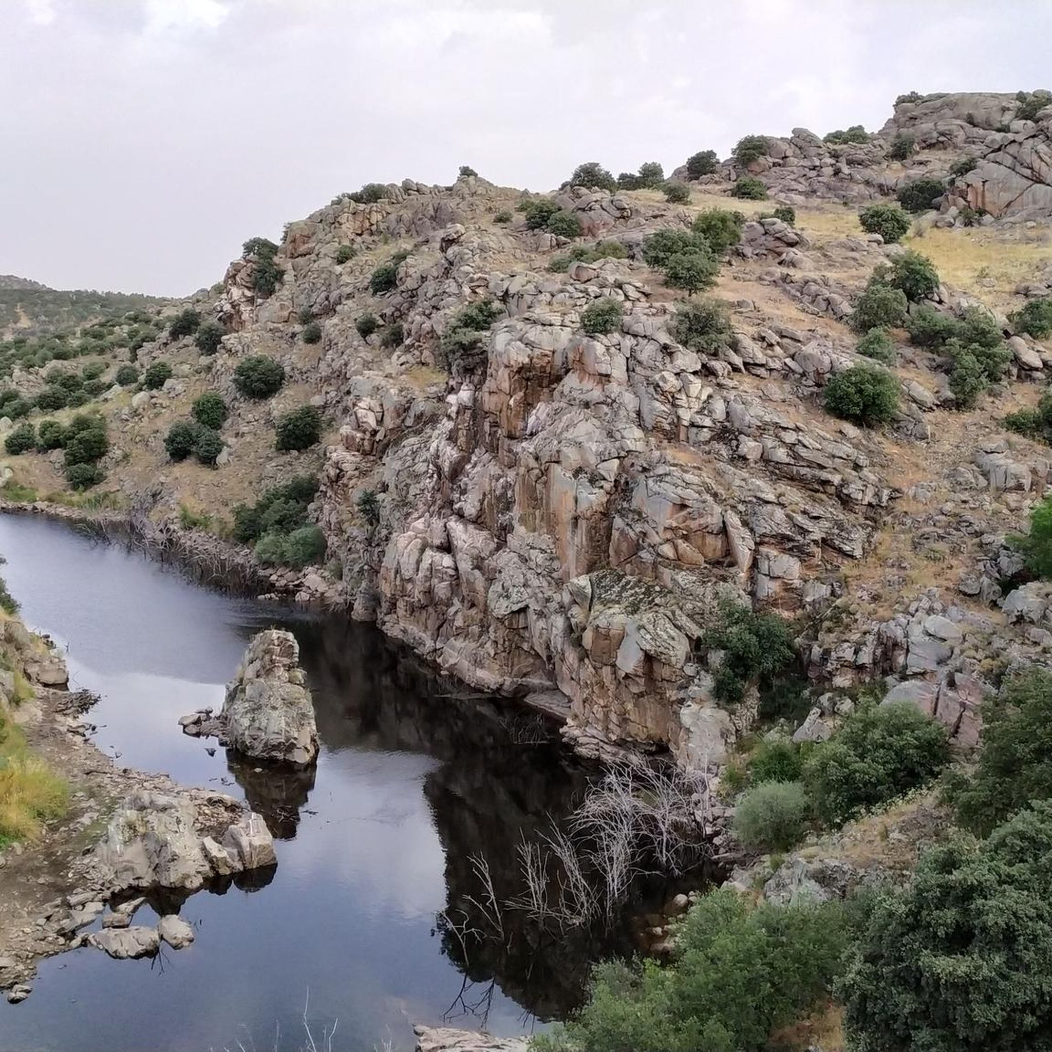
The Castro de Las Cogotas, located in the municipality of Cardeñosa (Ávila), is one of the most emblematic Iron Age archaeological sites on the Iberian Peninsula, especially linked to the Vetton people. It is situated on a hill next to the Adaja River, surrounded by holm oak groves, pastures, and fertile land. This location offered defensive advantages and abundant natural resources. The fort is open to the public and has an Interpretation Center that explains its history and characteristics. Periodic archaeological conferences are also held on the site.
2
0
Aveinte, a name with historical roots, has a fascinating legend dating back to ancient times. Many centuries ago, at the dawn of the Middle Ages, there was a small town in what we know today as Aveinte. The inhabitants of this place were simple people, dedicated mainly to agriculture and livestock. They lived in harmony with nature and worshiped the gods of the earth and sky. One day, during a time of drought and scarcity, the locals gathered in the town square to pray for rain and good harvests. The wise old man of the place, known as Adventius, led the ceremony. With his wrinkled hands and deep voice, he spoke words of supplication to heaven. Legend has it that, at that crucial moment, a mysterious figure appeared among the clouds. He was a luminous being, dressed in white robes and silver hair. The villagers were amazed and knelt before this heavenly presence. The being addressed Adventius and spoke to him in an ancient language that only he understood. “For your devotion and the faith of your people, I will grant a blessing,” he said. “From now on, every twenty years, the waters of the river that runs through Aveinte will overflow, fertilizing the land and ensuring abundant harvests.” Thus the name Aveinte was born, which means “advent” or “arrival” in honor of the heavenly visit. Since then, every twenty years, the river overflows and renews the earth, fulfilling the promise of the luminous being. The inhabitants of Aveinte keep this tradition alive and celebrate “Aveinte” with joy and gratitude. The legend has been passed down from generation to generation, and the town's name remains a reminder of its connection to the divine and renewed hope. So, when you walk through the cobblestone streets of Aveinte, remember this story and the magic that surrounds its name. 🌟🏡
2
0
The place name Mingorría retains Basque reminiscences, deriving from “mendi gorria,” which means “red mountain” or “red land.” This is observed in other cases in the province of Ávila, such as the town of Mendigorría in Navarra. In historical documents, Mingorría already appears as Ningorría, and it is believed that there was an assimilation due to the change of the liquid initials “M” to “N.” Another legend attributes the name of Mingorría to the notice that José Chinchurreta gave to monarch Felipe II, justifying the delay in the supply of granite during the works of the Monastery of El Escorial.
4
0

Three stone crosses located on a rocky outcrop near the Ermita del Berrocal, on the outskirts of Cardeñosa.
1
0

Cardeñosa is the ideal place to stop along the way and have a drink to continue the route. Here is the Castro Interpretation Center
1
0

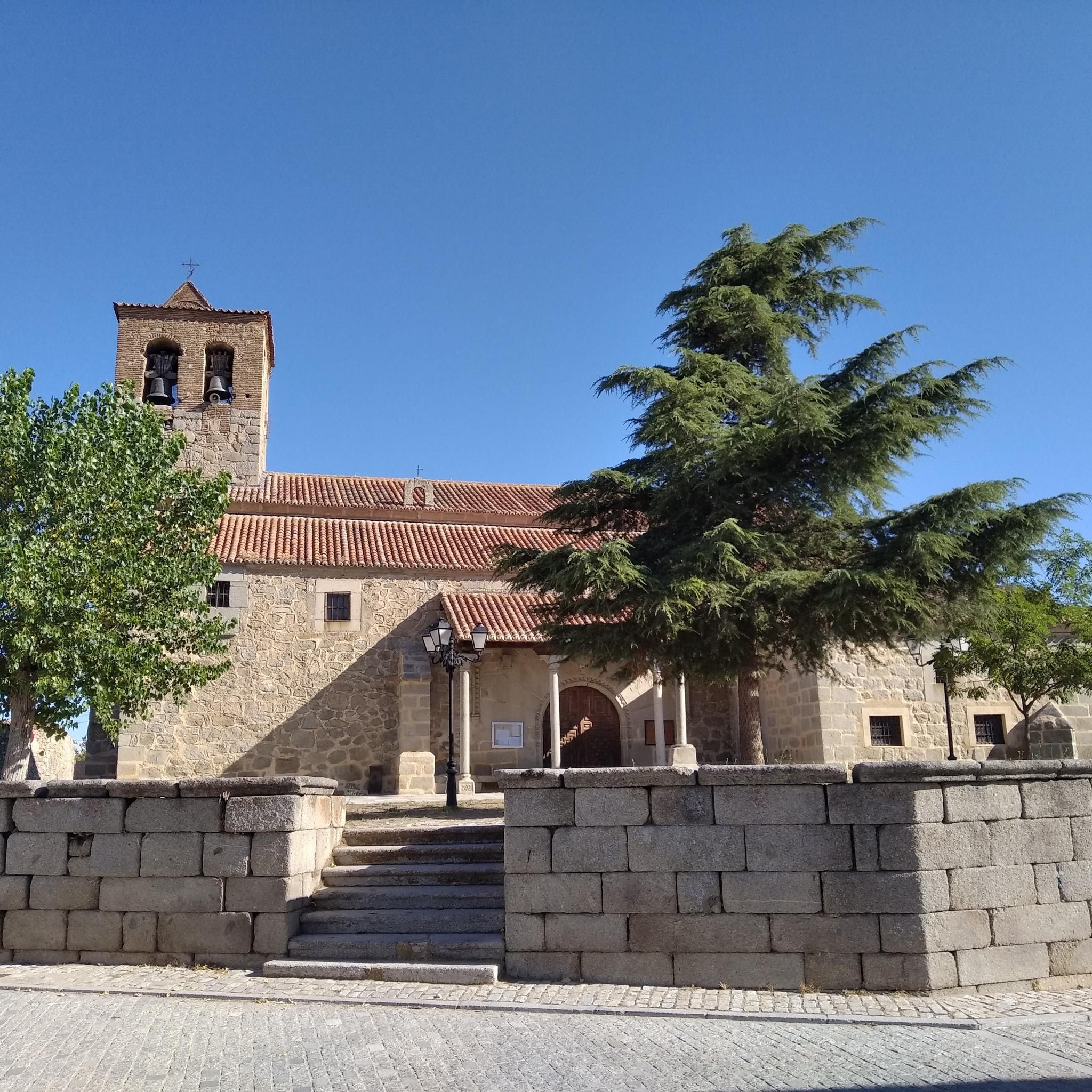
Small town located in a flat area between the cities between Ávila and Salamanca. Its church, that of Santo Tomas apostol, is one of the most important elements of the nucleus.
1
0
Nucleus that has a great history behind it not only because Las Cogotas is located closer to the reservoir but also, for example, the Arco toral of the depopulated Conejeros.
1
0
Las Cogotas is an ancient walled enclosure that is currently an important archaeological site located north of the city of Ávila and right next to the Embalse del Castro de Las Cogotas.
0
1
Frequently Asked Questions
What kind of terrain can I expect when touring cycling around Gotarrendura?
The immediate area around Gotarrendura, within the La Moraña region, is characterized by flat, open cereal fields, offering expansive vistas and gentle inclines ideal for relaxed touring cycling. However, the broader Ávila province, accessible from Gotarrendura, provides more diverse landscapes, including river valleys, dehesa landscapes with varied hills, and the rugged terrains of the Sierra de Gredos for those seeking more challenging rides.
Are there any historical or cultural landmarks to see along the touring cycling routes?
Yes, Gotarrendura is strategically located on the historical Camino de Santiago del Sudeste, which offers routes rich in cultural attractions like castles, monasteries, and churches. Locally, you can explore the 15th-century Iglesia de San Miguel Arcángel, the Museo López Berrón de Arte y Etnografía, and traditional adobe buildings. Some routes, like the Cardeñosa – Castro de Las Cogotas loop from Santo Domingo de las Posadas, pass by significant historical sites such as Castro de Las Cogotas.
What is the best time of year for touring cycling in the Gotarrendura region?
The region's generally flat topography and open fields make it enjoyable for touring cycling for much of the year. Spring and autumn typically offer pleasant temperatures and beautiful scenery. Summers can be hot, especially in the open cereal fields, so early morning or late afternoon rides are advisable. Winters are generally mild but can be chilly.
Are there any circular touring cycling routes available?
Yes, many of the touring cycling routes around Gotarrendura are designed as loops, allowing you to start and finish in the same location. Examples include the Bike loop from Santo Domingo de las Posadas, the Cardeñosa – Castro de Las Cogotas loop from Santo Domingo de las Posadas, and the Adaja River (dam) loop from Santo Domingo de las Posadas, all offering varied experiences of the local landscape.
What kind of natural features can I expect to see on a touring cycling trip?
The immediate surroundings of Gotarrendura are defined by vast, open cereal fields, providing a sense of tranquility and expansive vistas. You'll also find routes that follow river valleys, such as the Adaja River (dam) loop from Santo Domingo de las Posadas. Further afield in the Ávila province, you can encounter the dramatic peaks of the Sierra de Gredos and scenic dehesa landscapes with open woodlands.
Are there any routes suitable for families or beginners?
The flat and gentle inclines characteristic of the La Moraña region make many routes around Gotarrendura suitable for families and beginners looking for relaxed rides. The open cereal fields provide a safe and scenic environment for less experienced cyclists. All five routes in this guide are rated as moderate, but their relatively short distances and manageable elevation gains make them accessible for those with a basic level of fitness.
What are some of the villages or towns I might pass through on a touring cycling route?
When exploring the area, you might cycle through charming settlements that offer a glimpse into local life. Some routes pass near or through villages such as Cardeñosa, Aveinte, El Bohodón, and Mingorría. These offer opportunities to experience traditional architecture and local culture.
What is the typical difficulty level of touring cycling routes in Gotarrendura?
The touring cycling routes directly around Gotarrendura are generally considered moderate. They feature manageable distances and elevation gains, making them accessible to most cyclists with a reasonable level of fitness. For example, routes like the Sandy Dirt Road loop from Dehesa de Pancorbo cover around 33 km with moderate elevation changes.
Are there options for more challenging touring cycling in the wider Ávila province?
Absolutely. While Gotarrendura itself offers more relaxed rides, the broader Ávila province, particularly areas like the Sierra de Gredos Regional Park, provides significantly more challenging terrain. These areas feature rugged landscapes, varied hills, and routes that traverse parts of the Sistema Central mountain range, catering to experienced riders seeking demanding ascents and descents.
What kind of bikes are suitable for the routes around Gotarrendura?
Given the mix of flat, open fields and potential for rougher gravel paths, especially on sections of the Camino de Santiago, hybrid or mountain bikes are generally well-suited for touring cycling around Gotarrendura. Disc brakes are recommended for better performance and safety on diverse surfaces.
Are there any specific routes that offer a good balance of scenery and historical interest?
The Cardeñosa – Castro de Las Cogotas loop from Santo Domingo de las Posadas is an excellent choice, as it explores agricultural fields while also passing by historical sites like Castro de Las Cogotas. This route provides a good blend of the region's natural beauty and its rich past.
How long do the touring cycling routes typically take to complete?
The routes around Gotarrendura vary in length and duration. For instance, the Adaja River (dam) loop from Santo Domingo de las Posadas, at 27.0 km, can be completed in about 2 hours. Longer routes, such as the Sandy Dirt Road loop from Dehesa de Pancorbo (33.3 km), might take closer to 2 hours and 47 minutes, depending on your pace.
Most popular routes around Gotarrendura
Most popular attractions around Gotarrendura

Get inspired with the komoot mobile app


Explore more
Browse the best Cycling routes in other regions.
