The best walks and hikes around Gotarrendura
5
hikers
13
hikes
Hiking around Gotarrendura offers exploration within the vast, open plains of La Moraña in Ávila, Spain. The region is characterized by extensive cereal fields, providing long-distance views and a sense of tranquility. These flat, agricultural landscapes define the terrain, making it suitable for relaxed walks and appreciating the rural Spanish countryside. The area also features a traditional rural ambiance with historical routes.
Best hiking trails around Gotarrendura
- The most popular hiking route is Castro de las Cogotas Circular Trail,…
Last updated: May 20, 2026
4
hikers
11.9km
03:15
190m
190m
Hike a moderate 7.4-mile (11.9 km) circular route from Cardeñosa to the historic Castro de Las Cogotas with reservoir views.
16.2km
04:25
240m
240m
Moderate hike. Good fitness required. Mostly accessible paths. Sure-footedness required.

Sign up for free
8.98km
02:17
30m
30m
Hike the 5.6-mile Lagunas de La Moraña circular trail from El Oso, a moderate route through wetlands perfect for birdwatching.
23.4km
06:08
190m
190m
Hike the difficult 14.5-mile La Moraña abulense circular route from Rioacabado, exploring sandy plains, Mudejar architecture, and diverse bi
7.72km
02:07
120m
120m
Hike the Arco de Conejeros from Cardeñosa, a moderate 4.8-mile circular trail exploring ancient crosses and medieval ruins.
Get access to more routes and recommendations from other explorers.
Sign up for free
Already have an account?
Our route recommendations are based on thousands of hikes, rides, and runs completed by other people on komoot.
Start today with a free account
Your next adventure awaits.
Login or Signup
Popular around Gotarrendura


Tips from the Community

The Castro de Las Cogotas, located in the municipality of Cardeñosa (Ávila), is one of the most emblematic Iron Age archaeological sites on the Iberian Peninsula, especially linked to the Vetton people. It is situated on a hill next to the Adaja River, surrounded by holm oak groves, pastures, and fertile land. This location offered defensive advantages and abundant natural resources. The fort is open to the public and has an Interpretation Center that explains its history and characteristics. Periodic archaeological conferences are also held on the site.
2
0
Opened in 2017, the center offers a variety of educational and recreational activities, including guided tours, real-time bird watching via video cameras, and exhibits on local fauna and flora. The center also features dioramas, a screening room, and an observation deck, providing an immersive experience for visitors.
4
0
The museum allows visitors to explore the cultural and natural heritage of El Oso while enjoying a walk in the open air. It is a great way to learn more about the history and traditions of this small municipality in Ávila. 🌄😎🚶♂️
3
0
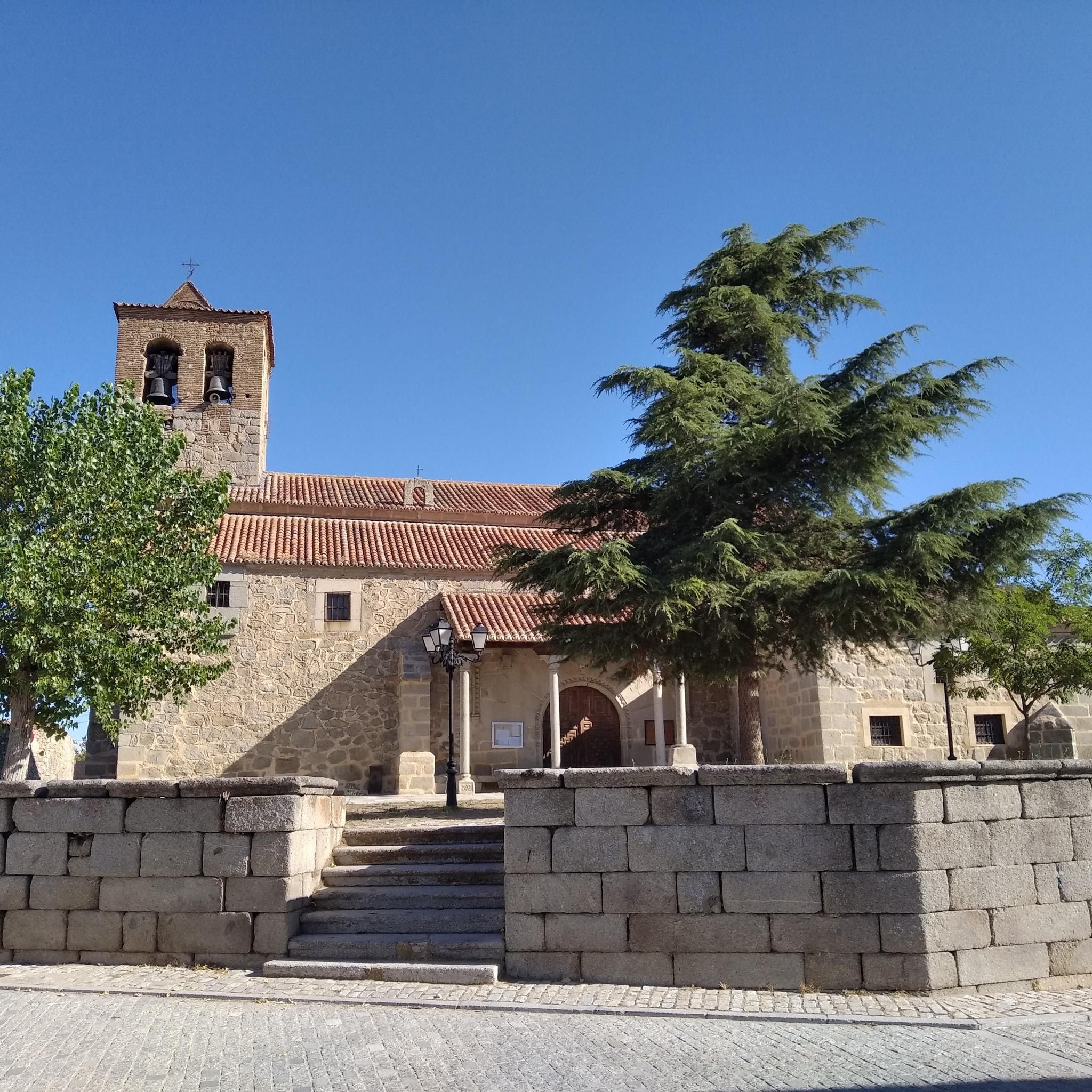
The Church of San Pedro Apóstol in El Oso, Ávila, is a parish church dating back to the 16th century. It stands out for its stone architecture, with three naves separated by large semicircular arches and a 17th-century Baroque main altarpiece. ⛪😎 In front of the church, there is the Stone Bear, also known as Verraco Vettón. This stone sculpture is part of the town's Open Air Museum and has great historical and cultural importance.🐻
4
0
Half a century ago, the Avila town of Las Berlanas suffered a catastrophe of hitherto unknown proportions. A flood devastated the municipality and one of its main surroundings, El Burgo, in addition to ending the lives of two people. To commemorate this tragic event, a monument has been erected that remembers the victims and the catastrophe, but also the efforts of the people of Berlin to improve themselves.
3
0

Three stone crosses located on a rocky outcrop near the Ermita del Berrocal, on the outskirts of Cardeñosa.
1
0
Along the way you reach the ruins of a medieval settlement, with building stones scattered on the ground of which only the main arch of a church remains standing.
2
0

Located inside the park, this monument, which was placed in 2009, commemorates the fiftieth anniversary of the flood that Las Berlanas suffered and which devastated part of this town, in which two people died and seventy families were left homeless.
1
0
Frequently Asked Questions
How many hiking trails are available around Gotarrendura?
There are over 10 hiking routes available around Gotarrendura, offering a range of options for exploring the open plains of La Moraña. These trails primarily feature moderate difficulty, with a few easier and more challenging options.
Are there any easy hiking trails suitable for beginners in Gotarrendura?
While most routes are moderate, there are some easier sections and paths that are suitable for beginners. The flat terrain of La Moraña generally offers relaxed walks. For example, the Cardeñosa and Arco de Conejeros Trail is a moderate route that is relatively shorter and can be a good starting point.
What kind of landscapes can I expect to see on a hike near Gotarrendura?
Hiking around Gotarrendura primarily takes you through the vast, open plains of La Moraña. You'll experience extensive cereal fields, offering long-distance views and a sense of tranquility. The area also features a traditional rural ambiance with charming adobe houses and historical routes like the Camino de Santiago del Sudeste.
Are there any circular hiking routes in the Gotarrendura area?
Yes, there are several circular routes available. A popular option is the Castro de las Cogotas Circular Trail, which is 7.4 miles (11.9 km) long and leads through open plains. Another well-liked choice is the Laguna de El Oso Loop, covering 5.6 miles (9.0 km) through flat terrain and rural scenery.
What is the best time of year to go hiking in Gotarrendura?
The best time for hiking in Gotarrendura is generally during spring and autumn when temperatures are milder. The open plains can be very exposed during the hot summer months, and while winter offers a different kind of beauty, it can be chilly. Spring brings blooming fields, and autumn offers pleasant walking conditions.
Are there any family-friendly hiking options around Gotarrendura?
The generally flat and open terrain of Gotarrendura makes many of its paths suitable for families. Routes like the Laguna de El Oso Loop are moderate in difficulty and offer manageable distances for a family outing, allowing everyone to enjoy the rural scenery.
Can I bring my dog on the hiking trails in Gotarrendura?
Yes, the open and rural nature of the trails around Gotarrendura generally makes them suitable for dog walking. Always ensure your dog is under control, especially when passing through agricultural areas or near livestock, and carry water for both yourself and your pet.
Are there any historical sites or attractions to see while hiking near Gotarrendura?
Yes, Gotarrendura is situated on the historic Camino de Santiago del Sudeste, offering a chance to walk a segment of this pilgrimage route. You can also explore sites like Castro de Las Cogotas, an ancient archaeological site, or the historic Palomar de Santa Teresa, which can be incorporated into local walks.
Where can I find parking for hiking trailheads in Gotarrendura?
As a rural village, parking is generally available within Gotarrendura itself, often near the village center or local amenities. For specific trailheads, it's advisable to check the route details on komoot, as many routes start and end in or near the village, or in nearby settlements like Cardeñosa.
What amenities are available in Gotarrendura for hikers?
Gotarrendura is a small rural village. While specific cafes, pubs, or restaurants might be limited, you can typically find basic amenities. For a wider range of services, including accommodation and dining, you might consider nearby larger towns in the Ávila province. The village itself offers a traditional charm.
What is the longest hiking route available near Gotarrendura?
One of the longer routes in the area is the Gotarrendura and El Oso Loop, which is a challenging 14.5 miles (23.4 km) trail. This route offers an extensive exploration of the local landscape, taking approximately 6 hours to complete.
Most popular routes around Gotarrendura
Most popular attractions around Gotarrendura

Get inspired with the komoot mobile app


Explore more
Browse the best Hikes in other regions.
