The best MTB trails in Reserva Geobotánica Pululahua
4.9
(11)
86
riders
4
rides
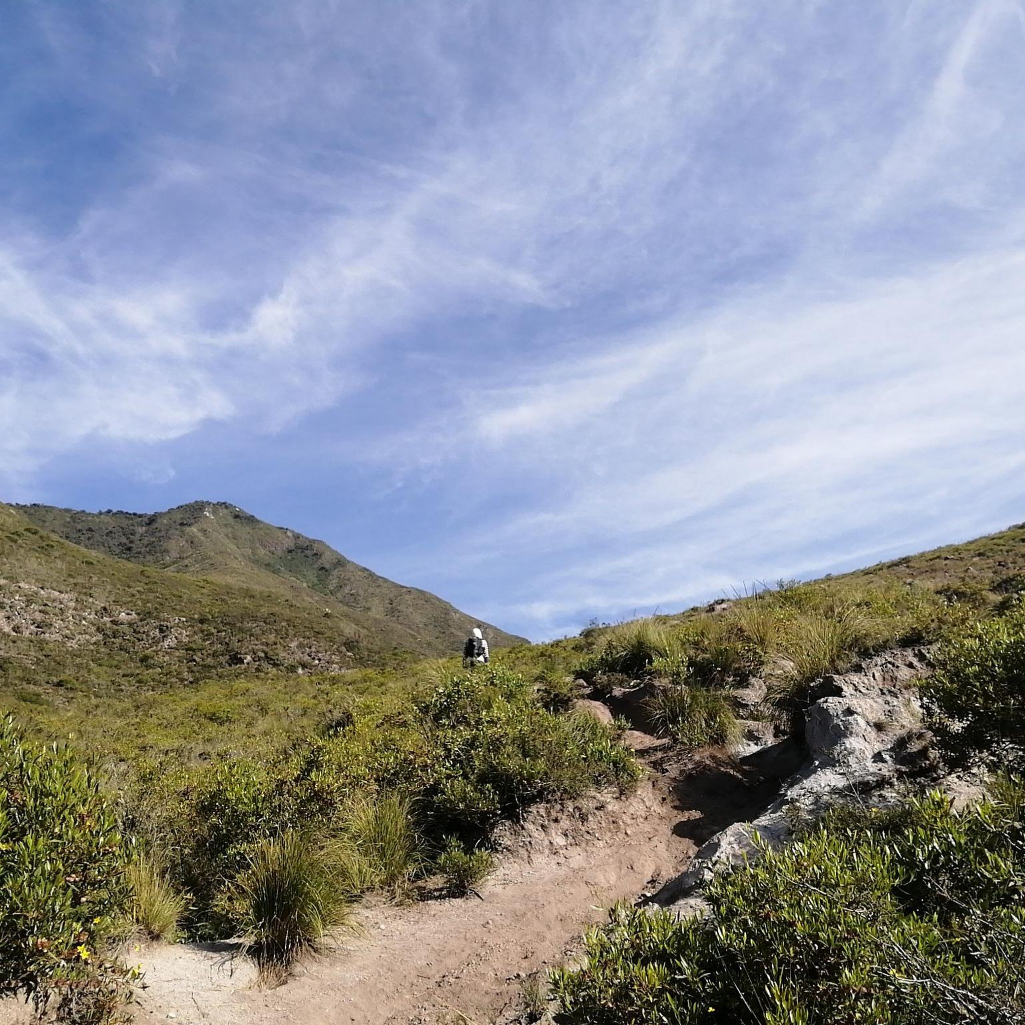
Mountain biking in Reserva Geobotánica Pululahua offers diverse terrain within a unique volcanic caldera. The region is characterized by the horseshoe-shaped Pululahua Crater, which is the largest inhabited volcanic crater globally, featuring fertile volcanic soil and prominent volcanic domes like Pondoña. Mountain bike trails navigate a network of dirt roads and paths, often enveloped in mists, contributing to a lush environment. The landscape includes significant elevation changes, with routes descending into the crater and offering panoramic views from its rim.
…Last updated: July 12, 2026
5.0
(2)
23
riders
36.8km
03:37
1,240m
1,240m
Hard mountain bike ride. Very good fitness required. Suitable for all skill levels.
5.0
(4)
30
riders
63.2km
05:40
1,820m
1,820m
Hard mountain bike ride. Very good fitness required. Suitable for all skill levels.

Sign up for free
4.8
(5)
25
riders
92.7km
07:39
2,300m
2,300m
Hard mountain bike ride. Very good fitness required. Suitable for all skill levels.
8
riders
103km
08:31
2,870m
2,870m
Hard mountain bike ride. Very good fitness required. Suitable for all skill levels.
Our route recommendations are based on thousands of hikes, rides, and runs completed by other people on komoot.
Start today with a free account
Your next adventure awaits.
Login or Signup
Popular around Reserva Geobotánica Pululahua
Tips from the Community

A path between the waterfall and Laguna leads down to this spot, where the river could be crossed. Path seems to continue downstream on the other side.
0
0
Wonderful ride. Quite steep and curvy, be careful of oncoming traffic. There isn't much but it can surprise you.
0
0
Good place to park is on the town square, in front of the police station. There is a public bathroom next to it
0
0
Excellent cevichocho and ice creams
0
0
Stop to smell the flowers and hear the birds.
0
0
Very curvy, be very careful of oncoming traffic.
0
0
Put your gloves and jacket on, the descent begins
0
0
Frequently Asked Questions
What kind of terrain can I expect on mountain bike trails in Reserva Geobotánica Pululahua?
The trails in Reserva Geobotánica Pululahua primarily feature fun dirt roads with minimal car traffic, along with 4x4 double tracks and technical singletracks. You'll encounter significant elevation changes, including challenging descents into the crater and steep, narrow sections, all within a unique volcanic caldera landscape.
Are there any family-friendly mountain bike routes in Reserva Geobotánica Pululahua?
While the listed routes are generally considered difficult, the reserve offers a variety of trails, some of which are shorter and less demanding. For example, some sections of the 'Lava Dome Circle' around the Pondoña dome can be a challenging 2-3 hour ride, but there are also easier dirt roads suitable for less experienced riders or families looking for a gentler experience. Always check the specific trail details for suitability.
What are the notable landmarks or viewpoints I can see while mountain biking in the reserve?
You'll find breathtaking vistas from the crater rim, especially at the Ventanillas Lookout (El Mirador), which offers panoramic views of the expansive crater landscape and its distinctive agricultural patterns. Within the crater, you can also see prominent volcanic domes like Pondoña, El Chivo, and Pan de Azúcar. The trails often provide views across multiple ecosystems.
Are there any circular mountain bike routes in Reserva Geobotánica Pululahua?
Yes, the reserve offers several circular routes. Popular options include the 'Pululahua loop from Calacali' and the 'Calacalí–Pululahua Dirt Road loop from El Labrador'. For those seeking a longer adventure, the 'Yunguilla Pululahua Circle' is a popular 4-6 hour trail, and the 'Chaupisacha Infiernillo Circle' offers fantastic views across multiple ecosystems.
What is the best time of year to go mountain biking in Reserva Geobotánica Pululahua?
The reserve is often enveloped in frequent mists, contributing to its lush environment. While specific seasonal recommendations aren't provided, the consistent climate near the equator means mountain biking is generally possible year-round. However, be prepared for potential rain and mist, which can make trails slick. Checking local weather forecasts before your ride is always advisable.
What kind of wildlife and plant life can I expect to see in the reserve?
Reserva Geobotánica Pululahua is Ecuador's only geobotanical protected reserve, safeguarding over 2,000 species of Andean flora, including numerous orchids, mosses, ferns, lichens, and bromeliads. This rich plant life, combined with a variety of birds, mammals, and exotic insects, makes it a true natural wonderland. Keep an eye out for the diverse biodiversity as you ride.
Is there public transport available to reach Reserva Geobotánica Pululahua for mountain biking?
The reserve is located just 17 km north of Quito, making it relatively accessible. While specific public transport routes for mountain bikers are not detailed, local buses or shared taxis from Quito to the nearby towns like Calacalí or El Labrador, which are common starting points for many routes, are generally available. From there, you might need to arrange a short taxi ride to the reserve entrance or a specific trailhead.
Where can I park my car when visiting Reserva Geobotánica Pululahua for mountain biking?
Parking is typically available near the main entrance points to the reserve, such as the Ventanillas Lookout (El Mirador) on the crater rim, or in the nearby communities like Calacalí or El Labrador, which serve as common starting points for many mountain bike routes. Look for designated parking areas or inquire locally upon arrival.
What do other mountain bikers enjoy most about the trails in Reserva Geobotánica Pululahua?
The area is highly rated by the komoot community, with an average score of 4.9 stars from over 11 reviews. Reviewers often praise the unique volcanic crater landscapes, the challenging dirt roads, and the diverse ecosystems encountered along the routes. The sense of adventure and the panoramic views are frequently highlighted.
Are there any thermal springs or unique natural features to explore in the reserve?
Yes, behind the Pondoña dome, in the Bucal area, you can discover thermal mineral water springs with a pleasant temperature of 28 °C (82.4 °F). This offers a unique natural feature to explore, perhaps as a relaxing stop after a challenging ride.
What is the typical duration and distance for mountain bike trails in this region?
Trail durations and distances vary significantly. You can find options ranging from easy rides lasting up to two hours to more challenging routes that can take over five hours. For instance, the Calacalí Monument – Descent to the Volcano Floor loop from Calacali is about 22.8 miles (36.8 km) and takes around 3 hours 36 minutes, while the Birds' Bridge – Calacalí–Pululahua Dirt Road loop from Pomasqui is a longer 39.8 miles (64.0 km) path.
What equipment should I consider bringing for mountain biking in Pululahua?
Given the diverse and often challenging terrain, it's advisable to bring a well-maintained mountain bike suitable for dirt roads, 4x4 tracks, and potentially technical singletracks. Essential gear includes a helmet, appropriate clothing for varying weather conditions (including potential mist and rain), water, snacks, a repair kit, and navigation tools. While bike rentals are available, those seeking professional-level equipment for more demanding trails might consider bringing their own.
Most popular routes in Reserva Geobotánica Pululahua

Get inspired with the komoot mobile app


Explore more
Browse the best MTB trails in other regions.
