The best walks and hikes in Reserva Geobotánica Pululahua
4.7
(10)
64
hikers
6
hikes
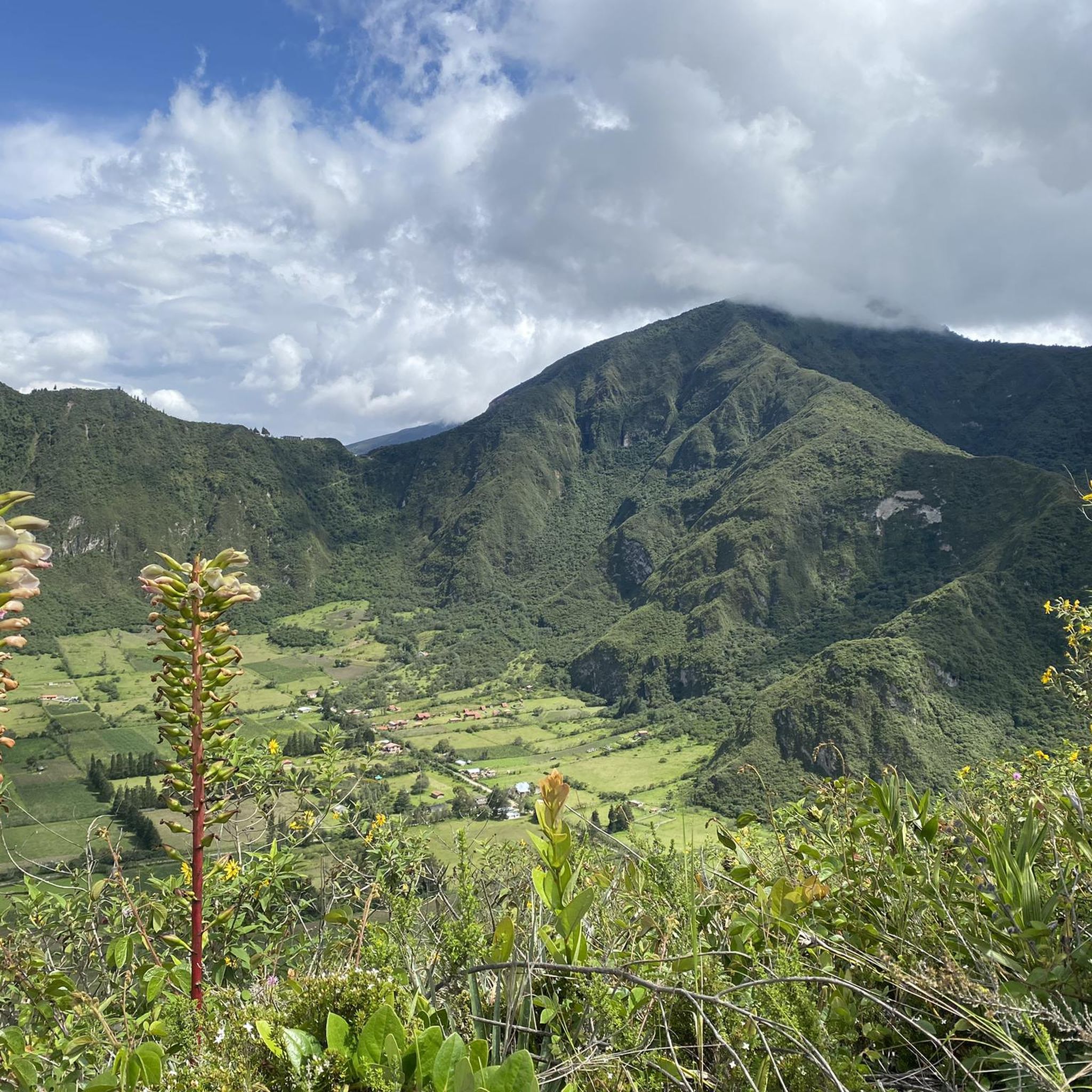
Hiking in Reserva Geobotánica Pululahua explores a unique volcanic caldera, characterized by its fertile crater floor and surrounding slopes. The landscape features diverse vegetation, from agricultural fields within the crater to cloud forest on its rims. Trails navigate varied terrain, offering views into the caldera and across the surrounding Andean foothills. The Pululahua Geobotanical Reserve provides a distinct environment for outdoor activities.
Best hiking trails in Reserva Geobotánica Pululahua
- The most popular hiking route is Descent to the Volcano Floor loop from Reserva Geobotánica Pululahua, a 8.0 miles (12.8 km) trail that takes 3 hours 58 minutes to complete. This moderate route descends into the caldera, offering close-up views of the crater floor.
- Another top favourite among local hikers is View of Pululahua Crater – Pululahua Dome loop from Riding Horses - Paseo a Caballo, a moderate 5.1 miles (8.2 km) path. This trail provides panoramic views of the Pululahua Crater and its surrounding dome.
- Local hikers also love the Pululahua – View of Pululahua Crater loop from Pululahua Ecolodge, a 9.5 miles (15.4 km) trail leading through varied terrain with significant elevation gain, often completed in about 5 hours 25 minutes.
- Hiking in Reserva Geobotánica Pululahua is defined by volcanic crater landscapes, diverse vegetation, and panoramic viewpoints. The network offers options for different ability levels, including easy hikes and more challenging routes.
- The routes in Reserva Geobotánica Pululahua are highly rated by the komoot community with an average score of 4.7 stars from over 10 reviews. More than 50 hikers have used komoot to explore Reserva Geobotánica Pululahua's varied terrain.
Last updated: July 5, 2026
4.3
(3)
18
hikers
12.8km
03:59
460m
460m
Moderate hike. Good fitness required. Easily-accessible paths. Suitable for all skill levels.
16
hikers
Moderate hike. Good fitness required. Easily-accessible paths. Suitable for all skill levels.

Sign up for free
4.3
(3)
17
hikers
Moderate hike. Good fitness required. Easily-accessible paths. Suitable for all skill levels.
5.0
(1)
3
hikers
15.4km
05:25
810m
810m
Hard hike. Very good fitness required. Easily-accessible paths. Suitable for all skill levels.
5.0
(2)
8
hikers
5.92km
03:06
730m
730m
Moderate hike. Good fitness required. Easily-accessible paths. Suitable for all skill levels.
Our route recommendations are based on thousands of hikes, rides, and runs completed by other people on komoot.
Start today with a free account
Your next adventure awaits.
Login or Signup
Popular around Reserva Geobotánica Pululahua
Tips from the Community

Very curvy, be very careful of oncoming traffic.
0
0

We were in the Pululahua crater and did a round trip over the Lulumbamba. The tour started at Casa l'Amore, where we had also stayed. At first a kind of sunken path led us into the valley, then we went continuously uphill on a rather overgrown path. We once missed a crucial and not immediately recognizable junction - that's the detour on the map, so you can save it - and once you get to the pass, not much is missing to the "summit" of Lulumbamba. Unfortunately, this summit is quite disappointing. On the one hand, you have to overcome a barbed wire fence to even reach it, and on the other hand, the view is largely overgrown. So we descended again and followed the high path, which offers beautiful views from the crater and into the crater. So this way was worth it! The descent into the crater was then comparable to the ascent on narrow and quite overgrown paths that stretched a little longer. You should plan 6 hours for the whole hike, preferably a little more.
1
0

Nice round tour with a wonderful view of the crater. Difficulty: easy to medium for experienced walkers. I recommend to climb up the Domo via the steeper way (left) and go down via the easy way.
2
0
Frequently Asked Questions
How many hiking trails are there in Reserva Geobotánica Pululahua?
Reserva Geobotánica Pululahua offers a selection of 6 hiking trails. These routes cater to various skill levels, including easy, moderate, and difficult options, allowing hikers to explore the unique volcanic caldera and its surroundings.
Are there easy hikes suitable for beginners in Pululahua?
Yes, there is at least one easy hike suitable for beginners in Pululahua. For a less strenuous option, consider the Pululahua – Pululahua Dome loop from Pululahua Ecolodge, which is 2.9 miles (4.6 km) long and takes about 1 hour 33 minutes to complete. This route offers a gentle introduction to the reserve's unique landscape.
What is the typical length and duration of hikes in Pululahua Geobotanical Reserve?
Hikes in Pululahua Geobotanical Reserve vary in length and duration. You can find routes ranging from shorter options like the 2.9-mile (4.6 km) Pululahua – Pululahua Dome loop from Pululahua Ecolodge, taking about 1 hour 33 minutes, to longer, more challenging trails such as the 9.5-mile (15.4 km) Pululahua – View of Pululahua Crater loop from Pululahua Ecolodge, which can take over 5 hours.
Are there circular hiking trails in Pululahua?
Yes, many of the trails in Pululahua are circular, allowing you to experience diverse scenery without retracing your steps. Examples include the popular Descent to the Volcano Floor loop from Reserva Geobotánica Pululahua and the View of Pululahua Crater – Pululahua Dome loop from Riding Horses - Paseo a Caballo.
Is there parking available for hikers at Pululahua?
Parking is generally available at the main entrances and viewpoints of Reserva Geobotánica Pululahua, such as near the Mirador de Pululahua. It's advisable to arrive early, especially on weekends, to secure a spot.
How can I get to Reserva Geobotánica Pululahua using public transport?
Public transport options to Reserva Geobotánica Pululahua typically involve taking a bus from Quito towards Calacalí or Nanegalito and getting off at the turn-off for Pululahua. From there, you might need to take a local taxi or walk to the reserve's entrance or specific trailheads. Confirm current routes and schedules locally.
Is Reserva Geobotánica Pululahua suitable for family hikes?
Yes, Pululahua can be suitable for families, especially if you choose one of the easier, shorter routes. The unique volcanic landscape and opportunities for wildlife spotting can be engaging for children. Always consider the elevation changes and trail conditions when planning a family outing.
Can I bring my dog on the trails in Pululahua Reserve?
As a Geobotanical Reserve, regulations regarding pets can be strict to protect the local flora and fauna. It is generally recommended to check with the park authorities directly before bringing your dog, as access might be restricted or require specific conditions, such as being on a leash at all times.
What is the best time of year to hike in Pululahua?
The best time to hike in Pululahua is generally during the dry season, which runs from June to September. During these months, you can expect clearer skies and less rain, offering better visibility of the crater and more comfortable hiking conditions. However, weather in the Andes can be unpredictable, so always be prepared for changes.
What should I wear for hiking in Pululahua Geobotanical Reserve?
Given the variable Andean weather, it's best to dress in layers. Include a waterproof and windproof jacket, as rain and strong winds can occur. Sturdy hiking boots are essential for the varied terrain, and sun protection (hat, sunglasses, sunscreen) is crucial due to the high altitude. Bring plenty of water and snacks.
Are there good viewpoints in Pululahua Geobotanical Reserve?
Absolutely. The reserve is renowned for its stunning viewpoints overlooking the Pululahua crater. The main Mirador de Pululahua offers panoramic vistas. Additionally, routes like the View of Pululahua Crater – Pululahua Dome loop from Riding Horses - Paseo a Caballo are specifically designed to showcase these breathtaking views.
What kind of wildlife can I expect to see in Pululahua?
Reserva Geobotánica Pululahua is home to diverse wildlife, particularly birds. You might spot various species of hummingbirds, tanagers, and raptors. Mammals like deer, rabbits, and armadillos also inhabit the area, though they are often more elusive. The unique plant life within the crater is also a highlight for nature enthusiasts.
What do other hikers enjoy most about hiking in Reserva Geobotánica Pululahua?
The area is highly rated by the komoot community, with an average score of 4.7 stars. Reviewers often praise the unique experience of hiking inside a volcanic caldera, the stunning panoramic views, and the diverse vegetation. The sense of tranquility and the opportunity to connect with nature in such a distinctive geological setting are frequently highlighted.
Most popular routes in Reserva Geobotánica Pululahua

Get inspired with the komoot mobile app


Explore more
Browse the best Hikes in other regions.
