The best cycling routes in Woodbridge Hill Conservation Area
5.0
(3)
69
riders
3
rides
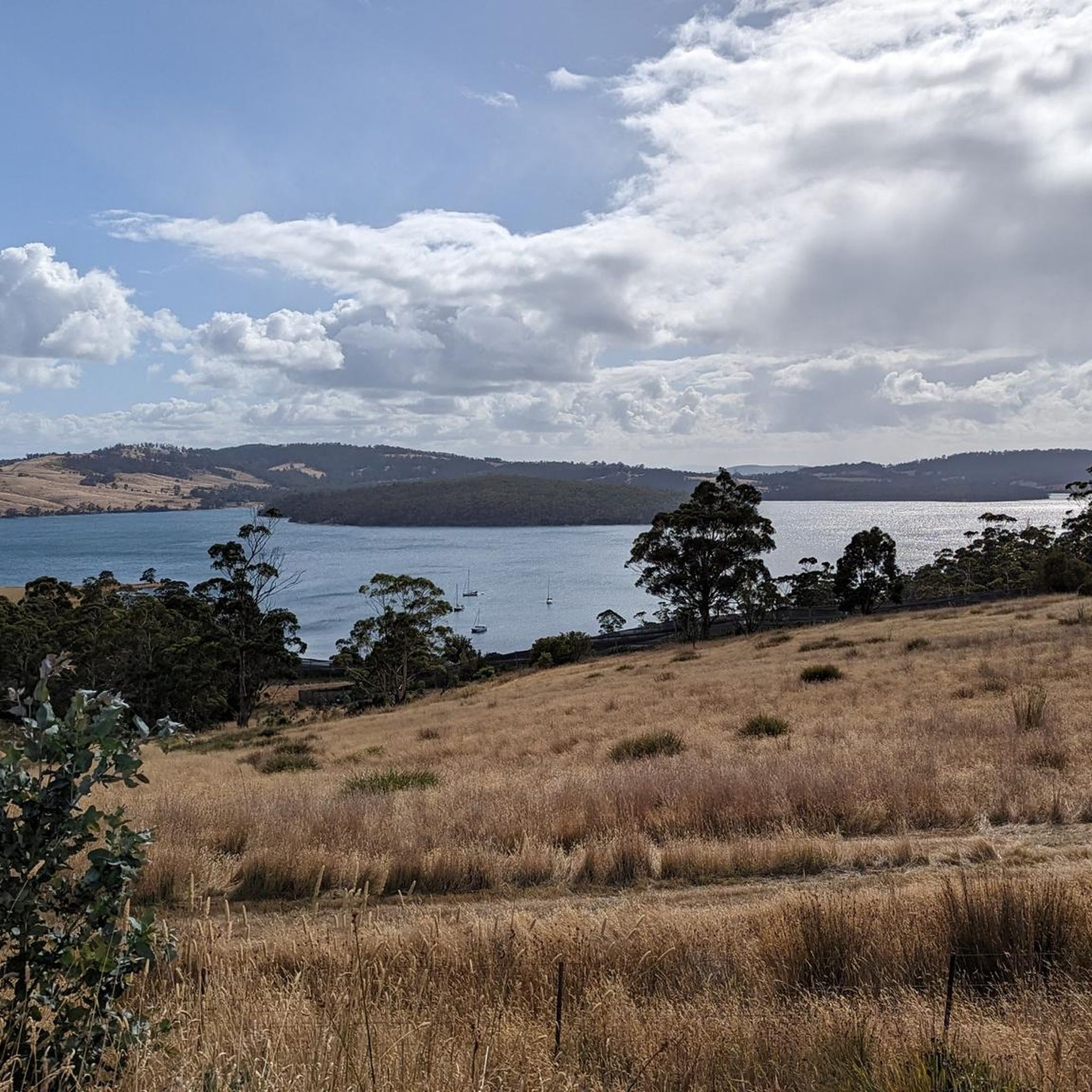
Touring cycling routes in Woodbridge Hill Conservation Area traverse a semi-rural landscape characterized by rolling hills and winding roads. The region, part of the Great Dividing Range, features varied topography with ascents and descents, offering views over the D'Entrecasteaux Channel. Traces of historical apple orchards are visible within the landscape, contributing to scenic cycling routes. Woodbridge Hill itself rises to 2,021 feet (616 meters), providing a challenging terrain for cyclists.
Best touring cycling routes in Woodbridge Hill Conservation Area
- The…
Last updated: June 27, 2026
5.0
(1)
13
riders
78.3km
04:42
690m
690m
Hard bike ride. Very good fitness required. Mostly paved surfaces. Suitable for all skill levels.
10
riders
76.4km
05:06
1,050m
1,050m
Hard bike ride. Very good fitness required. Mostly paved surfaces. Suitable for all skill levels.

Sign up for free
5.0
(2)
16
riders
42.5km
03:50
700m
700m
Hard bike ride. Very good fitness required. Mostly paved surfaces. Suitable for all skill levels.
25
riders
42.1km
02:52
360m
360m
Moderate bike ride. Good fitness required. Mostly paved surfaces. Suitable for all skill levels.
5
riders
31.6km
02:04
450m
450m
Moderate bike ride. Good fitness required. Mostly paved surfaces. Suitable for all skill levels.
Our route recommendations are based on thousands of hikes, rides, and runs completed by other people on komoot.
Start today with a free account
Your next adventure awaits.
Login or Signup
Popular around Woodbridge Hill Conservation Area
Tips from the Community


Great place to grab a coffee, food or even a beer
0
0
Good spot for coffee and food. There is also the pub.
0
0
This road is very picturesque but expect a hard climb. Well worth the views along the way
0
0
Frequently Asked Questions
How many touring cycling routes are available in Woodbridge Hill Conservation Area?
There are 5 touring cycling routes available in Woodbridge Hill Conservation Area. These routes are generally considered challenging, offering significant elevation gains and varied terrain.
What is the typical terrain like for touring cyclists in Woodbridge Hill Conservation Area?
The terrain in Woodbridge Hill Conservation Area is characterized by rolling hills and winding roads, typical of Tasmania's landscape. Cyclists can expect both ascents and descents, with Woodbridge Hill itself rising to 616 meters (2,021 ft). The routes often feature views over the D'Entrecasteaux Channel and traces of historical apple orchards.
Are there any circular touring cycling routes in the area?
Yes, several routes in the area are circular. For example, the Coal Point Conservation Area loop from Kettering is a 78.1 km (48.5 miles) loop, and the Bike loop from Kettering is a shorter 42.5 km (26.4 miles) option, both offering a complete circuit.
What are some notable viewpoints or natural features along the touring cycling routes?
Cyclists can enjoy picturesque views over the D'Entrecasteaux Channel along many routes. The region's semi-rural setting, with its rolling hills and winding roads, also offers glimpses of historical apple orchards. The broader area provides views of the Huon River and Hartz Mountains.
What is the difficulty level of touring cycling routes in Woodbridge Hill Conservation Area?
The touring cycling routes in Woodbridge Hill Conservation Area are generally considered difficult due to significant elevation gains and varied terrain. For instance, the Cygnet Town Centre – Commercial Hotel Cygnet loop from Kettering involves over 1000 meters of elevation gain. However, there are also moderate options like the Cygnet Town Centre – Slab Road Climb loop from Cygnet.
Are there any family-friendly touring cycling options in Woodbridge Hill Conservation Area?
While many routes in the immediate Woodbridge Hill Conservation Area are rated as difficult, the broader region offers varied terrain. For families seeking a less strenuous ride, it's advisable to look for routes with lower elevation gains. The Cygnet Town Centre – Slab Road Climb loop from Cygnet, at 31.6 km (19.6 miles) and rated moderate, might be a more suitable option for experienced families.
What amenities are available near the touring cycling routes, such as cafes or accommodation?
The Woodbridge area and nearby towns like Kettering and Cygnet offer various amenities. You can find dining options such as the Peppermint Bay Hotel, and local produce at Grandvewe Farm Sheep Cheesery or Mewstone Wines. These locations can provide opportunities for refreshments and breaks during your tour.
What do other touring cyclists enjoy most about cycling in Woodbridge Hill Conservation Area?
The area is highly rated by the komoot community, with an average score of 5.0 stars. Reviewers often praise the stunning scenery, the blend of challenging ascents and descents, and the quiet, lightly trafficked roads that make for an enjoyable touring experience.
Is public transport available to access the touring cycling routes?
While specific public transport options directly into the Conservation Area for cyclists might be limited, the nearby town of Kettering serves as a common starting point for many routes. Kettering is also where the ferry to Bruny Island departs, which is another popular cycling destination.
Are dogs allowed on the touring cycling routes in Woodbridge Hill Conservation Area?
The policy regarding dogs can vary within conservation areas and on specific trails. It's always recommended to check local signage or the official Woodbridge Hill Conservation Area guidelines before bringing your dog, especially on shared paths or in sensitive natural environments.
What is the best time of year to go touring cycling in Woodbridge Hill Conservation Area?
Tasmania generally offers good cycling conditions during the warmer months, from spring through autumn (September to May). During these periods, the weather is typically milder and more predictable, making for a more comfortable touring experience. Winter can bring colder temperatures and increased rainfall.
Are there any attractions nearby that can be combined with a touring cycling trip?
Absolutely! The broader region offers several attractions. You can explore the Huon Valley, known for its apple and berry farms, or visit local establishments like the Peppermint Bay Hotel, Grandvewe Farm Sheep Cheesery, or Mewstone Wines. Art Farm Birchs Bay also provides walking trails with sculptures. The ferry from Kettering to Bruny Island opens up another popular cycling destination.
Most popular routes in Woodbridge Hill Conservation Area

Get inspired with the komoot mobile app


Explore more
Browse the best Cycling routes in other regions.
