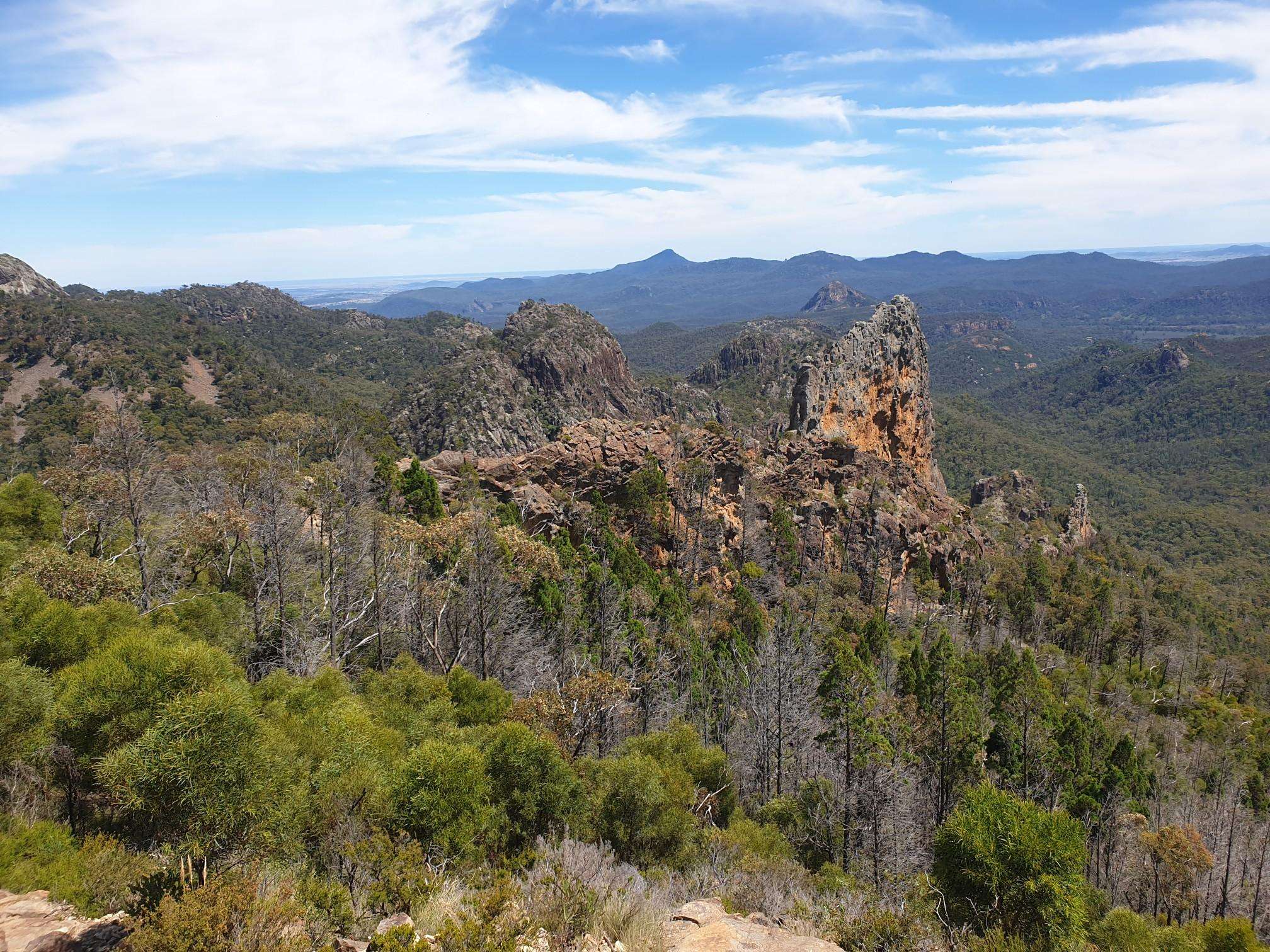
The best running trails in Warrumbungle National Park
28
runners
4
runs
Jogging in Warrumbungle National Park offers routes through a landscape shaped by ancient volcanic activity, featuring dramatic rock formations and diverse terrain. The region is characterized by towering volcanic spires, domes, and forested ridges, providing a range of running experiences. Runners can explore paths that wind through valleys, past prominent features like the Breadknife, and up to scenic viewpoints. The park's geology creates varied elevation profiles, from gentle paths to challenging ascents.
Best jogging routes in Warrumbungle National Park
- The most popular jogging route is Lugh's Throne – The Breadknife loop from Pincham Car Park, a 9.2 miles (14.8 km) trail that takes 2 hours 8 minutes to complete. This route offers close-up views of iconic volcanic formations and significant elevation gain.
- Another top favourite among local runners is Mamos Mountain loop from Pincham Car Park, a moderate 2.3 miles (3.8 km) path. This route provides a steady climb with panoramic views of the park's unique geology.
- Local runners also love the Warrumbungle National Park loop from Camp Blackman, a 3.4 miles (5.5 km) trail leading through varied park landscapes, often completed in about 40 minutes.
- Jogging in Warrumbungle National Park is defined by volcanic spires, forested ridges, and diverse terrain. The network offers options for different ability levels, from moderate loops to more difficult trails with significant ascents.
- The guide includes highly-rated routes that showcase the best of the region's landscape. More than 20 runners have used komoot to explore Warrumbungle National Park's varied terrain.
Last updated: August 20, 2026
5
runners
3.72km
00:42
250m
240m
Hard run. Good fitness required. Sure-footedness, sturdy shoes and alpine experience required.
5
runners
5.46km
00:35
60m
60m
Moderate run. Good fitness required. Mostly paved surfaces. Suitable for all skill levels.

Sign up for free
6
runners
3.79km
00:35
200m
200m
Moderate run. Good fitness required. Mostly paved surfaces. Suitable for all skill levels.
Our route recommendations are based on thousands of hikes, rides, and runs completed by other people on komoot.
Start today with a free account
Your next adventure awaits.
Login or Signup
Popular around Warrumbungle National Park
Frequently Asked Questions
What kind of terrain and elevation can I expect on running routes in Warrumbungle National Park?
Warrumbungle National Park offers a diverse range of terrain, from gentle paths along creek beds to challenging ascents with significant elevation gains. The landscape is characterized by unique volcanic formations, including towering spires and domes, forested ridges, and deep valleys. You'll find routes that wind through these varied environments, providing different levels of intensity and scenic views.
Are there any easy running routes suitable for beginners?
While many routes offer significant elevation, there are options for those seeking a more moderate experience. For example, the Warrumbungle National Park loop from Camp Blackman is a moderate 5.5 km trail with relatively low elevation gain, making it a good choice for a steady run. The Burbie Canyon walking track, though not listed as a komoot route here, is also known for being a gentle 2 km stroll.
Which running routes offer a more challenging workout?
For a more demanding run, consider the Lugh's Throne – The Breadknife loop from Pincham Car Park. This difficult 14.8 km route features over 600 meters of elevation gain and offers close-up views of iconic volcanic formations like the Breadknife. The Breadknife and Grand High Tops walk is also renowned as a challenging circuit for experienced runners.
What unique natural features or landmarks can I see while jogging?
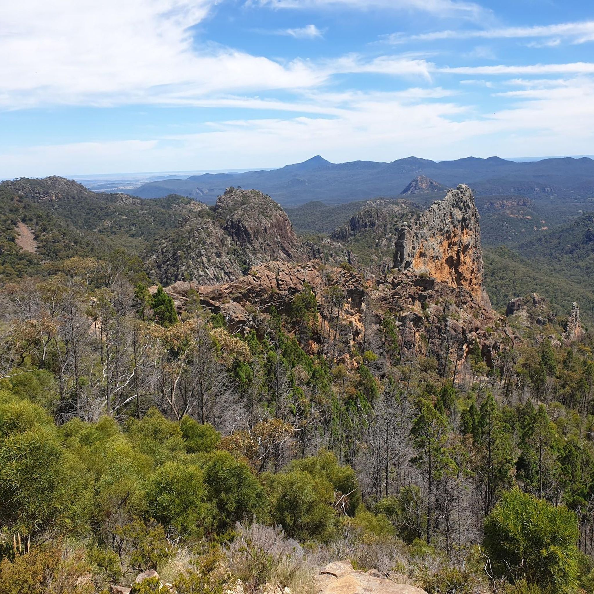
Warrumbungle National Park is famous for its spectacular volcanic formations. While running, you can encounter the dramatic Breadknife, the towering Belougery Spire, and enjoy panoramic views from spots like Bluff Mountain or Mount Exmouth. The park's unique geology provides a stunning backdrop to your run.
Are there many circular running routes available?
Yes, several popular running routes in Warrumbungle National Park are loops, allowing you to start and finish at the same point. Examples include the challenging Lugh's Throne – The Breadknife loop from Pincham Car Park, the moderate Mamos Mountain loop from Pincham Car Park, and the Warrumbungle National Park loop from Camp Blackman.
Where can I park when visiting the running trails?
Many of the running routes start from designated car parks within the national park. For instance, the Lugh's Throne – The Breadknife loop and the Mamos Mountain loop both begin from Pincham Car Park. Camp Blackman also offers amenities including parking, making it a convenient starting point for the Warrumbungle National Park loop.
What is the best time of year to go running in Warrumbungle National Park?
The park is enjoyable year-round, but spring and autumn generally offer the most pleasant running conditions with milder temperatures. Summer can be very hot, so early morning or late afternoon runs are advisable. Winter can be cool, but the clear skies often make for beautiful running weather. Always check local weather forecasts before heading out.
Can I expect to see wildlife while running in the park?
Yes, Warrumbungle National Park is home to diverse wildlife. Its varied landscapes provide habitats for hundreds of plant and animal species, including over 190 bird species, emus, kangaroos, and wallabies. Keep an eye out, especially during quieter times of the day, to spot some of the park's natural inhabitants.
Are there any family-friendly running options?
For families or those looking for a more relaxed pace, routes with less elevation and shorter distances are ideal. While not explicitly listed as 'family-friendly' in the data, the Warrumbungle National Park loop from Camp Blackman (5.5 km, moderate) or the Running loop from Camp Wambelong (3.7 km, moderate) could be suitable, depending on the family's fitness level. The Burbie Canyon track is also a gentle option for a leisurely stroll or light jog.
What do other runners enjoy most about jogging in Warrumbungle National Park?
Runners frequently praise the park's unique volcanic landscapes and the stunning panoramic views from its trails. The variety of terrain, from challenging ascents to more moderate loops, is also highly appreciated, offering something for different fitness levels. The opportunity to experience Australia's first Dark Sky Park, especially during early morning or evening runs, adds a unique celestial dimension to the experience.
Is public transport available to access the running routes?
Warrumbungle National Park is primarily accessed by private vehicle. There is no direct public transport service into the park itself that would conveniently drop you off at trailheads. Visitors typically drive to the park and then utilize the car parks located near the starting points of various routes.
Are there any permits required for jogging in Warrumbungle National Park?
While you don't typically need a specific 'jogging permit,' entry to Warrumbungle National Park usually requires a park entry fee. It's always best to check the official NSW National Parks and Wildlife Service website for the most current information regarding fees and any specific regulations. You can find more details at nsw.gov.au.
Most popular routes in Warrumbungle National Park
Most popular attractions in Warrumbungle National Park

Get inspired with the komoot mobile app


Explore more
Browse the best Running Trails & Routes in other regions.
