The best cycling routes in Finse Biotopvernområde
5.0
(11)
294
riders
4
rides
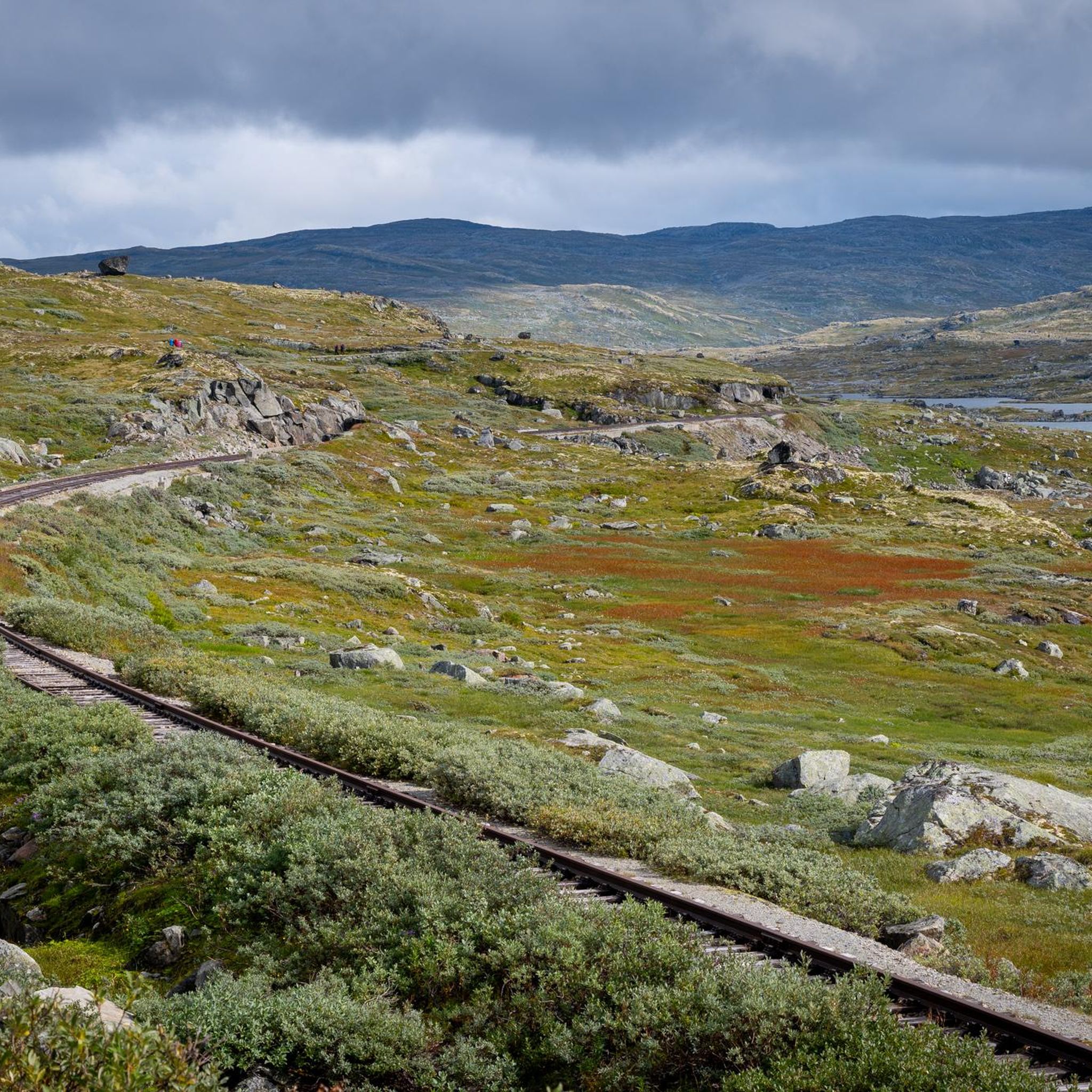
Touring cycling routes in Finse Biotopvernområde traverse a high-altitude mountain environment, characterized by glacial landscapes, vast plateaus, and deep valleys. The region, situated at 1222 meters above sea level, features a mix of historic gravel paths and rugged mountain terrain. Key physical features include the Hardangerjøkulen Glacier, the high-altitude Finsevatnet lake, and the Rallarvegen, a historic route built for the Bergen Line railway. This landscape provides a challenging yet rewarding setting for touring cyclists.
Best touring cycling routes in Finse…
Last updated: May 20, 2026
5.0
(2)
21
riders
19.5km
01:53
170m
170m
Moderate bike ride. Good fitness required. Mostly paved surfaces. Suitable for all skill levels.
5
riders
16.9km
01:13
110m
110m
Easy bike ride. Great for any fitness level. Mostly paved surfaces. Suitable for all skill levels.

Sign up for free
5.0
(5)
209
riders
81.9km
06:26
790m
1,770m
Cycle the Rallarvegen from Haugastøl to Flåm, a difficult 50.9-mile route through Norway's stunning mountain and fjord landscapes.
5.0
(4)
59
riders
Hard bike ride. Very good fitness required. Mostly paved surfaces. Suitable for all skill levels.
Our route recommendations are based on thousands of hikes, rides, and runs completed by other people on komoot.
Start today with a free account
Your next adventure awaits.
Login or Signup
Popular around Finse Biotopvernområde
Tips from the Community

The gravel track along Nedsta Storurevatnet is one of the most scenic stretches of the route. It hugs the shoreline closely, with shimmering water on one side and steep mountainsides on the other. The surface is generally good, though it can be loose and stony in places.
1
0

The natural surroundings of Finse are exceptionally beautiful, making it a great starting point for various one-day and multi-day tours. The connection to the train line from Oslo to Bergen also makes travel to and from the area very convenient.
0
0
Finse Station is located on the railway line connecting Oslo and Bergen. Finse is the highest station in Scandinavia.
0
0

Peace, space, beautiful view
1
0

Small church with an adjacent cemetery. Easily accessible from the fjord.
0
0

The station is the destination of many cyclists on the Rallarvegen coming from Haugastøl. It is the highest station in Northern Europe at 1222 meters and is surrounded by a unique landscape. You can sit here for a break and wonder where all the people waiting for the train in this wilderness come from. The station is also famous for its webcam, which you can use to observe the Norwegian winter.
0
0

I also took a short rest under one of these underpasses - from the constant cold wind and drizzle.
0
0
Lovely café on Rallarvegen – coffee, tea, snacks, cold drinks, and homemade hot waffles! Season opening: July 7th.
0
0
Frequently Asked Questions
What kind of terrain can I expect when touring cycling in Finse Biotopvernområde?
The terrain in Finse Biotopvernområde is primarily characterized by high-altitude mountain landscapes. You'll encounter historic gravel paths, vast plateaus, and glacial features. The most famous route, Rallarvegen, is a gravel path that traverses mountains, valleys, and past waterfalls, offering a unique experience of Norway's natural beauty.
Are there touring cycling routes suitable for beginners in Finse Biotopvernområde?
Yes, there are routes suitable for various skill levels. For beginners or those looking for an easier ride, the Finsehytta Hostel – Path by the Lake Near Finse loop from Finse is an excellent choice. This 10.5-mile (16.9 km) trail offers high-altitude lake and mountain views and is rated as easy.
How many touring cycling routes are available in Finse Biotopvernområde?
There are 4 touring cycling routes detailed in this guide for Finse Biotopvernområde, ranging from easy to difficult. These routes are highly rated by the komoot community, with an average score of 5.0 stars.
What is the best time of year for touring cycling in Finse Biotopvernområde?
Due to its high-altitude environment, Finse Biotopvernområde can be snow-covered for much of the year. The optimal cycling season typically runs from mid-July to mid-September, when the paths are clear and the weather is most favorable for exploring the mountain landscape.
Is it possible to rent bicycles in Finse?
Yes, bicycles can be rented directly in Finse, making it convenient for visitors to explore the area's touring cycling routes, including the famous Rallarvegen.
Are there options for public transport to access touring cycling routes in Finse Biotopvernområde?
Finse is notable as Norway's highest railway station, making it easily accessible by train. This provides a convenient way to reach the starting points of many touring cycling routes in the area, including those connecting to the Rallarvegen.
Are there any circular touring cycling routes around Finse?
Yes, there are circular routes available. One popular option is the Rallarvegen – Steinreich Pass Summit loop from Finse, a moderate 12.1-mile (19.5 km) path that offers stunning high-altitude mountain scenery and leads to a pass summit.
Can I bring my dog on touring cycling routes in Finse Biotopvernområde?
While the region is a natural habitat for wild reindeer, specific regulations regarding dogs on cycling routes within Finse Biotopvernområde may vary. It's always best to check local signage or official park information for the most current guidelines on bringing pets, especially in protected areas.
What interesting landmarks or natural features can I see along the touring cycling routes?
Along the routes, you can experience the majestic Finsevatnet Lake, situated at 1,214 meters above sea level. The historic Rallarvegen itself is a landmark, offering views of the Hardangerjøkulen Glacier and the surrounding mountain plateau. You might also encounter the Finse Biotope Protected Area – Rallarvegen Summit, which is a natural monument.
Are there any cafes or accommodation options in Finse village?
Finse village, being a key hub in the area, offers accommodation options such as Finsehytta Hostel, which is a starting point for one of the touring cycling loops. While specific cafes and pubs are not detailed, it's a small community that caters to visitors, especially those arriving by train or exploring the Rallarvegen.
What do other touring cyclists enjoy the most about touring cycling in Finse Biotopvernområde?
The area is highly rated by the komoot community, with an average score of 5.0 stars from over 12 reviews. Cyclists often praise the unique high-altitude mountain scenery, the historical significance of the Rallarvegen, and the immersive experience of the Norwegian wilderness, including views of the Hardangerjøkulen Glacier.
Are there any permits required for touring cycling in Finse Biotopvernområde?
Finse Biotopvernområde is a protected area, established to safeguard wild reindeer migration. Generally, cycling on designated paths like the Rallarvegen does not require special permits for tourists. However, it's always advisable to respect local regulations and stay on marked trails to protect the fragile high-mountain environment.
Most popular routes in Finse Biotopvernområde
Most popular attractions in Finse Biotopvernområde

Get inspired with the komoot mobile app


Explore more
Browse the best Cycling routes in other regions.
