The best walks and hikes in Tynehead Regional Park
4.6
(9)
202
hikers
20
hikes
Hiking in Tynehead Regional Park offers diverse landscapes across its 260 hectares, featuring a blend of forests, meadows, and river valleys. The park is characterized by the meandering Serpentine River, which is crucial for salmon rearing, and includes Surrey Lake with its wetlands and varied ecosystems. The terrain generally consists of gentle paths through deciduous-coniferous forests and open fields, with minimal elevation changes.
Best hiking trails in Tynehead Regional Park
- The most popular hiking route is Hawthorn Trail Loop, a 1.5 miles (2.4 km) trail that takes about 39 minutes to complete. This path meanders through former farm fields now converted into meadows.
- Another top favourite among local hikers is Serpentine/Tynehead Perimeter Trail loop — Tynehead Regional Park, an easy 2.3 miles (3.7 km) path. This multi-use trail loops around the eastern part of the park, following the banks of the Serpentine River.
- Local hikers also love the Surrey Lake loop — Surrey, a 1.4 miles (2.3 km) trail leading through wetlands, meadows, and forests, often completed in about 36 minutes.
- Hiking in Tynehead Regional Park is defined by diverse ecosystems, the Serpentine River, and lush meadows. The network offers options for different ability levels, primarily featuring easy routes.
- The routes in Tynehead Regional Park are highly rated by the komoot community with an average score of 4.6 stars from over 6 reviews. More than 140 hikers have used komoot to explore Tynehead Regional Park's varied terrain.
Last updated: August 19, 2026
4.5
(2)
23
hikers
7.43km
01:57
60m
60m
Easy hike. Great for any fitness level. Easily-accessible paths. Suitable for all skill levels.
4
hikers
3.06km
00:49
30m
40m
Easy hike. Great for any fitness level. Easily-accessible paths. Suitable for all skill levels.

Sign up for free
2
hikers
2.45km
00:39
20m
20m
Hike the easy 1.5-mile Hawthorn Trail Loop in Tynehead Regional Park, gaining 73 feet of elevation in about 38 minutes.
1
hikers
3.74km
00:59
30m
30m
Easy hike. Great for any fitness level. Easily-accessible paths. Suitable for all skill levels.
5
hikers
4.61km
01:14
50m
50m
Easy hike. Great for any fitness level. Easily-accessible paths. Suitable for all skill levels.
Get access to more routes and recommendations from other explorers.
Sign up for free
Already have an account?
Our route recommendations are based on thousands of hikes, rides, and runs completed by other people on komoot.
Start today with a free account
Your next adventure awaits.
Login or Signup


Tips from the Community

Covering more than 260 hectares, Tynehead Regional Park protects one of the largest remaining natural areas in Surrey. Forest trails, wetlands, meadows, and the Serpentine River create a diverse landscape that supports a wide variety of birds, mammals, and other wildlife. Despite being surrounded by urban development, the park provides a surprisingly peaceful escape with an extensive network of mostly level trails.
0
0
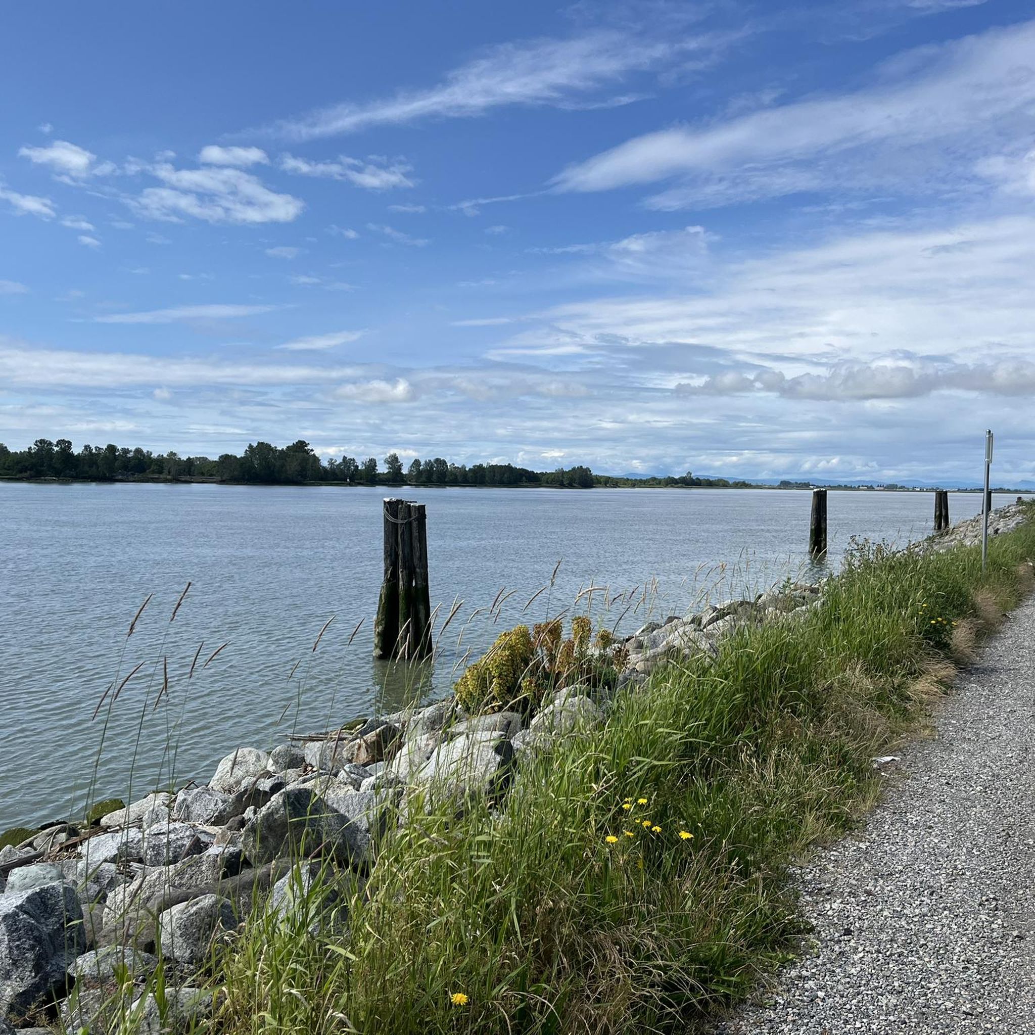
This crossing provides a close look at the Serpentine River as it winds through Tynehead Regional Park. The river forms an important wildlife corridor, supporting riparian forest and wetland habitat within the park. From the bridge, it's worth pausing for a moment to watch the slow-moving water and listen for birds in the surrounding trees.
0
0

This paved, multi-use trail traces thee edges of Tynehead Regional Park in a four kilometer loop. You'll find interpretive signage placed along the loop as you make your way around.
0
0

The Hawthorn Trail runs through open meadows and past hedgerows in the western half of Tynehead Park, offering a change from the forested paths nearby. It’s a flat, with packed gravel and wooden bridges, wide enough for strollers and wheelchairs. The trail is open year-round and popular with walkers, runners, and birders—plus it’s part of the off-leash network, so expect to meet a few friendly dogs along the way.
0
0
The Salmon Habitat Loop is an easy, family-friendly walk through the forest and along the upper Serpentine River, with interpretive signs and access to the Tynehead Hatchery. It’s a popular loop for spotting salmon in season and learning about local habitat restoration. If you’re here in the fall, you'll likely spot spawning salmon in the river.
0
0

The Serpentine River is a scenic waterway that runs from North Surrey to the Strait of Georgia. The river is a popular spot for anglers and is a stopping place for migratory birds and waterfowl.
0
0
Tynehead Regional Park is a 260-hectare park on the banks of the Serpentine River. The park offers a variety of trails, picnic areas, and even viewing platforms to catch the spawning salmon in the fall.
0
0
The Tynehead Perimeter Trail is a paved, interpretive, multi-use trail. The 4 km loop is located in the Tynehead Regional Park. Along the way, you will notice interpretive exhibits and informational signs about the park's ecosystem.
0
0
Frequently Asked Questions
How many hiking trails are there in Tynehead Regional Park?
Tynehead Regional Park features 7 hiking trails, offering a variety of experiences through its diverse landscapes. All routes are rated as easy, making them suitable for a wide range of visitors.
Are there easy hiking options suitable for families in Tynehead Regional Park?
Yes, all trails in Tynehead Regional Park are rated as easy, making them ideal for families and casual strollers. The park's network includes paths like the Hawthorn Trail Loop, which meanders through meadows, and the Salmon Habitat Loop Trail, which is family-friendly and offers educational signage about salmon.
What kind of terrain can I expect on the trails in Tynehead Regional Park?
The terrain in Tynehead Regional Park generally consists of gentle paths through deciduous-coniferous forests and open fields. You'll find a mix of paved sections, packed gravel, and natural surfaces, with minimal elevation changes. Trails like the Serpentine/Tynehead Perimeter Trail loop are multi-use and include some paved sections, while others like the Hawthorn Trail are flat with packed gravel.
Are dogs allowed on the trails in Tynehead Regional Park?
Yes, Tynehead Regional Park is dog-friendly. The Hawthorn Trail, for example, is part of the off-leash dog area, providing a great space for your canine companions to enjoy the outdoors.
Are there any circular routes in Tynehead Regional Park?
Yes, many of the trails in Tynehead Regional Park are designed as loops, offering convenient circular routes. Popular options include the Hawthorn Trail Loop and the Surrey Lake loop, which takes you through wetlands, meadows, and forests.
What natural features or landmarks can I see while hiking in Tynehead Regional Park?
Tynehead Regional Park is rich in natural features. The meandering Serpentine River is a centerpiece, crucial for salmon rearing, and you can often spot spawning salmon in the fall. The park also features diverse ecosystems with deciduous-coniferous forests, lush meadows, and Surrey Lake with its wetlands. You might also encounter historical 'springboard' notched stumps from turn-of-the-century logging. The Tynehead Hatchery is another notable point of interest.
Is Tynehead Regional Park accessible by public transport?
While the park is located in Surrey, British Columbia, specific public transport routes directly to the park entrance can vary. It's recommended to check local transit schedules for the most current information on bus routes serving the Tynehead area.
Is there parking available at Tynehead Regional Park?
Yes, parking is available at Tynehead Regional Park. There are designated parking areas, including near the Tynehead Hatchery, providing convenient access to the trailheads and park amenities.
What is the best time of year to visit Tynehead Regional Park for hiking?
Tynehead Regional Park offers enjoyable hiking year-round. However, the fall is particularly special as you can witness spawning salmon along the Serpentine River, especially on the Salmon Habitat Loop Trail. Spring and summer offer lush greenery and pleasant weather for exploring the meadows and forests.
Are there any accessible trails for wheelchairs or strollers in Tynehead Regional Park?
Yes, Tynehead Regional Park offers several accessible trails. The Tynehead Perimeter Trail is a multi-use, paved trail suitable for walkers, cyclists, and wheelchair users, though it does include some steeper sections. Other trails like the Birch Grove, Hatchery, and Salmon Habitat Trails are also wheelchair accessible.
What do other hikers enjoy the most about hiking in Tynehead Regional Park?
The area is highly rated by the komoot community, with an average score of 4.6 stars. Reviewers often praise the park's diverse ecosystems, the serene presence of the Serpentine River, and the lush meadows. Hikers appreciate the well-maintained, easy trails that cater to various abilities, making it a popular spot for a relaxing outdoor experience.
Can I combine different trails for a longer hike in Tynehead Regional Park?
Absolutely. The park's network of trails, including shorter options like the Birch Grove Trail, Sunny Trail, Nurse Stump Trail, and Trillium Trail, can be easily combined to create longer and more varied hiking experiences. This allows you to explore different sections of the park, from forested paths to open meadows.
Most popular routes in Tynehead Regional Park
Most popular attractions in Tynehead Regional Park

Get inspired with the komoot mobile app


Explore more
Browse the best Hikes in other regions.
