The best running trails in John Boyd Thacher State Park
60
runners
9
runs
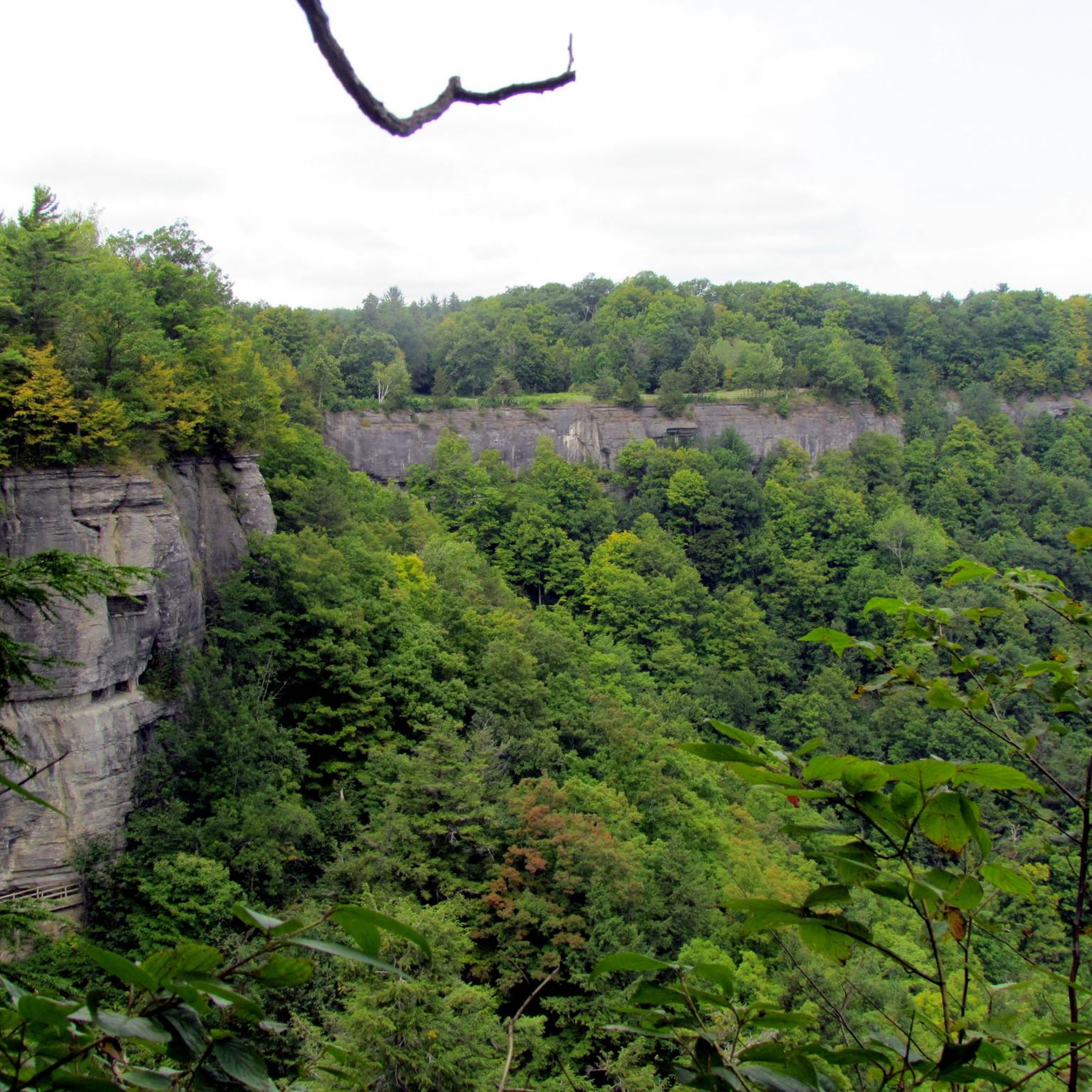
Jogging in John Boyd Thacher State Park offers diverse terrain along the Helderberg Escarpment, a six-mile-long limestone cliff-face. The park features a mix of dense woodlands, expansive open fields, and rock-strewn slopes, providing varied scenery for running. Its extensive trail network includes options ranging from flat and mostly flat paths to routes with uneven terrain, small hills, and steep sections, catering to different fitness levels. The park's landscape provides panoramic views of the Hudson-Mohawk Valleys and distant mountains.
Best jogging…
Last updated: October 9, 2026
9
runners
8.14km
00:57
80m
80m
Moderate run. Good fitness required. Mostly paved surfaces. Suitable for all skill levels.
2
runners
8.60km
01:03
80m
80m
Moderate run. Good fitness required. Mostly paved surfaces. Suitable for all skill levels.

3
runners
Moderate run. Good fitness required. Mostly paved surfaces. Suitable for all skill levels.
2
runners
8.31km
01:00
80m
80m
Moderate run. Good fitness required. Mostly paved surfaces. Suitable for all skill levels.
15
runners
23.6km
02:27
110m
110m
Hard run. Very good fitness required. Mostly paved surfaces. Suitable for all skill levels.
Get access to more routes and recommendations from other explorers.
Already have an account?
Our route recommendations are based on thousands of hikes, rides, and runs completed by other people on komoot.
Start today with a free account
Your next adventure awaits.
Popular around John Boyd Thacher State Park


Tips from the Community


You'll hike past limestone cliffs and rock-strewn slopes stretching over six miles. You'll always have great panoramic views of the Hudson-Mohawk Valleys and the Adirondack and Green Mountains.
1
0
Beautiful waterfall at John Boyd Thacher State Park's six-mile limestone cliff.
1
0
Frequently Asked Questions
How many running routes are available in John Boyd Thacher State Park?
There are 9 dedicated running routes in John Boyd Thacher State Park, offering a variety of distances and difficulties for joggers.
What kind of terrain can I expect on the jogging trails in the park?
The park offers diverse terrain, including rock-strewn slopes, dense woodlands, and expansive open fields. You can find routes with flat, mostly flat, and even sections, as well as more challenging paths with uneven terrain, small hills, steep sections, rocks, and roots.
Are there any routes suitable for beginners or those looking for an easier run?
Yes, John Boyd Thacher State Park has 2 routes classified as easy, perfect for beginners or those seeking a less strenuous jog. These trails typically feature more even terrain.
Can I find running routes that feature waterfalls in John Boyd Thacher State Park?
Absolutely! The park is known for its beautiful waterfalls. The Waterfall at Thacher Park loop from Thacher State Park is a moderate 6.1-mile route specifically designed to showcase these natural features. The famous Indian Ladder Trail also offers views of waterfalls like Mine Lot Falls.
Are there any family-friendly jogging trails in John Boyd Thacher State Park?
While specific family-friendly routes aren't highlighted, the park's easy and moderate trails, especially those with more even surfaces, can be suitable for families. The varied landscape and natural features provide an engaging environment for all ages.
What are the best routes for panoramic views of the Hudson-Mohawk Valleys?
For breathtaking panoramic views, consider routes along the Helderberg Escarpment. The Overlook – High Point Cliff loop from Thacher Park North Trailhead and the High Point Cliff loop from Thompson's Lake State Park both offer expansive cliff-top perspectives of the valleys and distant mountains.
Are there any circular running routes available in the park?
Yes, many of the routes in John Boyd Thacher State Park are designed as loops, allowing you to start and end at the same point. Examples include the Overlook – High Point Cliff loop and the Waterfall at Thacher Park loop.
What is the best time of year to go jogging in John Boyd Thacher State Park?
John Boyd Thacher State Park offers year-round opportunities for active recreation. While warmer months are ideal for traditional jogging, the multi-use trails are also suitable for cross-country skiing and snowshoeing in winter, providing a unique running experience in the snow.
Are dogs allowed on the running trails in John Boyd Thacher State Park?
Generally, dogs are permitted on trails in New York State Parks, but they must be kept on a leash no longer than six feet. It's always a good idea to check the specific park regulations before your visit to ensure a smooth experience for you and your canine companion.
What are some notable natural features or landmarks to look out for while running?
Beyond the stunning views from the Helderberg Escarpment, you'll encounter diverse woodlands, open fields, and rock formations. The park is also known for its rich fossil-bearing formations. The Emma Treadwell Thacher Nature Center near Thompson's Lake offers exhibits about the park's natural environment.
Is there parking available at the trailheads for joggers?
Yes, John Boyd Thacher State Park provides various parking areas, including at the Thacher Park North Trailhead and near Thompson's Lake State Park, offering convenient access to the extensive trail network for joggers.
How long do the running routes typically take to complete?
The duration varies significantly by route and your pace. For example, the moderate High Point Cliff loop from Thompson's Lake State Park is often completed in about 59 minutes, while the more difficult Overlook – High Point Cliff loop from Thacher Park North Trailhead can take over 2 hours.
Most popular routes in John Boyd Thacher State Park

Get inspired with the komoot mobile app


Explore more
Browse the best Running Trails & Routes in other regions.
