The best road cycling routes in John Boyd Thacher State Park
5.0
(1)
43
riders
7
rides
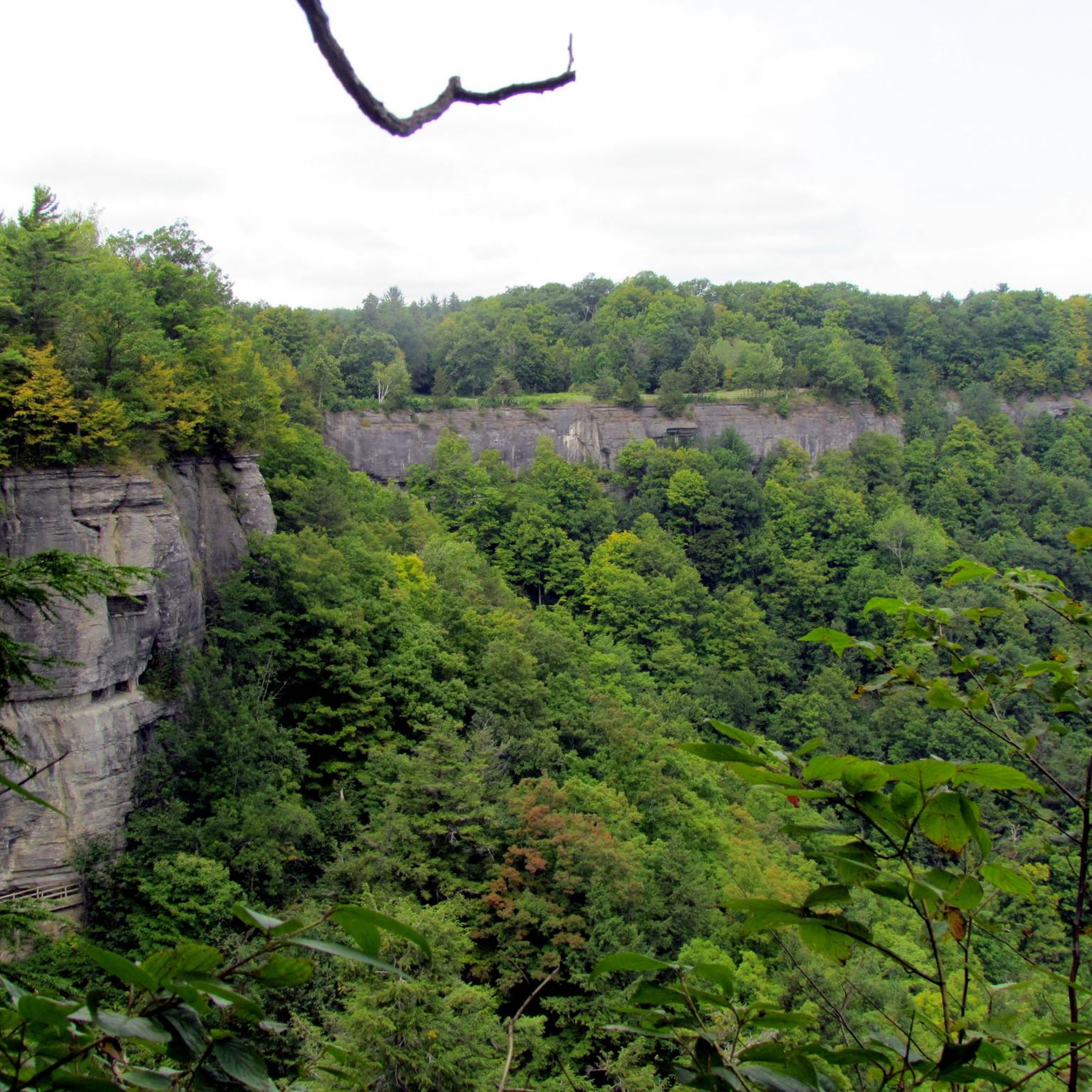
Road cycling routes in John Boyd Thacher State Park are characterized by the dramatic Helderberg Escarpment, a significant geological formation offering panoramic views of the Hudson-Mohawk Valleys. The terrain includes varied elevation changes, with some climbs reaching up to 14% maximum grade, alongside rock-strewn slopes, woodlands, and open fields. These features provide a diverse environment for road cyclists seeking both challenging ascents and scenic rides.
Best road cycling routes in John Boyd Thacher State Park
- The most popular road cycling route is Indian Ladder Farms – Altamont loop from Black Creek Marsh Wildlife Management Area, a 34.5 miles (55.6 km) trail that takes 2 hours 44 minutes to complete. This moderate route features significant elevation changes and scenic views.
- Another top favourite among local road cyclists is Rail Bridge – Normanskill Falls loop from Village of Voorheesville, an easy 21.2 miles (34.2 km) path. This route offers a mix of landscapes, including views of water features and varied terrain.
- Local road cyclists also love the Bethlehem EMT Volunteers Park – New Scotland Ave Bridge loop from Village of Voorheesville, an 11.6 miles (18.7 km) trail leading through local park areas, often completed in about 43 minutes.
- Road cycling in John Boyd Thacher State Park is defined by the Helderberg Escarpment, panoramic views, and varied terrain including woodlands and open fields. The network offers options for different ability levels, from easy rides to more demanding routes with significant elevation gains.
- The routes in John Boyd Thacher State Park are highly rated by the komoot community with an average score of 5.0 stars from 5 reviews. More than 90 road cyclists have used komoot to explore John Boyd Thacher State Park's varied terrain.
Last updated: October 2, 2026
5
riders
Moderate road ride. Good fitness required. Mostly well-paved surfaces and easy to ride.
21
riders
Moderate road ride. Good fitness required. Mostly well-paved surfaces and easy to ride.

11
riders
12.4km
00:29
50m
50m
Easy road ride. Great for any fitness level. Mostly well-paved surfaces and easy to ride.
3
riders
45.0km
02:08
370m
370m
Moderate road ride. Good fitness required. Mostly well-paved surfaces and easy to ride.
5.0
(1)
3
riders
38.1km
01:48
330m
330m
Moderate road ride. Good fitness required. Mostly well-paved surfaces and easy to ride.
Get access to more routes and recommendations from other explorers.
Already have an account?
Our route recommendations are based on thousands of hikes, rides, and runs completed by other people on komoot.
Start today with a free account
Your next adventure awaits.
Popular around John Boyd Thacher State Park


Tips from the Community

Had a shot of espresso and an oat bar for my halfway treat. Really nice place to park and rest!
0
0
Good post office, not too busy, and early 20th century architecture
0
0
Newly built in 2023! There’s a pizza place nearby.
0
0
Nice open park that’s small but big enough to run around a football.
0
0

The Albany County Helderberg-Hudson Rail Trail is a 9-mile multiuse trail that is built on the old Delaware & Hudson (D&H) Railroad. The trail is fully paved and mostly flat.
1
0
It’s my go-to trail from Albany to Vooresville
0
0
Nice quiet road, normally with low traffic. The road passes through farmland and rural Albany.
1
0
Frequently Asked Questions
How many road cycling routes are available in John Boyd Thacher State Park?
There are 11 road cycling routes available in and around John Boyd Thacher State Park on komoot, offering a range of experiences from easy rides to more challenging ascents. Six of these routes are classified as easy, and five are moderate.
What kind of terrain can I expect when road cycling in John Boyd Thacher State Park?
Road cycling in John Boyd Thacher State Park features varied terrain, largely defined by the dramatic Helderberg Escarpment. You can expect challenging climbs with significant elevation gains, some reaching up to a 14% maximum grade, alongside scenic stretches through woodlands, open fields, and rock-strewn slopes. Most surfaces are well-paved, suitable for road bikes.
Are there any routes suitable for beginner road cyclists?
Yes, there are several routes suitable for beginner road cyclists. For example, the Rail Bridge – Normanskill Falls loop from Village of Voorheesville is an easy 21.2-mile path with a mix of landscapes and moderate elevation gain. Another easy option is the Bethlehem EMT Volunteers Park – New Scotland Ave Bridge loop from Village of Voorheesville, which is 11.6 miles long.
What are the best routes for experiencing the panoramic views of the Helderberg Escarpment?
Many routes in the park offer stunning views from the Helderberg Escarpment. Routes that involve climbs, such as the 'Thacher Park' climb mentioned in regional research, will reward you with expansive panoramic views of the Hudson-Mohawk Valleys, and on clear days, the Adirondack and Green Mountains of Vermont, as well as the Taconic Mountains. The Indian Ladder Farms – Altamont loop from Black Creek Marsh Wildlife Management Area is a moderate route with significant elevation changes that provides scenic vistas.
What do other road cyclists enjoy most about road cycling in John Boyd Thacher State Park?
The area is highly rated by the komoot community, with an average score of 5.0 stars from 5 reviews. Road cyclists often praise the challenging climbs, the rewarding panoramic views from the Helderberg Escarpment, and the diverse natural scenery including woodlands and open fields.
Are there any notable landmarks or attractions to see along the road cycling routes?
While cycling, you'll be riding through a region rich in natural beauty. The Helderberg Escarpment itself is a significant geological formation. You might also consider visiting the Indian Ladder Trail, known for its waterfalls like Minelot Falls, or the Thacher Park Center for an observation deck and information. These attractions are typically accessed off-bike.
What is the best time of year for road cycling in John Boyd Thacher State Park?
The best time for road cycling in John Boyd Thacher State Park is generally from spring through fall. The Indian Ladder Trail, a popular feature, is open from early summer to mid-November, weather permitting, which gives an indication of the prime season for enjoying the park's natural features. Always check local weather conditions before heading out, especially during shoulder seasons.
Are there any loop routes available for road cyclists?
Yes, many of the routes are designed as loops. For instance, the Indian Ladder Farms – Altamont loop from Black Creek Marsh Wildlife Management Area and the Altamont – Blackbird Bike Cafe loop from Village of Voorheesville are popular loop options that allow you to start and finish at the same point.
Are there any cafes or places to stop for refreshments near the cycling routes?
Yes, some routes incorporate stops or pass near places for refreshments. For example, the Blackbird Bike Cafe loop from Guilderland Center suggests a route that includes a cafe, indicating that there are cyclist-friendly establishments in the surrounding areas where you can refuel.
What is the longest road cycling route in the park area?
The longest road cycling route listed is the Indian Ladder Farms – Altamont loop from Black Creek Marsh Wildlife Management Area, covering 34.5 miles (55.6 km) with a moderate difficulty rating and over 530 meters of elevation gain.
Is parking available for road cyclists at John Boyd Thacher State Park?
John Boyd Thacher State Park offers various facilities, including picnic areas and a visitor center, which typically include parking. While specific cycling parking areas are not detailed, general park parking is available for visitors accessing the trails and amenities. It's advisable to check the park's official website for current parking information and any potential fees.
Are there any routes that feature water elements like waterfalls?
While the road cycling routes themselves may not directly pass by waterfalls, the region is known for them. The Indian Ladder Trail, a famous hiking trail within the park, offers views of waterfalls like Minelot Falls. For a route that includes views of water features, consider the Rail Bridge – Normanskill Falls loop from Village of Voorheesville.
Most popular routes in John Boyd Thacher State Park

Get inspired with the komoot mobile app


Explore more
Browse the best Road cycling routes in other regions.
