The best walks and hikes around Fitjavatnet
4.3
(25)
148
hikers
10
hikes
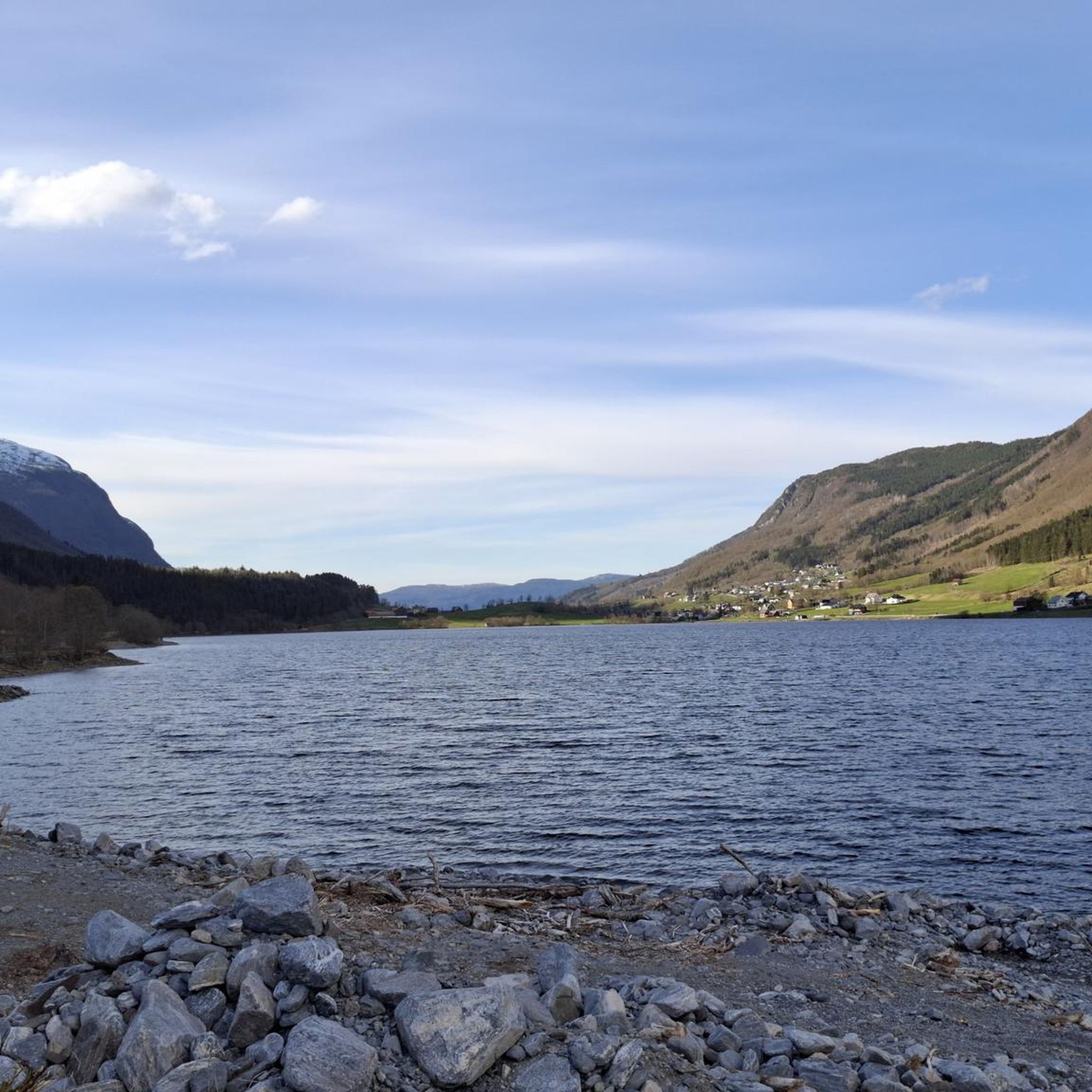
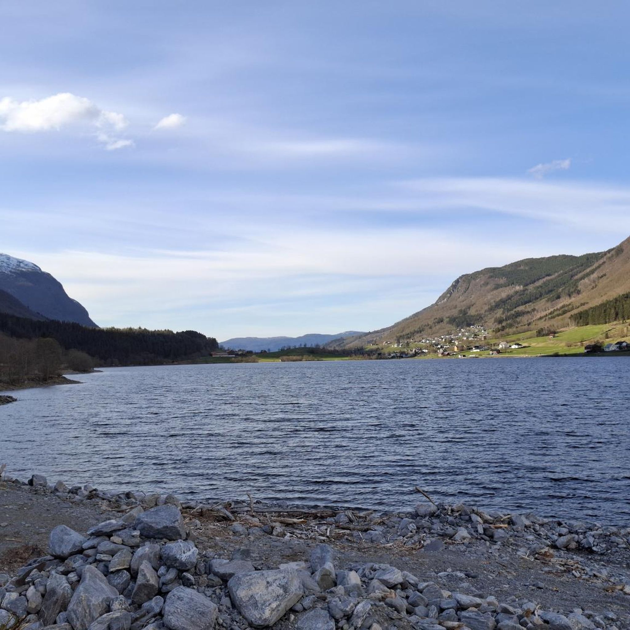
Hiking around Fitjavatnet, located in Sykkylven, Møre og Romsdal, Norway, offers diverse trails integrated into the local hiking network. The region features varied terrain, from lighted trails and forest roads to more challenging mountain paths with grassy areas and marshland. Fitjavatnet itself is a unique brackish water lake with an outlet to the Sykkylvsfjorden, fed also by Velledalselva, creating a distinct natural environment for exploration. The lake sits just above sea level, providing a unique landscape for hikers.
Best hiking trails around Fitjavatnet
- The most popular hiking route is Skarhammaren – Smårisa loop from Sykkylven, a 2.7 miles (4.3 km) trail that takes 2 hours 58 minutes to complete. This difficult route features significant elevation gain through varied mountain terrain.
- Another top favourite among local hikers is Høyset – Gimsdalsfossen loop from Blindheim, a moderate 5.3 miles (8.5 km) path. This trail offers a longer experience through the region's diverse landscapes, including forest and mountain sections.
- Local hikers also love the Sykkylven – Sykkylven Sign loop from Sykkylven kyrkje, a 5.6 miles (9.0 km) trail leading through local forests and offering views of the surrounding area, often completed in about 2 hours 24 minutes.
- Hiking around Fitjavatnet is defined by lighted trails, forest roads, and mountain terrain with grass and some marsh. The network offers options for easy, moderate, and difficult routes, catering to different ability levels.
- The routes in Fitjavatnet are highly rated by the komoot community with an average score of 4.0 stars from more than 20 reviews. More than 100 hikers have used komoot to explore Fitjavatnet's varied terrain.
Last updated: August 20, 2026
5.0
(2)
4
hikers
13.6km
04:01
390m
390m
Moderate hike. Good fitness required. Easily-accessible paths. Suitable for all skill levels.
18
hikers
4.29km
02:58
510m
510m
Hard hike. Good fitness required. Sure-footedness, sturdy shoes and alpine experience required.

Sign up for free
5.0
(1)
8
hikers
10.7km
03:22
420m
420m
Moderate hike. Good fitness required. Easily-accessible paths. Suitable for all skill levels.
2
hikers
6.76km
02:15
320m
320m
Moderate hike. Good fitness required. Easily-accessible paths. Suitable for all skill levels.
3.0
(1)
4
hikers
9.01km
02:25
100m
100m
Moderate hike. Good fitness required. Easily-accessible paths. Suitable for all skill levels.
Get access to more routes and recommendations from other explorers.
Sign up for free
Already have an account?
Our route recommendations are based on thousands of hikes, rides, and runs completed by other people on komoot.
Start today with a free account
Your next adventure awaits.
Login or Signup
Popular around Fitjavatnet
Tips from the Community

In the summer months Gimsdalsetra is a very popular hiking destination. This small dairy farm area provides a small, stiff, steep hiking and cycling destination. It offers great views of the surrounding mountains.
0
0
This is a designated Stikk UT car park. You will find more details in the Stikk UT app or on the website.
0
0
The walk to the Velleseter DNT hut is mainly on a gravel road all the way to the cabin, so it is pretty family friendly. It is only around two kilometres one way. For the last 100 metres or so you have to go through a gate, and then there is a footpath to the door of the cabin. It is a steady, good climb all the way up on the road, and you have great views of the mountains on the way.
0
0
The Velleseter DNT cabin sits in the beautiful valley of Velleseterdalen. It is very popular, as the surrounding mountain peaks are popular with hikers and the cabin itself is easily accessible and popular with families. The cabin is not manned, sleeps eleven in two bedrooms with bunk beds and is locked with a DNT key.
0
0

Skardet is a summit that can be reached via a smooth ascents road offering increasingly beautiful views as you climb. It's a mountain peak where the landscape opens up with each step higher, revealing wider vistas of the surrounding terrain. The climb to Skardet is accessible and rewarding, with the road making the ascent possible for those seeking a well-marked path to a summit with growing panoramic views.
0
0
This smooth road winds upward toward Skardet summit, where the views grow richer with every step, opening wider, deeper, and more beautiful as the land rises beneath your feet.
0
0
This panoramic road allows you to enjoy typical Norwegian views and an unforgettable experience.
0
0

Highlight Start point
0
0
Frequently Asked Questions
What kind of terrain can I expect on the hiking trails around Fitjavatnet?
The trails around Fitjavatnet offer a diverse range of terrain. You'll find everything from lighted trails and forest roads to more challenging mountain terrain that includes grassy areas and some marshland. This variety caters to different hiking preferences and skill levels.
Are there any easy hiking routes suitable for beginners or families near Fitjavatnet?
Yes, Fitjavatnet offers several easy routes. For a pleasant, shorter walk, consider the Sunnmørsalpane Ski Center loop from Gamlesætra, which is about 3.7 km. Another accessible option is the Sætsvatna Lake loop from Ikornnes kyrkje, covering about 5.4 km.
What are the unique natural features of Fitjavatnet itself?
Fitjavatnet is quite unique due to its connection to the Sykkylvsfjorden. Saltwater from the fjord can flow into the lake during high tide, creating a brackish water environment. This makes it a wintering ground for wetland birds and a habitat for both salmon and sea trout, offering opportunities for birdwatching and fishing alongside hiking.
How many hiking routes are available in the Fitjavatnet area?
There are at least 6 distinct hiking routes documented around Fitjavatnet, ranging in difficulty from easy to difficult. This provides a good selection for various hiking experiences.
Are there any circular hiking routes around Fitjavatnet?
Yes, many of the trails around Fitjavatnet are designed as loops. For example, the Skarhammaren – Smårisa loop from Sykkylven offers a challenging circular experience, while the Sykkylven – Sykkylven Sign loop from Sykkylven kyrkje provides a moderate loop through local forests.
What do other hikers say about the trails in Fitjavatnet?
The hiking trails around Fitjavatnet are highly regarded by the komoot community, holding an average rating of 4.0 stars from over 20 reviews. Hikers often praise the varied terrain and the natural beauty of the region.
What is the longest moderate hike available in the area?
For a longer, moderate experience, the Høyset – Gimsdalsfossen loop from Blindheim is an excellent choice. This trail covers approximately 8.5 km and takes you through diverse landscapes including forest and mountain sections.
Is Fitjavatnet part of any recognized outdoor programs?
Yes, Fitjavatnet is a designated destination within Samnanger Turlag's "Sjekk-UT" program, which highlights its appeal and integration into the local network for outdoor enthusiasts.
What is the elevation gain like on the more challenging trails?
The more challenging trails, such as the Skarhammaren – Smårisa loop from Sykkylven, feature significant elevation gain, reaching over 500 meters. These routes are best suited for experienced hikers looking for a strenuous workout.
Are there any specific points of interest or landmarks to look out for while hiking?
While there are no specific highlights listed in the immediate vicinity of the trails, the unique brackish water environment of Fitjavatnet itself, with its potential for birdwatching and fishing, serves as a natural point of interest. Additionally, the Velledalselva (Storelva in Velledalen) feeds into the lake, adding to the scenic beauty.
How does the lake connect to the wider region?
Fitjavatnet has a direct outlet to the Sykkylvsfjorden at Straumgjerde, connecting it to the larger fjord system. Fylkesvei 60, which links Stranda and Sykkylven, also runs along the lake, offering scenic views for those traveling by road and providing access to various trailheads.

Get inspired with the komoot mobile app


Explore more
Browse the best Hikes in other regions.
