The best running trails around Djupvatnet
5.0
(3)
225
runners
4
runs
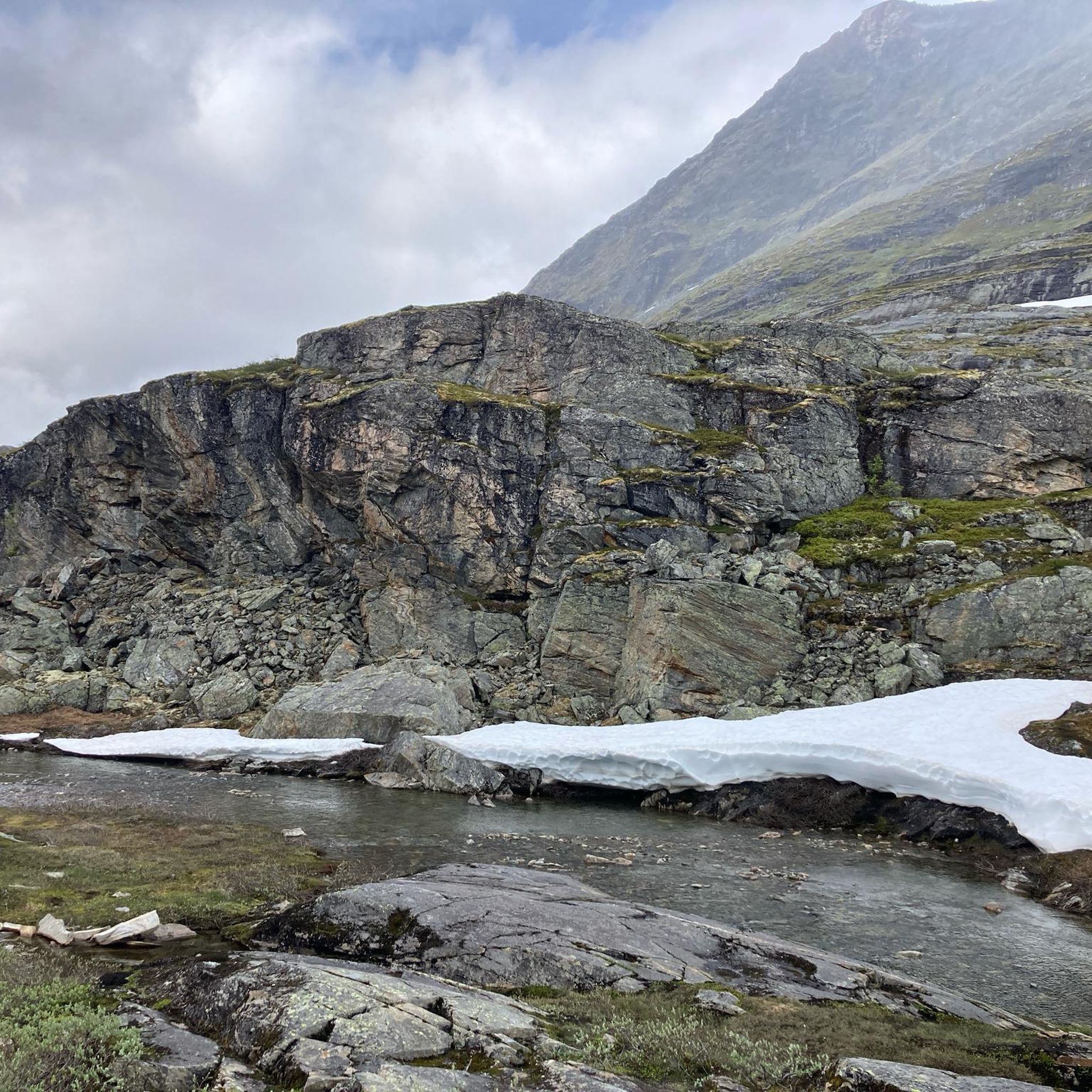
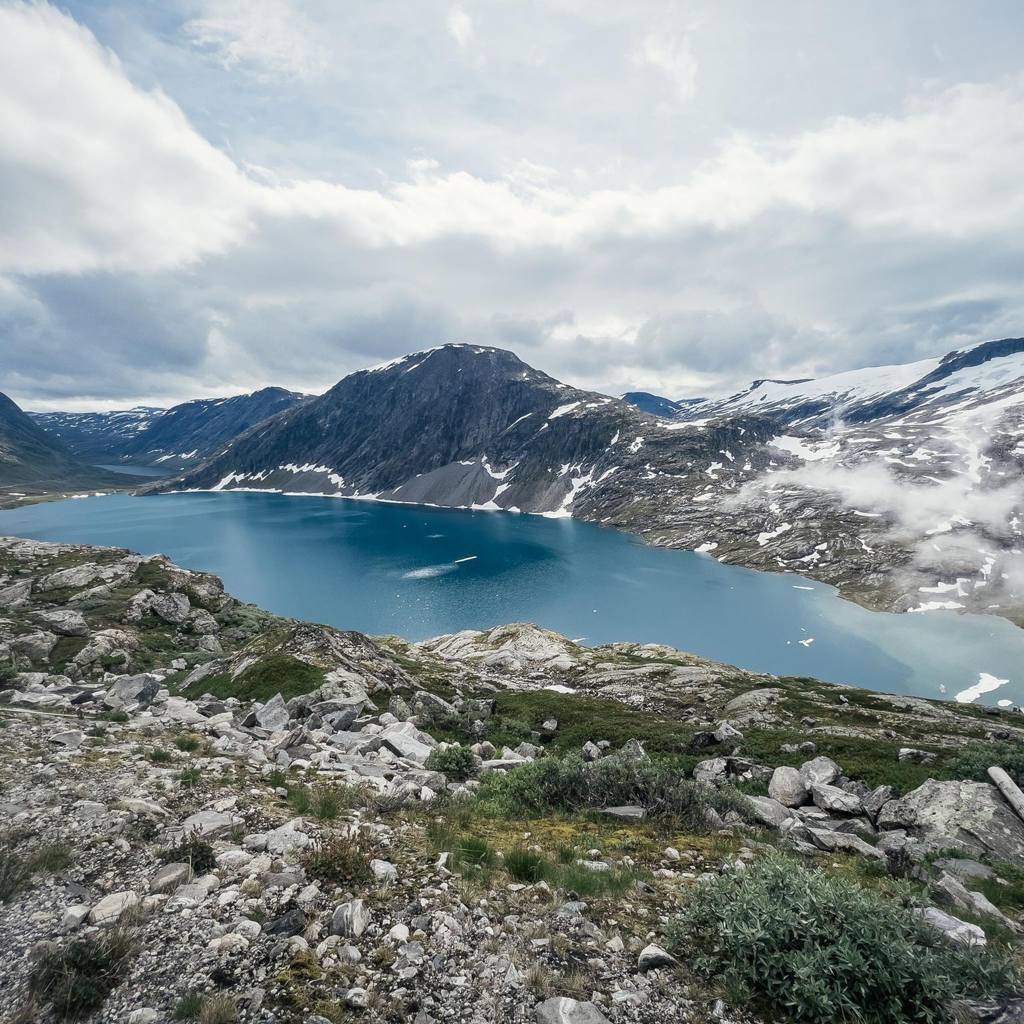
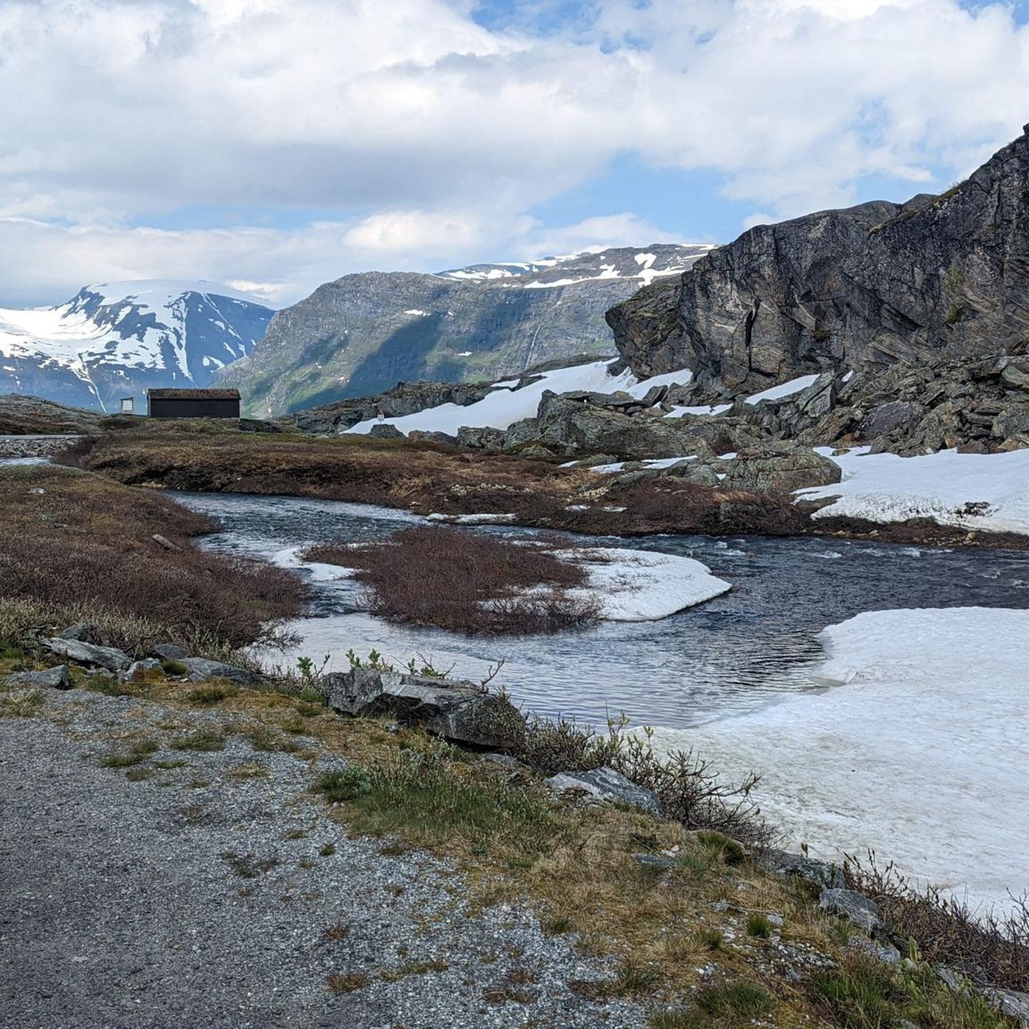
Jogging around Djupvatnet offers routes through a high-altitude glacial landscape, characterized by deep blue waters reflecting surrounding mountains. Situated at 1,016 meters (3,333 feet) above sea level, the region features majestic peaks and scenic roads. This environment provides a challenging yet rewarding setting for runners, with terrain that includes mountainous paths and accessible sections along County Road 63.
Best jogging routes around Djupvatnet
- The most popular jogging route is Stavbrekkleiva loop from Djupvatnet, a 9.5 miles (15.3 km) trail…
Last updated: June 26, 2026
10
runners
15.3km
01:47
460m
460m
Hard run. Very good fitness required. Mostly paved surfaces. Suitable for all skill levels.
6
runners
8.72km
01:11
330m
330m
Hard run. Very good fitness required. Sure-footedness, sturdy shoes and alpine experience required.

Sign up for free
5.0
(1)
57
runners
6.74km
01:06
450m
460m
Hard run. Very good fitness required. Mostly accessible paths. Some sure footedness required.
5.0
(1)
34
runners
8.16km
01:20
540m
540m
Hard run. Very good fitness required. Mostly paved surfaces. Suitable for all skill levels.
23
runners
7.61km
00:59
350m
350m
Hard run. Very good fitness required. Mostly paved surfaces. Suitable for all skill levels.
Our route recommendations are based on thousands of hikes, rides, and runs completed by other people on komoot.
Start today with a free account
Your next adventure awaits.
Login or Signup
Tips from the Community

This breathtaking view is something you simply have to experience! The Geirangerfjord is indescribably beautiful, and its wild nature is truly impressive. Most importantly: Don't just take photos and selfies, but take your time and really savor the experience and cherish it as a lasting memory ;)
3
0

great view of Geiranger and the fjord
0
0

Beautiful nature and surroundings
1
0

The view of the fjord here is absolutely amazing. The path can sometimes be a bit rooty.
1
0
It's a real idyll. Surrounded by nature, you can see llamas and goats. A true Norwegian experience.
0
0

The climb is quite challenging, but once you reach the top, you'll be rewarded with a stunning natural spectacle and a breathtaking view. It's definitely worth it.
0
0
The climb is quite challenging, but once you reach the top you are rewarded with a fabulous natural spectacle and a breathtaking view. It is definitely worth it.
3
0
The climb is quite challenging, but once you reach the top you are rewarded with a fabulous natural spectacle and a breathtaking view. It is definitely worth it.
1
0
Frequently Asked Questions
How many running routes are available around Djupvatnet?
There are several dedicated running routes around Djupvatnet, with komoot featuring at least 4 distinct trails. These routes offer a challenging experience through the high-altitude glacial landscape.
What is the typical terrain like for running near Djupvatnet?
The terrain around Djupvatnet is characterized by a high-altitude glacial landscape, featuring majestic mountains and deep blue waters. Runners can expect mountainous paths and accessible sections along the scenic Norwegian County Road 63. The routes are generally challenging, with significant elevation changes.
What do other runners say about the routes in Djupvatnet?
The running routes in Djupvatnet are highly rated by the komoot community, with an average score of 5.0 stars from 3 reviews. Over 200 runners have used komoot to explore the varied and challenging terrain, often praising the expansive views and the rewarding high-mountain experience.
Are there running routes suitable for beginners around Djupvatnet?
The routes currently featured in this guide are generally classified as difficult, offering a significant challenge due to the high-altitude terrain and elevation changes. While there are 'easy' or 'moderate' walking trails in the broader area, dedicated beginner-friendly running routes might require careful selection or adaptation of existing paths, such as sections along the paved Fv63.
What kind of elevation changes can I expect on the running trails?
Given Djupvatnet's location at 1,016 meters (3,333 feet) above sea level and its mountainous surroundings, you can expect substantial elevation changes on the running trails. For example, the Stavbrekkleiva loop from Djupvatnet involves over 450 meters of ascent and descent, providing a demanding workout.
Are there any scenic viewpoints or landmarks to see while running?
Absolutely. The Djupvatnet area is rich with stunning vistas. While running, you'll be treated to views of the deep blue glacial waters reflecting the surrounding mountains. Nearby panoramic viewpoints like the Geiranger Skywalk and Dalsnibba Utsiktspunkt offer spectacular vistas that can serve as motivating destinations or scenic breaks during your run. The scenic road Fv63 also provides continuous scenic views.
When is the best time of year to go running around Djupvatnet?
The best time for running around Djupvatnet is typically during the warmer months, from late spring to early autumn. Due to its high-altitude location, snow can linger even in summer, contributing to a dramatic landscape but also affecting trail conditions. Always check local conditions before heading out.
Can I go running in Djupvatnet during winter?
Running in Djupvatnet during winter can be challenging due to its high-altitude location and the presence of snow, which can persist even into the summer months. Many trails may be covered, and conditions can be harsh. It's advisable to consult local conditions and be prepared with appropriate gear if considering winter running.
Are there any circular running routes available?
Yes, several circular running routes are available. For instance, the Stavbrekkleiva loop from Djupvatnet is a popular 15.3 km circular trail offering expansive views of the high-mountain terrain. Another option is the Flydalsjuvet loop from Opplenskedal, an 8.6 km difficult path.
Are the running trails around Djupvatnet suitable for dogs?
While specific regulations for dogs on these trails are not detailed, the natural, open environment of Djupvatnet generally welcomes dogs. However, given the challenging and mountainous terrain, ensure your dog is fit for such conditions and always keep them on a leash, especially near wildlife or other visitors. Always practice Leave No Trace principles.
Are there any amenities like cafes or places to rest near the running paths?
The serene environment around Djupvatnet is more focused on natural beauty than extensive amenities. While specific cafes directly on the running paths are not common, the area is known for its picnic spots, allowing runners to relax and refuel amidst nature. For more substantial amenities, you might need to venture towards nearby towns like Geiranger.
What is the longest running route available in this guide?
The longest running route featured in this guide is the Stavbrekkleiva loop from Djupvatnet, which spans 15.3 kilometers (9.5 miles) and typically takes around 1 hour and 47 minutes to complete. This difficult route offers expansive views of the high-mountain terrain.
Are there any running routes that offer views of waterfalls?
Yes, some routes in the broader Djupvatnet region, particularly those closer to Geiranger, offer views of dramatic waterfalls. For example, the Storsæterfossen loop from Geiranger leads through a dramatic landscape where you can experience the region's impressive natural water features.

Get inspired with the komoot mobile app


Explore more
Browse the best Running Trails & Routes in other regions.
